Discover Croom
Croom in Shellharbour (New South Wales) is a place in Australia about 107 mi (or 172 km) north-east of Canberra, the country's capital city.
Current time in Croom is now 03:17 PM (Sunday). The local timezone is named Australia / Sydney with an UTC offset of 10 hours. We know of 9 airports near Croom, of which two are larger airports. The closest airport in Australia is Wollongong Airport in a distance of 2 mi (or 3 km), North-West. Besides the airports, there are other travel options available (check left side).
Also, if you like playing golf, there are a few options in driving distance. If you need a hotel, we compiled a list of available hotels close to the map centre further down the page.
While being here, you might want to pay a visit to some of the following locations: Parramatta, Sydney, Katoomba, Canberra and . To further explore this place, just scroll down and browse the available info.
Local weather forecast
Todays Local Weather Conditions & Forecast: 22°C / 72 °F
| Morning Temperature | 15°C / 59 °F |
| Evening Temperature | 20°C / 67 °F |
| Night Temperature | 17°C / 62 °F |
| Chance of rainfall | 0% |
| Air Humidity | 52% |
| Air Pressure | 1025 hPa |
| Wind Speed | Moderate breeze with 11 km/h (7 mph) from South-West |
| Cloud Conditions | Broken clouds, covering 58% of sky |
| General Conditions | Light rain |
Monday, 29th of April 2024
24°C (75 °F)
17°C (62 °F)
Moderate rain, gentle breeze, overcast clouds.
Tuesday, 30th of April 2024
16°C (60 °F)
15°C (59 °F)
Heavy intensity rain, moderate breeze, overcast clouds.
Wednesday, 1st of May 2024
15°C (60 °F)
16°C (61 °F)
Light rain, moderate breeze, overcast clouds.
Hotels and Places to Stay
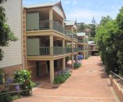
Terralong Terrace Apartments
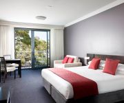
The Sebel Kiama Harbourside
Lakeview Hotel Motel
Lake Illawarra Bed and Breakfast
Kiama Shores Motel
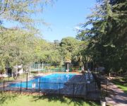
Jamberoo Resort
Comfort Inn Fairways
Videos from this area
These are videos related to the place based on their proximity to this place.
First Aid First Training
http://www.firstaidfirsttraining.com.au/ for all your first aid and fire safety training requirements.We also stock first aid kits and supplies. Book now 0423162910 We cover the entire Illawarra...
Garage Days - by Ron Gooley (a digital story from the Lake Illawarra MAP Project)
MENTOR FILM MAKER: Sandra Pires SYNOPSIS: Oak Flats was a paradise for struggling working class families, building their houses and their community bit by bit as money and time allowed.
Away From the Hurley Burley - by Bob Terry (a digital story from the Lake Illawarra MAP Project)
SYNOPSIS: In Oak Flats there were always plenty of things to do and plenty of ways to learn responsibility. SCRIPT: In 1930 my Aunty bought some land on the lake and put up a shack. Whenever...
Hexacopter, RCT Brushless gimbal, Hero3BE, Arducopter 3.0.1
Maiden flight after a full rebuild of my scratch built 800mm M2M Hexacopter. Tested stabilize mode, loiter mode and RTL (return to launch) with auto land. Sorry for the image quality, I didn't...
Qantas Boeing 747-400 landing at Illawarra Regional Airport
On 8 March 2015 four awesome Qantas pilots landed a Boeing 747-400 at Illawarra Regional Airport in Albion Park NSW (a very small runway for a very big plane...). In 1989 VH-OJA "The City of...
Qantas QF7474 very low fly over approach to small regional airport. #QFfarewellOJA
Qantas QF7474 approach low fly over for final flight to Wollongong Airport.
IMG 0483 1
Funniest thing to watch, 36 year old screaming because she didn't realize how low the Qantas 747 would be above her landing Boeing 747 Final landing in Albion Park Wollongong - VH-OJA's last ...
Biplane Stunt Flight
An aerobatic stunt sequence over Woolongong, in a 1943 Boeing PT-17 Stearman, the Lilly Warra. Thanks to Southern Biplanes. http://www.southernbiplanes.com.au.
Beer, wine and a whole lotta spirit!
Night out on the town, was smashed on the train into the city... after a few clubs and a load of booze this is the state i was in when i came home. Glad it was recorded cos i cant remember a thing lol.
Videos provided by Youtube are under the copyright of their owners.
Attractions and noteworthy things
Distances are based on the centre of the city/town and sightseeing location. This list contains brief abstracts about monuments, holiday activities, national parcs, museums, organisations and more from the area as well as interesting facts about the region itself. Where available, you'll find the corresponding homepage. Otherwise the related wikipedia article.
Albion Park, New South Wales
Albion Park is a suburb situated in the Macquarie Valley (Shellharbour) in the City of Shellharbour, which is in turn one of the three local government areas that comprise the Wollongong Metropolitan Area, New South Wales, Australia. Although it is surrounded by a 'green belt' of farms, Albion Park has a population of approximately 11,261 and continues to expand by a rate of 12.5% per year.
Albion Park Rail, New South Wales
Albion Park Rail is a suburb of Wollongong, New South Wales, Australia situated in the Macquarie Valley (Shellharbour) in the local government area of Shellharbour. The South Coast railway line was opened to the railway station and Bombo in 1887. At the time the nearest town was Albion Park, several kilometres away. Over time, houses were built around the railway station, and Albion Park Rail developed into a town in its own right.
Oak Flats railway station
Oak Flats is a station on the Cityrail South Coast line in New South Wales. It serves the suburb of Oak Flats. It is located on the single track section of the South Coast line between Unanderra and Bomaderry and has a single side platform.
Oak Flats, New South Wales
Oak Flats is a suburb of Wollongong, New South Wales, Australia situated on the south western shores of Lake Illawarra and within the South Coast region of New South Wales. It is a residential area of 6,400 people (2006 census) Oak Flats is one of the 324 suburbs that sits within the Wollongong Statistical District which covers the local authority areas of Wollongong, Shellharbour and Kiama. Oak Flats is locally governed by the Shellhabour City Council which governs 22 suburbs within the area.
Macquarie Rivulet
Macquarie Rivulet is a river in New South Wales which is 23 kilometres long. It rises near Robertson, New South Wales and drains the eastern edge of the Southern Highlands plateau and part of the Illawarra escarpment. It flows through Albion Park Rail, then goes into Lake Illawarra and indirectly into the Pacific Ocean. The towns of Tullimbar and Albion Park Rail, New South Wales are near the river.
Corpus Christi Catholic High School, Wollongong
Corpus Christi Catholic High School (CCCHS) is a Catholic co-educational school located in Oak Flats, Australia. Founded in 2006, the school is operated by the Wollongong Catholic Education Office in its service of the Roman Catholic Diocese of Wollongong. The school is registered by the NSW Board of Studies as an accredited years 7 to 12 high school.
Shellharbour City Centre, New South Wales
Shellharbour City Centre is a small southern suburb of Wollongong, located in the Illawarra region of New South Wales, Australia. Its name reflects its status as the commercial and administrative centre for the City of Shellharbour local government area, and is home to the Council Administration Centre (Lamerton House), Stockland Shellharbour shopping centre, cinemas and other retail shops. The suburb was planned and developed to be the commercial heart of the local government area.
Blackbutt, New South Wales
Blackbutt is a southern suburb of Wollongong, New South Wales, Australia. The eastern half of the suburb is occupied by the Blackbutt Forest Reserve.


