Delve into Fairy Meadow
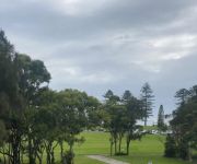
The district Fairy Meadow of Wollongong in Wollongong (New South Wales) with it's 6,424 habitants Fairy Meadow is a district located in Australia about 117 mi north-east of Canberra, the country's capital town.
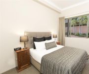
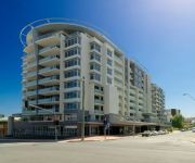
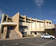
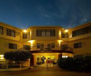
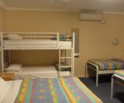
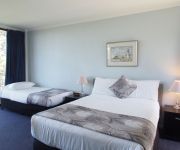
In need of a room? We compiled a list of available hotels close to the map centre further down the page.
Since you are here already, you might want to pay a visit to some of the following locations: Parramatta, Sydney, Katoomba, Canberra and . To further explore this place, just scroll down and browse the available info.
Local weather forecast
Todays Local Weather Conditions & Forecast: 17°C / 62 °F
| Morning Temperature | 14°C / 58 °F |
| Evening Temperature | 16°C / 61 °F |
| Night Temperature | 16°C / 61 °F |
| Chance of rainfall | 2% |
| Air Humidity | 65% |
| Air Pressure | 1030 hPa |
| Wind Speed | Fresh Breeze with 13 km/h (8 mph) from North |
| Cloud Conditions | Few clouds, covering 14% of sky |
| General Conditions | Light rain |
Thursday, 2nd of May 2024
16°C (61 °F)
16°C (60 °F)
Light rain, moderate breeze, overcast clouds.
Friday, 3rd of May 2024
17°C (63 °F)
16°C (61 °F)
Moderate rain, moderate breeze, scattered clouds.
Saturday, 4th of May 2024
17°C (63 °F)
17°C (62 °F)
Moderate rain, moderate breeze, overcast clouds.
Hotels and Places to Stay
SAGE HOTEL WOLLONGONG F.K.A CHIFLEY
Novotel Wollongong Northbeach
BELMORE ALL SUITE HOTEL
QUEST WOLLONGONG
Adina Wollongong
BEST WESTERN CITY SANDS
Beach Park Motel
Normandie Motel and Function Centre
Flinders Motel
Boat Harbour Motel
Videos from this area
These are videos related to the place based on their proximity to this place.
New Years Eve North Wollongong Hotel 2012 - 2013 Video 4/4
New Years Eve North Wollongong Hotel 2012 - 2013 Video 4/4 This year the entertainment line-up is nothing short of out of this world. RUBY ROSE is set to headline the stellar event. She will...
Flying two Bixler 2s in Wollongong Australia
My son and I flying Bixler 2 model RC planes in Fairy Meadow, Wollongong Australia. This was my 4th or 5th flight, and first loop. My son can do all kinds of stunts, inside and outside loops,...
Skydive Wollongong City Beach Australia Landing Parachuting Tandem Skydiving
This was one of about a dozen jumps done throughout the day. Filming started as they jumped.
Raw Footage of Willy's Skydive the Beach sydney, Wollongong
Taken with Skydive the beach sydney's GoPro camera.
Fairy Meadow Skate Park Demo/Teaser - Old School Skate Session 2013
Cranking out some old school moves on my single kick Lance Mountain Powell Peralta, One early May morning at Fairy Meadow skate park, N.S.W, Australia. Gopro Hero2. Filmed, edited and Rider-...
first skydive. they don't give you the cool goggles
they give you the dorky goggles that are absurdly tight.
Spring into Corrimal 2012 - Parade, Crowning the King of Corrimal, Fun Rides
Parade, Crowning the King of Corrimal and some entertainment including Fun Rides. Filmed on a CANON EOS550D.
Spring into Corrimal 2011. World champion unicyclist performs.
Spring into Corrimal 2011 street performer / World champion Jamey Mossengren juggles fiery torches while riding a tall unicycle four meters in the air bringing the crowed to a stand still.
Videos provided by Youtube are under the copyright of their owners.
Attractions and noteworthy things
Distances are based on the centre of the city/town and sightseeing location. This list contains brief abstracts about monuments, holiday activities, national parcs, museums, organisations and more from the area as well as interesting facts about the region itself. Where available, you'll find the corresponding homepage. Otherwise the related wikipedia article.
University of Wollongong
The University of Wollongong also simply known as UOW is a public university located in the coastal city of Wollongong, New South Wales, Australia, approximately 80 kilometres south of Sydney. As of 2012, the university had a total of 30,516 students enrolled, including 11,440 international students from more than 140 countries. The University of Wollongong marked the University's 60th Founding Anniversary in 2011.
Fairy Meadow, New South Wales
Fairy Meadow is a suburb in the city of Wollongong, New South Wales, Australia. Located in the Illawarra region, it is a mainly low density residential area, except for a strip of small commercial properties located along the Princes Highway.
Towradgi, New South Wales
Towradgi is a small beach-side suburb approximately 5 km north of Wollongong. Towradgi is a corruption of the aboriginal word "Kow-radgi" meaning "guardian of the sacred stones". On an early map it was called Towroger. Towradgi is served by Towradgi station, opened in 1948. Electric double deck trains serve Towradgi. It is bordered to the north by Corrimal, the west by Fernhill & Tarrawanna and to the south by Fairy Meadow. The Pacific Ocean can be found to the east.
Balgownie, New South Wales
Balgownie is a small suburb of Wollongong City, New South Wales, Australia. Balgownie lies to the north-west of the Wollongong CBD. It stretches from the lower slopes of Mount Keira along the Illawarra escarpment to the base of the Broker's Nose promontory. To the east, Balgownie is bordered by the light industrial and commercial suburb of Fairy Meadow. The main street, Balgownie Road, connects the suburb to the nearby Princes Highway.
Puckeys Estate Reserve
Puckey's Estate Reserve is a coastal nature reserve in Wollongong, Australia. It is mainly she-oak forest, but also has sand dune and wetland areas, including areas along Para Creek. It is located in the suburb of Fairy Meadow and is bounded by Fairy Meadow Beach to the east, Squires Way to the west, Elliotts Road to the north and Fairy Lagoon to the south. Puckey's Estate was traditionally used by the Wadi Wadi people, the Aboriginal tribe in Wollongong.
Wollongong Botanic Garden
The Wollongong Botanic Garden is located in the Wollongong suburb of Keiraville at the foot of Mount Keira in New South Wales, Australia. It is the local botanical gardens of the Illawarra and was opened in September 1970. http://www. hoskins. id. au/nextgen/showphoto. php?personID=2293I&tree=hoskinsfamily&ordernum=1 The garden is co-located with the historic Gleniffer Brae house, used for functions and the Wollongong Conservatorium of Music.
Keira High School
Keira High School in Wollongong, New South Wales has existed as an institution under several names since 1917. Originally a collection of boys' technical schools on several sites throughout Wollongong, the school was amalgamated in 1954 at its current site in Lysaght Street North Wollongong. The school then became known as Keira Boys High School and remained as such until 1984.
Smith's Hill High School
Smith's Hill High School is the only academically selective school in Wollongong, New South Wales, Australia. To gain entry into the school, student's must obtain marks which place them in the top 120 Year 6 students applicants; in a state-set examination for entry into all Academically Selective High Schools in NSW. The successful students will then be offered a place to commence their time at the school in the following academic year.
North Wollongong railway station
North Wollongong is a railway station on the South Coast Line of the CityRail outer suburban network, serving the suburb of North Wollongong. The station consists of two side platforms. It receives, on average, two services per hour on weekdays (with more services during peak hours) and one per hour on weekends. The station is unofficially also identified on its platforms as the University of Wollongong station, due to the proximity of the university to the station.
Wollongong High School of the Performing Arts
Wollongong High School of the Performing Arts is a specialist co-educational, government secondary school located in Fairy Meadow, a suburb of Wollongong, New South Wales, Australia, run by the New South Wales Department of Education and Training. It was founded in 1916. The school enrolls both local area students and students who gain entry through auditions. The school estimates that over a third of the student body has gained entry through auditions.
Corrimal railway station
Corrimal is a CityRail railway station on the South Coast railway line. It serves the residential suburb of Corrimal which is a suburb of Wollongong. The station has two side platforms, connected by a footway at a level crossing. The station is served by about one train per hour for most of the time (usually a Thirroul-Port Kembla local service), with additional trains at weekday peak hours. The station has street access to both platforms, via a level crossing.
Towradgi railway station
Towradgi is a CityRail railway station on the South Coast railway line. It serves the residential suburb of Towradgi which is a suburb of Wollongong. The station has two side platforms, connected by a footway along a road overpass. The station is served by about one train per hour for most of the time (usually a Thirroul-Port Kembla local service), with additional trains at weekday peak hours.
Fairy Meadow railway station
Fairy Meadow is a CityRail railway station on the South Coast railway line. It serves the residential Wollongong suburb of Fairy Meadow. The station has two side platforms, connected by a pedestrian overbridge and level crossing. The station is served by about one train per hour for most of the time (usually a Thirroul-Port Kembla local service), with additional trains at weekday peak hours.
City of Wollongong
The City of Wollongong is a local government area in the Illawarra region of New South Wales, Australia. The area is situated adjacent to the Tasman Sea, the Southern Freeway and the South Coast railway line.
North Wollongong, New South Wales
North Wollongong is the immediate northern coastal suburb of Wollongong, New South Wales, Australia. North Wollongong is used to refer to the northern area of Wollongong as well as North Wollongong by locals, despite the official suburb not including the northern apartment areas of Wollongong and North Beach, known as North Wollongong.
Corrimal, New South Wales
Corrimal is a northern suburb of the city of Wollongong, New South Wales, Australia. Corrimal's CBD is situated on the Princes Highway, and several streets adjacent to it. The main shopping centres are Stockland Corrimal and Corrimal Park Mall next to the park on the highway. Outside this centre is an old locomotive that Corrimal is known for, the welcome signs featuring it. It ran on the Bulli Colliery Line (no longer existent) to Bellambi Haven from 1909 to 1967.
North Dalton Park
North Dalton Oval is located on Pioneer Rd, Towradgi, in the northern suburbs of Wollongong, New South Wales, Australia. The ground has a grandstand on the western side, where plastic bucket seats were installed over the concrete steps in late 2007. The remainder of the ground is surrounded by a small hill which gives the ground an overall capacity of around 6,000. The scoreboard is at the northern end of the ground.
Queen of Nations (clipper ship)
Queen Of Nations was an 827-ton wooden clipper ship. She was built in Aberdeen in 1861, and sailed out of Auckland, New Zealand, on the Sydney to Liverpool route. Queen of Nations wrecked in May 1881 on Corrimal Beach, New South Wales, Australia.
Smiths Hill Fort
Smiths Hill Fort was a fort at North Wollongong, New South Wales, Australia. The fort was also known as Wollongong Fort.
Tarrawanna, New South Wales
Tarrawanna is a northern suburb of Wollongong, New South Wales, Australia, extending westward from the Princes Highway over the Illawarra Escarpment.
Gwynneville, New South Wales
Gwynneville is an inner city suburb of Wollongong, New South Wales, Australia located approximately 2 km north west of the city centre. It was originally named Gwynne Ville after the Gwynne family who owned the property. It was sold it two large lots, both of which were subdivided. The first area, owned by Mr John Gwynne, consisted of 86 allotments, and went to auction on the 3rd of March 1886.
Corrimal High School
Corrimal High School is a comprehensive high school located in East Corrimal in Wollongong, New South Wales. The school has been operating since 1951. The subjects include English, Mathematics, Science, Geography, History, PDHPE, Industrial Arts, Visual Arts, Music, Agriculture, Food Technology and Sport Science.
East Corrimal, New South Wales
East Corrimal is a northern seaside suburb of Wollongong, New South Wales, Australia. Predominantly residential, the suburb includes Corrimal High School and Corrimal East Public School, as well as Corrimal Beach and tourist park at the eastern end. A park was opened in 1959 to the west of the high school and north of the primary school, named Phil Adams Park, which features tall trees, paths and several seats.
International House, University of Wollongong
International House is the oldest residential college of the University of Wollongong and is an affiliate of the 16 International Houses Worldwide. It provides accommodation to approximately 218 students who are attending the University of Wollongong. It is situated at the corner of Porter and Hindmarsh Avenue in North Wollongong, near the North Wollongong railway station.
SMART Infrastructure Facility
The SMART Infrastructure Facility is the national centre for infrastructure solutions in Australia, located at the University of Wollongong, New South Wales, Australia. SMART stands for ‘Simulation, Modelling, Analysis, Research and Teaching’.


