Discover Gwynneville
The district Gwynneville of Wollongong in Wollongong (New South Wales) with it's 2,523 citizens Gwynneville is a district in Australia about 116 mi north-east of Canberra, the country's capital city.
Looking for a place to stay? we compiled a list of available hotels close to the map centre further down the page.
When in this area, you might want to pay a visit to some of the following locations: Parramatta, Sydney, Katoomba, Canberra and . To further explore this place, just scroll down and browse the available info.
Local weather forecast
Todays Local Weather Conditions & Forecast: 17°C / 63 °F
| Morning Temperature | 15°C / 60 °F |
| Evening Temperature | 16°C / 60 °F |
| Night Temperature | 16°C / 61 °F |
| Chance of rainfall | 5% |
| Air Humidity | 62% |
| Air Pressure | 1032 hPa |
| Wind Speed | Moderate breeze with 11 km/h (7 mph) from North |
| Cloud Conditions | Clear sky, covering 2% of sky |
| General Conditions | Light rain |
Friday, 3rd of May 2024
16°C (61 °F)
15°C (60 °F)
Light rain, moderate breeze, overcast clouds.
Saturday, 4th of May 2024
17°C (63 °F)
16°C (60 °F)
Light rain, moderate breeze, overcast clouds.
Sunday, 5th of May 2024
17°C (62 °F)
17°C (63 °F)
Heavy intensity rain, moderate breeze, overcast clouds.
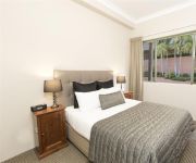
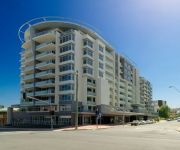
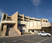
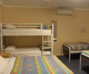
Hotels and Places to Stay
SAGE HOTEL WOLLONGONG F.K.A CHIFLEY
QUEST WOLLONGONG
BELMORE ALL SUITE HOTEL
Novotel Wollongong Northbeach
Adina Wollongong
BEST WESTERN CITY SANDS
Flinders Motel
Normandie Motel and Function Centre
Beach Park Motel
Boat Harbour Motel
Videos from this area
These are videos related to the place based on their proximity to this place.
Wollongong virtual 3D city model - aero3Dpro
http://aero3dpro.com.au Large scale virtual 3D city model of Wollongong, NSW, Australia generated using aerial photogrammetry techniques.
Wollongong, New South Wales, Australia
Wollongong is a city in the Illawarra region of New South Wales. Heading south, Wollongong starts where Sydney finishes. It is the third largest city in the state behind Sydney and Newcastle...
Skydiving Wollongong
http://www.adrenalin.com.au/skydiving-tandem-skydive/nsw-sydney/air/12779 Live the most exhilarating experience of your life...skydiving, the highest, fastest, most spectacular adventure sport...
My Skydive the beach, Wollongong, tandem jump 22/2/2015
For my 40th birthday I got a tandem skydive over Wollongong woooo hoooo!!!!
me skydiving over the beach Wollongong for my 14th birthday
me skydiving over the beach Wollongong for my 14th birthday it was so much fun!!!!!!!!!!!!
Wollongong Sunrise Timelapse
I was playing with a D7000 shooting frames using triggertrap on my phone. This is the result.
Figtree Physie - Wollongong ColorRun 2014
Our Open Senior dance class entered a team into the 2014 Wollongong ColourRun and used to opportunity to raise funds for the NSW Cancer Council. We raised over $2700... and had a blast ...
New Years Eve North Wollongong Hotel 2012 - 2013 Video 4/4
New Years Eve North Wollongong Hotel 2012 - 2013 Video 4/4 This year the entertainment line-up is nothing short of out of this world. RUBY ROSE is set to headline the stellar event. She will...
Videos provided by Youtube are under the copyright of their owners.
Attractions and noteworthy things
Distances are based on the centre of the city/town and sightseeing location. This list contains brief abstracts about monuments, holiday activities, national parcs, museums, organisations and more from the area as well as interesting facts about the region itself. Where available, you'll find the corresponding homepage. Otherwise the related wikipedia article.
Wollongong
Wollongong is a seaside city located in the Illawarra region of New South Wales, Australia. Wollongong lies on the narrow coastal strip between the Illawarra Escarpment and the Pacific Ocean, 82 kilometres (51 mi) south of Sydney. Wollongong's Statistical District has a population of 292,190, making Wollongong the third largest city in New South Wales after Sydney and Newcastle, and the ninth largest city in Australia.
University of Wollongong
The University of Wollongong also simply known as UOW is a public university located in the coastal city of Wollongong, New South Wales, Australia, approximately 80 kilometres south of Sydney. As of 2012, the university had a total of 30,516 students enrolled, including 11,440 international students from more than 140 countries. The University of Wollongong marked the University's 60th Founding Anniversary in 2011.
Fairy Meadow, New South Wales
Fairy Meadow is a suburb in the city of Wollongong, New South Wales, Australia. Located in the Illawarra region, it is a mainly low density residential area, except for a strip of small commercial properties located along the Princes Highway.
MacCabe Park
MacCabe Park is a small park located in the City of Wollongong, Australia. It is commonly misspelt McCabe Park, though the sign has since been changed to its correct name. In 1855 a land grant was made to Governor Brown, the present site of the park. It contains a playground at the north east corner of the rectangular area covered by the park, the local youth centre is in the north west side, and a sculpture called "Nike" is found in this area amidst a garden area.
Puckeys Estate Reserve
Puckey's Estate Reserve is a coastal nature reserve in Wollongong, Australia. It is mainly she-oak forest, but also has sand dune and wetland areas, including areas along Para Creek. It is located in the suburb of Fairy Meadow and is bounded by Fairy Meadow Beach to the east, Squires Way to the west, Elliotts Road to the north and Fairy Lagoon to the south. Puckey's Estate was traditionally used by the Wadi Wadi people, the Aboriginal tribe in Wollongong.
Wollongong Botanic Garden
The Wollongong Botanic Garden is located in the Wollongong suburb of Keiraville at the foot of Mount Keira in New South Wales, Australia. It is the local botanical gardens of the Illawarra and was opened in September 1970. http://www. hoskins. id. au/nextgen/showphoto. php?personID=2293I&tree=hoskinsfamily&ordernum=1 The garden is co-located with the historic Gleniffer Brae house, used for functions and the Wollongong Conservatorium of Music.
Keira High School
Keira High School in Wollongong, New South Wales has existed as an institution under several names since 1917. Originally a collection of boys' technical schools on several sites throughout Wollongong, the school was amalgamated in 1954 at its current site in Lysaght Street North Wollongong. The school then became known as Keira Boys High School and remained as such until 1984.
Smith's Hill High School
Smith's Hill High School is the only academically selective school in Wollongong, New South Wales, Australia. To gain entry into the school, student's must obtain marks which place them in the top 120 Year 6 students applicants; in a state-set examination for entry into all Academically Selective High Schools in NSW. The successful students will then be offered a place to commence their time at the school in the following academic year.
North Wollongong railway station
North Wollongong is a railway station on the South Coast Line of the CityRail outer suburban network, serving the suburb of North Wollongong. The station consists of two side platforms. It receives, on average, two services per hour on weekdays (with more services during peak hours) and one per hour on weekends. The station is unofficially also identified on its platforms as the University of Wollongong station, due to the proximity of the university to the station.
Wollongong railway station
Wollongong Station is a railway station on the South Coast Line of the CityRail outer suburban network, serving the central business district of the Illawarra region's major centre of Wollongong. The station consists of two side platforms for through trains with two non-electrified dock platforms for terminating services from the south.
Wollongong High School of the Performing Arts
Wollongong High School of the Performing Arts is a specialist co-educational, government secondary school located in Fairy Meadow, a suburb of Wollongong, New South Wales, Australia, run by the New South Wales Department of Education and Training. It was founded in 1916. The school enrolls both local area students and students who gain entry through auditions. The school estimates that over a third of the student body has gained entry through auditions.
Wollongong Showground
Wollongong Showground is a rectangular multi-purpose stadium located in the city of Wollongong, New South Wales, Australia. The stadium was officially opened in 1911. From 1982 until 1998 it played host to every home match for the Illawarra Steelers NRL team. It is now used as one home ground of the St George Illawarra Dragons rugby league side.
City of Wollongong
The City of Wollongong is a local government area in the Illawarra region of New South Wales, Australia. The area is situated adjacent to the Tasman Sea, the Southern Freeway and the South Coast railway line.
Coniston, New South Wales
Coniston is a suburb of Wollongong in New South Wales. Coniston has one public primary school, east of the railway, and its main street is Gladstone Avenue which is the business center of the suburb. The suburb has a beach, Coniston Beach, to the east of Wollongong Golf Course, and Coniston railway station is in the suburb's business centre. Coniston has a pub, Gilmore's Hotel Coniston which is a drinking establishment.
Wollongong Central
Wollongong Central is a major shopping centre in the Illawarra region, located in the CBD of Wollongong, New South Wales approximately 90 kilometres south of Sydney. It is operated and managed by Australian property investment company, General Property Trust (GPT). It is of local importance and is used by much of the Illawarra community as a social and shopping centre. It is situated in the western half of the Crown Street Mall.
North Wollongong, New South Wales
North Wollongong is the immediate northern coastal suburb of Wollongong, New South Wales, Australia. North Wollongong is used to refer to the northern area of Wollongong as well as North Wollongong by locals, despite the official suburb not including the northern apartment areas of Wollongong and North Beach, known as North Wollongong.
WIN Entertainment Centre
WIN Entertainment Centre (formally Wollongong Entertainment Centre and commonly WEC) is a multi-purpose indoor arena, located in downtown Wollongong, New South Wales, Australia. The WEC opened on 5 September 1998 with a concert by Bob Dylan and Patti Smith; 4,935 people attended the event. Dylan performed at the venue again in 2011 performing to a crowd of 3,214 people.
Roman Catholic Diocese of Wollongong
The Roman Catholic Diocese of Wollongong is a suffragan Latin rite diocese of the Archdiocese of Sydney, established in 1951, covering the Illawarra and Southern Highlands regions of New South Wales, Australia. St Francis Xavier's Cathedral, Wollongong is the seat of the Roman Catholic Bishop of Wollongong, currently the Most Reverend Peter Ingham.
West Wollongong, New South Wales
West Wollongong is the innermost western suburb of the coastal city of Wollongong, New South Wales, Australia. It is mainly a residential area, serviced by a small commercial strip with a music store, chicken shop, electric goods store and carpet store along the Princes Highway with several petrol stations, two restaurants, a liquor store, a chemist and a flower shop.
Smiths Hill Fort
Smiths Hill Fort was a fort at North Wollongong, New South Wales, Australia. The fort was also known as Wollongong Fort.
Gwynneville, New South Wales
Gwynneville is an inner city suburb of Wollongong, New South Wales, Australia located approximately 2 km north west of the city centre. It was originally named Gwynne Ville after the Gwynne family who owned the property. It was sold it two large lots, both of which were subdivided. The first area, owned by Mr John Gwynne, consisted of 86 allotments, and went to auction on the 3rd of March 1886.
Adolphus (1852)
The Adolphus was a wooden Brigantine that was wrecked on the rocks west of Pier Head at Wollongong harbour in New South Wales on 29 November 1866. The ship was carrying coal from Wollongong to Sydney under the command of Captain William Kean. There were no casualties, but the vessel was lost. The wreck has not been located, but the approximate coordinates are {{#invoke:Coordinates|coord}}{{#coordinates:-34.4189|150.9071|type:landmark_region:AU|||||| |primary |name= }}.
St Francis Xavier's Cathedral, Wollongong
The Cathedral Saint Francis Xavier, Wollongong, New South Wales, Australia, is the seat of the Roman Catholic Bishop of the Diocese of Wollongong, presently the Most Reverend Peter Ingham. The Cathedral is the oldest church of any denomination in the Illawarra region.
International House, University of Wollongong
International House is the oldest residential college of the University of Wollongong and is an affiliate of the 16 International Houses Worldwide. It provides accommodation to approximately 218 students who are attending the University of Wollongong. It is situated at the corner of Porter and Hindmarsh Avenue in North Wollongong, near the North Wollongong railway station.
SMART Infrastructure Facility
The SMART Infrastructure Facility is the national centre for infrastructure solutions in Australia, located at the University of Wollongong, New South Wales, Australia. SMART stands for ‘Simulation, Modelling, Analysis, Research and Teaching’.


