Explore Mount Pleasant
The district Mount Pleasant of in Wollongong (New South Wales) is located in Australia about 116 mi north-east of Canberra, the country's capital.
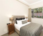
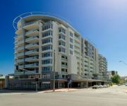
If you need a place to sleep, we compiled a list of available hotels close to the map centre further down the page.
Depending on your travel schedule, you might want to pay a visit to some of the following locations: Parramatta, Sydney, Katoomba, Canberra and . To further explore this place, just scroll down and browse the available info.
Local weather forecast
Todays Local Weather Conditions & Forecast: 17°C / 63 °F
| Morning Temperature | 14°C / 57 °F |
| Evening Temperature | 17°C / 62 °F |
| Night Temperature | 15°C / 60 °F |
| Chance of rainfall | 0% |
| Air Humidity | 65% |
| Air Pressure | 1030 hPa |
| Wind Speed | Moderate breeze with 12 km/h (8 mph) from North |
| Cloud Conditions | Scattered clouds, covering 38% of sky |
| General Conditions | Light rain |
Thursday, 2nd of May 2024
18°C (64 °F)
15°C (60 °F)
Light rain, moderate breeze, scattered clouds.
Friday, 3rd of May 2024
18°C (64 °F)
14°C (58 °F)
Overcast clouds, moderate breeze.
Saturday, 4th of May 2024
18°C (65 °F)
15°C (59 °F)
Light rain, moderate breeze, overcast clouds.
Hotels and Places to Stay
SAGE HOTEL WOLLONGONG F.K.A CHIFLEY
Novotel Wollongong Northbeach
BELMORE ALL SUITE HOTEL
QUEST WOLLONGONG
Adina Wollongong
BEST WESTERN CITY SANDS
Flinders Motel
Normandie Motel and Function Centre
Beach Park Motel
Boat Harbour Motel
Videos from this area
These are videos related to the place based on their proximity to this place.
New Years Eve North Wollongong Hotel 2012 - 2013 Video 4/4
New Years Eve North Wollongong Hotel 2012 - 2013 Video 4/4 This year the entertainment line-up is nothing short of out of this world. RUBY ROSE is set to headline the stellar event. She will...
Mt Keira - Wollongong NSW Australia
Mount Keira /ˈkɪərə/ is a 464[2] metre high mountain lying four kilometres northwest of the city of Wollongong, New South Wales, Australia. Its distinctive shape and proximity to Wollongong...
Fairy Meadow Skate Park Demo/Teaser - Old School Skate Session 2013
Cranking out some old school moves on my single kick Lance Mountain Powell Peralta, One early May morning at Fairy Meadow skate park, N.S.W, Australia. Gopro Hero2. Filmed, edited and Rider-...
Charlie after a 5km run on a 40 degree day...
Went for a walk with Charlie up to the old Corrimal Mine; since I was on my bike, she got more of a run than usual. Bloody hot day for it though; she's still panting 30 mins after getting back!
Keeping and Breeding Finches and Softbills in Outback Western Australia - Gary McCrae
Gary McCrae from Kalgoorlie-Boulder Western Australia is one of Australia's most capable finch and softbill breeders. At the October 2014 Wollongong Finch Club meeting Gary describes his aviary...
Balmoral @ Beaches...1 Grand Court Fairy Meadow
Be Part of Something Special...Balmoral @ Beaches is a luxury apartment complex nestled between Fairy Meadow and Towradgi...Come and experience the lifestyle change you deserve. Nathan ...
MT KEIRA DOWNHILL MOUNTAIN BIKING - JUN 13 GOPRO HD EDIT
Checking out some downhill/mountain tracks at Mt Keira , N.S.W, Australia. Riders in Order of Appearance- Emre, Levi, Joel. (solo J - jcproductions007) Edit - Solo J- jcproductions007 Stayed...
Videos provided by Youtube are under the copyright of their owners.
Attractions and noteworthy things
Distances are based on the centre of the city/town and sightseeing location. This list contains brief abstracts about monuments, holiday activities, national parcs, museums, organisations and more from the area as well as interesting facts about the region itself. Where available, you'll find the corresponding homepage. Otherwise the related wikipedia article.
University of Wollongong
The University of Wollongong also simply known as UOW is a public university located in the coastal city of Wollongong, New South Wales, Australia, approximately 80 kilometres south of Sydney. As of 2012, the university had a total of 30,516 students enrolled, including 11,440 international students from more than 140 countries. The University of Wollongong marked the University's 60th Founding Anniversary in 2011.
Fairy Meadow, New South Wales
Fairy Meadow is a suburb in the city of Wollongong, New South Wales, Australia. Located in the Illawarra region, it is a mainly low density residential area, except for a strip of small commercial properties located along the Princes Highway.
Mount Keira
Mount Keira is a 464 metre high mountain lying 4 kilometres northwest of the city of Wollongong, New South Wales, Australia. Its distinctive shape and proximity to Wollongong make it a major local landmark. It is noted for the views of the city from the popular summit lookout and its history of coal mining. It was formed as part of the Illawarra escarpment fold between 80 and 60 million years ago and the erosion by creeks that ensued.
Towradgi, New South Wales
Towradgi is a small beach-side suburb approximately 5 km north of Wollongong. Towradgi is a corruption of the aboriginal word "Kow-radgi" meaning "guardian of the sacred stones". On an early map it was called Towroger. Towradgi is served by Towradgi station, opened in 1948. Electric double deck trains serve Towradgi. It is bordered to the north by Corrimal, the west by Fernhill & Tarrawanna and to the south by Fairy Meadow. The Pacific Ocean can be found to the east.
Balgownie, New South Wales
Balgownie is a small suburb of Wollongong City, New South Wales, Australia. Balgownie lies to the north-west of the Wollongong CBD. It stretches from the lower slopes of Mount Keira along the Illawarra escarpment to the base of the Broker's Nose promontory. To the east, Balgownie is bordered by the light industrial and commercial suburb of Fairy Meadow. The main street, Balgownie Road, connects the suburb to the nearby Princes Highway.
Puckeys Estate Reserve
Puckey's Estate Reserve is a coastal nature reserve in Wollongong, Australia. It is mainly she-oak forest, but also has sand dune and wetland areas, including areas along Para Creek. It is located in the suburb of Fairy Meadow and is bounded by Fairy Meadow Beach to the east, Squires Way to the west, Elliotts Road to the north and Fairy Lagoon to the south. Puckey's Estate was traditionally used by the Wadi Wadi people, the Aboriginal tribe in Wollongong.
Mount Pleasant, New South Wales
Mount Pleasant is a suburb in the city of Wollongong, New South Wales, Australia. It is situated on the northern flank of Mount Keira extending across to the Illawarra escarpment. It is home to the Rhododendron Park, found on Parrish Avenue.
Wollongong Botanic Garden
The Wollongong Botanic Garden is located in the Wollongong suburb of Keiraville at the foot of Mount Keira in New South Wales, Australia. It is the local botanical gardens of the Illawarra and was opened in September 1970. http://www. hoskins. id. au/nextgen/showphoto. php?personID=2293I&tree=hoskinsfamily&ordernum=1 The garden is co-located with the historic Gleniffer Brae house, used for functions and the Wollongong Conservatorium of Music.
Keira High School
Keira High School in Wollongong, New South Wales has existed as an institution under several names since 1917. Originally a collection of boys' technical schools on several sites throughout Wollongong, the school was amalgamated in 1954 at its current site in Lysaght Street North Wollongong. The school then became known as Keira Boys High School and remained as such until 1984.
North Wollongong railway station
North Wollongong is a railway station on the South Coast Line of the CityRail outer suburban network, serving the suburb of North Wollongong. The station consists of two side platforms. It receives, on average, two services per hour on weekdays (with more services during peak hours) and one per hour on weekends. The station is unofficially also identified on its platforms as the University of Wollongong station, due to the proximity of the university to the station.
Wollongong High School of the Performing Arts
Wollongong High School of the Performing Arts is a specialist co-educational, government secondary school located in Fairy Meadow, a suburb of Wollongong, New South Wales, Australia, run by the New South Wales Department of Education and Training. It was founded in 1916. The school enrolls both local area students and students who gain entry through auditions. The school estimates that over a third of the student body has gained entry through auditions.
Towradgi railway station
Towradgi is a CityRail railway station on the South Coast railway line. It serves the residential suburb of Towradgi which is a suburb of Wollongong. The station has two side platforms, connected by a footway along a road overpass. The station is served by about one train per hour for most of the time (usually a Thirroul-Port Kembla local service), with additional trains at weekday peak hours.
Fairy Meadow railway station
Fairy Meadow is a CityRail railway station on the South Coast railway line. It serves the residential Wollongong suburb of Fairy Meadow. The station has two side platforms, connected by a pedestrian overbridge and level crossing. The station is served by about one train per hour for most of the time (usually a Thirroul-Port Kembla local service), with additional trains at weekday peak hours.
City of Wollongong
The City of Wollongong is a local government area in the Illawarra region of New South Wales, Australia. The area is situated adjacent to the Tasman Sea, the Southern Freeway and the South Coast railway line.
North Wollongong, New South Wales
North Wollongong is the immediate northern coastal suburb of Wollongong, New South Wales, Australia. North Wollongong is used to refer to the northern area of Wollongong as well as North Wollongong by locals, despite the official suburb not including the northern apartment areas of Wollongong and North Beach, known as North Wollongong.
Mount Nebo (New South Wales)
Mount Nebo is a tall hill, part of the Illawarra escarpment foothills on the edge of the suburban fringe of the city of Wollongong, New South Wales. Its summit (252 metres above sea level), is reached by a steep road (O'Brien's Road) from the suburb of Figtree. O'Brien's Road is unusual in that it was built as a private toll road in the early 19th century to connect Sydney and the Illawarra. O'Briens Road began at the locally famous fig tree that gave the name to Figtree.
Keiraville, New South Wales
Keiraville is an inner suburb of the city of Wollongong, New South Wales, Australia in the Illawarra region. It is situated in the foothills of Mount Keira, approximately three kilometres northwest of Wollongong.
The Illawarra Grammar School
The Illawarra Grammar School (TIGS) is an independent, Anglican, co-educational day school located at Mangerton in the Illawarra region of New South Wales, Australia. The school currently caters for about 1100 students from pre-preparatory school to Year 12.
Mount Ousley, New South Wales
Mount Ousley is a residential suburb situated on the foothills of Mount Keira about four kilometres northwest from the city of Wollongong, New South Wales, Australia. It is also the name of the road which crosses the nearby Illawarra Escarpment and is adjacent to the University of Wollongong. Mount Ousley has a public school, Mount Ousley Public School. It also has an independent Montessori school Elonera Montessori School (EMS), that offers education from Preschool to Year 10.
West Wollongong, New South Wales
West Wollongong is the innermost western suburb of the coastal city of Wollongong, New South Wales, Australia. It is mainly a residential area, serviced by a small commercial strip with a music store, chicken shop, electric goods store and carpet store along the Princes Highway with several petrol stations, two restaurants, a liquor store, a chemist and a flower shop.
Tarrawanna, New South Wales
Tarrawanna is a northern suburb of Wollongong, New South Wales, Australia, extending westward from the Princes Highway over the Illawarra Escarpment.
Gwynneville, New South Wales
Gwynneville is an inner city suburb of Wollongong, New South Wales, Australia located approximately 2 km north west of the city centre. It was originally named Gwynne Ville after the Gwynne family who owned the property. It was sold it two large lots, both of which were subdivided. The first area, owned by Mr John Gwynne, consisted of 86 allotments, and went to auction on the 3rd of March 1886.
Brokers Nose
Brokers Nose or Mount Corrimal is the name of an outcrop of the Illawarra Escarpment west of Corrimal, New South Wales. Its summit is 440 metres above sea level and there is a television transmission tower atop it. There is a track leading to the top but both track and summit are not open to the public; the summit is protected as part of the Illawarra Escarpment State Recreation Area. The name is vague in its origins and there are three possible explanations for it.
International House, University of Wollongong
International House is the oldest residential college of the University of Wollongong and is an affiliate of the 16 International Houses Worldwide. It provides accommodation to approximately 218 students who are attending the University of Wollongong. It is situated at the corner of Porter and Hindmarsh Avenue in North Wollongong, near the North Wollongong railway station.
SMART Infrastructure Facility
The SMART Infrastructure Facility is the national centre for infrastructure solutions in Australia, located at the University of Wollongong, New South Wales, Australia. SMART stands for ‘Simulation, Modelling, Analysis, Research and Teaching’.


