Discover Cordeaux Heights
The district Cordeaux Heights of in Wollongong (New South Wales) with it's 5,067 citizens Cordeaux Heights is a district in Australia about 113 mi north-east of Canberra, the country's capital city.
Looking for a place to stay? we compiled a list of available hotels close to the map centre further down the page.
When in this area, you might want to pay a visit to some of the following locations: Parramatta, Sydney, Katoomba, Canberra and . To further explore this place, just scroll down and browse the available info.
Local weather forecast
Todays Local Weather Conditions & Forecast: 14°C / 58 °F
| Morning Temperature | 14°C / 58 °F |
| Evening Temperature | 15°C / 59 °F |
| Night Temperature | 15°C / 59 °F |
| Chance of rainfall | 22% |
| Air Humidity | 87% |
| Air Pressure | 1029 hPa |
| Wind Speed | Gentle Breeze with 8 km/h (5 mph) from North |
| Cloud Conditions | Overcast clouds, covering 100% of sky |
| General Conditions | Moderate rain |
Saturday, 4th of May 2024
17°C (62 °F)
15°C (58 °F)
Light rain, gentle breeze, overcast clouds.
Sunday, 5th of May 2024
15°C (58 °F)
15°C (59 °F)
Heavy intensity rain, moderate breeze, overcast clouds.
Monday, 6th of May 2024
17°C (62 °F)
15°C (60 °F)
Moderate rain, moderate breeze, broken clouds.
Hotels and Places to Stay
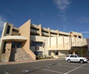
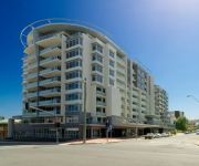
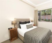
SAGE HOTEL WOLLONGONG F.K.A CHIFLEY
QUEST WOLLONGONG
BEST WESTERN CITY SANDS
Adina Wollongong
BELMORE ALL SUITE HOTEL
Novotel Wollongong Northbeach
Flinders Motel
Normandie Motel and Function Centre
Beach Park Motel
Boat Harbour Motel
Videos from this area
These are videos related to the place based on their proximity to this place.
Round 2 final
Round 2 final of elite watercooled at the Australian Mini Moto Championships at Wollongong City Raceway on 28/6/2009.
2015 Norco Sight Carbon Review
Mini review of my 2015 Norco Sight C7.1. This is the top model in Norco's All Mountain category with the 160 mm Norco Range filling the Enduro category There are 5 bikes in total in the...
Kart Drifting @ Fox Karting Centre Wollongong
Kart Drifting now available for anyone to try @ Fox Karting Centre Wollongong. Give us a call on (02) 4260 8958 for more information.
Mt Keira - Wollongong NSW Australia
Mount Keira /ˈkɪərə/ is a 464[2] metre high mountain lying four kilometres northwest of the city of Wollongong, New South Wales, Australia. Its distinctive shape and proximity to Wollongong...
Scotty jaggerman Deez - I Take Drugs
Scotty 'jaggerman' Deez - I Take Drugs Recorded in 2005, NSW Australia. Video put together Feb. 2014 for more Scotty jaggerman Deez songs: https://soundcloud.com/scottyjaggermandeez.
'Classic Beats 2013' Hannah Gee
A combined claymation and photo-cut animation I made for uni this semester. All of the visual material was made through stopmotion photographic techniques. The soundtrack is a mix of sounds...
New data centre opens in the Illawarra
A new purpose-built data centre at Unanderra was officially opened by Minister for Finance and Services, Andrew Constance, on Friday, 5 December. The $125 million state-of-the-art hub has...
Videos provided by Youtube are under the copyright of their owners.
Attractions and noteworthy things
Distances are based on the centre of the city/town and sightseeing location. This list contains brief abstracts about monuments, holiday activities, national parcs, museums, organisations and more from the area as well as interesting facts about the region itself. Where available, you'll find the corresponding homepage. Otherwise the related wikipedia article.
University of Wollongong
The University of Wollongong also simply known as UOW is a public university located in the coastal city of Wollongong, New South Wales, Australia, approximately 80 kilometres south of Sydney. As of 2012, the university had a total of 30,516 students enrolled, including 11,440 international students from more than 140 countries. The University of Wollongong marked the University's 60th Founding Anniversary in 2011.
Mount Keira
Mount Keira is a 464 metre high mountain lying 4 kilometres northwest of the city of Wollongong, New South Wales, Australia. Its distinctive shape and proximity to Wollongong make it a major local landmark. It is noted for the views of the city from the popular summit lookout and its history of coal mining. It was formed as part of the Illawarra escarpment fold between 80 and 60 million years ago and the erosion by creeks that ensued.
Mount Kembla
Mount Kembla is a mountain in New South Wales, Australia, as well a semi-rural township of Wollongong, which gets its name from the mountain. Kembla is an Aboriginal word meaning "plenty of game". It is a coal mining area, notable for the Mount Kembla Mine disaster of 1902 in which 96 people lost their lives.
Nan Tien Temple
Nan Tien Temple is a Buddhist temple complex located in the industrial suburb of Berkeley, on the southern outskirts of the Australian city of Wollongong, approximately 80 km south of Sydney. Nan Tien is a Chinese term which means "southern paradise". Nan Tien is one of the branch temples of the Taiwanese Fo Guang Shan Buddhist order, founded in 1967 by Hsing Yun, which has over 120 branches worldwide. The temple is one of the largest Buddhist temples in the southern hemisphere.
Unanderra, New South Wales
Unanderra is a suburb of Wollongong in New South Wales, Australia. It is located approximately 10 km south-west of the Wollongong CBD. It is bordered to the west by Farmborough, Cordeaux Heights and Farmborough Heights in the Mount Kembla foothills, the north by Figtree, the east by Berkeley and Flagstaff Hill, site of the Nan Tien Temple, and the south by Kembla Grange. Unanderra is both a residential suburb, mostly to the west of the Princes Highway and industrial, to the east.
Wollongong Botanic Garden
The Wollongong Botanic Garden is located in the Wollongong suburb of Keiraville at the foot of Mount Keira in New South Wales, Australia. It is the local botanical gardens of the Illawarra and was opened in September 1970. http://www. hoskins. id. au/nextgen/showphoto. php?personID=2293I&tree=hoskinsfamily&ordernum=1 The garden is co-located with the historic Gleniffer Brae house, used for functions and the Wollongong Conservatorium of Music.
Kembla Grange Racecourse railway station
Kembla Grange Racecourse (also known as Kembla Grange) is a CityRail railway station in Kembla Grange on the South Coast railway line. It serves the adjacent horse racing course. The station is on a single line section of the South Coast line, and has one side platform. The station is served only on weekends, and only by demand (an 'a' station). Until 2005 a limited number of trains previously serviced Kembla Grange on Monday to Fridays. The station is not near any housing.
Unanderra railway station
Unanderra railway station is located on the South Coast (Illawarra) railway line in the Wollongong suburb of Unanderra, New South Wales, Australia. It is served by 'intercity' trains of CityRail's South Coast line. Opened in 1887, the station consists of an island platform with access via an overbridge across the rail tracks. The station marks the end of the double track section of the South Coast line, and the junction with the Unanderra-Moss Vale railway line is located to the south.
Lysaghts railway station
Lysaghts is a CityRail railway station on the Port Kembla branch of the South Coast railway line in Australia. It is a workers only station serving BlueScope Steel Springhill Works to the west and the Flat Products Area of Port Kembla Steelworks to the east. Access from the station to these properties is restricted to employees only by security gates. The station has two side platforms, connected by an overhead footbridge.
Cringila railway station
Cringila is a CityRail railway station on the Port Kembla branch of the South Coast railway line. It serves the Wollongong suburb of Cringila. The station has an island platform. The northern access from the platform provides access to BlueScope Steel Port Kembla Steelworks via a secured gate. The southern access is from Five Island Road. It is served by approximately one train per hour, usually a local service to Thirroul, but with extra direct trains to and from Sydney in the peak hours.
Mount Nebo (New South Wales)
Mount Nebo is a tall hill, part of the Illawarra escarpment foothills on the edge of the suburban fringe of the city of Wollongong, New South Wales. Its summit (252 metres above sea level), is reached by a steep road (O'Brien's Road) from the suburb of Figtree. O'Brien's Road is unusual in that it was built as a private toll road in the early 19th century to connect Sydney and the Illawarra. O'Briens Road began at the locally famous fig tree that gave the name to Figtree.
The Illawarra Grammar School
The Illawarra Grammar School (TIGS) is an independent, Anglican, co-educational day school located at Mangerton in the Illawarra region of New South Wales, Australia. The school currently caters for about 1100 students from pre-preparatory school to Year 12.
Cringila, New South Wales
Cringila is a densely populated southern suburb in the city of Wollongong, New South Wales, Australia, about 4 km along Springhill Road. The suburb is bounded by Berkeley, Unanderra, Lake Heights and Warrawong. The suburb is planned on a north-south residential/commercial strip and the east west streets that adjoin it, making a rectangular pattern. From the hilltops fine views of Lake Illawarra to the south and Port Kembla steelworks and industries to the north are had.
Mangerton, New South Wales
Mangerton is an inner western suburb of the coastal city of Wollongong, New South Wales, Australia. Mount Mangerton is the name of the hill on which Mangerton resides mostly. The hill is part of the Mangerton hill mass which also incorporates Mount Saint Thomas, a lower peak, south of Mangerton, see Coniston. The suburb is mostly residential with the exception of a convenience store in its southwestern area and a couple of specialty stores beside it.
Mount Ousley, New South Wales
Mount Ousley is a residential suburb situated on the foothills of Mount Keira about four kilometres northwest from the city of Wollongong, New South Wales, Australia. It is also the name of the road which crosses the nearby Illawarra Escarpment and is adjacent to the University of Wollongong. Mount Ousley has a public school, Mount Ousley Public School. It also has an independent Montessori school Elonera Montessori School (EMS), that offers education from Preschool to Year 10.
Cordeaux Heights, New South Wales
Cordeaux Heights is a suburb in the city of Wollongong, New South Wales, Australia. It is situated on the eastern foothills of Mount Kembla as is its southern neighbour Farmborough Heights. Its northern boundary of housing is along Cordeaux Road which goes to Mount Kembla Village. Cordeaux Heights has a few shops.
Figtree, New South Wales
Figtree is an inner western suburb of Wollongong, New South Wales, Australia. It is southwest of West Wollongong and connected to Wollongong by the Princes Highway and The Avenue. At the junction of the highway and The Avenue is Westfield Figtree, a two storey indoor shopping centre with a Woolworths, Coles and Kmart. The shopping centre was opened in 1965. The second story is used by a couple of businesses and a second storey to its carpark facilities.
West Wollongong, New South Wales
West Wollongong is the innermost western suburb of the coastal city of Wollongong, New South Wales, Australia. It is mainly a residential area, serviced by a small commercial strip with a music store, chicken shop, electric goods store and carpet store along the Princes Highway with several petrol stations, two restaurants, a liquor store, a chemist and a flower shop.
Westfield Figtree
Westfield Figtree is a major shopping centre, located in Figtree, a suburb of Wollongong, New South Wales, Australia.
Kembla Heights, New South Wales
Kembla Heights is a village suburb of Wollongong, New South Wales. It is situated on Harry Graham Drive which is part of a tourist route and runs along the Illawarra Escarpment for a distance between Mount Kembla and Mount Keira. The Dendrobium Colliery (Illawara Coal, BHP) is located in this suburb.
Farmborough Heights, New South Wales
Farmborough Heights is a southern, medium-high wealth suburb in the city of Wollongong, New South Wales, Australia. It is situated to the west of Unanderra in the foothills of Mount Kembla. The suburb mainly consists of separate residential dwellings, but also has a general store and a take away. The take away and many other stores were demolished in 2010 to make room for more housing. Farmborough Heights is situated on two ridges, both are the lesser slopes of Mount Kembla.
John Crehan Park
John Crehan Park is a multi-use stadium in the southern part of Wollongong, Australia. The stadium is on Merret Avenue, Cringila. It is currently used mostly for football matches. It is the home of New South Wales Premier League side Wollongong FC and Illawarra Premier League side Cringila Lions. It was once the temporary home ground of the Rockdale Ilinden Football Club as their regular home ground was disrupted by near-by construction.
Drummond Battery
Drummond Battery was a counter bombardment battery at Port Kembla, New South Wales, Australia during World War II. Constructed in 1942 to provide protection for Port Kembla from enemy shipping and submarines. Two BL 9.2 inch Mk X gun emplacements with related underground facilities were constructed near Drummond, Wollongong.
Figtree High School
Figtree High School is a comprehensive public high school located on Gibsons Road in Figtree, a suburb of Wollongong, New South Wales, Australia.
Berkeley, New South Wales
Berkeley is a suburb of Wollongong, New South Wales. The suburb is located in Wollongong's southern suburbs, on the northern shore of Lake Illawarra. Historically a farming community situated between the hills and Lake Illawarra, Berkeley became one of the Illawarra's solutions to a public housing shortage in the early years. Subsequently several public housing developments commenced and most of these are still in existence today in certain parts of the suburb.


