Safety Score: 2,7 of 5.0 based on data from 9 authorites. Meaning we advice caution when travelling to United States.
Travel warnings are updated daily. Source: Travel Warning United States. Last Update: 2024-05-02 08:23:34
Discover Aberdeen
Aberdeen in Suffolk County (Massachusetts) is a place in United States about 390 mi (or 627 km) north-east of Washington DC, the country's capital city.
Current time in Aberdeen is now 12:35 AM (Friday). The local timezone is named America / New York with an UTC offset of -4 hours. We know of 11 airports near Aberdeen, of which 5 are larger airports. The closest airport in United States is General Edward Lawrence Logan International Airport in a distance of 7 mi (or 12 km), East. Besides the airports, there are other travel options available (check left side).
Also, if you like playing golf, there are a few options in driving distance. We encountered 2 points of interest in the vicinity of this place. If you need a hotel, we compiled a list of available hotels close to the map centre further down the page.
While being here, you might want to pay a visit to some of the following locations: Boston, Dedham, Taunton, Providence and North Providence. To further explore this place, just scroll down and browse the available info.
Local weather forecast
Todays Local Weather Conditions & Forecast: 14°C / 57 °F
| Morning Temperature | 9°C / 48 °F |
| Evening Temperature | 12°C / 53 °F |
| Night Temperature | 9°C / 49 °F |
| Chance of rainfall | 0% |
| Air Humidity | 60% |
| Air Pressure | 1023 hPa |
| Wind Speed | Gentle Breeze with 8 km/h (5 mph) from South-West |
| Cloud Conditions | Broken clouds, covering 69% of sky |
| General Conditions | Broken clouds |
Friday, 3rd of May 2024
13°C (55 °F)
8°C (46 °F)
Broken clouds, gentle breeze.
Saturday, 4th of May 2024
9°C (48 °F)
9°C (48 °F)
Moderate rain, light breeze, overcast clouds.
Sunday, 5th of May 2024
17°C (63 °F)
13°C (56 °F)
Light rain, light breeze, overcast clouds.
Hotels and Places to Stay
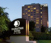
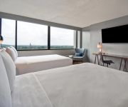
DoubleTree Suites by Hilton Boston - Cambridge
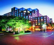
Crowne Plaza BOSTON - NEWTON
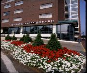
Charles Hotel Harvard Square
AC Hotel Boston Cleveland Circle
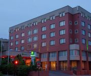
Holiday Inn BOSTON-BROOKLINE
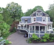
Chesley Road Bed and Breakfast
The Inn at Longwood Medical
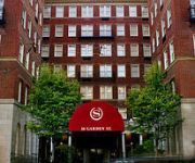
Sheraton Commander Hotel
Harvard Square
Courtyard Boston Cambridge
Videos from this area
These are videos related to the place based on their proximity to this place.
Fr. Pavlos of Sinai in Brookline MA, at Holy Cross Greek Orthodox school of theology
Fr. Pavlos is an Elder, a monk from a very famous monastery in Egypt. St. Katherine's Monastery is new to the mountains where Moses reseved the ten commandments, where he spoke with God face...
Brookline Ma | Flat Roof | Shingled Roof | Ice Dam | Call 781-455-0556 | GF Sprague
Here's a recent job G.F. Sprague completed in Brookline Massachusetts (http://www.gfsprague.com/roofing-brookline/). The project involved repairing and replacing a flat roof and a shingle...
Cabot Estate in Jamaica Plain
Cabot Estate in Jamaica Plain is located at 241 Perkins Street, across the Jamaica Pond. Take a look at the beautiful grounds and amenities it offers.
Ir. Kelly Patrícia fala sobre a Busca de Deus em Allston (USA)
A Ir. Kelly Patrícia que está desde o início do mês de fevereiro em missão nos EUA, esteve com um grupo de brasileiros em Allston (Massachusetts - USA) onde falou sobre a Busca de Deus....
A Ride thru Allston MA after the Big Snowstorms of February 2015
A Ride thru Allston MA after the Big Snowstorms of February 2015.
Worcester Bound MBTA Commuter Train Passing thru Allston/Brighton.
Worcester bound MBTA commuter train passing thru Allston and under the Everett St. bridge into Brighton in late afternoon of August 29, 2014.
Refuge Cafe, Allston
How to spend a cosy afternoon in Allston ? Try this: a coffee, a coconut cupcake and a book in Refuge Cafe. My blog in English www.maathiildee.com/en ... et en français www.maathiildee.com/fr.
Leavitt Steam Engine/Pump animation
Informational display video of the Leavitt triple-expansion steam engine/water pump system located in the Chestnut Hill Museum. This version is fairly low-res; the full-sized version runs in...
Videos provided by Youtube are under the copyright of their owners.
Attractions and noteworthy things
Distances are based on the centre of the city/town and sightseeing location. This list contains brief abstracts about monuments, holiday activities, national parcs, museums, organisations and more from the area as well as interesting facts about the region itself. Where available, you'll find the corresponding homepage. Otherwise the related wikipedia article.
Brighton, Boston
Brighton is a dissolved municipality and current neighborhood of Boston, Massachusetts, United States, and is located in the northwest corner of the city. It is named after the town of Brighton in the English city of Brighton and Hove. For its first 160 years Brighton was part of Cambridge and was known as “Little Cambridge. " Throughout much of its early history it was a rural town with a significant commercial center at its eastern end.
Cleveland Circle and Reservoir (MBTA stations)
Cleveland Circle and Reservoir are adjacent stops on different branches of the Massachusetts Bay Transportation Authority's Green Line, located at Beacon Street and Chestnut Hill Avenue at Cleveland Circle, in the Brighton neighborhood of Boston. Cleveland Circle is the terminus of the "C" branch, whilst Reservoir is an intermediate stop on the "D" branch, although Reservoir is sometimes used as a terminus.
Mount Saint Joseph Academy (Boston, Massachusetts)
Saint Joseph Preparatory High School is a Catholic, college-preparatory high school that advances the traditions and strengths of Mount Saint Joseph Academy and Trinity Catholic High School, Saint Joseph Preparatory High School will feature a rigorous education specializing in skill integration in technology, math and science applied across a curriculum that includes science, math, languages, social studies, fine arts, theology and physical education.
Dean Road (MBTA station)
Dean Road is the twelfth stop (starting from the beginning of the line at Kenmore) on the "C" Branch of the Green Line, which is a light rail line belonging to the MBTA. It is located in the median of Beacon Street, in the Boston suburb of Brookline. Additionally, like Cleveland Circle and Reservoir, Dean Road offers an easy transfer point between the "C" Branch and "D" Branch, as it is a 45 second walk south down Dean Road to the Beaconsfield stop.
South Street (MBTA station)
South Street is a stop on the MBTA Green Line's "B" branch from Boston College to Government Center. It is between Boston College and Chestnut Hill Avenue. There is no parking available.
Tappan Street (MBTA station)
Tappan Street is a surface-level station on the MBTA Green Line "C" Branch in Brookline, Massachusetts. The station is located in the median of Beacon Street just east of Tappan Street. The station consists of two side platforms which serve the "C" Branch's two tracks. The travel time from the station to Park Street is 29 minutes. Electrified streetcars have been running on the section of Beacon Street west of Coolidge Corner, including stops at Tappan Street, since 1889.
Englewood Avenue (MBTA station)
Englewood Avenue is a station on the MBTA Green Line "C" Branch in Brookline, Massachusetts. The station is located on Beacon Street at Englewood Avenue. Englewood Avenue consists of two side platforms which serve the "C" Branch's two tracks. The travel time from the station to Park Street is 31 minutes.
Warren Street (MBTA station)
Warren Street is a station on the MBTA Green Line "B" Branch located in Brighton, Massachusetts. The station is located at Commonwealth Avenue and Warren Street. Warren Street consists of two side platforms which serve the "B" Branch's two tracks. The station is not wheelchair accessible even for low-floor trams.
Washington Street (MBTA station)
Washington Street is a station on the MBTA Green Line "B" Branch located in Brighton, Massachusetts. The station is located at Commonwealth Avenue and Washington Street. Washington Street consists of two side platforms which serve the "B" Branch's two tracks.
Sutherland Street (MBTA station)
Sutherland Street is a station on the MBTA Green Line "B" Branch located in Brighton, Massachusetts. Although the MBTA website lists the stop as "Sutherland Street", both street signage and onboard announcements refer to the cross-street and stop as "Sutherland Road". The station is located at Sutherland and Commonwealth Avenue. The stop consists of two side platforms which serve the "B" Branch's two tracks.
Chiswick Road (MBTA station)
Chiswick Road is a station on the MBTA Green Line "B" Branch located in Brighton, Massachusetts. The station is located at Commonwealth Avenue and Chiswick Road. Chiswick Road consists of two side platforms which serve the "B" Branch's two tracks.
Boston Camera Club
The Boston Camera Club is the leading amateur photographic organization serving Boston, Massachusetts and vicinity. Founded in 1881, it offers activities of interest to amateur photographers, particularly digital photography. It meets weekly and is open to the public.


