Safety Score: 2,7 of 5.0 based on data from 9 authorites. Meaning we advice caution when travelling to United States.
Travel warnings are updated daily. Source: Travel Warning United States. Last Update: 2024-05-16 08:19:50
Explore Crow Point
Crow Point in Plymouth County (Massachusetts) is a city in United States about 397 mi (or 639 km) north-east of Washington DC, the country's capital.
Local time in Crow Point is now 12:27 PM (Thursday). The local timezone is named America / New York with an UTC offset of -4 hours. We know of 11 airports in the vicinity of Crow Point, of which 5 are larger airports. The closest airport in United States is General Edward Lawrence Logan International Airport in a distance of 9 mi (or 15 km), North-West. Besides the airports, there are other travel options available (check left side).
Also, if you like golfing, there are multiple options in driving distance. We found 5 points of interest in the vicinity of this place. If you need a place to sleep, we compiled a list of available hotels close to the map centre further down the page.
Depending on your travel schedule, you might want to pay a visit to some of the following locations: Boston, Dedham, Taunton, Providence and North Providence. To further explore this place, just scroll down and browse the available info.
Local weather forecast
Todays Local Weather Conditions & Forecast: 12°C / 54 °F
| Morning Temperature | 12°C / 54 °F |
| Evening Temperature | 12°C / 53 °F |
| Night Temperature | 12°C / 53 °F |
| Chance of rainfall | 23% |
| Air Humidity | 95% |
| Air Pressure | 1010 hPa |
| Wind Speed | Moderate breeze with 12 km/h (7 mph) from South-West |
| Cloud Conditions | Overcast clouds, covering 100% of sky |
| General Conditions | Moderate rain |
Thursday, 16th of May 2024
16°C (61 °F)
11°C (52 °F)
Few clouds, gentle breeze.
Friday, 17th of May 2024
14°C (58 °F)
10°C (50 °F)
Overcast clouds, gentle breeze.
Saturday, 18th of May 2024
12°C (54 °F)
10°C (50 °F)
Broken clouds, gentle breeze.
Hotels and Places to Stay
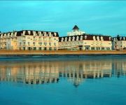
Nantasket Beach Resort
Nantasket Hotel at the Beach
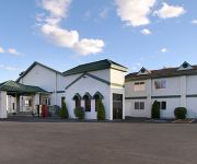
SUPER 8 WEYMOUTH BOSTON AREA
Videos from this area
These are videos related to the place based on their proximity to this place.
New England Surfing - Hull, MA - May 29, 2009
New England Surfing - Nantasket Beach, Hull, MA - Surfing waves by Northeast Surfing.com and Lees Entertainment llc. A video of northeast surfing llc, CEO John McInerney. Taken May 29, 2009...
Fish
Guy catches 2 small stripers without a pole! He used a spool of thick line with a single hook and a piece of clam. This was Saturday 8-22-09 at Nantasket Beach. Waterproof camera has poor quality...
Cleaning Services Hingham MA - 508.559.8062 - The Maids
Looking for Cleaning Services in Hingham MA? With our 22-Step Healthy Touch Deep Cleaning System, we provide you and your family with the healthiest living environment possible! Want A Free...
GTW: South Shore Country Club
Golfing the World takes a trip to Hingham MA to check out the South Shore Country Club. Best public course in South Shore. www.golfingtheworld.tv.
Jack Diamond Law Offices Hingham OUI Attorney Reviews
http://www.hinghamduiattorney.com/ 617-237-6074 Jack Diamond Law Offices Hingham OUI Attorney Hingham reviews New Review "Attorney Diamond reviewed all of the circumstances...
Air Conditioning Upgrade | Hingham Scituate Cohasset Duxbury
www.sigmams.com 781.8379994. The existing air handler had one vent to the office space. We tied into the existing Duct Work, brought in a supply pump and ran new duct work to sufficiently cool...
12 Longmeadow Rd, Hingham MA
Nicole Condon and Lauren Mahoney of Keller Williams present a sneek peek at 12 Longmeadow Rd in Hingham MA. INFO: For More information contact: Nicole Codon 781- 635-3625 Lauren ...
Videos provided by Youtube are under the copyright of their owners.
Attractions and noteworthy things
Distances are based on the centre of the city/town and sightseeing location. This list contains brief abstracts about monuments, holiday activities, national parcs, museums, organisations and more from the area as well as interesting facts about the region itself. Where available, you'll find the corresponding homepage. Otherwise the related wikipedia article.
WBZ (AM)
WBZ is the call sign for an AM radio station in Boston, Massachusetts owned by CBS Radio, itself owned by the CBS Corporation. Originally based in and broadcast from Springfield, Massachusetts, WBZ is the first licensed commercial radio station in the United States. WBZ moved to Boston in 1931 in a swap with a now-defunct synchronous repeater, WBZA.
World's End (Hingham)
World's End is a 251 acre (1 km²) park and conservation area located on a peninsula in Hingham, Massachusetts. The peninsula is bordered by the Weir River to the North and East and Hingham Harbor to the West. The land is composed of four drumlins (Pine Hill, Planter's Hill, and the double drumlins of World's End proper) harboring tree groves interspersed with fields attractive to butterflies and grassland-nesting birds, and offers walking paths and views of the Boston skyline.
Ragged Island (Massachusetts)
Ragged Island is an island in the Hingham Bay area of the Boston Harbor Islands National Recreation Area, in the U.S. state of Massachusetts. The island has a permanent size of 4 acres, and it is composed of Roxbury puddingstone which rises to a height of 30 feet above sea level. Broken ledges surround most of the island with small gravel beaches on the southeast and northwest sides; there are also small tidal mudflats.
Bumpkin Island
Bumpkin Island, also known as Round Island, Bomkin Island, Bumkin Island or Ward's Island, is an island in the Hingham Bay area of the Boston Harbor. Since 1996 it is part of the Boston Harbor Islands National Recreation Area. The island has an area of 30 acres, plus an intertidal zone of a further 31 acres . It is composed of a central drumlin with an elevation of 70 feet above sea level, surrounded by a rock-strewn shoreline.
Langlee Island
Langlee Island or Langley Island is an island in the Hingham Bay area of the Boston Harbor Islands National Recreation Area. The island has a permanent size of 4 acres, plus an intertidal zone of a further 3 acres, and is composed of a massing of Roxbury puddingstone which rises to a height of 40 feet above sea level. This results in steep cliffs on the northern shore, whilst there are several small sandy beaches and a tidal mudflat on the east side.
Button Island (Massachusetts)
Button Island is a small island in the Hingham Bay area of the Boston Harbor Islands National Recreation Area. It is part of the Town of Hingham. The island has a permanent size of under 1-acre, plus an intertidal zone of a further 116 acres . It is composed of a massing of glacial till which rises to a height of 10 feet above sea level. The island is managed by the town of Hingham, and access is by private boat only.
Sarah Island (Massachusetts)
Sarah Island is an island in the Hingham Bay area of the Boston Harbor Islands National Recreation Area. The island has a permanent size of just under 5 acres, and is composed large outcroppings and ledges of Roxbury puddingstone together with glacial till which rises to a height of 30 feet above sea level. The ledges, beaches and mudflats make the ideal nesting place for gulls. The island was purchased by John Langlee in 1686, later passing to John R.
Derby Academy
Derby Academy is an elementary and middle school that offers a coeducational curriculum to Pre-Kindergarten through 8th grade. It is located near Route 3A and Broad Cove in Hingham, Massachusetts. The grades are divided into the Lower School (Pre-Kindergarten – Grade 3), Middle School (Grades 4-6), and Upper School (Grades 7-8).


