Safety Score: 2,7 of 5.0 based on data from 9 authorites. Meaning we advice caution when travelling to United States.
Travel warnings are updated daily. Source: Travel Warning United States. Last Update: 2024-05-16 08:19:50
Discover Cedarville
Cedarville in Plymouth County (Massachusetts) is a city in United States about 396 mi (or 637 km) north-east of Washington DC, the country's capital city.
Local time in Cedarville is now 05:22 AM (Thursday). The local timezone is named America / New York with an UTC offset of -4 hours. We know of 11 airports in the vicinity of Cedarville, of which 4 are larger airports. The closest airport in United States is Barnstable Municipal Boardman Polando Field in a distance of 17 mi (or 28 km), South-East. Besides the airports, there are other travel options available (check left side).
Also, if you like golfing, there are a few options in driving distance. We discovered 3 points of interest in the vicinity of this place. Looking for a place to stay? we compiled a list of available hotels close to the map centre further down the page.
When in this area, you might want to pay a visit to some of the following locations: Barnstable, Edgartown, Taunton, Nantucket and Boston. To further explore this place, just scroll down and browse the available info.
Local weather forecast
Todays Local Weather Conditions & Forecast: 12°C / 54 °F
| Morning Temperature | 12°C / 54 °F |
| Evening Temperature | 13°C / 56 °F |
| Night Temperature | 12°C / 53 °F |
| Chance of rainfall | 12% |
| Air Humidity | 86% |
| Air Pressure | 1011 hPa |
| Wind Speed | Fresh Breeze with 13 km/h (8 mph) from South-West |
| Cloud Conditions | Overcast clouds, covering 100% of sky |
| General Conditions | Moderate rain |
Thursday, 16th of May 2024
15°C (58 °F)
10°C (51 °F)
Scattered clouds, gentle breeze.
Friday, 17th of May 2024
15°C (59 °F)
10°C (50 °F)
Overcast clouds, gentle breeze.
Saturday, 18th of May 2024
12°C (54 °F)
11°C (51 °F)
Overcast clouds, gentle breeze.
Hotels and Places to Stay
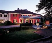
Mirbeau Inn & Spa
Danl Webster Inn and Spa
BELFRY INN AND BIST
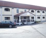
Sandwich Inn and Suites
All Seasons Inn and Suites
SANDWICH LODGE AND RESORT
Quality Inn Bourne
Belfry Inne
Videos from this area
These are videos related to the place based on their proximity to this place.
Crossing the Sagamore Bridge
Crossing the Cape Cod Canal Sagamore Bridge on Jan 29 2012. No traffic.
Over Sagamore from CapeCod - Route 6 Massachusetts
This is a drive over the Sagamore bridge from Cape Cod MA - Leaving the Cape.
Over Sagamore to CapeCod - Route 6 Massachusetts
Drive over the Sagamore bridge from route 3 to Cape Code MA. No more rotary before the bridge! Nice drive.
5 Bedroom Water Front Vacation Rental Home in Sagamore Beach, Cape Cod, property 15964
Once you step into this beautifully designed home overlooking Cape Cod Bay you won't want to leave. This is waterfront living at its best. Big WOW views of the ocean across the whole front...
Driving over the Sagamore Bridge.MPG
Driving over the Sagamore Bridge spanning the Cape Cod Canal,going down Rt 6 towards Harwich.
Bourne Sagamore Beach Apartment for rent
Jack Gately of gatelyrealty.com talks about a new apartment for rent in Bourne Sagamore Beach. Agree or disagree with Jack? Email him at jack@gatelyrealty.com Jack Gately and gatelyrealty.com...
Cape Cod Canal by Train 2009 AUG
Great views of the Sagamore Bridge along the Cape Cod Canel, the adjoining bike paths, and the little villages, salt ponds, and marshes, and cranberry bogs along the way.
5150 hp tractor tug Sabine in the Cape Cod Canal
The Sabine just east of the Sycamore Bridge escorting our tug and tow of petroleum product. (From tugboatinformation.com) Built in 2007, by Eastern Shipbuilding of Panama City, Florida (Hull...
Wooden Boat Rubrail and Clamp Installed
The rub rail and the clamp are installed on the starboard side of the Long John work boat Sagamore Massachusetts Filmed and Edited by Chappi Productions ©
Videos provided by Youtube are under the copyright of their owners.
Attractions and noteworthy things
Distances are based on the centre of the city/town and sightseeing location. This list contains brief abstracts about monuments, holiday activities, national parcs, museums, organisations and more from the area as well as interesting facts about the region itself. Where available, you'll find the corresponding homepage. Otherwise the related wikipedia article.
Cedarville, Massachusetts
Cedarville is the southeasternmost village in Plymouth, Massachusetts, United States. Cedarville is bounded to the north by Ellisville Road and Hedges Pond, to the south by the Town of Bourne, to the west by Little Herring Pond and Great Herring Pond, and to the east by Cape Cod Bay. Residents enjoy swimming, boating, fishing, clamming and sunrise on the Cape Cod Bay.
Great Herring Pond
Great Herring Pond is a 376-acre warm water pond mostly located in Plymouth, Massachusetts, with the southern portion extending into Bourne. The village of Pondville in the Cedarville section of Plymouth lies on the eastern shore of the pond. The pond has an average depth of 20 ft (6 m) and a maximum depth of 42 ft (13 m). The bottom is composed of sand, rubble and muck. A tire reef was installed in 1979 to provide additional fish shelter.
Little Herring Pond
Little Herring Pond is a 90-acre, shallow natural pond in the Cedarville section of Plymouth, Massachusetts, USA. The pond is located north of Great Herring Pond, west of Hedges Pond, southwest of Black Jimmy Pond (Hyles Pond), northeast of Island Pond and Triangle Pond, and east of Long Duck Pond. The pond has an average depth of three feet and a maximum depth of only four feet. The outflow is a stream that feeds Great Herring Pond, which in turn feeds the Herring River.
Island Pond (Cedarville, Massachusetts)
Island Pond is a 77-acre pond in the Cedarville section of Plymouth, Massachusetts, one of three ponds named Island Pond within the town (one is located near South Pond village, and the other is located in The Pinehills development, better known as Great Island Pond). The pond is located northwest of Great Herring Pond, north of Elbow Pond, southwest of Little Herring Pond, and south of Triangle Pond.
Triangle Pond (Massachusetts)
Triangle Pond is a 10-acre pond in the Cedarville section of Plymouth, Massachusetts. The pond is located northwest of Great Herring Pond, north of Island Pond, southwest of Little Herring Pond, and east of Long Duck Pond.
Elbow Pond (Plymouth, Massachusetts)
Elbow Pond is a 16-acre pond in the Cedarville section of Plymouth, Massachusetts. The pond is located south of Island Pond and west of Great Herring Pond.
Hedges Pond (Plymouth, Massachusetts)
Hedges Pond is a 26-acre pond in the Cedarville section of Plymouth, Massachusetts with access from Hedges Pond Rd. The pond is located more than one mile (1.6 km) north of Cedarville's business district past the Route 3 underpass, southeast of Black Jimmy Pond (Hyles Pond), and east of Little Herring Pond. Hedges Pond has no private residences on its shores. Camp Dennen once occupied the eastern shore of the pond.
Black Jimmy Pond
Black Jimmy Pond, also known as Hyles Pond, is an 11-acre pond in the Cedarville section of Plymouth, Massachusetts. The pond is located northwest of Hedges Pond and northeast of Little Herring Pond. Camp Clark, a camp run by the Old Colony YMCA, is located on the northern shore of the pond.


