Safety Score: 2,7 of 5.0 based on data from 9 authorites. Meaning we advice caution when travelling to United States.
Travel warnings are updated daily. Source: Travel Warning United States. Last Update: 2024-04-30 08:30:35
Delve into Salem Neck
Salem Neck in Essex County (Massachusetts) is located in United States about 409 mi (or 658 km) north-east of Washington DC, the country's capital town.
Current time in Salem Neck is now 06:19 AM (Tuesday). The local timezone is named America / New York with an UTC offset of -4 hours. We know of 9 airports close to Salem Neck, of which 3 are larger airports. The closest airport in United States is General Edward Lawrence Logan International Airport in a distance of 14 mi (or 22 km), South-West. Besides the airports, there are other travel options available (check left side).
Also, if you like playing golf, there are some options within driving distance. We encountered 3 points of interest near this location. If you need a hotel, we compiled a list of available hotels close to the map centre further down the page.
While being here, you might want to pay a visit to some of the following locations: Boston, Dedham, Brentwood, Dover and Taunton. To further explore this place, just scroll down and browse the available info.
Local weather forecast
Todays Local Weather Conditions & Forecast: 8°C / 47 °F
| Morning Temperature | 9°C / 48 °F |
| Evening Temperature | 8°C / 47 °F |
| Night Temperature | 8°C / 46 °F |
| Chance of rainfall | 0% |
| Air Humidity | 77% |
| Air Pressure | 1019 hPa |
| Wind Speed | Gentle Breeze with 8 km/h (5 mph) from West |
| Cloud Conditions | Overcast clouds, covering 100% of sky |
| General Conditions | Overcast clouds |
Tuesday, 30th of April 2024
7°C (44 °F)
7°C (44 °F)
Light rain, gentle breeze, overcast clouds.
Wednesday, 1st of May 2024
11°C (52 °F)
12°C (54 °F)
Overcast clouds, gentle breeze.
Thursday, 2nd of May 2024
10°C (50 °F)
8°C (46 °F)
Overcast clouds, gentle breeze.
Hotels and Places to Stay
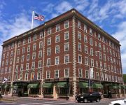
Hawthorne Hotel
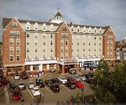
Salem Waterfront Hotel & Suites
The Merchant
The Marblehead Inn
Courtyard Boston Danvers
Clipper Ship Inn
Stepping Stone Inn
HARBOR LIGHT INN - MARBLEHEAD
Wylie Inn and Conference Ctr
Salem Inn
Videos from this area
These are videos related to the place based on their proximity to this place.
A Visit to Salem Jail
David Moisan and Dan Stanwood lead a video tour through historic Salem Jail in Salem, Massachusetts. Presents Salem Jail as it was for the first and only video tour before the Jail is redeveloped....
Ben's Tours--Salem, MA
Each installment of Ben's Tours takes you on a visit to a special place. This time join me for a walk around the streets of historic Salem, Massachusetts. First settled in 1626, Salem's past...
Friendship of Salem MA leaves for Gloucester MA 9/5/10
According to the EssexHeritage.org website "Friendship is a full scale replica of the original ship built in 1796. The three-masted, square-rigged, 342-ton vessel was an "East Indiaman,"...
GoPro Video of the Gerry 5 at the Salem Willows Muster
The Gerry #5 V.F.A. of Marblehead, Massachusetts in competition at the Salem Willows Muster 2012.
Salem Harbor Hot Wing Challenge Pt 2
The rules are explained, and the contest begins. Spectators are cheering as the contestants suffer along, still at the table.. Big face off between Robbbie D.(former Defcon Deathmatch winner...
8 Curtis Point Beverly, MA
http://bostonnorthrealestate.com/8-curtis-point-beverly-ma Photos by Jim Abts - http://www.jamesabts.com/ John & Cindy Farrell Coldwell Banker Residential Brokerage Boston through the North...
The Beverly Project
An ongoing photographic study of independent business owners in the north shore town of Beverly, Massachusetts.
Beverly to Newburyport, MA on MBTA's Commuter Rail
View out the window from an MBTA commuter train between Beverly and Newburyport MA on August 19, 2014.
Videos provided by Youtube are under the copyright of their owners.
Attractions and noteworthy things
Distances are based on the centre of the city/town and sightseeing location. This list contains brief abstracts about monuments, holiday activities, national parcs, museums, organisations and more from the area as well as interesting facts about the region itself. Where available, you'll find the corresponding homepage. Otherwise the related wikipedia article.
Smith Pool
Smith Pool is a very small body of water located between Salem Neck, Winter Island, and Cat Cove in Salem, Massachusetts. It's easily accessible from Winter Island Road on Winter Island.
Cat Cove
Cat Cove is a cove in the northwestern portion of Salem Harbor in Salem, Massachusetts. The cove is located between Winter Island and Salem Neck. There is a powerplant located on the coast of Salem Neck bordering the southwestern edge of Cat Cove.
Salem Harbor
Salem Harbor is a harbor in northeastern Massachusetts spanning an area north and south of Salem. Historically the Salem Harbor was the site of one of the major international ports in the colonies. During the American Revolutionary War, merchant ships were enlisted as privateers, an important role to augment the ill-prepared Continental Navy. Now the harbor is used for commercial and recreational purposes.
Juniper Cove
Juniper Cove is a cove in the Salem Channel, within the city limits of Salem, Massachusetts. The Salem Neck coast that borders Juniper Cove is mostly populated, by residential areas.
Salem Neck (Massachusetts)
Salem Neck is a peninsula in northeastern Salem, Massachusetts, in the United States. It stretches from Salem's powerplant on Salem Harbor to Juniper Point on Salem Neck. The peninsula is populated primarily by residential and recreational areas. Winter Island is an island connected to its mid-western coast by a causeway.
John Cabot House
The John Cabot House is a historic house located in Beverly, Massachusetts. It is owned by the Beverly Historical Society and open to the public five days a week.
John Hale House
The John Hale House (circa 1694), also known as the Rev. John Hale Farm, is a historic Colonial house located at 39 Hale Street, Beverly, Massachusetts. The house is now operated as a nonprofit museum by the Beverly Historical Society, with period furnishings and a room containing witchcraft-related artifacts. This house was built in 1694, possibly with structural members from an earlier parsonage, by Beverly’s first minister, Rev. John Hale (1636–1700).
Massachusetts Route 22
Route 22 is a short north–south Massachusetts state route that connects Beverly and Essex. The entire route is located within Essex County.
Salem Willows
Salem Willows is an oceanfront neighborhood and amusement park in Salem, Massachusetts. It is named for the European white willow trees planted there in 1801 to form a shaded walk for patients convalescing at a nearby smallpox hospital. The area became a public park in 1858, and in the twentieth century became a summer destination for residents of Boston's North Shore, many of whom escaped the heat of the city on newly popular streetcars.
Coast Guard Air Station Salem
Coast Guard Air Station Salem was a United States Coast Guard air station located in Salem, Massachusetts. Its area of coverage extended from New York City to the Canadian border.
Fort Lee (Salem, Massachusetts)
Fort Lee is a historic site that was an American Revolution fort in Salem, Massachusetts. The fort was built in 1776 and added to the National Register of Historic Places in 1994. In 2012, only overgrown earthworks were discernible on the site.
Beverly Historical Society
"It is the mission of the Society to preserve, interpret, and disseminate Beverly's regional artistic, cultural, social, and transportation history. " The Beverly Historical Society, located in Beverly, Massachusetts, was founded in 1891, and its headquarters is the 1781 John Cabot House, which has two floors of museum exhibits.


