Safety Score: 2,7 of 5.0 based on data from 9 authorites. Meaning we advice caution when travelling to United States.
Travel warnings are updated daily. Source: Travel Warning United States. Last Update: 2024-04-29 08:03:39
Touring Ellis
Ellis in Riverside County (California) is a town located in United States about 2,246 mi (or 3,615 km) west of Washington DC, the country's capital place.
Time in Ellis is now 02:54 AM (Monday). The local timezone is named America / Los Angeles with an UTC offset of -7 hours. We know of 9 airports nearby Ellis, of which 5 are larger airports. The closest airport in United States is Ontario International Airport in a distance of 29 mi (or 47 km), North-West. Besides the airports, there are other travel options available (check left side).
Also, if you like the game of golf, there are several options within driving distance. Need some hints on where to stay? We compiled a list of available hotels close to the map centre further down the page.
Being here already, you might want to pay a visit to some of the following locations: Riverside, San Bernardino, Orange, Santa Ana and San Diego. To further explore this place, just scroll down and browse the available info.
Local weather forecast
Todays Local Weather Conditions & Forecast: 23°C / 74 °F
| Morning Temperature | 12°C / 54 °F |
| Evening Temperature | 24°C / 75 °F |
| Night Temperature | 16°C / 60 °F |
| Chance of rainfall | 0% |
| Air Humidity | 34% |
| Air Pressure | 1011 hPa |
| Wind Speed | Light breeze with 4 km/h (3 mph) from East |
| Cloud Conditions | Clear sky, covering 0% of sky |
| General Conditions | Sky is clear |
Monday, 29th of April 2024
24°C (75 °F)
15°C (59 °F)
Sky is clear, light breeze, clear sky.
Tuesday, 30th of April 2024
20°C (68 °F)
15°C (59 °F)
Sky is clear, light breeze, clear sky.
Wednesday, 1st of May 2024
25°C (77 °F)
17°C (63 °F)
Sky is clear, gentle breeze, clear sky.
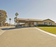
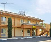
Hotels and Places to Stay
Red Lion Inn & Suites Perris
RED LION INN AND SUITES PERRIS
AMERICAS BEST VALUE INN
MOTEL 6 MENIFEE SUN CITY
Videos from this area
These are videos related to the place based on their proximity to this place.
2 Way Hot Air Balloon Skydive at Perris Airfield, California
Exit shots of a 2-way balloon jump at Perris airfield.
Perris Auto Speedway IMCA Modified Heat 1 4.11.15
Perris Auto Speedway IMCA Modified Heat 1 4.11.15.
Brody Phillips | Perris Raceway 8-31-13
Brody Phillips Perris Raceway Saturday August 31, 2013 Enjoying my 3 day weekend off work riding! :) 100+ degree heat with SUPER high humidity is probably why im the only one out there hahaha...
CampgroundViews.com - Lake Perris State Recreation Area Perris California CA
http://www.CampgroundViews.com takes user submitted videos combined with professional editing to provide tent and RV campers with a first person view of a campground or RV park. Lake Perris...
My BPA AFF Skydiving Course in California - Skydive Perris - Jan 2015
With thanks to my awesome instructors on the BPA AFF course, Tony Goodman and Tony Butler. Awesome job.
Perris California Tunnel Time (Rennay's Second timein the tunnel)
Perris Skydive Tunnel Time with Mary was an amazing time...the folks there are real Pros and very knowlegable.
Videos provided by Youtube are under the copyright of their owners.
Attractions and noteworthy things
Distances are based on the centre of the city/town and sightseeing location. This list contains brief abstracts about monuments, holiday activities, national parcs, museums, organisations and more from the area as well as interesting facts about the region itself. Where available, you'll find the corresponding homepage. Otherwise the related wikipedia article.
Perris, California
Perris is a city in Riverside County, California, USA. At the 2010 census, the city population was 68,386, up from 36,189 at the 2000 census.
Orange Empire Railway Museum
The Orange Empire Railway Museum, 2201 South "A" Street, Perris, California, is a railroad museum founded in 1956 at the Pinacate Station as the "Orange Empire Trolley Museum. " The museum also operates a heritage railroad on the museum grounds.
Perris Union High School District
The Perris Union High School District is a school district with district offices located at 155 East 4th Street in Perris, California. It has schools in Perris and in nearby Romoland and Menifee. It is the only high school-only district in Riverside County. The Perris Union High School District educates about 10,000 secondary and middle school students who live in Perris Valley.
Motte Rimrock Reserve
The Motte Rimrock Reserve, a unit of the University of California Natural Reserve System affiliated with the University of California, Riverside, is an ecological reserve and biological field station located on a small plateau overlooking the Perris Valley in west-central Riverside County, California, United States.
Pinacate, California
Pinacate, was a small settlement east of the Pinacate Mining District in Riverside County, California. It was established when the California Southern Railroad line was built between Colton and San Diego in 1882. Due to a land title dispute the town was moved to the north to become Perris, California in 1885. The Pinacate station remained and has become the location of the Orange Empire Railway Museum.
Perris Valley Airport
Perris Valley Airport is a privately owned and operated airport open to public use and located one mile (1.6 km) southeast of Perris serving Riverside County, California. The airport has one runway and is used for general aviation and extensive skydiving. The airport operates from dawn to dusk daily year-round. A skydiving drop zone operates at the airport, and skydivers land about 50 feet from the runway. The primary occupant is Perris Valley Skydiving.
California Military Institute
California Military Institute school is a publicly funded charter school located in Perris, California, which serves grades 7-12. It is attended by 542 students. It is part of the Perris Union High School District.


