Safety Score: 2,7 of 5.0 based on data from 9 authorites. Meaning we advice caution when travelling to United States.
Travel warnings are updated daily. Source: Travel Warning United States. Last Update: 2024-04-28 08:22:10
Delve into Dorset Village
The district Dorset Village of Hyde Park in Los Angeles County (California) is a district located in United States about 2,300 mi west of Washington DC, the country's capital town.
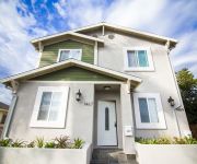
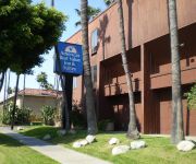
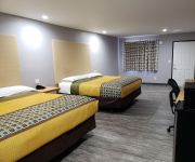
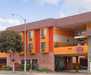
In need of a room? We compiled a list of available hotels close to the map centre further down the page.
Since you are here already, you might want to pay a visit to some of the following locations: Los Angeles, Orange, Santa Ana, Riverside and Ventura. To further explore this place, just scroll down and browse the available info.
Local weather forecast
Todays Local Weather Conditions & Forecast: 21°C / 70 °F
| Morning Temperature | 15°C / 59 °F |
| Evening Temperature | 19°C / 66 °F |
| Night Temperature | 18°C / 64 °F |
| Chance of rainfall | 0% |
| Air Humidity | 44% |
| Air Pressure | 1015 hPa |
| Wind Speed | Moderate breeze with 9 km/h (6 mph) from North-East |
| Cloud Conditions | Clear sky, covering 0% of sky |
| General Conditions | Sky is clear |
Monday, 29th of April 2024
21°C (70 °F)
18°C (65 °F)
Sky is clear, gentle breeze, clear sky.
Tuesday, 30th of April 2024
21°C (69 °F)
17°C (63 °F)
Sky is clear, gentle breeze, clear sky.
Wednesday, 1st of May 2024
20°C (67 °F)
17°C (63 °F)
Sky is clear, gentle breeze, clear sky.
Hotels and Places to Stay
Los Angeles Vacation Rooms
AMERICAS BEST VALUE INN
Crenshaw Inn Motel
Regal Inn Los Angeles
Royal Century Hotel
Hollywood Inn Express LAX
BEST WESTERN AIRPARK HOTEL
Adventurer Hotel Los Angeles LAX
Cloud 9 Inn LAX
Hyde Park
Videos from this area
These are videos related to the place based on their proximity to this place.
PL4922 - Updated 2 Bed Apartment For Rent (Inglewood, CA)
Pacific Listings is proud to present this impressive 2 Bed + 1 Bath apartment for rent in Inglewood, CA. Private Laundry Room, Garage Parking with storage, all new tile flooring inside and...
Como compro una casa HUD en español -Inglewood
Otro video con informacion acerca de Que es una Casa de HUD? Y como lograr comprarlas. COmprando Casas en Español con Ron Escobar le trae infomacion detallada de que es una casa de hud y.
How to Buy and HUD Home in Inglewood, CA
What is a HUD Home? What is an FHA Loan? How do I buy a HUD Home? Where do I find HUD Homes? all of this information discussed in this video and showcasing a HUD Home listed in Inglewood, ...
PL4036 - Townhouse Style 2+1.5 for Rent (Inglewood, CA)
Pacific Listings is proud to present this 2-story townhouse style 2Bed + 1.5 Bath apartment in Inglewood, CA. This apartment features new carpet & tile, new granite counters, dishwasher, pool,...
USC Sankofa Play Display IML404
USC IML404 class made some deliberate projects to help improve the neighborhood in Leimert Park Plaza. We beautified an unused structure (in this case a display ad which wasn't used in years)...
Jesus Cusito Penalevar singing at Rincon Rumbero
A few minutes of Jesus "Cusito" Penalevar singing a guaguanco at Rincon Rumbero (Leimert Park, California) on June 2, 2012. Rincon Rumbero takes place the first Saturday of every month at...
Rincon Rumbero - February 1, 2014 (Join us the 1st Saturday of every month)
A quick clip shot by AUS (Rincon Rumbero Founding Father) from Rincon Rumbero on February 1, 2014. Rincon Rumbero goes down the 1st Saturday of every month at KAOS Network in the Leimert ...
Bembe Rincon Rumbero January 2012
A breif video segment featuring a Bembe sung by Craig Ramos at Rincon Rumbero place on January 5, 2012. Taking place the first Saturday of every month at the KAOS Network in Leimert Park,...
Videos provided by Youtube are under the copyright of their owners.
Attractions and noteworthy things
Distances are based on the centre of the city/town and sightseeing location. This list contains brief abstracts about monuments, holiday activities, national parcs, museums, organisations and more from the area as well as interesting facts about the region itself. Where available, you'll find the corresponding homepage. Otherwise the related wikipedia article.
View Park-Windsor Hills, California
View Park-Windsor Hills is a census-designated place (CDP) in Los Angeles County, California, United States. The population was 11,075 at the 2010 census, up from 10,958 at the 2000 census. View Park lies on the north end of the CDP, along Angeles Vista Boulevard; Windsor Hills is on the southern end, to the north of Slauson Avenue. View Park-Windsor Hills is both one of the wealthiest, and one of the wealthiest majority-African American, areas in the United States.
Black Dahlia
"The Black Dahlia" was a nickname given to Elizabeth Short (July 29, 1924 – c. January 15, 1947), an American woman who was the victim of a gruesome and much-publicized murder. Short acquired the moniker posthumously by newspapers in the habit of nicknaming crimes they found particularly colorful. Short was found mutilated, her body sliced in half at the waist, on January 15, 1947, in Leimert Park, Los Angeles, California.
The Forum (Inglewood)
The Forum (known for a 15-year period as the Great Western Forum) is an indoor arena, in Inglewood, California, a suburb of Los Angeles. Along with Madison Square Garden, it was one of the most well-known indoor sports venues in the US, during its time operating as a major venue. The Forum achieved its greatest fame as the home of the Los Angeles Lakers, of the NBA and of the Los Angeles Kings, of the NHL from 1967 until 1999, when the teams moved to the new Staples Center.
Hollywood Park Racetrack
Hollywood Park is a thoroughbred race course and poker card room in Inglewood, California, about three miles (5 km) from Los Angeles International Airport and adjacent to the Forum.
Leimert Park, Los Angeles
Leimert Park is a neighborhood in Los Angeles, California roughly bounded by Rodeo Road on the north, 4th Avenue and Roxton Avenue on the east, Vernon Avenue on the south, and Crenshaw Boulevard on the west. Crenshaw District lies to the south, View Park to the west, Vermont Square to the east, and Jefferson Park to the north. The district's principal thoroughfare is Leimert Boulevard, which bisects the neighborhood from northeast to southwest. Leimert Park's ZIP code is 90008.
Baldwin Hills, Los Angeles
Baldwin Hills is a community and neighborhood in the South Los Angeles area of Los Angeles, within southwestern Los Angeles County, California. Baldwin Hills is in their namesake Baldwin Hills range overlooking the Los Angeles Basin and the lower plain immediately to the north.
Crenshaw, Los Angeles
Crenshaw (also known as The Crenshaw District) is a neighborhood and district in southwestern Los Angeles, California. It derives its name from Crenshaw Boulevard, one of the city's principal thoroughfares. Crenshaw is bordered by Chesterfield Square on the east, Hyde Park on the south, View Park-Windsor Hills on the west. It includes Leimert Park.
Jefferson Park, Los Angeles
Jefferson Park is a district in South Los Angeles, California.
Crenshaw High School
Crenshaw High School is a secondary school located in South Central, Los Angeles, California. The school first opened in 1968 and currently enrolls an average of 1,400 students. The school is currently being considered for an overhaul by the LAUSD to be transformed into a magnet school due to its high drop-out rates, poor API scores, and failure to meet state requirements.
KDAY
KDAY in Redondo Beach, California, is one of a pair of synchrocasting radio stations based in South Los Angeles that airs a Urban Contemporary format aimed at African Americans in the 18-49 range. KDAY is owned by Magic Broadcasting and broadcasts at 93.5 MHz on the FM dial. From 2004 to 2008, KDAY and KDAI in Ontario, California were a pair of synchrocasting radio stations serving LA/Orange County and Riverside/San Bernardino.
KRCD (FM)
KRCD is a commercial radio station in Inglewood, California, broadcasting to the Los Angeles area on 103.9 FM. KRCV is a commercial radio station in West Covina, California, broadcasting to the western sections of the Riverside-San Bernardino area on 98.3 FM. KRCV & KRCD air a Spanish-language oldies music format branded as "Recuerdo".
Baldwin Hills Reservoir
The Baldwin Hills Reservoir was a water storage basin located on a low hilltop in Baldwin Hills, Los Angeles, California. It was constructed between 1947 and 1951 by the Los Angeles Department of Water and Power directly on an active fault line which was subsidiary to the well-known nearby Newport-Inglewood fault. The underlying geologic strata were considered unstable for a reservoir, and the design called for a compacted soil lining meant to prevent seepage into the foundation.
KJLH
KJLH (102.3 FM) is an Urban Adult Contemporary radio station serving the Los Angeles area. It plays R&B and classic soul music under the format, and occasionally plays some Hip-Hop, Gospel and Smooth Jazz tracks. Licensed to the Los Angeles suburb of Compton, California, the station is owned by Taxi Productions, which in turn is owned by Stevie Wonder.
KWKW
KWKW (1330 AM, "Radio Deportes") is an American radio station licensed to serve Los Angeles, California. The station is owned by Lotus Communications Corporation. KWKW is one of the oldest Spanish-language radio stations in the Greater Los Angeles area. Currently, the station broadcasts an all-sports format as an affiliate of ESPN Deportes Radio.
KTYM
KTYM is a radio station broadcasting a Urban Gospel radio format. Licensed to Inglewood, California, USA, the station serves the Los Angeles area. The station is currently owned by Trans America Broadcasting Corp.. Programming on the station consists mainly of church services, teaching programs, and Bible studies. There a number of time-brokered shows.
West Angeles Church of God in Christ
West Angeles Church of God in Christ is a Pentecostal Christian church and a member of the Church of God in Christ denomination. Its main place of worship, the West Angeles Cathedral, is located in the West Adams Historic District of Los Angeles, California. It was founded by Elder Clarence E. Church in 1943. The first sanctuary was located on Adams Boulevard, near Interstate 10 (known locally as the Santa Monica Freeway). In 1969 after Elder Church's death, Charles E.
KFOX (AM)
KFOX is a Korean language AM radio station licensed to Torrance, California, broadcasting to the Los Angeles metropolitan area on 1650 kHz AM. KFOX is one of three radio stations in the greater Los Angeles area that broadcast entirely in Korean; the others are KMPC and KYPA. KFOX was launched in 1997 as KKJZ and was a simulcast of adult standards station KGIL. After several years, KKJZ became "K-News," providing constant news updates, and eight traffic updates each hour.
Marlton School
Marlton School is a public school for deaf and hard of hearing students in Los Angeles. This school offers a bilingual program in American Sign Language and English. Marlton was one of the first non-residential schools to be admitted to the prestigious Center for ASL/English Bilingual Education and Research (CAEBER) program called ASL/English Bilingual Professional Development (AEBPD).
St. Mary's Academy (Inglewood, California)
St. Mary's Academy is a Roman Catholic high school for girls located within the city of Inglewood, California, United States.
Centinela Freeman Regional Medical Center, Memorial Campus
Centinela Freeman Regional Medical Center, Memorial Campus was a hospital in Inglewood, California, USA. The hospital was operated by Centinela Freeman HealthSystem, and was one of the three campuses of the Centinela Freeman Regional Medical Center. The hospital was founded by the Sisters of St. Joseph of Carondelet in 1954 as Daniel Freeman Memorial Hospital, named after Daniel Freeman, founder of the city of Inglewood.
Baldwin Hills Crenshaw Plaza
Baldwin Hills Crenshaw Plaza (also known as Baldwin Hills Crenshaw, or by its acronym BHCP) is a shopping mall (the first post-war retail complex in California), whose first two stores opened in October and November 1947. The original open-air complex, known as the Broadway-Crenshaw Center, was located in Los Angeles, California. When it opened in 1947, the retail hub was anchored by a The Broadway department store, a May Company department store, Woolworth variety store, and Von's supermarket.
Inglewood High School (California)
Inglewood High School is a public high school in Inglewood, California, USA. Opened in 1905, it is part of Inglewood Unified School District. Inglewood High School is a member of the CIF Los Angeles section, and thus is eligible for Los Angeles City Championships in sports. The school's football stadium is named for Jack Kent Cooke, who built the The Forum, founded the Los Angeles Kings, owned the Los Angeles Lakers in the late 60s and the 70s, and later owned the Washington Redskins.
Crenshaw Christian Center
The Crenshaw Christian Center is a ministry in South Los Angeles, California, founded by pastor Frederick K. C. Price. It is located on the site of the old Pepperdine University campus, which was sold to Crenshaw Christian Center. Price, oversaw construction of the "FaithDome" on the site, the largest domed church in the United States, seating over 10,000.
Rancho La Cienega o Paso de la Tijera
Rancho La Cienega o Paso de la Tijera (also known as "Rancho La Tijera ") was a 4,219-acre Mexican land grant in present day Los Angeles County, California given in 1843 by Governor Manuel Micheltorena to Vicente Sánchez. "La Cienega" is derived from the Spanish word cienaga, which means swamp or marshland and refers to the natural springs and wetlands in the area between Beverly Hills and Park La Brea and the Baldwin Hills range.
St. Cecilia Catholic Church (Los Angeles)
St. Cecilia's Catholic Church is a Roman Catholic parish in the Our Lady of the Angels Pastoral Region of the Archdiocese of Los Angeles. The church is located at 4230 South Normandie Avenue in the South Los Angeles section of Los Angeles, California USA. The Lombard Romanesque church was built in 1927.


