Safety Score: 2,7 of 5.0 based on data from 9 authorites. Meaning we advice caution when travelling to United States.
Travel warnings are updated daily. Source: Travel Warning United States. Last Update: 2024-05-01 08:01:32
Delve into Ladera Heights
Ladera Heights in Los Angeles County (California) with it's 6,498 habitants is located in United States about 2,303 mi (or 3,706 km) west of Washington DC, the country's capital town.
Current time in Ladera Heights is now 02:35 PM (Wednesday). The local timezone is named America / Los Angeles with an UTC offset of -7 hours. We know of 9 airports close to Ladera Heights, of which 4 are larger airports. The closest airport in United States is Los Angeles International Airport in a distance of 4 mi (or 6 km), South-West. Besides the airports, there are other travel options available (check left side).
Also, if you like playing golf, there are some options within driving distance. We encountered 8 points of interest near this location. If you need a hotel, we compiled a list of available hotels close to the map centre further down the page.
While being here, you might want to pay a visit to some of the following locations: Los Angeles, Orange, Santa Ana, Ventura and Riverside. To further explore this place, just scroll down and browse the available info.
Local weather forecast
Todays Local Weather Conditions & Forecast: 20°C / 67 °F
| Morning Temperature | 15°C / 59 °F |
| Evening Temperature | 18°C / 64 °F |
| Night Temperature | 16°C / 62 °F |
| Chance of rainfall | 0% |
| Air Humidity | 56% |
| Air Pressure | 1011 hPa |
| Wind Speed | Gentle Breeze with 8 km/h (5 mph) from North-East |
| Cloud Conditions | Clear sky, covering 1% of sky |
| General Conditions | Sky is clear |
Wednesday, 1st of May 2024
21°C (70 °F)
17°C (63 °F)
Sky is clear, gentle breeze, clear sky.
Thursday, 2nd of May 2024
21°C (70 °F)
17°C (63 °F)
Sky is clear, gentle breeze, clear sky.
Friday, 3rd of May 2024
20°C (68 °F)
15°C (59 °F)
Sky is clear, moderate breeze, clear sky.
Hotels and Places to Stay
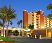
Four Points by Sheraton Los Angeles Westside
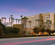
DoubleTree by Hilton Hotel Los Angeles - Westside
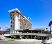
Hilton Los Angeles Airport
Embassy Suites by Hilton Los Angeles Int*l Airport North
Los Angeles Airport Marriott
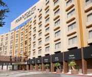
Four Points by Sheraton Los Angeles International Airport
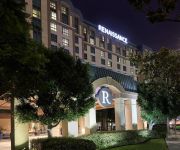
Renaissance Los Angeles Airport Hotel
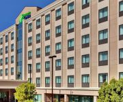
Holiday Inn LOS ANGELES - LAX AIRPORT
La Quinta Inn and Suites LAX
Holiday Inn Express LOS ANGELES - LAX AIRPORT
Videos from this area
These are videos related to the place based on their proximity to this place.
Captain Tall Tale Climbs the Culver City Steps
Captain Tall Tale the 8'3" Adventurer climbs the Baldwin Hills Scenic Overlook also known as the Culver City Steps.
PL3836 - Beautiful 1 Bed + 1 Bath for Rent (Culver City, CA)
Pacific Listings is proud to present this bright & spacious 1 bedroom + 1 bathroom for rent in Culver City, CA. This rental features a spacious layout, real hardwood floor, washer & dryer,...
Culver City 4th of July 2010 Parade at Lindberg Park, Culver City CA.mp4
The Castro's Cloris and Daisy.
Vertical Mile: Climbing 21 Laps at Culver City Stairs in 4.5 Hours
This video documents a marathon stair-climb training session I did at the very-unique outdoor staircase named Culver City Stairs, part of the Baldwin Hills Scenic Overlook on June 4, 2013....
Josh Fox explains why there is NO safe fracking.
Josh Fox speaking at the May 15, 2012 press conference in front of the Inglewood Oil Field in the Baldwin Hills of Los Angeles CA. The conference was called to kick off the BAN FRACKING campaign...
Shower | Shower Door Installation (424) 210-58555 Frameless Shower Doors Ladera Heights, CA
Shower | Shower Door Installation (424) 210-58555 Frameless Shower Doors Ladera Heights, CA http://www.mr-glass-and-window.com/ FRAMELESS SHOWER DOORS FULL SERVICES (424) ...
Garage Door Repair Ladera Heights 1 (800) 801-3903 Garage Door Spring Repair Services
Garage Door Repair Ladera Heights - Any Type Of Garage Door Repair, Plus Garage Door Spring Repair Services (800) 801-3903 http://www.the-garage-door-guys.com/ Garage Door Repair - The ...
LAFD / Auto Dealership Blaze-Vacant / Part 1 of 2
LAFD Major Emergency - 1/21/2014 - It took over 140 LA Firefighters over two hours to control a spectacular blaze that tore through a vacant auto dealership on the 5200 block of West Centinela...
LAFD / Auto Dealership Blaze-Vacant / Part 2 of 2
LAFD Major Emergency - 1/21/2014 - It took over 140 LA Firefighters over two hours to control a spectacular blaze that tore through a vacant auto dealership on the 5200 block of West Centinela...
Videos provided by Youtube are under the copyright of their owners.
Attractions and noteworthy things
Distances are based on the centre of the city/town and sightseeing location. This list contains brief abstracts about monuments, holiday activities, national parcs, museums, organisations and more from the area as well as interesting facts about the region itself. Where available, you'll find the corresponding homepage. Otherwise the related wikipedia article.
Sharon Tate
Sharon Marie Tate (January 24, 1943 - August 9, 1969) was an American actress. During the 1960s she played small television roles before appearing in several films. After receiving positive reviews for her comedic performances, she was hailed as one of Hollywood's promising newcomers and was nominated for a Golden Globe Award for her performance in Valley of the Dolls (1967). She also appeared regularly in fashion magazines as a model and cover girl.
Holy Cross Cemetery, Culver City
Holy Cross Cemetery is a Roman Catholic cemetery at 5835 West Slauson Avenue in Culver City, California, United States, operated by the Roman Catholic Archdiocese of Los Angeles. Opened in 1939, Holy Cross comprises 200 acres . It contains—amongst others—the graves and tombs of showbusiness professionals. Most celebrities are in the section "The Grotto" in the southwest part of the cemetery; after entering the main gate, turn left and follow the leftmost road up the hill.
La Cienega Boulevard
La Cienega Boulevard is a major north–south arterial road that runs between El Segundo Boulevard in El Segundo, California on the south and the Sunset Strip/Sunset Boulevard in West Hollywood.
KDAY
KDAY in Redondo Beach, California, is one of a pair of synchrocasting radio stations based in South Los Angeles that airs a Urban Contemporary format aimed at African Americans in the 18-49 range. KDAY is owned by Magic Broadcasting and broadcasts at 93.5 MHz on the FM dial. From 2004 to 2008, KDAY and KDAI in Ontario, California were a pair of synchrocasting radio stations serving LA/Orange County and Riverside/San Bernardino.
KRCD (FM)
KRCD is a commercial radio station in Inglewood, California, broadcasting to the Los Angeles area on 103.9 FM. KRCV is a commercial radio station in West Covina, California, broadcasting to the western sections of the Riverside-San Bernardino area on 98.3 FM. KRCV & KRCD air a Spanish-language oldies music format branded as "Recuerdo".
Baldwin Hills Reservoir
The Baldwin Hills Reservoir was a water storage basin located on a low hilltop in Baldwin Hills, Los Angeles, California. It was constructed between 1947 and 1951 by the Los Angeles Department of Water and Power directly on an active fault line which was subsidiary to the well-known nearby Newport-Inglewood fault. The underlying geologic strata were considered unstable for a reservoir, and the design called for a compacted soil lining meant to prevent seepage into the foundation.
KJLH
KJLH (102.3 FM) is an Urban Adult Contemporary radio station serving the Los Angeles area. It plays R&B and classic soul music under the format, and occasionally plays some Hip-Hop, Gospel and Smooth Jazz tracks. Licensed to the Los Angeles suburb of Compton, California, the station is owned by Taxi Productions, which in turn is owned by Stevie Wonder.
KTYM
KTYM is a radio station broadcasting a Urban Gospel radio format. Licensed to Inglewood, California, USA, the station serves the Los Angeles area. The station is currently owned by Trans America Broadcasting Corp.. Programming on the station consists mainly of church services, teaching programs, and Bible studies. There a number of time-brokered shows.
Culver Crest, Culver City, California
The Culver Crest is a neighborhood in Culver City, California. It is bordered on the south by the Beverlywood West condominiums, located at Sawtelle Boulevard and Overland Avenue, by West Los Angeles College on the north, by Overland Avenue on the west, and by the Holy Cross Cemetery and the Baldwin Hills on the east/southeast. On the corner of Sawtelle and Overland there is a public elementary school named El Rincon.
Fox Hills, Culver City, California
Fox Hills is a neighborhood of Culver City, California, USA. It is roughly triangular in shape, bounded by West Slauson Avenue to the north, the San Diego Freeway to the southwest, and Wooster Avenue to the southeast. Fox Hills was annexed to Culver City in 1964, at which time it consisted of undeveloped land, riding stables, and golf courses. In the 1970s, the neighborhood was developed with apartments, condominiums, and the Fox Hills Mall, and indoor shopping center which opened in 1975.
Antioch University Los Angeles
Antioch University Los Angeles (AULA) is a small non-profit private liberal arts school currently located in Culver City, California, United States. The school is a campus of Antioch University.


