Safety Score: 3,0 of 5.0 based on data from 9 authorites. Meaning we advice caution when travelling to New Zealand.
Travel warnings are updated daily. Source: Travel Warning New Zealand. Last Update: 2024-04-28 08:22:10
Discover Greenhithe
The district Greenhithe of Paremoremo in Auckland (Auckland) is a district in New Zealand about 312 mi north of Wellington, the country's capital city.
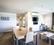
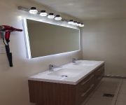
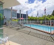
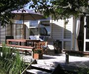
Looking for a place to stay? we compiled a list of available hotels close to the map centre further down the page.
When in this area, you might want to pay a visit to some of the following locations: Auckland, Whangarei, Hamilton, Tauranga and Rotorua. To further explore this place, just scroll down and browse the available info.
Local weather forecast
Todays Local Weather Conditions & Forecast: 17°C / 63 °F
| Morning Temperature | 13°C / 55 °F |
| Evening Temperature | 14°C / 57 °F |
| Night Temperature | 14°C / 58 °F |
| Chance of rainfall | 0% |
| Air Humidity | 46% |
| Air Pressure | 1028 hPa |
| Wind Speed | Light breeze with 5 km/h (3 mph) from South-West |
| Cloud Conditions | Few clouds, covering 23% of sky |
| General Conditions | Few clouds |
Monday, 29th of April 2024
18°C (65 °F)
13°C (56 °F)
Broken clouds, gentle breeze.
Tuesday, 30th of April 2024
18°C (64 °F)
15°C (58 °F)
Overcast clouds, moderate breeze.
Wednesday, 1st of May 2024
19°C (66 °F)
14°C (56 °F)
Light rain, moderate breeze, overcast clouds.
Hotels and Places to Stay
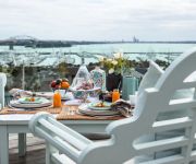
St Marys Residence Private Luxury
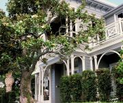
Mollies Boutique Hotel
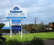
Hobson Motor Inn
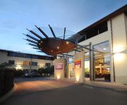
HEARTLAND HOTEL AKLD AIRPORT
Quest Albany
Albany Rosedale Motel
Aristotles North Shore
Ocean Inn Motel
The Great Ponsonby ArtHotel
Haven Bed and Breakfast
Videos from this area
These are videos related to the place based on their proximity to this place.
Elegant scarf tying styles
On a recent trip to India I was enchanted with the elegant way women wore scarves, regardless of the climate. There are many ways to wear scarves and on this short video, I share 2 different...
Curry Sutra - Indian Soul Fuel Open Kitchen Part 1 /12
This is th first part and will be followed soon by others.. We are Curry Sutra offering you your best Indian takeaway experience in the North Shore at 7 Sunnyhaven Avenue, Beach Haven, North...
Wednesday Night Race Hobsonville
Racing the upper Harbour on Cervina just to the west of Greenhithe.
3/1A Williams Rd, Hobsonville, Auckland - Presented by Dan Manford
This delightful family home is immaculately presented and is the perfect entry into Hobsonville. Offering three bedrooms, two bathrooms, sunny living and sep...
3D - New Ferry Service to Beach Haven (2013 02 03)
As of early December 2013, this 3D video must be watched in Firefox or MS IE 11 in order to avoid it being displayed in a "letterbox". Google Chrome is broken for many 3D videos on YouTube...
If you hate exercise this may help
Some of us loathe exercise for exercise sake. It can seem a strange use of time to go to the gym when there are things at home which have rewards beyond the physical. Here are some ideas...
How do I become more elegant ?
How do I add grace and elegance to my life and increase my femininity? Here are a few tips which may help. Based on the book Your Inner Fox - Unleash the Elegance Within http://amzn.to/XNHJ6s...
Videos provided by Youtube are under the copyright of their owners.
Attractions and noteworthy things
Distances are based on the centre of the city/town and sightseeing location. This list contains brief abstracts about monuments, holiday activities, national parcs, museums, organisations and more from the area as well as interesting facts about the region itself. Where available, you'll find the corresponding homepage. Otherwise the related wikipedia article.
Whenuapai
Suburb:Whenuapai City:Waitakere Island:North Island Surrounded by - to the north - to the east - to the south - to the west Waitemata Harbour Hobsonville Hobsonville Massey Whenuapai is a suburb and Aerodrome located in the western Waitakere area of Auckland City, in the North Island of New Zealand. It is located on the northwestern shore of the Waitemata Harbour, 15 kilometres to the northwest of Auckland's city centre.
North Harbour, New Zealand
Suburb:North Harbour City:Auckland Island:North Island Surrounded by - to the north - to the east - to the south - to the west Albany Rosedale Chester Park Lucas Creek North Harbour is the name of a suburb of Auckland, New Zealand. It is located 12 kilometres north of the city centre, to the south of the suburb of Albany, close to the northern edge of the city.
Glenfield, New Zealand
Glenfield (Formerly Mayfield) is a suburb of North Shore, one of several cities in the Auckland metropolitan area in northern New Zealand. It is located to the north of the Waitemata Harbour, nine kilometres northwest of the Auckland city centre. The suburb is located in the northern inland part of North Shore city, and is surrounded by the suburbs of Marlborough, Sunnynook, Forrest Hill, Birkenhead, Northcote and is situated close to Takapuna.
Paremoremo
Paremoremo is a largely rural locality about 8 km (5 miles) southwest of Albany on the northern fringe of Auckland, New Zealand. Coatesville is about 7 km to the north, and Riverhead is about 8 km to the west. The population was 2,193 in the 2006 Census, an increase of 102 from 2001.
RNZAF Base Auckland
RNZAF Base Auckland is a Royal New Zealand Air Force base located near the upper reaches of the Waitemata Harbour in Auckland, New Zealand. The base formerly comprised two separate airfields, Whenuapai and Hobsonville. Hobsonville was established as a seaplane station in 1928 and was the RNZAF's primary flying boat base in New Zealand until 1967.
Albany Senior High School, Auckland
Albany Senior High School (known as ASHS) is situated in North Harbour, Auckland, New Zealand. Opened in February 2009, it is New Zealand's first state senior high school.
Greenhithe, New Zealand
Greenhithe is an Auckland suburb. As from 1 November 2010, Greenhithe is under the governance of the Auckland Council. According to the 2001 census, Greenhithe had a population of 4,170. Greenhithe has however shown dramatic growth since the North Shore City Council determined that Greenhithe was to be a major growth area. By 2006 the population had increased to 6,390.
Birkdale, New Zealand
Birkdale is a suburb of Auckland, New Zealand. The population was 6,798 in the 2006 Census, an increase of 429 from 2001. The suburb is in the North Shore ward, one of the thirteen administrative divisions of Auckland City.
Beach Haven, New Zealand
Beach Haven is a suburb of Auckland, New Zealand and is located north-west from the city's CBD. It has 3396 households and 9834 residents.
West Harbour, Auckland
West Harbour is a suburb of Waitakere City, located in the west of Auckland. It is named for its location on the western side of the Waitemata Harbour. West Harbour is under the local governance of the Waitakere City Council. Local features include many public reserves, two local primary schools, West Harbour School and Marina View School, and farm land. West Harbour is home to Westpark Marina, a large marina catering to over 600 of private leisure boats and yachts.
North Harbour Stadium
North Harbour Stadium is a stadium, situated in Albany, in North Shore City, New Zealand. It was opened in 1997, after nearly a decade of discussion, planning and construction. Rugby union, soccer and rugby League are the only sports played on the main ground, as it is rectangular in shape. The neighbouring oval plays host to the region's major cricket matches. The stadium also hosts large open air concerts.
Riverhead, New Zealand
Riverhead is a small, historically predominantly working-class town located at the head of the Waitemata Harbour in the north-west of Auckland, New Zealand. The region around Riverhead and the neighbouring towns of Kumeu and Huapai is known for its vineyards. This town has had its 15 minutes in the spotlight appearing in movies Bridge to Teribithia and Crooked Earth and the odd television show such as Outrageous Fortune.
Auckland Prison
Not to be confused with Mount Eden Prison in Auckland. Auckland Prison (original name Paremoremo Prison, colloquially Pare, pronounced "Par-re") is a prison facility consisting of medium security and maximum security compounds in Paremoremo, Auckland, New Zealand. The two compounds are separate but located close together in a rural area. The prison contains New Zealand's only specialist maximum-security unit, housing some of the most severe criminals in the country.
Westfield Glenfield
Westfield Glenfield is a shopping centre in Glenfield, part of North Shore City, in Auckland. Opened in 1971, it is situated on the corner of Glenfield Road and Downing Street. The mall was bought by Westfield Group in 1996. In 2000, a major renovation was concluded by Westfield, which cost $100 million. The centre features 132 stores, including the major stores Farmers, The Warehouse, Foodtown and Countdown.
Upper Harbour Bridge
The Upper Harbour Bridge or Greenhithe Bridge is a motorway bridge (technically two bridges as of 2006), which spans over a reach of the Waitemata Harbour and connects Hobsonville and Greenhithe, New Zealand. It is also an important connection for State Highway 18, which will become even more important once the Western Ring Route is finished (likely to be in the 2010s).
Pinehurst School
Pinehurst School is a private education institute located in Auckland, New Zealand with a roll of approximately 650 students. The institute was established in 1991, and turned 15 in 2006; this event was marked with a celebration in which all the staff and students took part in. The school is relatively new compared to the other private schools in the region of Albany, though has matured greatly over the past 18 years.
Hobsonville
Hobsonville is a rural suburban district of the Auckland metropolitan area in the North Island of New Zealand. Home to the former Royal New Zealand Air Force airfield, it is currently being redeveloped as a new suburb of Auckland, in the area of the former Waitakere City. The Hobsonville area (or Hobsonville Corridor) lies between the North Western Motorway and State Highway 16 in the west and the Hobsonville Peninsula and Upper Harbour Bridge in the east.
Westfield Albany
Westfield Albany is a new shopping centre of the Westfield Group in Albany, New Zealand, opposite the Albany Lakes Civic Park. Once the last sections opened in April 2008, at 7 ha (70,000 m²) of indoor space (4.9 ha retail and 2.1 ha offices), it became the largest shopping centre in New Zealand, eclipsing even recently opened Sylvia Park, and costing around NZ$ 210 million to construct.
Albany Junior High School
Albany Junior High School is situated in North Harbour, Auckland, New Zealand. Opened in 2005, it was the first purpose built Junior High in New Zealand. The concept of a junior high school, although common in the United States, is controversial in New Zealand. Two more junior high schools are being built in Manukau, and there are five others already operating. It caters for years 7-10, after which most of the students will move on to the nearby Albany Senior High, which opened in 2009.
Windy Ridge, New Zealand
Windy Ridge is a suburb of North Shore, New Zealand, one of the four cities which comprise Auckland. Windy Ridge had 3,054 people in 1996, 3,111 people in 2001 and 3,375 people in 2006. It has about the same income as Beach Haven and slightly higher than Auckland's average.
Bayview, New Zealand
Bayview is a suburb of Auckland in New Zealand. The population was 5,127 in the 2006 Census, an increase of 333 from 2001. The area was included into the North Shore ward in 2010, one of the new thirteen administrative areas of the new Auckland city.
Kauri Park
Kauri Park is a suburb of North Shore, one of several cities in the Auckland metropolitan area in northern New Zealand. The population was 3,771 in the 2006 Census, an increase of 381 from 2001.
Unsworth Heights
Unsworth Heights is a suburb of North Shore, one of several cities in the Auckland metropolitan area in northern New Zealand. New Zealand State Highway 18 (Upper Harbour Highway) passes to the north of the suburb, and the Albany Highway to the south. The two routes intersect just to the west of Unsworth Heights. Unsworth Reserve is to the east. The population of the Unsworth Heights statistical area was 5,169 in the 2006 Census, an increase of 549 from 2001.
Wainoni, Auckland
Wainoni is a suburb of North Shore, one of several cities in the Auckland metropolitan area in northern New Zealand. New Zealand State Highway 18 passes to the south and east of the suburb, and Lucas Creek, an extension of the Waitemata Harbour, forms the northeastern boundary. Wainoni Park lies between the suburb and Greenhithe to the southwest. Wainoni is part of the Greenhithe census area.
Witheford Heights
Witheford Heights is a suburb of North Shore, New Zealand, one of the four cities which comprise Auckland. The population of Witheford Heights was 3,012 in the 2006 Census, an increase of 384 from 2001.


