Safety Score: 3,0 of 5.0 based on data from 9 authorites. Meaning we advice caution when travelling to New Zealand.
Travel warnings are updated daily. Source: Travel Warning New Zealand. Last Update: 2024-05-05 08:24:42
Discover Murrays Bay
The district Murrays Bay of Mairangi Bay in Auckland (Auckland) with it's 4,500 citizens Murrays Bay is a subburb in New Zealand about 315 mi north of Wellington, the country's capital city.
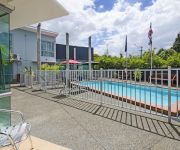
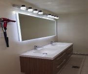
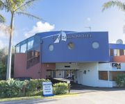
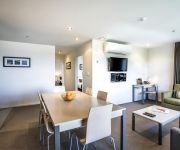
If you need a hotel, we compiled a list of available hotels close to the map centre further down the page.
While being here, you might want to pay a visit to some of the following locations: Auckland, Whangarei, Hamilton, Tauranga and Rotorua. To further explore this place, just scroll down and browse the available info.
Local weather forecast
Todays Local Weather Conditions & Forecast: 17°C / 63 °F
| Morning Temperature | 12°C / 54 °F |
| Evening Temperature | 15°C / 59 °F |
| Night Temperature | 15°C / 59 °F |
| Chance of rainfall | 0% |
| Air Humidity | 59% |
| Air Pressure | 1024 hPa |
| Wind Speed | Gentle Breeze with 6 km/h (4 mph) from South-West |
| Cloud Conditions | Clear sky, covering 3% of sky |
| General Conditions | Sky is clear |
Monday, 6th of May 2024
17°C (62 °F)
13°C (56 °F)
Light rain, gentle breeze, broken clouds.
Tuesday, 7th of May 2024
14°C (57 °F)
14°C (57 °F)
Moderate rain, gentle breeze, overcast clouds.
Wednesday, 8th of May 2024
17°C (62 °F)
13°C (55 °F)
Light rain, gentle breeze, broken clouds.
Hotels and Places to Stay
Aristotles North Shore
Albany Rosedale Motel
City of Sails Motel
Quest Albany
Emerald Inn
Takapuna Motor Lodge
THE SPENCER ON BYRON HOTEL
Ocean Inn Motel
Milford House B&B
Poenamo Hotel
Videos from this area
These are videos related to the place based on their proximity to this place.
Robin's Nest... or invest? 2/26 Robin Lane, Browns Bay
Tucked away off the road, in a quiet, family friendly cul-de-sac sits this perfect starter home or investment property. Surrounded by prestigious, substantial family homes this is a top location...
Emergency Services in the Browns Bay Santa Parade 2010
NZ Police, Coastguard, Fire Service, and St John Ambulance in the Browns Bay Santa Parade. Browns Bay Santa Parade 4 December 2010 Clyde Road Browns Bay Auckland New Zealand.
Browns Bay Santa Parade 2010
Browns Bay Santa Parade 4 December 2010 Clyde Road Browns Bay Auckland New Zealand.
Browns Bay Tiny Tiger Academy Martial Arts Obstacle Course
One of our fun obstacle courses, visit www.facebook.com/tinytigeracademy for more details.
Hair Salon Browns Bay Call 09-479 7279 Our Services
http://www.hair-salon-browns-bay.com Hair Salon Browns Bay Call 09-479 7279 - The Best Hair Salon in 3 Inverness Rd, Browns Bay 0630 for Hairdressing, Colours, Foils, Restyling, Hairups,...
Bays 831 & 832 Responding, East Coast Rd, 14 Apr 09
East Coast Bays 831 and 832 responding along East Coast Road. Its vary rarely I see either of them, let alone both! East Coast Bays 831 1999 Scania P94DB http://www.111emergency.co.nz/X-Z/XI84...
Rangitoto College 2010 Enviro-Challenge Video
This is Rangitoto College's Enviro-Challenge Video with "Enviro Troll" (ET) This video just goes to show that "Enviro Troll" (ET) is always out there watching you...so when you litter, you...
Videos provided by Youtube are under the copyright of their owners.
Attractions and noteworthy things
Distances are based on the centre of the city/town and sightseeing location. This list contains brief abstracts about monuments, holiday activities, national parcs, museums, organisations and more from the area as well as interesting facts about the region itself. Where available, you'll find the corresponding homepage. Otherwise the related wikipedia article.
Rangitoto College
Rangitoto College is a state coeducational secondary school, located on the North Shore of Auckland, New Zealand. Serving Years 9 to 13, Rangitoto has a school roll of 2949 as of July 2012, making it the largest "brick-and-mortar" school in New Zealand (only The Correspondence School has more enrolled students).
Milford, New Zealand
Milford is a suburb of Auckland, New Zealand's largest city. Located on Auckland's North Shore and part of North Shore City, Milford is located on the northern side of Lake Pupuke. It also has a popular swimming beach, which runs some two kilometers from Black Rock in the south to Castor Bay in the north. The Wairau Creek empties into the Hauraki Gulf at the northern end of Milford Beach, and its lower tidal reaches host the Milford Marina.
Browns Bay, New Zealand
Browns Bay is an Auckland suburb. It is one of the East Coast Bays suburbs, and is well known for its shops and beaches. Browns Bay is under the local governance of the Auckland Council, and is located in the North Shore ward of the new Auckland city, one of the thirteen newly amalgamated administrative areas. The population was 3,978 in the 2006 Census, an increase of 282 from 2001. 40x40pxThis section appears to be written like an advertisement.
Mairangi Bay
Mairangi Bay is a suburb in North Shore City in New Zealand, across the Waitemata Harbour from Auckland. Mairangi Bay is under the local governance of the North Shore City Council. The population was 5,277 in the 2006 Census, an increase of 501 from 2001. The Bay's beach itself has, along with adjacent Murrays and Campbells Bays, undergone civil works projects since 2004 to improve stormwater management.
Forrest Hill, New Zealand
Forrest Hill is a suburb of Auckland. Forrest Hill was under the local governance of the North Shore City Council, which amalgamated into Auckland Council on 1 November 2010. The population was 5,283 in the 2006 Census, an increase of 372 from 2001.
Torbay, New Zealand
Torbay is an Auckland suburb. Torbay was under the local governance of the North Shore City Council but was amalgamated into the Auckland "Supercity" in 2010. The name Torbay comes from the area of the same name in the south east of Devon, England. The population was 4,554 in the 2006 Census, an increase of 123 from 2001.
Castor Bay
Castor Bay is a bay and suburb of Auckland in the North Island of New Zealand. Located between Milford and Campbells Bay it forms part of Auckland's East Coast Bays. To the east lies the islands of Rangitoto and Motutapu which are easily visible from land. The suburb is in the North Shore ward, one of the thirteen administrative divisions of Auckland City. The population was 2,877 in the 2006 Census, an increase of 93 from 2001.
Rothesay Bay
Suburb:Rothesay Bay City:North Shore Island:North Island Surrounded by - to the north - to the east - to the south - to the south-west - to the north-west Browns Bay Hauraki Gulf Murrays Bay Pinehill Northcross Rothesay Bay is a small suburb in North Shore City's East Coast Bays region. The suburb is roughly the same size as Murrays Bay, the suburb to the immediate south. The name is taken from the small inlet into the Hauraki Gulf, which can be accessed via Rothesay Bay Road.
Pinehurst School
Pinehurst School is a private education institute located in Auckland, New Zealand with a roll of approximately 650 students. The institute was established in 1991, and turned 15 in 2006; this event was marked with a celebration in which all the staff and students took part in. The school is relatively new compared to the other private schools in the region of Albany, though has matured greatly over the past 18 years.
Murrays Bay
Murrays Bay is a small suburb in Auckland's East Coast Bays region. The suburb is roughly the same size as Rothesay Bay, the suburb to the immediate north. It is primarily a residential area but does have a community centre, restaurant and takeaway. Murrays Bay is regularly serviced by buses which go to Takapuna and Auckland City. The population was 4,581 in the 2006 Census, an increase of 303 from 2001.
Pinehill, New Zealand
Pinehill is a small suburb in the East Coast Bays area of Auckland, New Zealand. Pinehill contains two shopping centres, one along East Coast Road and the other along Greville Road. The suburb has only recently grown because of the housing estates being built in the area for the rapidly growing Albany area. Pinehill is regularly serviced by buses which go to Takapuna and Auckland City. The Auckland Northern Motorway passes to the west of the suburb.
Westfield Albany
Westfield Albany is a new shopping centre of the Westfield Group in Albany, New Zealand, opposite the Albany Lakes Civic Park. Once the last sections opened in April 2008, at 7 ha (70,000 m²) of indoor space (4.9 ha retail and 2.1 ha offices), it became the largest shopping centre in New Zealand, eclipsing even recently opened Sylvia Park, and costing around NZ$ 210 million to construct.
Sunnynook, New Zealand
Sunnynook is a suburb of North Shore, one of several cities in the Auckland metropolitan area in northern New Zealand, and is under the local governance of the North Shore City Council. The suburb is centered around the Sunnynook Shopping Center and the nearby Sunnynook Park. Sunnynook also has a skateboard bowl located in Sunnynook Park, which is also home to the Glenfield Greyhounds rugby league club. There is also the new Sunnynook bus station.
Southern Cross Hospital North Harbour
Southern Cross Hospital North Harbour is the only private surgical in-patient hospital in North Shore City, New Zealand. It is run by Southern Cross Hospitals Limited, part of the Southern Cross Healthcare Group, and was established in 1991. The facility has 67 beds and four operating theatres, with around 5,000 operations undertaken annually.
City Impact Church New Zealand
City Impact Church is a nondenominational church of faith with pentecostal beliefs based in East Coast Bays, New Zealand. Formerly known as Bays Christian Fellowship, it was founded in 1982 by current senior pastors Peter Mortlock and his wife Bev Mortlock. It has now grown to around 3000 extended members (as of mid-2008). It runs two Sunday services, one at 10 am and another at 6:30 pm .
Glenfield North
Glenfield North is a suburb of North Shore, one of several cities in the Auckland metropolitan area in northern New Zealand. The Auckland Northern Motorway passes to the east of the suburb, and Wairau Road (Route 26) separates it from Central Glenfield to the south. The Wairau Park Shopping Complex runs along Link Drive to the south-east. The population of Glenfield North was 4,050 in the 2006 Census, an increase of 165 from 2001.
Long Bay, New Zealand
Long Bay is a suburb of North Shore, now incorporated into the Auckland metropolitan area in northern New Zealand. The population was 954 in the 2006 Census, an increase of 210 from 2001. The coastline is occupied by the Long Bay Regional Park, and the shoreline is a marine reserve, which opened in 1996. The beach is sandy and swimming is safe. Smaller beaches to the north, accessible except at high tide, are used by nudists.
Long Bay College
Long Bay College is a state coeducational secondary school located on the North Shore of Auckland, New Zealand. Serving Years 9 to 13, the school has 1660 students as of November 2012.
Northcross
Northcross is a suburb of North Shore, one of several cities in the Auckland metropolitan area in northern New Zealand. It is located on the north shore of the Waitemata Harbour. The population was 3,033 in the 2006 Census, an increase of 1,233 from 2001, and houses East Coast Bays who are current Champions of the 2010 Lotto Sport Italia NRFL Premier.
Campbells Bay
Campbells Bay is a suburb in Auckland City in New Zealand. The suburb is under the local governance of the Auckland Council. The population was 2,316 in the 2006 Census, an increase of 111 from 2001. The suburb is in the 'North Shore ward, one of the thirteen administrative divisions of the city of Auckland. The Bay's beach itself has, along with adjacent Murrays and Mairangi Bays, undergone civil works projects since 2004 to improve stormwater management.
Torbay Heights
Torbay Heights is an Auckland suburb, which is under the local governance of the North Shore City Council. The population was 6,831 in the 2006 Census, an increase of 276 from 2001.
Wairau Valley, Auckland
Wairau Valley is a suburb of North Shore, one of several cities in the Auckland metropolitan area in northern New Zealand. The area is predominantly light industrial/commercial. New Zealand State Highway 1 passes to the east, and the Wairau Park shopping complex extends to the north. Wairau Valley is part of the Glenfield North census area.
Windsor Park, New Zealand
Windsor Park is a suburb of North Shore, one of several cities in the Auckland metropolitan area in northern New Zealand. Windsor Park is part of the Pinehill census area.
Centrepoint (commune)
Centrepoint was a commune in Albany, New Zealand, created in 1977 by Herbert "Bert" Thomas Potter (1925–2012) and 36 others. The commune was created in the model of the therapeutic encounter groups popularised in the 1960s in California. At its largest, it was home to over 200 people. On 25 April 1990, Potter was convicted of drug charges. In November 1992 Potter was sentenced to 7 years jail after being convicted of 13 charges of indecently assaulting five girls between 1979 and 1984.
Sunnynook Busway Station
Sunnynook Busway Station is a bus station in Sunnynook, New Zealand, part of the Auckland Northern Busway. Sunnynook is the smallest station on the Northern Busway. The station provides shelters, real time information on bus services and passenger drop off and pick up


