Safety Score: 3,3 of 5.0 based on data from 9 authorites. Meaning please reconsider your need to travel to Netherlands.
Travel warnings are updated daily. Source: Travel Warning Netherlands. Last Update: 2024-05-16 08:19:50
Discover Holevoet
The district Holevoet of Lambalgen in Gemeente Woudenberg (Provincie Utrecht) is a district in Netherlands about 33 mi south-east of Amsterdam, the country's capital city.
Looking for a place to stay? we compiled a list of available hotels close to the map centre further down the page.
When in this area, you might want to pay a visit to some of the following locations: Utrecht, 's-Hertogenbosch, Arnhem, Lelystad and Kranenburg. To further explore this place, just scroll down and browse the available info.
Local weather forecast
Todays Local Weather Conditions & Forecast: 18°C / 65 °F
| Morning Temperature | 12°C / 53 °F |
| Evening Temperature | 16°C / 60 °F |
| Night Temperature | 14°C / 56 °F |
| Chance of rainfall | 11% |
| Air Humidity | 71% |
| Air Pressure | 1010 hPa |
| Wind Speed | Gentle Breeze with 8 km/h (5 mph) from South |
| Cloud Conditions | Overcast clouds, covering 95% of sky |
| General Conditions | Moderate rain |
Saturday, 18th of May 2024
20°C (68 °F)
13°C (55 °F)
Light rain, gentle breeze, broken clouds.
Sunday, 19th of May 2024
19°C (67 °F)
14°C (57 °F)
Moderate rain, gentle breeze, few clouds.
Monday, 20th of May 2024
17°C (63 °F)
9°C (47 °F)
Light rain, moderate breeze, clear sky.
Hotels and Places to Stay
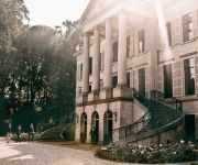
Parc Broekhuizen
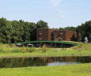
Hampshire Boshotel Overberg
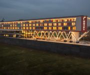
Van der Valk Hotel Veenendaal
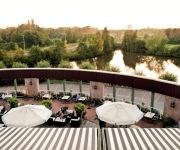
Van der Valk Hotel Leusden Amersfoort
Videos from this area
These are videos related to the place based on their proximity to this place.
Bicycle trip: Stationsweg in Scherpenzeel to Dorpsstraat in Renswoude [ZAWSRDKEO part 4]
This is part 4 (of 9) of the bicycle trip Zeist - Austerlitz - Woudenberg - Scherpenzeel - Renswoude - De Klomp - Ede - Oosterbeek [or 'ZAWSRDKEO' as a short tag]. This part goes from Stationswe...
Solex rijden door Woudenberg en Scherpenzeel
Met de personeelsvereniging op de Solex door Woudenberg em Scherpenzeel rijden.
Première Need for Speed te Ede 08-03-14
Na de TMCN meet & greet in Woudenberg rijden we gezamenlijk op naar het verzamelpunt ergens in Ede voor de premiere voor de film Need for Speed.
Walibi baby in de buidel / Wallaby baby in the pouch
This mother has a baby wallaby in her pouch so big you can't imagine it would fit in there.
Meerijden met de machinist van Ut naar Ah.
meekijken over de schouder van een machinist, op het traject van Utrecht naar Arnhem met de intercity die stopt op Veenendaal-de klomp en Ede-Wageningen. インターシティとユトレヒトか...
Mandarijn Eend met Nonnetje / Aix galericulata with Smew, Mergellus albellus
Ducks in a pond in the Netherlands.
Mark Ronson in Amsterdam
We flew into Amsterdam via private jet in Nov 07 and were driven at speed until we arrived at the famous "paradise club"
Chatterdale Mystery (Virtual language village in OpenSim)
Chatterdale Mystery is a quest in Chatterdale, the first virtual language village on OpenSim. The village is built by 3DLES, the quest is written by NEXT TELL. HD Recordings are made by...
Bicycle Trip: Bergweg in Overberg to Laagerfseweg in Scherpenzeel [BCWbDAMMAZ p6]
Bicycle Trip: Bergweg in Overberg to Laagerfseweg in Scherpenzeel [BCWbDAMMAZ p6] This is part 6 (of 9) of the bicycle trip Bunnik - Cothen - Wijk bij Duurstede - Amerongen - Maarsbergen -...
Visit 8 Countries in 9 Days Luxemberg, Belgium, Netherlands
Kevin and Sue McCarthy finish their marathon visit to Europe with visits to Luxemberg, Belgium and the Netherlands. You'll see Harley riders in Belgium,the canals of Amsterdam and more.
Videos provided by Youtube are under the copyright of their owners.
Attractions and noteworthy things
Distances are based on the centre of the city/town and sightseeing location. This list contains brief abstracts about monuments, holiday activities, national parcs, museums, organisations and more from the area as well as interesting facts about the region itself. Where available, you'll find the corresponding homepage. Otherwise the related wikipedia article.
Buren
' is a municipality and a city in the Betuwe region in the Netherlands. It is also a (historical) county, with the Dutch Monarch still holding the title "Count of Buren".
Amerongen
Amerongen is a village in the central Netherlands on the border of the Utrecht Hill Ridge. It lies about 7 km south west of Veenendaal (10.5 km by road). The landscape rises from the flat water meadows of the Nederrijn (Lower Rhine) to the Utrecht Hill Ridge ("Utrechtse Heuvelrug"). The highest point in the western Netherlands is located 2 km east of the village. The Amerongense Berg (Amerongen Mountain) has a height of 69 metres above sea level.
Leersum
Leersum is a town in the Dutch province of Utrecht. It is a part of the municipality of Utrechtse Heuvelrug, and lies about 9 km west of Veenendaal. In 2001, the town of Leersum had 6013 inhabitants. The built-up area of the town was 1.44 km², and contained 2465 residences. Until 2006, there was a separate municipality Leersum, covering both the village of Leersum and Darthuizen.
Maarn
Maarn is a town in the Dutch province of Utrecht. It is a part of the municipality of Utrechtse Heuvelrug, and is located about 10 km east of Zeist. In 2001, the town of Maarn had 4,071 inhabitants. The built-up area of the town was 1.26 km², and contained 1,793 residences. Until 2006, Maarn was a separate municipality, covering both Maarn and Maarsbergen. Maarn is a small village in the heart of the Utrechtse Heuvelrug, a protected nature reserve in the Netherlands.
De Glind
De Glind is a small village near Barneveld in the middle of Netherlands, in the province Gelderland. De Glind Digitaal Website
Hooglanderveen
Hooglanderveen is a village in the Dutch province of Utrecht. It is a part of the municipality of Amersfoort, and lies about 4 km northeast of Amersfoort. It is notable for the presence of a large catholic church. Formerly, the village of Hooglanderveen was located outside of the city limits of Amersfoort, but the new residential areas of Nieuwland and Vathorst now mean that Hooglanderveen will be surrounded by the city. In 2001, the town of Hooglanderveen had 1442 inhabitants.
De Klomp
De Klomp is a location in the municipality of Ede, with a railway station called "Veenendaal-De Klomp railway station". It is located in the Dutch province of Gelderland.
Overberg, Netherlands
Overberg is a small village in the Dutch province of Utrecht. It is a part of the municipality of Utrechtse Heuvelrug. It is located on both sides of the Utrecht-Rhenen railway line, but has no station. It is around 5 km west of the centre of Veenendaal, and 25 km east of the city of Utrecht.
De Mars
De Mars is a hamlet in the Dutch province of Gelderland. It is a part of the municipality of Buren, and lies about 8 km south of Veenendaal. The area belonging to De Mars was originally located north of the Rhine river. However, the river bed now runs along a new route north of De Mars. The statistical area "De Mars", which also can include the surrounding countryside, has a population of around 270.
Eck en Wiel
Eck en Wiel is a village in the Dutch province of Gelderland. It is a part of the municipality of Buren, and lies about 9 km southwest of Veenendaal. In 2001, the village of Eck en Wiel had 820 inhabitants in the built-up area. The built-up area of the town was 0.18 km², and contained 324 residences. The statistical area "Eck en Wiel", which also can include the peripheral parts of the village, as well as the surrounding countryside, has a population of around 1720.
Ingen, Netherlands
Ingen is a town in the Dutch province of Gelderland. It is a part of the municipality of Buren, and lies about 9 km southwest of Veenendaal. Before 1999 the town was part of the municipality Lienden from 1818 till 1999. The houses are widely spread into a bowl form. The houses link to the townships De Ganzert and Eck en Wiel in the West.
Lienden
Lienden is a town in the Dutch province of Gelderland. It is a part of the municipality of Buren, and lies about 9 km south of Veenendaal. Lienden was a separate municipality until 1999, when it was merged with Buren. In 2007, the town of Lienden had 6230 inhabitants. The built-up area of the town was 0.81 km², and contained 1147 residences.
Ommeren
Ommeren is a town in the Dutch province of Gelderland. It is a part of the municipality of Buren, and lies about 9 km northeast of Tiel. In 2001, the town of Ommeren had 180 inhabitants. The built-up area of the town was 0.047 km², and contained 72 residences. The statistical area "Ommeren", which also can include the peripheral parts of the village, as well as the surrounding countryside, has a population of around 460.
Grebbe line
The Grebbe Line was a forward defence line of the Dutch Water Line, based on inundation. The Grebbe Line ran from the Grebbeberg in Rhenen northwards until the IJsselmeer.
Darthuizen
Darthuizen is a hamlet in the Dutch municipality of Utrechtse Heuvelrug. From 1818 to 1857, Darthuizen was a separate municipality. On 8 June 1857, it merged into the municipality of Leersum.
Lagerwey Wind
Lagerwey Wind BV is a Dutch company. It is located in Barneveld and is focussed on the design of modern direct drive wind turbines. In 2009 the first L82-2MW was put into operation in Germany, followed by India. In 2012 2 units of the L93-2.6MW were put in operation in Lelystad (the Netherlands). More units are planned. The models that can be delivered now are: L82-2.0MW L93-1.5MW L93-2.6MW L100-2.5MW L100-3.0MW
Asschat
Asschat is a hamlet in the municipality Leusden, in the Dutch province of Utrecht. The hamlet is separated from the village of Leusden in the west by the Valleikanaal canal, and it borders the hamlet Snorrenhoef in the east. The name Asschat (1696) derives from af-schede, afscheiding: partition, indicating an old border. The family Scholten van Aschat is named after the hamlet.
Breedeveen
Breedeveen is a hamlet in the municipality Utrechtse Heuvelrug, in the Dutch province Utrecht. It lies in a forest north of the village of Leersum, on the road from Leersum to Woudenberg. Breedeveen has a population of 80 (as of 2004).
Intres B.V
Intres B.V. (International Retail Support) is a Dutch retail organisation, established in Hoevelaken. The company provides various services to owners of shops and is franchisor of such brands as Intersport, Livera and Libris. Intres B.V. is 100th in the list of Dutch companies in terms of income and number of employees for 2005 and 2006. The activities of Intres can be divided into four divisions: Fashion, Living, Intersport Netherlands and Media.
Heiligenberg (Leusden)
The Heiligenberg is an estate near the Dutch town of Leusden. The estate is located on a 12 meter high hill, the "Heiligenberg" (Holy Mountain), which dates from the last ice age, about 10,000 years ago. On this hill, then known as Hohorst, bishop Ansfridus of Utrecht founded a small abbey around the year 1000. The abbey was moved to the city of Utrecht around 1030, but the Heiligenberg remained in their possession until 1592. In 1637, the house became an estate.
Tresoar
Tresoar (Friesian for "treasure") is the short name for the Frysk Histoarysk en Letterkundich Sintrum ("Friesian History and Literature Center") in Leeuwarden. Tresoar manages digital archives about Friesland and its literature. There is a study room open to the public, and most catalogs are online and free to access.
Castle Amerongen
The Castle Amerongen was built in 1673 on the site of a previous stronghold that had been burned in 1672 by the French.
De Hoeksteen, Barneveld
De Hoeksteen (The Cornerstone) in Barneveld, the Netherlands, is the second largest church building in the Netherlands. It is used by the congregation of the Gereformeerde Gemeenten in Nederland, a highly conservative denomination. The church services are conducted using exclusively the Statenvertaling (Dutch for States Translation) of the Bible.
Mariënhof
Mariënhof was a restaurant located in Amersfoort, in the Netherlands. It was a fine dining restaurant that was awarded one Michelin star in the period 1996-2001. Head chef of Mariënhof was Jon Sistermans. The restaurant ended due to the transfer of ownership of the former monastery from insurance company "Amersfoortse Verzekeringen" to the "Van den Tweel Horeca Groep". The new owners changed course and wanted the restaurant to leave the fine dining and move into a lower class.
De Zwaan, Lienden
De Zwaan (The Swan) is a tower mill in Lienden, the Netherlands, which is in working order. The mill was built in 1644 and is listed as a Rijksmonument, number 25834.


!['Bicycle trip: Stationsweg in Scherpenzeel to Dorpsstraat in Renswoude [ZAWSRDKEO part 4]' preview picture of video 'Bicycle trip: Stationsweg in Scherpenzeel to Dorpsstraat in Renswoude [ZAWSRDKEO part 4]'](https://img.youtube.com/vi/RTbFzWFSSjk/mqdefault.jpg)


!['Bicycle Trip: Bergweg in Overberg to Laagerfseweg in Scherpenzeel [BCWbDAMMAZ p6]' preview picture of video 'Bicycle Trip: Bergweg in Overberg to Laagerfseweg in Scherpenzeel [BCWbDAMMAZ p6]'](https://img.youtube.com/vi/cIeIkFMYox4/mqdefault.jpg)
