Safety Score: 2,8 of 5.0 based on data from 9 authorites. Meaning we advice caution when travelling to Hungary.
Travel warnings are updated daily. Source: Travel Warning Hungary. Last Update: 2024-05-12 08:29:37
Delve into Székes
The district Székes of Ócsa in Pest megye is a district located in Hungary about 16 mi south-east of Budapest, the country's capital town.
In need of a room? We compiled a list of available hotels close to the map centre further down the page.
Since you are here already, you might want to pay a visit to some of the following locations: Gyal, Vecses, Dabas, Monor and Szigetszentmiklos. To further explore this place, just scroll down and browse the available info.
Local weather forecast
Todays Local Weather Conditions & Forecast: 18°C / 64 °F
| Morning Temperature | 12°C / 53 °F |
| Evening Temperature | 21°C / 70 °F |
| Night Temperature | 13°C / 55 °F |
| Chance of rainfall | 0% |
| Air Humidity | 56% |
| Air Pressure | 1020 hPa |
| Wind Speed | Gentle Breeze with 7 km/h (4 mph) from West |
| Cloud Conditions | Broken clouds, covering 70% of sky |
| General Conditions | Light rain |
Monday, 13th of May 2024
18°C (64 °F)
13°C (55 °F)
Sky is clear, gentle breeze, clear sky.
Tuesday, 14th of May 2024
19°C (66 °F)
15°C (60 °F)
Sky is clear, gentle breeze, clear sky.
Wednesday, 15th of May 2024
19°C (66 °F)
14°C (58 °F)
Light rain, gentle breeze, broken clouds.
Hotels and Places to Stay
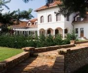
Bodrogi Kúria Wellness
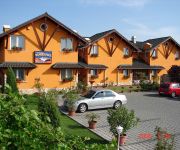
Bagolyvár Étterem & Vendégház & Wellness
Videos from this area
These are videos related to the place based on their proximity to this place.
Mini Hype berepülés 2009.10. Vecsés
Peti mini hype modellje,az első repülés,ugymond berepülés,kis izgalom,stb.. A videó elején egy Canon Ixus 80-assal készített time lapse felvétel látható,utánna a Sony PM1-es HD...
FPV part 2. / Easy Glider - Vecsés
Modell : Easy Glider Pro /2200mAh+1000mAh Li-Po/ Hitec Spectra 24 Optima 7 / FPV - Video transmitter : 1.2Ghz (1240Mhz) 800mW + Original Tx/Rx antenna / Camera : Sony 1/3 CCD + 2.5mm...
A Jobbik önkormányzati képviselője tiltakozik az újabb luxuskiadás ellen
http://gyal.jobbik.hu/content/jobbik-%C3%B6nkorm%C3%A1nyzati-k%C3%A9pvisel%C5%91je-tiltakozik-az-%C3%BAjabb-luxus-kiad%C3%A1s-ellen Így kell közpénzből egymásnak osztogatni.
Gyál városközpont építése - time lapse
Gyál városközpont építése, time-lapse videó (2012.06.01-2012.09.25) http://www.varosuzemeltetes-gyal.hu http://www.varosfejlesztes-gyal.hu.
vk 1
Gyál városközpont építése, time-lapse, I. ütem (2012.06.01-2012.07.16) http://www.varosuzemeltetes-gyal.hu http://www.varosfejlesztes-gyal.hu.
Videos provided by Youtube are under the copyright of their owners.
Attractions and noteworthy things
Distances are based on the centre of the city/town and sightseeing location. This list contains brief abstracts about monuments, holiday activities, national parcs, museums, organisations and more from the area as well as interesting facts about the region itself. Where available, you'll find the corresponding homepage. Otherwise the related wikipedia article.
Pest County
Pest County is a county (megye) in central Hungary. It covers an area of 6,393.14 square kilometres, and has a population of 1,213,090 (2009). It surrounds the national capital Budapest and the majority of the county's population (65.2%/790,995 in 2009) live in the suburbs of Budapest. It shares borders with Slovakia and the Hungarian counties Nógrád, Heves, Jász-Nagykun-Szolnok, Bács-Kiskun, Fejér and Komárom-Esztergom. The River Danube flows through the county.
Taksony
Named after the last pagan ruling prince, Taksony of Hungary, Taksony is a village of roughly 6,000 inhabitants roughly 23 kilometers south of Budapest, on the bank of the Ráckeve branch of the Danube known as Kisduna (Little Danube). Taksony is known for its many natural springs and tranquil scenery and serves as a haven for fishermen, boaters and summer vacationers.
Pesterzsébet
Pesterzsébet is the 20th district of Budapest, Hungary. It is located in the southern part of the capital and is the 17th biggest district in the city. It is a mostly suburban area with approximately 70,000 residents.
Pestszentlőrinc
Pestszentlőrinc, Saint Lawrence of Pest, the 18th district of Budapest is situated at the south-eastern part of the city. It is made up of two earlier distinct towns: Pestszentlőrinc and Pestszentimre. The population of the district today is around 100.000 and this amount is divided between the two divisions as 80%-20%. The area joined Budapest shortly after World War II.
Kőbánya
Kőbánya is the 10th district of Budapest and one of the largest by territory. It is located in southeast Pest, easily accessible from the downtown by Metro 3, whose terminus is named Kőbánya-Kispest. It has strong industrial and organized labour traditions and has suffered much setback after the collapse of Socialism in 1989-90. Today, the district is rebuilding itself into a living area for the middle classes.
Csepel
Csepel is the 21st district and a neighbourhood in Budapest, Hungary. Csepel officially became part of Budapest on 1 January 1950.
Gedeon Richter Ltd
Gedeon Richter Plc. (Hungarian: Richter Gedeon Nyrt. ), the largest pharmaceutical factory in Hungary, was established by Mr. Gedeon Richter, a pharmacist in 1901. Mr. Richter was not only the founder of the company, but the establishment of his firm also marked the beginning of the development of the Hungarian pharmaceutical industry. Initially, small-scale pharmaceutical production took place in the "Sas" (Eagle) Pharmacy, which still operates.
Kőbánya-Kispest (Budapest Metro)
Kőbánya-Kispest is the southern terminus of the M3 Line (North-South line) of the Budapest Metro. It is also a railway station and a changing place of several bus lines (68, 85, 85E, 93, 98, 98E, 136E, 148, 151, 182, 184, 193E, 200E - this run from here to Budapest Ferenc Liszt International Airport, 201E, 202E, 282E, 284E). In Budapest people sometimes call this station Köki, which is short for Kőbánya-Kispest. It is the largest meeting-point in South-Pest.
Ecseri út (Budapest Metro)
Ecseri út is a station on the M3 (North-South) line of the Budapest Metro. Next to the station there are the northern blocks of Attila József microraion.
Határ út (Budapest Metro)
Határ út is a station on the M3 (North-South) line of the Budapest Metro. Near the station, there are several tram and bus terminus, and a shopping centre. Határ út station named after the adjacent street Határ út, which literally means "(City) Limit Street". Before the formation of Greater Budapest it was the border of Budapest Capital.
Pöttyös utca (Budapest Metro)
Pöttyös utca (lit. Spotted street) is a station on the M3 (North-South) Line of the Budapest Metro. Next to the station, there is a huge socialist housing estate, which named after Attila József.
People's Park (Budapest)
Népliget is located in Budapest, Hungary. It is a central bus station for coaches. In front of the bus station, there is a large, open field which is practically called the Népliget, but Hungarians tend to use Népliget in relation with the bus centre. Beside the coach station and the park itself, Népliget is also noted for the Planetarium. The 3rd Metro line (North-South line) in Budapest has a stop there. The tram #1-#1A have three stops along the north-western border of the Népliget.
Bozsik Stadion
Bozsik József Stadion is a multi-use stadium in Budapest, Hungary. It is currently used for football matches and is the home stadium of Budapest Honvéd FC. The stadium has a capacity of 7,200.
Üllői út
Üllői út (Üllői Avenue, lit. means "Road to Üllő") is a major transport artery in Budapest, Hungary. Üllői út is the longest avenue in Budapest. It is 15.6 km long and absolutely straight. It starts at the edge of Inner City proper, crosses Small Boulevard and Grand Boulevard and runs as far as the boundary of the capital in southeastern direction, reaching the nearby towns of Vecsés and Üllő, the latter providing its name.
Kozma Street Cemetery
The Kozma Street Cemetery is the biggest Jewish cemetery of Budapest, Hungary. It is located next to the New Public Cemetery (Újköztemető).
Alsónémedi
Alsónémedi is a village in Pest County, Budapest metropolitan area, Hungary. It has a population of 4,841 (2007).
Felsőpakony
Felsőpakony is a village in Pest county, Budapest metropolitan area, Hungary. It has a population of 3,282 (2007).
Inárcs
Inárcs is a village in Pest county, Hungary.
Kakucs
Kakucs is a village in Pest county, Hungary.
Péteri
Péteri is a village in Pest county, Hungary.
Kispest
Kispest is the 19th (XIX) district of Budapest, Hungary. It lies to the south-southeast of the historical Pest city. It was founded in 1871 on rural land as a small village beside the city limits of Budapest, so it was named Kispest (Little Pest). From 1880 to 1990 Kispest's population increased from 1820 to 72,838. Kispest became part of Greater Budapest in 1950. The huge panel Kispesti lakótelep was built in the 1980s (12,100 flats, c.
Wekerle estate
The Wekerle estate is a part of Budapest's XIX. district. Kispest, formerly a suburb was administratively attached to Budapest in 1950 along with several other settlements of Greater Budapest. Wekerle estate was named after Sándor Wekerle, then Hungarian prime minister, who supported the idea of building comfortable, human-scale housing estates for government employees, and was instrumental in launching the project of creating a garden city habitat.
Rákoskert
Rákoskert is a former town in Hungary now part of District XVII of Budapest. Rákoskert was united with Budapest on January 1, 1950.
Stadion Dózsa György út
Stadion Dózsa György út is a sports stadium in Vecsés, Hungary. The stadium is home to the famous association football side Vecsési FC. The stadium has a capacity of 3,000.
New Public Cemetery, Budapest
New Public Cemetery is the largest cemetery in Budapest and one of the largest in Europe with an area of about 2.07 km² and 3 million burials since its opening in 1886. It is adjacent to the Kozma Street Cemetery; the largest Jewish cemetery in Hungary. Its main building, which was constructed in 1903, has a 26-meter-high bell tower. In addition to its rich vegetation and wide avenues, the cemetery is famous for plot 301, where the martyrs of the 1956 revolution were buried.


