Safety Score: 3,0 of 5.0 based on data from 9 authorites. Meaning we advice caution when travelling to Austria.
Travel warnings are updated daily. Source: Travel Warning Austria. Last Update: 2024-05-05 08:24:42
Explore Mitterpullendorf
The district Mitterpullendorf of Oberpullendorf in Politischer Bezirk Oberpullendorf (Burgenland) is located in Austria about 50 mi south of Vienna, the country's capital.
If you need a place to sleep, we compiled a list of available hotels close to the map centre further down the page.
Depending on your travel schedule, you might want to pay a visit to some of the following locations: Oberloisdorf, Stoob, Mannersdorf an der Rabnitz, Raiding and Unterfrauenhaid. To further explore this place, just scroll down and browse the available info.
Local weather forecast
Todays Local Weather Conditions & Forecast: 23°C / 74 °F
| Morning Temperature | 12°C / 54 °F |
| Evening Temperature | 21°C / 69 °F |
| Night Temperature | 16°C / 61 °F |
| Chance of rainfall | 0% |
| Air Humidity | 51% |
| Air Pressure | 1012 hPa |
| Wind Speed | Moderate breeze with 11 km/h (7 mph) from North |
| Cloud Conditions | Scattered clouds, covering 46% of sky |
| General Conditions | Light rain |
Monday, 6th of May 2024
21°C (70 °F)
16°C (61 °F)
Scattered clouds, moderate breeze.
Tuesday, 7th of May 2024
17°C (62 °F)
12°C (54 °F)
Light rain, moderate breeze, overcast clouds.
Wednesday, 8th of May 2024
13°C (55 °F)
12°C (54 °F)
Overcast clouds, fresh breeze.
Hotels and Places to Stay
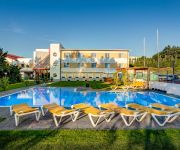
Sporthotel Kurz
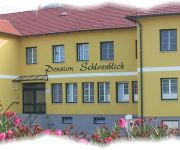
"Schlossblick" Fam.Toth-Golubits Pension
Bauernhof Ferienwohnungen Schiefer-Schrödl
Jufa Hotel Neutal
Appartement Böhm
Appartements Pazmann
Videos from this area
These are videos related to the place based on their proximity to this place.
Franz Liszt. Das begehbare Klavier. Raiding. Burgenland. Video by Russian Austria
http://www.russianaustria.com Franz Liszt. Das begehbare Klavier. Raiding. Burgenland. Ходящее фортепиано. Pусская Австрия - новости, форум, работа,...
Mittagsgeläut der katholischen Kirche in Stoob
Hier wird die Glocke 3 (cis'') der katholischen Kirche in Stoob um 12 Uhr geläutet. Weiteres ist von dieser Kirche nicht bekannt. Auf jedenfall sind es so weit ich weiß historische Glocken.
Stoob, evangelische Kirche: Abendläuten
19 Uhr läuten der evangelischen Kirche in Stoob. Die Glocke erklingt im Ton f' und hat einen Durchmesser von ca. 1m. Gewicht und Gießer sind nicht bekannt. Man hört deswegen manchmal laute...
Freibad Oberpullendorf
Das Freibad verfügt über ein Sportbecken mit einer Bahnlänge von 33,3m. Zusätzlich gibt es einen Nichtschwimmerbereich, eine Wasserrutsche, Gastronomie.
Geländefahrtraining der Stadtfeuerwehr Oberpullendorf
Am 9. August fand unser erstes Geländefahrtraining statt. Wir waren mit unserem SRF-A, TLF-A 4000, KDOF-A, SOF-A und RLF-A ausgerückt um das Fahren in unwegsameren Gelände zu trainieren....
Kapplsitzung 2012 Oberpullendorf
Eine nicht mehr wegzudenkende Sitzung in Oberpullendorf ist die in der Faschingszeit stattfindende Kapplsitzung. Copyright © 2014 | echtzeit-tv | Redaktion Burgenland | Helmut Schöllenbauer.
Mittagsgeläut der Pfarrkirche Oberpullendorf
1) Stundenschlag mit den Glocken 3 (a') und 1 (e') 2) Mittagsangelus mit Glocke 2 (g') Die Daten der Glocken sind nicht bekannt. Man merkt zwar, dass Glocke 2 älter ist, als die anderen, aber...
Bendl Walter Spenglerei-Dacheindeckung in Oberpullendorf, Burgenland
Zu Bendl Walter Spenglerei-Dacheindeckung aus Oberpullendorf finden Sie ein ausführliches Porträt unter http://firmenabc.at/bendl-walter-spenglereidacheindeckung_BKhn Seit wann gibt es...
Videos provided by Youtube are under the copyright of their owners.
Attractions and noteworthy things
Distances are based on the centre of the city/town and sightseeing location. This list contains brief abstracts about monuments, holiday activities, national parcs, museums, organisations and more from the area as well as interesting facts about the region itself. Where available, you'll find the corresponding homepage. Otherwise the related wikipedia article.
Burgenland
Burgenland is the easternmost and least populous state (or Land) of Austria. It consists of two Statutarstädte (chartered towns) and seven districts, with in total 171 municipalities. It is 166 km long from north to south but much narrower from west to east (5 km wide at Sieggraben). The region is part of the Centrope Project.
Oberpullendorf District
Bezirk Oberpullendorf (Croatian: Kotar Gornja Pulja) is a district of the state of Burgenland in Austria.
Balf
Balf is the name of a prominent family of the region Babol, and originate from the House of Suren. They are major land owners in the North of Iran and have a large interest in construction services across the Middle East and the Far East. See construction companies in Asia. Balf is a town in Hungary, a district of Sopron. The well-known Jewish scholar and writer Antal Szerb was deported to a concentration camp near Balf and beaten to death there in January 1945.
Sacred Heart Church (Kőszeg, Hungary)
The Church of Jesus’ Heart (Hungarian: Jézus Szíve templom) is a parish church in the historical centre of Kőszeg, Western Hungary. The building is considered to be a fine example of Gothic Revival architecture. The church was designed by Viennese architect Ludwig Schöne and was built between 1892 and 1894 in place of the old Korona Hotel on the main square. It is a hall church with three naves, a transept and a polygonal sacrarium. It has a 57 metres high tower and two pinnacles.
Alpokalja
Alpokalja (English "feet of the Alps") is a geographic region in Western Hungary. Its highest point in Hungary is Írott-kő, with 882 metres. Although there are several lower mountains, the majority of the territory is hilly. Fir forests are characteristic to the region. Alpokalja contains two major, but not very extensive mountain range: the Kőszeg Mountains and the Sopron Mountains. The Vas Hills and Balfi Hills are also considered part of the territory.
Kőszeg Mountains
Kőszeg Mountains is a mountain range in the Alpokalja area, the easternmost region of the Alps. The territory of the range is shared between Austria and Hungary. Its highest point is the Írott-kő (literally written stone) with a height of 883 metres.
Sopron Mountains
The Sopron Mountains is a mountain range, the eastward extension of the Eastern Alps. It is part of the Alpokalja area of Hungary and also of the Burgenland. It is located close to the city of Sopron (Western Hungary). Its highest point is the Brentenriegel with 606 metres.
Harka
Harka is a village in Győr-Moson-Sopron county, Hungary.
Írott-kő
Írott-kő or Geschriebenstein is the highest mountain of the Kőszeg Mountains range, located on the border between Austria and Hungary. Its height is 884 m according to Austrian sources, whereas Hungarian references mostly mention 883 m. It is the highest mountain of Western Hungary and of Burgenland. Its former names were Fenyőhegy and Szálkő.
Horvátzsidány
Horvátzsidány is a small village in Vas county, Hungary. Writer Jakab Szabár was born here.
Kiszsidány
Kiszsidány is a village in Vas county, Hungary.
Kőszegdoroszló
Kőszegdoroszló is a village in Vas county, Hungary. The village has a thriving tourist trade.
Kőszegpaty
Kőszegpaty is a village in Vas county, Hungary.
Lukácsháza
Lukácsháza is a village in Vas county, Hungary.
Nemescsó
Nemescsó is a village in Vas county, Hungary.
Ólmod
Ólmod is a village in Vas county, Hungary.
Pusztacsó
Pusztacsó is a village in Vas county, Hungary.
Tömörd
Tömörd is a village in Vas county, Hungary.
Burg Lockenhaus
Burg Lockenhaus is a castle and medieval fortress located in the Güns Valley in the southeastern part of Lockenhaus, in Burgenland, eastern Austria. The castle was built in Romanesque and Gothic architectural styles around 1200, and was initially called "Leuca" or Léka. It is part of the Naturpark Geschriebenstein.
Siege of Güns
The Siege of Güns or Siege of Kőszeg was a siege of Kőszeg in the Kingdom of Hungary within Habsburg Monarchy, that took place in 1532. In the siege, the defending forces of the Austrian Habsburg Monarchy under the leadership of Croatian Captain Nikola Jurišić, defended the small border fort of Kőszeg with only 700-800 Croatian soldiers, with no cannons and few guns.
Church of St. Nikolaus, Lockenhaus
The Church of Saints Nicholas (German: Pfarrkirche zum Heiligen Nikolaus, St. Nikolaus) is an early Baroque parish church located in the Güns Valley in Lockenhaus, in the Austrian state of Burgenland. It was built during the period of 1655 to 1669. Commissioned by Franz III. Nádasdy, the church was entrusted to the Augustinians and was dedicated to both St. Nicholas of Myra and St. Nicholas of Tonentino, in reference to the role of Fr.
Burgruine Landsee
Burgruine Landsee is a castle ruin located in the Austrian state of Burgenland.


