Safety Score: 2,7 of 5.0 based on data from 9 authorites. Meaning we advice caution when travelling to United States.
Travel warnings are updated daily. Source: Travel Warning United States. Last Update: 2024-04-30 08:30:35
Delve into Nahant
Nahant in Essex County (Massachusetts) with it's 3,410 habitants is located in United States about 403 mi (or 648 km) north-east of Washington DC, the country's capital town.
Current time in Nahant is now 11:31 PM (Tuesday). The local timezone is named America / New York with an UTC offset of -4 hours. We know of 9 airports close to Nahant, of which 3 are larger airports. The closest airport in United States is General Edward Lawrence Logan International Airport in a distance of 6 mi (or 10 km), South-West. Besides the airports, there are other travel options available (check left side).
Also, if you like playing golf, there are some options within driving distance. We encountered 5 points of interest near this location. If you need a hotel, we compiled a list of available hotels close to the map centre further down the page.
While being here, you might want to pay a visit to some of the following locations: Boston, Dedham, Taunton, Brentwood and Dover. To further explore this place, just scroll down and browse the available info.
Local weather forecast
Todays Local Weather Conditions & Forecast: 8°C / 46 °F
| Morning Temperature | 7°C / 44 °F |
| Evening Temperature | 9°C / 48 °F |
| Night Temperature | 8°C / 47 °F |
| Chance of rainfall | 0% |
| Air Humidity | 80% |
| Air Pressure | 1016 hPa |
| Wind Speed | Gentle Breeze with 6 km/h (4 mph) from West |
| Cloud Conditions | Overcast clouds, covering 100% of sky |
| General Conditions | Light rain |
Wednesday, 1st of May 2024
13°C (55 °F)
9°C (49 °F)
Light rain, gentle breeze, overcast clouds.
Thursday, 2nd of May 2024
11°C (51 °F)
8°C (47 °F)
Overcast clouds, gentle breeze.
Friday, 3rd of May 2024
9°C (48 °F)
8°C (46 °F)
Overcast clouds, light breeze.
Hotels and Places to Stay
The Winthrop Arms Hotel
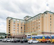
Comfort Inn & Suites Logan International Airport
The Marblehead Inn
Château sur Mer Bed & Breakfast
HARBOR LIGHT INN - MARBLEHEAD
WINTHROP BEACH INN AND SUITES BOSTON LOG
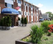
Rodeway Inn Logan International Airport
Videos from this area
These are videos related to the place based on their proximity to this place.
El Momo Depue de la 12 - Lynn Massachusetts
Cantando en vivo en Lynn Massachusetts en el dia de la Independencia Dominicana.
Seas Hitting the Seawall in Lynn Massachusetts
It was definitely high tide on March 13th 2013 in Lynn Massachusetts.
A Touch of Health Chiropractic Wellness Center - Short | Swampscott, MA
http://doctoramar.com/ - Call us today at (781) 592-7600. At A Touch of Health Chiropractic Wellness Center, we specialize in chiropractic, personal injury care, and physical medicine. In addition...
Stormy Weather - Lynn/Swampscott - 12/9/2009
The waves on Lynn Shore Drive near the Lynn/Swampscott border after the storm. The wave at 0:14 got me a bit!
217 Humphrey Street Swampscott MA
http://www.exite-listings.com/111234 A magical moment is yours as you enter this spectacular waterfront residence Enjoy breathtaking unobstructed views of Swampscott Harbor, Nahant Bay,...
2005 Chrysler Town & Country Used Cars Lynn MA
http://www.lynnwayauto.net This 2005 Chrysler Town & Country is available from Lynnway Auto Sales Inc. For details, call us at 781-581-5160.
Hoompa Nickle Road Race Nahant Massachusetts
http://viewtherace.com http://www.facebook.com/ViewTheRace The Hoompa Nickle Road Race is a 5 mile road race held in Nahant, Massachusetts. The race starts and finishes near the Nahant Life...
Videos provided by Youtube are under the copyright of their owners.
Attractions and noteworthy things
Distances are based on the centre of the city/town and sightseeing location. This list contains brief abstracts about monuments, holiday activities, national parcs, museums, organisations and more from the area as well as interesting facts about the region itself. Where available, you'll find the corresponding homepage. Otherwise the related wikipedia article.
Bass Rock (Lynn, Essex County, Massachusetts)
Bass Rock is a small barren rock within Nahant Harbor, in Nahant, Massachusetts, USA. The island is southwest of the Cliff Street/Willow Road curve and west of Josephs Beach.
St. Mary's High School (Lynn, Massachusetts)
St. Mary's High School is a private, Roman Catholic high school in Lynn, Massachusetts. It is located in the Roman Catholic Archdiocese of Boston.
Lynn (MBTA station)
Lynn (signed as Central Square - Lynn) is a passenger rail station on the MBTA Commuter Rail Newburyport/Rockport Line located in downtown Lynn, Massachusetts, located 11.5 route miles from North Station. The station consists of a single center island platform serving the two station tracks on an elevated grade that runs through the downtown area of Lynn. A large parking garage is integrated into the station structure.
Old Lynn High School
Old Lynn High School is a historic school at 50 High Street in Lynn, Massachusetts.
Marian Court College
Marian Court College is a two-year college in Swampscott in the North Shore region of Massachusetts. Marian Court College is a Roman Catholic institution founded in 1964 and sponsored by the Sisters of Mercy. Its campus, based on an oceanfront estate, includes Calvin Coolidge's summer white house, now a classroom building. The College offers both day and evening degree programs leading to the Associate in Science degree, as well as offering several certificate programs.
Egg Rock (Nahant Bay)
Egg Rock (sometimes called Elephant Rock) in Nahant Bay near Nahant, Massachusetts is a small (3-acre) island at {{#invoke:Coordinates|coord}}{{#coordinates:42.4333|N|70.8978|W|region:US-MA_type:isle|||| |primary |name= }}. It was formerly the site of a lighthouse known as Egg Rock Light but now is owned by the state of Massachusetts as a bird sanctuary. Egg Rock can be seen clearly from the coasts of Nahant, Swampscott, and Lynn.
Fort Ruckman
Fort Ruckman was a U.S. Coast Artillery fort located in Nahant, Massachusetts. Originally called the Nahant Military Reservation, the fort was laid out in 1904-1907 and covered an area of about 45 acres just northwest of Bass Point, on the southwest side of the Nahant peninsula. During the 1920s, this area was renamed in honor of Maj. Gen. John Wilson Ruckman, a former Colonel in the Coast Artillery.
Broad Sound (Massachusetts)
Broad Sound is a bay on the Massachusetts coast north of Boston. It lies on the west of Massachusetts Bay, between Nahant and Deer Island; Lynn harbor is at its north end. The main channel of Boston Harbor empties into the sound.


