Safety Score: 2,7 of 5.0 based on data from 9 authorites. Meaning we advice caution when travelling to United States.
Travel warnings are updated daily. Source: Travel Warning United States. Last Update: 2024-05-07 07:59:51
Delve into Coury Heights
Coury Heights in Bristol County (Massachusetts) is located in United States about 376 mi (or 604 km) north-east of Washington DC, the country's capital town.
Current time in Coury Heights is now 04:04 PM (Tuesday). The local timezone is named America / New York with an UTC offset of -4 hours. We know of 11 airports close to Coury Heights, of which 4 are larger airports. The closest airport in United States is New Bedford Regional Airport in a distance of 2 mi (or 3 km), South-West. Besides the airports, there are other travel options available (check left side).
Also, if you like playing golf, there are some options within driving distance. We encountered 2 points of interest near this location. If you need a hotel, we compiled a list of available hotels close to the map centre further down the page.
While being here, you might want to pay a visit to some of the following locations: Taunton, Providence, Edgartown, Cranston and North Providence. To further explore this place, just scroll down and browse the available info.
Local weather forecast
Todays Local Weather Conditions & Forecast: 21°C / 69 °F
| Morning Temperature | 13°C / 55 °F |
| Evening Temperature | 17°C / 62 °F |
| Night Temperature | 11°C / 52 °F |
| Chance of rainfall | 0% |
| Air Humidity | 41% |
| Air Pressure | 1008 hPa |
| Wind Speed | Gentle Breeze with 8 km/h (5 mph) from North |
| Cloud Conditions | Clear sky, covering 1% of sky |
| General Conditions | Sky is clear |
Tuesday, 7th of May 2024
14°C (57 °F)
13°C (55 °F)
Light rain, moderate breeze, overcast clouds.
Wednesday, 8th of May 2024
18°C (64 °F)
10°C (50 °F)
Heavy intensity rain, moderate breeze, overcast clouds.
Thursday, 9th of May 2024
10°C (50 °F)
9°C (49 °F)
Light rain, moderate breeze, overcast clouds.
Hotels and Places to Stay
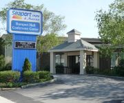
SEAPORT INN AND MARINA
Fairfield Inn & Suites New Bedford
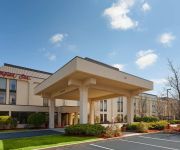
Hampton Inn New Bedford-Fairhaven
Residence Inn New Bedford Dartmouth
Regency Inn & Suites
Videos from this area
These are videos related to the place based on their proximity to this place.
Acushnet Centennial Parade 1960 Vintage - Restored Classic Color Film
The year was 1960 and Acushnet, MA celebrated it's 100th Anniversary with multiple events and a parade on July 4th of that year.It appears that the film was taken from the Parting Ways Building...
Acushnet Creamery Demolition
If you're new, Subscribe! http://bit.ly/1qfux9S Watch Acushnet Creamery get demolished in this video captured on the scene! © 2015 Townsquare Media Go here: http://fun107.com Like us: https://ww...
ACUSHNET APPLE/PEACH PARADE 2013
The 34th Annual Acushnet Apple/Peach Parade led by the newly crowned Miss Apple Peach, Bethany Fernandes, and the Junior Miss Apple Peach winner Amy Pringle cruise by The Long Plain ...
The Annual Apple-Peach Parade in Acushnet 2014
The Annual Apple-Peach Parade in Acushnet 2014. The parade is a favorite highlight of Acushnet's annual Apple-Peach Festival. A video presentation of The Fairhaven-Acushnet Advocate. Video...
2015 - New Bedford State of the City Address.
Mayor Jon Mitchell. March 26, 2015 at Greater New Bedford Regional Voc-Tech High School.
New Bedford 2014 State of the City Address
Mayor Jon Mitchell delivers his 3rd State of the City Address at an annual luncheon hosted by the New Bedford Area Chamber of Commerce and sponsored by Webster Bank. Recorded on Thursday ...
Jury Selection in Robert Roy Trial
Local man from Acushnet accused of murdering his wife more than 20 years ago. Only three jurors were seated. Trial expected to last three weeks.
Rat Terror in New Bedford's Brooklawn Park
Lots of rats in Brooklawn Park New Bedford Massachusetts.
Gary's Best in New Bedford, MA
http://HotDogStories.com July 22 brought me back to the one stop from last year's tour where I had not one, but two hot dogs: Gary's Best in New Bedford. The house linguica sauce was the reason,...
1997 Ford F-450 SD Used Cars New Bedford MA
http://www.usedcarsnewbedford.com This 1997 Ford F-450 SD is available from Ralph's Auto Center. For details, call us at 866-696-0174.
Videos provided by Youtube are under the copyright of their owners.
Attractions and noteworthy things
Distances are based on the centre of the city/town and sightseeing location. This list contains brief abstracts about monuments, holiday activities, national parcs, museums, organisations and more from the area as well as interesting facts about the region itself. Where available, you'll find the corresponding homepage. Otherwise the related wikipedia article.
Acushnet Center, Massachusetts
Acushnet Center is a census-designated place (CDP) in the town of Acushnet in Bristol County, Massachusetts, United States. The population was 3,073 at the 2010 census.
New Bedford Regional Airport
New Bedford Regional Airport is a public airport located two miles (3 km) northwest of the central business district of New Bedford, a city in Bristol County, Massachusetts, United States. This airport is owned by the City of New Bedford. The airport lies within Class D airspace and has an operating FAA control tower (open during daytime hours). The Acushnet Cedar Swamp borders the airport to the north.
Acushnet River
The Acushnet River is the largest river, 8.6 miles long, flowing into Buzzards Bay in southeastern Massachusetts, in the United States. The name "Acushnet" comes from the Wampanoag or Algonquian word, "Cushnea", meaning "as far as the waters", a word that was used by the original owners of the land in describing the extent of the parcel they intended to sell to the English settlers from the nearby Plimouth colony.
Sherwood Forest, Massachusetts
Sherwood Forest is an area within the town of Becket, Massachusetts, established in 1982 with the approval of the Massachusetts State Senate and signed into existence by Governor of Massachusetts Edward J. King. Through agreement between the town and Sherwood Forest Enterprises, the real estate development company that created the area, the town of Becket is not responsible for things such as asphalt road maintenance and snow removal.
Greater New Bedford Regional Vocational-Technical High School
Greater New Bedford Regional Vocational-Technical High School (commonly referred to as GNB Voc-Tech or simply Voc-Tech) is a vocational high school located in New Bedford, Massachusetts for students in grades 9-12. The school draws its student body from the towns and cities of New Bedford, Dartmouth, and Fairhaven. It is considered its own school district, thus having an on-site superintendent as well as an academics principal and a vocational-technical principal.
Our Lady of Perpetual Help Parish (New Bedford, Massachusetts)
Our Lady of Perpetual Help Parish is a Roman Catholic parish designated for Polish immigrants in New Bedford, Massachusetts, United States. Founded in 1905, Our Lady of Perptual Help is one of the Polish-American Roman Catholic parishes in New England in the Diocese of Fall River. Since the 1930s, the parish has been staffed by the Conventual Franciscans.
St. Anthony of Padua Church (New Bedford, Massachusetts)
St. Anthony of Padua is a Roman Catholic church in New Bedford, Massachusetts, part of the Diocese of Fall River.
King's Highway (MBTA station)
King's Highway is a future railroad station on the MBTA Commuter Rail's Providence/Stoughton Line located in New Bedford, Massachusetts. It is being built as part of the state's effort to extend rail service to Fall River and New Bedford.


