Safety Score: 2,7 of 5.0 based on data from 9 authorites. Meaning we advice caution when travelling to United States.
Travel warnings are updated daily. Source: Travel Warning United States. Last Update: 2024-05-18 08:26:29
Delve into Leeco
Leeco in Wolfe County (Kentucky) is a city located in United States about 370 mi (or 596 km) west of Washington DC, the country's capital town.
Current time in Leeco is now 10:08 AM (Saturday). The local timezone is named America / New York with an UTC offset of -4 hours. We know of 8 airports closer to Leeco, of which 7 are larger airports. The closest airport in United States is Blue Grass Airport in a distance of 55 mi (or 88 km), North-West. Besides the airports, there are other travel options available (check left side).
Also, if you like playing golf, there are some options within driving distance. We saw 1 points of interest near this location. In need of a room? We compiled a list of available hotels close to the map centre further down the page.
Since you are here already, you might want to pay a visit to some of the following locations: Beattyville, Campton, Stanton, Booneville and Frenchburg. To further explore this place, just scroll down and browse the available info.
Local weather forecast
Todays Local Weather Conditions & Forecast: 24°C / 76 °F
| Morning Temperature | 14°C / 57 °F |
| Evening Temperature | 23°C / 74 °F |
| Night Temperature | 18°C / 64 °F |
| Chance of rainfall | 0% |
| Air Humidity | 60% |
| Air Pressure | 1012 hPa |
| Wind Speed | Light breeze with 5 km/h (3 mph) from South |
| Cloud Conditions | Overcast clouds, covering 92% of sky |
| General Conditions | Overcast clouds |
Saturday, 18th of May 2024
26°C (79 °F)
18°C (65 °F)
Light rain, gentle breeze, clear sky.
Sunday, 19th of May 2024
29°C (84 °F)
19°C (66 °F)
Sky is clear, light breeze, clear sky.
Monday, 20th of May 2024
30°C (85 °F)
21°C (70 °F)
Sky is clear, gentle breeze, clear sky.
Hotels and Places to Stay
Cliffview Resort
Black Bear Lodge Motel
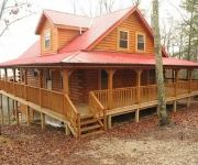
Red River Gorge Cabin Rentals
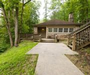
Natural Bridge State Resort Park
Videos from this area
These are videos related to the place based on their proximity to this place.
Natural Bridge State Resort Park Documentary
This is a documentary about vandalism, graffiti, and access issues at Natural Bridge State Resort Park, near Slade, Kentucky. Since its production, the cave featured in the video has been...
Natural Bridge State Resort Park at NewporterJazz
Ride with us as we travel 11 minutes and 600 feet on a sky lift to Natural Bridge.
Kentucky Rock Crawling
This video was taken near the Red River Gorge, outside Slade, KY at the 2010 Spring/Summer run for the local fireman. A subscriber told me it was, "Damnation Alley" along the Falls Area of...
Riding the Sky Lift at Natural Bridge Park in Kentucky
Take a ride down from the mountaintop on the Sky Lift of Natural Bridge State Park where we spent our vacation. See also the digital flip-book of photos and reflections from Natural Bridge...
Destruction of the Narrows Road
"If it was up to me, people wouldn't be allowed in Natural Bridge State Park." These words were spoken several years ago by a young naturalist on duty at the Park. The Park visitor to whom...
Hiking at Natural Bridge State Resort Park in Kentucky
Discover the scenic side of life at http://Ydstoti.com. Hiking at Natural Bridge State Resort Park in Kentucky.
Videos provided by Youtube are under the copyright of their owners.


