Safety Score: 2,7 of 5.0 based on data from 9 authorites. Meaning we advice caution when travelling to United States.
Travel warnings are updated daily. Source: Travel Warning United States. Last Update: 2024-05-18 08:26:29
Delve into Prairie View (subdivision)
The district Prairie View (subdivision) of Fishers in Hamilton County (Indiana) is a subburb in United States about 487 mi west of Washington DC, the country's capital town.
If you need a hotel, we compiled a list of available hotels close to the map centre further down the page.
While being here, you might want to pay a visit to some of the following locations: Noblesville, Indianapolis, Tipton, Greenfield and Anderson. To further explore this place, just scroll down and browse the available info.
Local weather forecast
Todays Local Weather Conditions & Forecast: 27°C / 81 °F
| Morning Temperature | 18°C / 65 °F |
| Evening Temperature | 24°C / 74 °F |
| Night Temperature | 22°C / 72 °F |
| Chance of rainfall | 0% |
| Air Humidity | 50% |
| Air Pressure | 1015 hPa |
| Wind Speed | Light breeze with 4 km/h (3 mph) from South-East |
| Cloud Conditions | Clear sky, covering 0% of sky |
| General Conditions | Light rain |
Monday, 20th of May 2024
28°C (82 °F)
22°C (71 °F)
Broken clouds, gentle breeze.
Tuesday, 21st of May 2024
28°C (82 °F)
24°C (75 °F)
Light rain, moderate breeze, overcast clouds.
Wednesday, 22nd of May 2024
22°C (72 °F)
17°C (62 °F)
Moderate rain, fresh breeze, overcast clouds.
Hotels and Places to Stay
Hilton Garden Inn Indianapolis Northeast-Fishers
Fairfield Inn & Suites Indianapolis Fishers
Staybridge Suites INDIANAPOLIS-FISHERS
SpringHill Suites Indianapolis Fishers
Courtyard Indianapolis Castleton
Residence Inn Indianapolis Fishers
Candlewood Suites INDIANAPOLIS
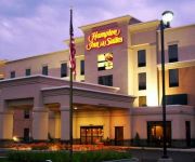
Hampton Inn - Suites Indianapolis-Fishers
Hampton Inn Indianapolis-NE-Castleton
Holiday Inn Express FISHERS
Videos from this area
These are videos related to the place based on their proximity to this place.
Locomotive cab ride in ITMZ 200, Fishers, Indiana
A 30-minute cab ride in ITMZ 200 from Fishers to Noblesville, Indiana, and includes some streetrunning.
2015 Honda CR-V @ Honda of Fishers
The most efficient CR-V yet A new engine and new technology make CR-V one of the highest fuel efficiency[2] SUVs on the market. Collision Mitigation Braking System™ CMBS™ can help bring...
State Fair Train in Fishers Indiana
This is the Fair Train leaving Fishers heading toward the Indiana State Fair on August 13th 2011 at approximately 1930hrs. This was shot for my 9 year old (almost 10) buddy Jack who loves...
11662 Stonebrook Place Fishers, IN 46038
Walk to Starbucks, grocery, restaurants, shops, Fishers Farmers Market, free summer concerts and River Glen Country Club. Well maintained home with lots of updates and plenty of storage in...
Honda Fishers A Building Of A New Foundation
While this state-of-the-art New Honda Dealership is the newest in the greater Indianapolis area, it is an evolution of the 1st exclusive Honda Automobile Dealership in Indiana, Honda West that...
Preowned 2000 GMC Sonoma Fishers IN
We are proud to present this 2000 GMC Sonoma. Please visit our website at http://www.fritzinfishers.com/ and if you have any questions you can always call us at (888) 736-6629. We've been...
Behind the Scenes at Conner Prairie
Follow interpreter Chris to go behind the scenes at Conner Prairie! See how she begins her day as an interpreter & how she interacts visitors of all ages to help them learn about history &...
Conner Prairie Interactive History Park - March 2012
Conner Prairie Interactive History Park getting a Makeover -
It's a Glorious Fourth for The Face
Danielle visits Conner Prairie for their Glorious Fourth of July event to see just how this important holiday was spent in the 19th century. And have a little fun along the way!
Videos provided by Youtube are under the copyright of their owners.
Attractions and noteworthy things
Distances are based on the centre of the city/town and sightseeing location. This list contains brief abstracts about monuments, holiday activities, national parcs, museums, organisations and more from the area as well as interesting facts about the region itself. Where available, you'll find the corresponding homepage. Otherwise the related wikipedia article.
Hamilton County, Indiana
Hamilton County is a county located in the U.S. state of Indiana. Census 2010 recorded a population of 274,569. The county seat is Noblesville. Hamilton County’s roots are in agriculture. However after World War II, Indianapolis grew north and the county developed as a suburb. Many farm fields have been replaced by both residential and commercial development. Today, the county is one of the fastest-growing counties in the United States. According to 2007 estimates by the U.S.
Noblesville, Indiana
Noblesville is a city in and the county seat of Hamilton County, Indiana, United States, located just north of Indianapolis. The population was 51,969 at the 2010 census making it the 14th largest city/town in the state, up from 19th in 2007. The city is part of Delaware, Fall Creek, Noblesville, and Wayne townships. Noblesville is also home to the Klipsch Music Center, an outdoor music venue, and the Indiana Transportation Museum.
Westfield, Indiana
Westfield is a city in Hamilton County, Indiana, United States. In the year 2010 United States Census, the population was 30,068. Westfield is in the Indianapolis Metropolitan Area.
Lawrence North High School
Lawrence North High School is a public high school in Indianapolis, Indiana. It is located at 7802 North Hague Road on the northeast side of the city. It is one of two high schools serving grades nine through twelve in the Metropolitan School District of Lawrence Township. The 2006–07 enrollment was 2,853.
2002 Midwest to Mid-Atlantic United States tornado outbreak
The 2002 Midwest to Mid-Atlantic United States tornado outbreak of April 27, 2002 and April 28, 2002 was a widespread outbreak that moved from west to east over a Saturday and Sunday. Iowa, Kansas, Missouri and Nebraska were affected on the 27th; tornadoes were reported in Illinois, Indiana, Kentucky, Maryland, New York, Ohio, Pennsylvania, Tennessee, Virginia and West Virginia on the 28th.
Carmel High School (Carmel, Indiana)
Carmel High School is a public high school in Carmel, Indiana, whose name is commonly abbreviated to CHS. The dean of CHS is Dr. Newton. The high school is part of the Carmel Clay School District and has an enrollment of around 4,800 students, making it the largest high school in the state of Indiana by number of students.
Fishers Junior High School
Fishers Junior High School is located at 13257 Cumberland Road in Fishers, Indiana, United States. It is one of three public junior high schools serving grades seven through eight in the Fishers area of Hamilton County, Indiana. The building was originally built in the late 1970s known as Hamilton Southeastern Middle School as a 6-8 school but when the opening of Fall Creek Intermediate School occurred the school became 7-8 in 1999.
Heritage Christian School (Indianapolis)
Heritage Christian School is a private, non-denominational, Christian evangelical school with approximately 1,450 students in grades Prep K - 12. It is part of the Association of Christian Schools International (ACSI). Heritage is located at the southern terminus of Interstate 69 on the northeast side of Indianapolis at 75th Street and Binford Boulevard.
Castleton Square
Castleton Square Mall is the largest and busiest mall in the state of Indiana. Built by Edward J. DeBartolo, Sr. , in 1972, it is located in northeastern Indianapolis and owned by Simon Property Group. The largest stores are Dick's Sporting Goods, JCPenney, Macy's, Von Maur and Sears. A large area in front of Dick's contains a large children's play area and a food court which are popular meeting places within the mall.
Keystone at the Crossing
Keystone at the Crossing is an upscale business and shopping district located in northern Indianapolis at the intersection of East 86th Street and North Keystone Avenue (formerly known as State Road 431). The Fashion Mall is considered the heart of the district.
Town Run Trail Park
Town Run Trail Park is a 127-acre natural resource park in Indianapolis, Indiana. The facility is owned by Indy Parks and Recreation and was made possible through donations from Martin Marietta Aggregates, Mr. Oliver Dougherty, and R.N. Thompson Associates Inc. It is located near the White River on East 96th Street between Keystone Avenue and Allisonville Road. The main attraction at the park is a singletrack mountain bike course.
Westfield High School (Westfield, Indiana)
Westfield High School is a public high school located in Westfield, Indiana, north of Indianapolis. Westfield High School is part of the Westfield Washington School District, and is commonly abbreviated as "WHS". Enrollment is about 1,900 students, although the school has grown significantly in the past decade.
Fishers High School
Fishers High School (FHS) is the second high school in Hamilton Southeastern Schools in Fishers, Indiana. The student count for the 2011-2012 year is 2,206. Fishers High School has been approved by the International Baccalaureate Organization as an IB World School, and began offering the International Baccalaureate Diploma Programme in the fall of 2007. The Fishers High School mascot is a tiger. The Tigers' athletic teams participate in the Hoosier Crossroads Conference.
Geist, Indianapolis
Geist is an area in northeastern Indianapolis, Indiana and southeastern Hamilton County. It is named for Geist Reservoir.
Castleton, Indianapolis
Castleton is a heavily commercialized neighborhood surrounding the original southern terminus of Interstate 69 on the northeast side of Indianapolis, Indiana. It is located in Lawrence and Washington townships of Marion County. Castleton Square Mall, the largest mall in Indiana, is located here.
Indiana Transportation Museum
The Indiana Transportation Museum is a railroad museum located in the Forest Park neighborhood of Noblesville, Indiana. It owns a variety of preserved railroad equipment, some of which still operate today.
The Fashion Mall at Keystone
The Fashion Mall at Keystone, known better as The Fashion Mall, is an upscale shopping center in the northeast section of the city of Indianapolis, Indiana. The mall is located off I-465 at 86th Street and Keystone. The mall is considered the heart of the Keystone at the Crossing district. Developed, managed, and owned by Indianapolis-based Simon Property Group, the center is currently anchored by Nordstrom and Saks Fifth Avenue.
WHJE
WHJE is a radio station broadcasting an Alternative format. Licensed to Carmel, Indiana, USA. The station is currently owned by Carmel/Clay School Corporation. The transmitter is located atop Carmel High School, in Carmel, Indiana. WHJE is a non for profit high school station. All D.J. 's are high school students ranging from sophomores to seniors.
St. Theodore Guerin High School
St. Theodore Guerin High School is a private Roman Catholic high school in Noblesville, Indiana. It is part of the Roman Catholic Diocese of Lafayette in Indiana. It is named after Saint Mother Théodore Guérin.
Heady Lane Cemetery
Heady Lane Cemetery is located in Fishers, Indiana. The cemetery dates back to the early 19th century and has headstones for many members of the Heady family in it. According to a legend surrounding Heady Lane Cemetery there are spirits along the Hollow at 126th Street in Fishers at Allisonville Road.
Indianapolis Metropolitan Airport
Indianapolis Metropolitan Airport is a public airport located 2 miles southwest of Fishers, a town in Hamilton County, Indiana, United States. Also located eight miles (13 km) northeast of the central business district of Indianapolis, it is owned by the Indianapolis Airport Authority and serves as a reliever airport for Indianapolis International Airport. Although most U.S.
8888 Keystone Crossing
8888 Keystone Crossing is a high rise in Indianapolis, Indiana. It was completed in 1988 and has 18 floors. It is primarily used for office space and is the tallest building in Indiana outside of a major downtown.
Indiana
Indiana is a U.S. state located in the midwestern and Great Lakes regions of North America. Indiana is the 38th largest by area and the 16th most populous of the 50 United States. Indiana is the least extensive state in the contiguous United States west of the Appalachian Mountains. Its capital and largest city is Indianapolis. Indiana was admitted to the United States as the 19th U.S. state on December 11, 1816.
Community Hospital North
Community Hospital North is a hospital located in the Castleton neighborhood of Indianapolis, Indiana, USA. It is part of the Community Health Network group of hospitals in Indiana.
Orchard Park Elementary
Orchard Park Elementary is an elementary school that is located at the south side of Carmel, Indiana in Hamilton County. It is one of the eleven elementary schools in the Carmel Clay Schools district. In 2007, a new preschool division on the north side of the school was completed which featured more space for incoming toddlers.


