Safety Score: 2,7 of 5.0 based on data from 9 authorites. Meaning we advice caution when travelling to United States.
Travel warnings are updated daily. Source: Travel Warning United States. Last Update: 2024-04-28 08:22:10
Discover Sierra Heights
Sierra Heights in San Bernardino County (California) is a city in United States about 2,248 mi (or 3,618 km) west of Washington DC, the country's capital city.
Local time in Sierra Heights is now 02:39 AM (Sunday). The local timezone is named America / Los Angeles with an UTC offset of -7 hours. We know of 8 airports in the vicinity of Sierra Heights, of which 3 are larger airports. The closest airport in United States is Ontario International Airport in a distance of 12 mi (or 19 km), South-West. Besides the airports, there are other travel options available (check left side).
Also, if you like golfing, there are a few options in driving distance. We discovered 2 points of interest in the vicinity of this place. Looking for a place to stay? we compiled a list of available hotels close to the map centre further down the page.
When in this area, you might want to pay a visit to some of the following locations: San Bernardino, Riverside, Orange, Santa Ana and Los Angeles. To further explore this place, just scroll down and browse the available info.
Local weather forecast
Todays Local Weather Conditions & Forecast: 23°C / 73 °F
| Morning Temperature | 14°C / 57 °F |
| Evening Temperature | 24°C / 74 °F |
| Night Temperature | 18°C / 64 °F |
| Chance of rainfall | 0% |
| Air Humidity | 30% |
| Air Pressure | 1014 hPa |
| Wind Speed | Gentle Breeze with 7 km/h (4 mph) from North-East |
| Cloud Conditions | Clear sky, covering 0% of sky |
| General Conditions | Sky is clear |
Sunday, 28th of April 2024
24°C (75 °F)
19°C (66 °F)
Sky is clear, gentle breeze, clear sky.
Monday, 29th of April 2024
24°C (74 °F)
18°C (64 °F)
Sky is clear, gentle breeze, clear sky.
Tuesday, 30th of April 2024
22°C (72 °F)
18°C (64 °F)
Sky is clear, gentle breeze, clear sky.
Hotels and Places to Stay
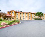
Comfort Inn Fontana
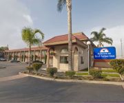
AMERICAS BEST VALUE INN
Videos from this area
These are videos related to the place based on their proximity to this place.
Cajon Pass - Devore & Morman Rocks
Devore is one of the first major grades leading up to Cajon Pass. I'd set up here for 20 minutes and got 3 trains come through, including this large Union Pacific manifest train. Later...
BNSF: 5 BNSF locos lead a double stack up Cajon Pass at Keenbrook
A penta-header BNSF double-stack leads a fleet of JB Hunt semi-trailers up Cajon Pass at Keenbrook overlook, San Bernardino Mtns. with I-15 freeway to Las Vegas in the background, near Devore...
Sea Dogs, RPFS-91 last day, Initiation into Guild (part 2)
Sea Dogs of Saint Dymphna at the Renaissance Pleasure Faire, South. June 9, 1991, end of the last day of the run of faire. Story of St. Dymphna, the patron saint of sailors and the insane,...
Garry Shuck Mike Barnes Fontana II Skatepark
Sessioning the peanut bowl at Fontana II Skatepark, March 7, 2009.
6604 Jacaranda Avenue, Fontana, CA Presented by Joseph Iuliucci.
Click to see more: http://www.searchallproperties.com/listings/2023002/6604-Jacaranda-Avenue-Fontana-CA/auto?reqpage=video 6604 Jacaranda Avenue Fontana, CA 92336 Contact Joseph Iuliucci.
1963 Chevrolet Impala Used Cars Fontana CA
http://www.superiorautocenter.com This 1963 Chevrolet Impala is available from Superior Auto Center. For details, call us at 909-822-0404.
One Way or Another - California's Interstate Freeways
Cucamonga Peak of Los Angeles National Forest seen from Fontana on Interstate-210 west then interchange to I-215south past interchange I-110e-w to Santa Rosa Plateau. 100503ceMon.10:30PDST ...
Videos provided by Youtube are under the copyright of their owners.
Attractions and noteworthy things
Distances are based on the centre of the city/town and sightseeing location. This list contains brief abstracts about monuments, holiday activities, national parcs, museums, organisations and more from the area as well as interesting facts about the region itself. Where available, you'll find the corresponding homepage. Otherwise the related wikipedia article.
Rialto Municipal Airport
Rialto Municipal Airport, originally called Miro Field, is a general aviation airport located three miles (5 km) northwest of the central business district (CBD) of the city of Rialto, in San Bernardino County, California, USA. It is used exclusively by privately operated and chartered aircraft; no commercial airlines fly into this airport.
A. B. Miller High School
(Fontana) A. B. Miller High School is one of five high schools in the Fontana Unified School District that services students in the Fontana area of California.
San Manuel Amphitheater
The San Manuel Amphitheater (formerly the Glen Helen Pavilion, Hyundai Pavilion, and the Blockbuster Pavilion), is a 65,000 capacity amphitheater located in the hills of Glen Helen Regional Park in the neighborhood of Devore in the city of San Bernardino. It is the largest outdoor amphitheater in the United States. The orchestra, box, and loge sections seat a combined 10,902 people, while the lawn section seats 54,098.


