Safety Score: 2,7 of 5.0 based on data from 9 authorites. Meaning we advice caution when travelling to United States.
Travel warnings are updated daily. Source: Travel Warning United States. Last Update: 2024-04-25 08:17:04
Discover Devil Canyon
Devil Canyon in San Bernardino County (California) is a city in United States about 2,242 mi (or 3,608 km) west of Washington DC, the country's capital city.
Local time in Devil Canyon is now 11:50 AM (Thursday). The local timezone is named America / Los Angeles with an UTC offset of -7 hours. We know of 8 airports in the vicinity of Devil Canyon, of which 3 are larger airports. The closest airport in United States is Ontario International Airport in a distance of 18 mi (or 29 km), South-West. Besides the airports, there are other travel options available (check left side).
Also, if you like golfing, there are a few options in driving distance. We discovered 2 points of interest in the vicinity of this place. Looking for a place to stay? we compiled a list of available hotels close to the map centre further down the page.
When in this area, you might want to pay a visit to some of the following locations: San Bernardino, Riverside, Orange, Santa Ana and Los Angeles. To further explore this place, just scroll down and browse the available info.
Local weather forecast
Todays Local Weather Conditions & Forecast: 12°C / 54 °F
| Morning Temperature | 12°C / 53 °F |
| Evening Temperature | 15°C / 59 °F |
| Night Temperature | 12°C / 54 °F |
| Chance of rainfall | 0% |
| Air Humidity | 78% |
| Air Pressure | 1019 hPa |
| Wind Speed | Light breeze with 5 km/h (3 mph) from North-East |
| Cloud Conditions | Overcast clouds, covering 100% of sky |
| General Conditions | Light rain |
Thursday, 25th of April 2024
14°C (58 °F)
12°C (54 °F)
Light rain, gentle breeze, overcast clouds.
Friday, 26th of April 2024
20°C (68 °F)
14°C (58 °F)
Sky is clear, gentle breeze, clear sky.
Saturday, 27th of April 2024
21°C (70 °F)
16°C (61 °F)
Sky is clear, gentle breeze, clear sky.
Hotels and Places to Stay
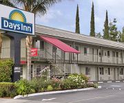
DAYS SAN BERNARDINO HIGHLAND
Sleepy Hollow Cabins and Hotel of Crestline/Lake Gregory
HILLS GARDEN HOTEL
MOTEL 6 SAN BERNARDINO NORTH
THE NORTH SHORE INN
Videos from this area
These are videos related to the place based on their proximity to this place.
Hang Gliding Crestline
Flying Marshall Peak .. On a Wills Wing Falcon 3 - 195. Andy Jackson Airpark / Crestline is located about 60 miles east of Los Angeles, California, in the San Bernardino Mountains.
Crestline Launch Time Lapse - 8-16-2014
Time lapse video of The Crestline, CA, hang glider launch on Saturday, 8/16/2014. Images taken every two minutes, shown at 1/4 second per frame. There were quite a few pilots out flying,...
Rain 20140907 - Crestline Launch View
Time lapse of the rain storm on Sunday 9-7-14 from the CSS Crestline webcam, looking ESE.
Dusty Rhodes Tandem Crestline 8-9-14
We were up on the microwave tower Saturday morning, working on the CSS webcams, when we saw these people over on launch. Dusty Rhodes taking someone tandem hang gliding from Crestline ...
First Solo Paragliding
My first paragliding solo, Stephan Nowak instructor, from Marshall Field (halfway up Crestline) to Andy Jackson Airpark (just west of CSU San Bernardino). What a rush!
Wing Lifted and Flipped - 2015/03/14 Marshall Peak
The hang glider down on the lower launch at Marshal Peak, farthest from the camera, got flipped around and over by a nasty bit of air that hit me a little bit later. Could have been a dust...
San Bernardino Karate teaching manners to kids
Here is an example of how we teach manners and Self Discipline in our children's Programs. Feel Free to call and set up a FREE trial lesson. try out class, see to see if our program is a...
San Bernardino karate
Here is an example of how students learn basic movements and work on focus and memory. Feel free to call and set up a FREE trial lesson to see if our class is a fit for your family . 909-881-9603.
Videos provided by Youtube are under the copyright of their owners.
Attractions and noteworthy things
Distances are based on the centre of the city/town and sightseeing location. This list contains brief abstracts about monuments, holiday activities, national parcs, museums, organisations and more from the area as well as interesting facts about the region itself. Where available, you'll find the corresponding homepage. Otherwise the related wikipedia article.
Muscoy, California
Muscoy is a census-designated place (CDP) in San Bernardino County, California, United States. The population was 10,644 at the 2010 census, up from 8,919 at the 2000 census. Muscoy shares zip code 92407 with northwest San Bernardino, California's Verdemont neighborhood, Devore Heights, and Arrowhead Farms. Residents enjoy a semi-rural setting with large lots where they can raise horses and other livestock, nursery plants, and fruit trees.
Coussoulis Arena
Formally known as the James & Aerianthi Coussoulis Arena, the "Coussoulis Arena" is a 5,000-seat multi-purpose arena in San Bernardino, California, USA. It is home to the California State University, San Bernardino Coyotes basketball team. It opened in 1995.
Cajon High School
Cajon High School is located in the University District of San Bernardino, California, and is part of the San Bernardino City Unified School District.
Rancho Muscupiabe
Rancho Muscupiabe was a 30,145-acre Mexican land grant in present day San Bernardino County, California given to Michael C. White April 29, 1843 by Governor Manuel Micheltorena. The name comes from a Serrano word Muscupiabit, meaning "Place of little pines. " The rancho was adjacent to the Cajon Pass.


