Safety Score: 2,7 of 5.0 based on data from 9 authorites. Meaning we advice caution when travelling to United States.
Travel warnings are updated daily. Source: Travel Warning United States. Last Update: 2024-05-03 08:06:06
Delve into Huntington Shorecliffs Mobile Home Park
The district Huntington Shorecliffs Mobile Home Park of Huntington Beach in Orange County (California) is a subburb in United States about 2,290 mi west of Washington DC, the country's capital town.
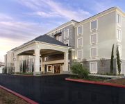
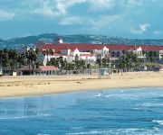
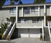
If you need a hotel, we compiled a list of available hotels close to the map centre further down the page.
While being here, you might want to pay a visit to some of the following locations: Santa Ana, Orange, Los Angeles, Riverside and San Bernardino. To further explore this place, just scroll down and browse the available info.
Local weather forecast
Todays Local Weather Conditions & Forecast: 17°C / 63 °F
| Morning Temperature | 15°C / 59 °F |
| Evening Temperature | 16°C / 61 °F |
| Night Temperature | 15°C / 60 °F |
| Chance of rainfall | 0% |
| Air Humidity | 69% |
| Air Pressure | 1012 hPa |
| Wind Speed | Moderate breeze with 10 km/h (6 mph) from North-East |
| Cloud Conditions | Overcast clouds, covering 100% of sky |
| General Conditions | Light rain |
Sunday, 5th of May 2024
15°C (59 °F)
14°C (58 °F)
Light rain, fresh breeze, clear sky.
Monday, 6th of May 2024
16°C (61 °F)
15°C (58 °F)
Sky is clear, moderate breeze, clear sky.
Tuesday, 7th of May 2024
17°C (63 °F)
16°C (61 °F)
Sky is clear, gentle breeze, clear sky.
Hotels and Places to Stay
The Waterfront Beach Resort a Hilton Hotel
Pasea Hotel and Spa
3509 Seashore AB 68196 by RedAwning
AYRES HOTEL FOUNTAIN VALLEY
Kimpton Shorebreak Hotel
Hyatt Regency Huntington Beach
Seashore A 68260 by RedAwning
23 Escapade Court 68308 by RedAwning
33rd St 68149 by RedAwning
35th St AB 68265 by RedAwning
Videos from this area
These are videos related to the place based on their proximity to this place.
Huntington Beach
In today's episode we're checking out Huntington Beach — also known as Surf City USA! Stretching 8 1/2 miles between Newport Beach on the south, and Sunset Beach on the north, Huntington...
Fishing Huntington Beach Bolsa Chica Wetlands
Got Two Bat Rays 2 Smooth Hound Sharks 2 Sting Rays and the 2 that got away , all in all it was a good day of fishing =)
Huntington Beach Hail
It looks like snow, but a rare 1" accumulation of HAIL is covering this Southern California beach! Timelapse recorded 3/2/2015.
Design Build Custom Traditional Kitchen Remodel in Huntington Beach by APlus Kitchen & Home Remodel
This is a beautiful custom kitchen remodel that we have recently completed in city of Huntington Beach Orange County. The kitchen has expanded in to two sections while having the most beautiful...
Surf City USA Half Marathon Huntington Beach California.mov
http://www.viewtherace.com http://www.facebook.com/ViewTheRace The Surf City USA Half Marathon in Huntington Beach, California is one of the biggest half marathons in the country with close...
Carrozza Surfboards Magic Fish Grovel Session Huntington Beach
Took my 5'8" X 21" X 2 3/8" Carrozza Surfboards Magic Fish model out at south side Huntington Beach Pier. Waves were super groveler style but was still able to get some speed and throw a couple...
Stephanie Hargrove (562)264-5557 Mary Kay in Huntington Beach LMStudioM
http://www.marykay.com/Stephanie.Hargrove Stephanie Hargrove (562)264-5557 Mary Kay in Huntington Beach LMStudioM http://lmstudiomarketing.com/ Video Production ...
Mike & Keir - GoPro Surf Film - Huntington Beach
Mike & Keir - GoPro Surf Film Huntington Beach CA - Aug 2013.
Skimboarding at Huntington Beach
June 16, 2012 Episode 2 professional skimboarders showing there skills and volleyball abilities at Huntington beach with the fam http://jjsketch.wix.com/luck#!home/mainPage.
High over Huntington Beach
Flying high over Huntington Beach. All video shot on 2/27/15 and 2/28/15 using GoPro HERO4 Black at 2.7K and TBS Discovery Pro. I loved seeing the kite surfer shred at 5:00.
Videos provided by Youtube are under the copyright of their owners.
Attractions and noteworthy things
Distances are based on the centre of the city/town and sightseeing location. This list contains brief abstracts about monuments, holiday activities, national parcs, museums, organisations and more from the area as well as interesting facts about the region itself. Where available, you'll find the corresponding homepage. Otherwise the related wikipedia article.
Fountain Valley, California
Fountain Valley is a city in Orange County, California. The population was 55,313 at the 2010 census. A classic bedroom community, Fountain Valley is a middle-class residential area.
Orange Coast College
Orange Coast College (OCC) is a community college in Orange County, California, United States. It was founded in 1947, with its first classes opening in the fall of 1948. It provides two-year associate of art and science degrees, certificates of achievement, and lower-division classes transferable to other colleges and universities. The school enrolls 24,424 undergraduate students. In terms of population size, Orange Coast College is the third largest college in Orange County.
SureFire
SureFire, LLC. is an American company based in Fountain Valley, California. Their main products are flashlights, headlamps, weapon-mounted lights and laser sights. In addition, Surefire also manufactures knives, sound suppressors, Picatinny Rails and batteries. The company is a major supplier of flashlights to the U.S. Armed Forces. Surefire products are used in the US by law-enforcement agencies.
BJ's Restaurant & Brewery
BJ’s Restaurants, Inc. currently owns and operates 131 casual dining restaurants under the name BJ's Restaurant & Brewery. The Company operates several microbreweries which produce and distribute BJ's handcrafted beers throughout the chain. BJ's is credited with creating the "Pizookie", a fresh baked cookie (white chocolate and macadamia nut, chocolate chip and many other flavors), with vanilla ice cream, served in a pizza style pan.
Edison High School (Huntington Beach, California)
Edison High School is a public high school located in Huntington Beach, California which first began operation in 1969. It is a part of the Huntington Beach Union High School District.
1933 Long Beach earthquake
The Long Beach earthquake of 1933 took place on March 10, 1933 at 17:55 PST, with a magnitude of 6.4, causing widespread damage to buildings throughout Southern California. The epicenter was offshore, southeast of Long Beach on the Newport-Inglewood Fault. An estimated fifty million dollars worth of property damage resulted, and 120 lives were lost. Many of these fatalities occurred as people ran out of buildings and were hit by falling debris.
Whittier Law School
Whittier Law School is a law school in Costa Mesa, California. Founded in 1966, it is a fully accredited ABA law school in Orange County, California. A private university, it is part of Whittier College.
Brethren Christian Junior/Senior High School
Brethren Christian is a private Christian high school located at Huntington Beach, California. It is situated on a 15-acre site leased from the Huntington Beach School District, formerly the site of Gisler Middle School. The school has about 400 junior and senior high students that live within a 25-mile radius of the school, commute from over 40 communities, and represent over 150 different churches within the Christian community.
Mile Square Regional Park
Mile Square Regional Park is a park located in Fountain Valley, California. It includes two lakes, three 18-hole golf courses, archery range, baseball and softball fields, picnic shelters, and a 20-acre urban nature area planted with California native plants, a 55 acre (223,000 m²) recreation center with tennis courts, basketball courts, racquetball courts, a gymnasium, the Kingston Boys & Girls Club, and a community center.
Midway City, California
Midway City is a census-designated place in the United States that forms part of the county land controlled by Orange County, California. The only area in Orange County that incorporates its chamber of commerce and homeowners association to act in concert like a city council, the area mostly is surrounded by Westminster with Huntington Beach bordering its southwest boundary. Midway City was so named because it is horizontally midway between Seal Beach, to the west, and Santa Ana, to the east.
California's 46th congressional district
California's 46th congressional district is a congressional district in the U.S. state of California that from 2003 to 2013 covered part of Los Angeles County and Orange County. The district included Huntington Beach, Costa Mesa, and Rancho Palos Verdes. The district is currently represented by Democrat Loretta Sanchez. The district is based in Orange County and includes the communities of Anaheim and Santa Ana.
Huntington Beach Public Library
The Huntington Beach Public Library and Cultural Center (HBPL) is located in Huntington Beach, California. This medium-sized public library offers free wireless access, online databases, books, children's programs, computers, DVD movies, CD music for the residents of Huntington Beach, California. Non-residents are also welcome to use the library's resources for a nominal fee. The library is financed and governed by the City of Huntington Beach, California.
Meadowlark Airport
Meadowlark Airport was a small general aviation airport in Southern California, about a mile east of the Pacific Ocean in Huntington Beach. Meadowlark's IATA airport code was L16. The airport operated privately in the 1940s and operated publicly from the 1950s to 1989.
Early College High School (Costa Mesa, California)
Dwyer Middle School
Dwyer Middle School is located in Huntington Beach, California. There are 1,180 students from 6th to 8th grade that attend the school during the 2009-2010 school year. Dwyer is a three-time California Distinguished School, earning that distinction in 1998, 2003, and in 2009. It is one of only 261 schools in the entire state to be so honored in 2009. Dwyer is known as "The House of Scholars and Champions.
Cuckoo's Nest (nightclub)
The Cuckoo's Nest was a punk rock nightclub that was located at 1714 Placentia Avenue in Costa Mesa, California. There were often confrontations with the punks from the Cuckoo's Nest and the cowboys from Zubie's, which shared a parking lot. The police were constantly harassing the punks.
Bella Terra
Bella Terra is an outdoor shopping mall in Huntington Beach, California. It was built on the site of the former Huntington Center. 1966: Opened as the enclosed Huntington Center. It originally had The Broadway, JCPenney, and Montgomery Ward. 1986: New wing is built with Mervyn's. 1992: JCPenney closes and moves to Westminster Mall. 1995: Burlington Coat Factory replaces JCPenney 1996: The Broadway closes. 2001: Montgomery Ward closes 2003: Mall closes, except for Meryvn's and BCF.
Estancia High School
Estancia High School is a public high school in Costa Mesa, California. Estancia is part of the Newport-Mesa Unified School District in Orange County and is located at 2323 Placentia Avenue.
Huntington Beach Oil Field
The Huntington Beach Oil Field is part of rich pools of oil found along the West Coast of the United States in the early 1920s stretching from Huntington Beach, California to Santa Barbara, California. On May 24, 1920, the first Huntington Beach well, the Huntington A-1 {{#invoke:Coordinates|coord}}{{#coordinates:33.683522|-118.009536||||||| |primary |name= }}, was brought in as a producing well. By October 1921, the field had 59 producing wells.
Apollos University
Apollos University, headquartered in Huntington Beach, California is an American privately owned distance education university. The university offers masters and doctoral degree programs in business administration and management. The university was originally founded in August 2004 as a non-profit university. However, it closed the non-profit corporation and reopened as a for-profit corporation in May, 2005.
Rancho Las Bolsas
Rancho Las Bolsas was a 33,460-acre 1834 Mexican land grant resulting from the partition of Rancho Los Nietos, located from the coast on inland within present day northwestern Orange County, California. The Spanish name "las bolsas" means "the pockets", and refers to pockets of land amongst the marsh wetlands of the Santa Ana River estuary.
Rancho La Bolsa Chica
Rancho La Bolsa Chica was an 8,107-acre Mexican land grant in present day coastal northwestern Orange County, California given in 1841 by Governor Juan Alvarado to Joaquín Ruiz. The name means "little pocket", and refers to pockets of land amongst the marsh wetlands of the Santa Ana River estuary. The rancho lands include the present day city of Huntington Beach, the community of Sunset Beach, and the significant Bolsa Chica Ecological Reserve.
Hoag (health network)
Hoag is a not-for-profit regional health care delivery network in Orange County, California, that treats nearly 30,000 inpatients and 350,000 outpatients annually. Hoag consists of two acute-care hospitals, seven health centers and four urgent care centers. Hoag Hospital Newport Beach, which has served Orange County since 1952, and Hoag Hospital Irvine, which opened in 2010, are Magnet designated hospitals by the American Nurses Credentialing Center (ANCC).
Newport Heights, Newport Beach
Newport Heights is an upscale neighborhood located in Newport Beach, California. Its general borders are Pacific Coast Highway, Dover Drive, 16th Street, and Newport Blvd. The primary zip code is 92663. Newport Heights is known for its views as it sits on a cliff up above PCH looking down at Mariners Mile.
First Chinese Baptist Church of Fountain Valley
First Chinese Baptist Church of Fountain Valley or FCBCFV is an evangelical Christian church located in Fountain Valley, California, and is sited in southern Orange County. The church was founded in 1977 by pastor Murphy Lum, with its first assembly on February 2, 1977, and first worship service on February 20, 1977. It's various fellowship groups were also formed during the founding of the church, splitting each group in accordance to each person's age.


