Safety Score: 2,7 of 5.0 based on data from 9 authorites. Meaning we advice caution when travelling to United States.
Travel warnings are updated daily. Source: Travel Warning United States. Last Update: 2024-04-28 08:22:10
Explore Clair
Clair in Orange County (California) is a city in United States about 2,286 mi (or 3,679 km) west of Washington DC, the country's capital.
Local time in Clair is now 02:13 AM (Sunday). The local timezone is named America / Los Angeles with an UTC offset of -7 hours. We know of 7 airports in the vicinity of Clair, of which 5 are larger airports. The closest airport in United States is Long Beach /Daugherty Field/ Airport in a distance of 10 mi (or 16 km), West. Besides the airports, there are other travel options available (check left side).
Also, if you like golfing, there are multiple options in driving distance. We found 9 points of interest in the vicinity of this place. If you need a place to sleep, we compiled a list of available hotels close to the map centre further down the page.
Depending on your travel schedule, you might want to pay a visit to some of the following locations: Santa Ana, Orange, Los Angeles, Riverside and San Bernardino. To further explore this place, just scroll down and browse the available info.
Local weather forecast
Todays Local Weather Conditions & Forecast: 20°C / 68 °F
| Morning Temperature | 15°C / 59 °F |
| Evening Temperature | 19°C / 66 °F |
| Night Temperature | 17°C / 63 °F |
| Chance of rainfall | 0% |
| Air Humidity | 49% |
| Air Pressure | 1015 hPa |
| Wind Speed | Gentle Breeze with 9 km/h (5 mph) from North-East |
| Cloud Conditions | Clear sky, covering 0% of sky |
| General Conditions | Sky is clear |
Sunday, 28th of April 2024
21°C (70 °F)
18°C (64 °F)
Sky is clear, gentle breeze, clear sky.
Monday, 29th of April 2024
20°C (68 °F)
17°C (63 °F)
Sky is clear, gentle breeze, clear sky.
Tuesday, 30th of April 2024
19°C (67 °F)
17°C (62 °F)
Sky is clear, gentle breeze, clear sky.
Hotels and Places to Stay
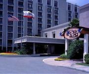
RAMADA PLAZA GARDENGROVANAHEIM
KNOTTS BERRY FARM HOTEL
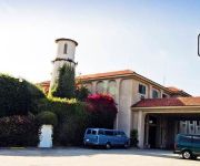
Kitchen Studios Hotel Pepper Tree Anaheim
Hampton Inn Los Angeles-Orange County-Cypress
Brookhurst Plaza Inn
National Inn Garden Grove
Kona Inn Motel Anaheim
Colony Inn
Morada Inn
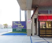
Tropic Lodge
Videos from this area
These are videos related to the place based on their proximity to this place.
Time Travel Tuesdays Caio Terra vs Bruno Malfacine BJJ Worlds 2008
http://www.budovideos.com/ presents Time Travel Tuesdays. Caio Terra vs Bruno Malfacine - these two competitors have a history longer than most in BJJ. In what will be one of the many times...
Time Travel Tuesdays Jeff Glover vs Philipe Della Monica Nogi Worlds 2008
http://www.budovideos.com/ presents Time Travel Tuesdays. Today we bring you this 2008 Nogi Worlds match up between top American fighter Jeff Glover and one of Gracie Barra's top black belt's...
Time Travel Tuesdays Braulio Estima vs Tarsis Humphreys Pan Ams Nogi 2008
http://www.budovideos.com/ presents Time Travel Tuesdays. We bring you this classic fight between Braulio Estima and Tarsis Humphreys in the Pan Ams Nogi 2008. Enjoy and don't forget to subscribe ...
Time Travel Tuesdays Michael Langhi vs Rafael Barbosa Pan Ams 2008
http://www.budovideos.com presents Time Travel Tuesdays. We bring you this match up between top competitors Michael Langhi and Rafael Barbosa in the 2008 Pan Ams. Enjoy and don't forget to...
Time Travel Tuesdays Kron Gracie vs Marcelo Mafra Pan Ams 2008
http://www.budovideos.com/ presents Time Travel Tuesdays. Today we head back to the 2008 Pan Ams where we see brown belt Kron Gracie go at it again but this time against Marcelo Mafra. Enjoy...
Time Travel Tuesdays Romulo Barral vs Rafael Lovato Jr 2007 Pan Ams
Time travel Tuesdays is back! #TTT this time with a classic match from two very game competitors. You may have heard of them, Romulo Barral and Rafael Lovato Jr! These guys were amazing back...
Time Travel Tuesdays Andre Galvao vs Braulio Estima BJJ Worlds 2008
http://www.budovideos.com presents Time Travel Tuesdays. Today we bring you this classic match up between Andre Galvao and Braulio Estima from the Worlds 2008. This is one of the many times...
Adventure City - Freeway roller coaster full HD 1080p
The small roller coaster ride in Adventure City. Jerky but fast and fun! Captured with the high definition Panasonic HS60 camcorder. On ride from the rear facing passenger's POV (point of...
Treetop Racers - Adventure City - onride POV
This is the Treetop Racers, an unusual mouse coaster at Adventure City, Anaheim, CA, that previously operated in Australia before being brought to USA in 1999. Sadly it appears the ride closed...
Freeway Coaster - Adventure City
This is the kiddie coaster, Freeway Coaster, at Adventure City, California - filmed during the ECC USA Trip 2002. David Ellis - Roller Coasters, Thrill Rides and more Check out my other videos...
Videos provided by Youtube are under the copyright of their owners.
Attractions and noteworthy things
Distances are based on the centre of the city/town and sightseeing location. This list contains brief abstracts about monuments, holiday activities, national parcs, museums, organisations and more from the area as well as interesting facts about the region itself. Where available, you'll find the corresponding homepage. Otherwise the related wikipedia article.
Stanton, California
Stanton is a city located in western Orange County, California. The population was 38,186 at the 2010 census, up from 37,403 at the 2000 census. The City was incorporated in 1956 and operates under the Council-Manager form of government, providing a full range of municipal services. Stanton is bounded by Cypress on the west, Anaheim on the north, and east, and Garden Grove on the east and south.
Cornelia Connelly High School
Cornelia Connelly School is a Catholic college-preparatory high school for girls in Anaheim, California. Established in 1961 by the Sisters of the Society of the Holy Child Jesus, it is named after Cornelia Connelly, founder of that Roman Catholic religious institute. Although located in the Roman Catholic Diocese of Orange, it is an independent school, one of ten Holy Child schools in the United States.
Magnolia High School (California)
Magnolia High School is a public high school in Anaheim, California and is part of the Anaheim Union High School District. It serves approx. 1,763 students in grades nine through twelve. 77 percent of its students are Hispanic, 8 percent Asian, 9 percent Caucasian and 6 percent Black. The most current gender statistics are 49% male and 51% female. The school is named after the nearest major street to the west.
Tiger Woods Learning Center
The Tiger Woods Learning Center was established in 2006 by Tiger Woods to get students thinking about the role education plays in their futures. The learning center is used by several thousand students, with a day program for grades 4-6 and an after school program for grades 7-12. There is also summer program, weekend and community outreach programs and online learning programs. The centre features extensive multi-media facilities and an outdoor golf teaching area.
Adventure City
Adventure City is a theme park located in Anaheim, California near the city of Stanton. The park's slogan is "The Little Theme Park that's BIG on Family Fun". Occupying an area of over 2 acres, Adventure City is one of the smallest theme parks in California, and receives an average attendance of between 200,000 and 400,000 per year. The Coca-Cola Company, is the park's only major sponsor.
Dale Junior High School
Dale Junior High School is a school for 7th and 8th grade in Anaheim, California in the United States. The school is part of the Anaheim Union High School District. Its mascot is the Lancer. {{#invoke:Coordinates|coord}}{{#coordinates:33|49|11|N|117|59|02|W|region:US-CA_type:edu_source:GNIS |primary |name= }}
Rancho Los Coyotes
Rancho Los Coyotes was a 48,806-acre 1834 Mexican land grant resulting from the partition of the Rancho Los Nietos grant, in present day southeastern Los Angeles County and northwestern Orange County, California. The rancho lands include the present day cities of Cerritos, La Mirada, Stanton, and Buena Park.
Anaheim Island, California
Anaheim Island (also known as Anaheim West, Southwest Anaheim, and Garza Island) consists of several unincorporated neighborhoods located in the northwestern part of Orange County, California, United States. Established between the 1910s and 1960s, the neighborhoods are bounded by the cities of Anaheim to the east, north and west, Stanton to the southwest, and Garden Grove to the south.


