Safety Score: 2,7 of 5.0 based on data from 9 authorites. Meaning we advice caution when travelling to United States.
Travel warnings are updated daily. Source: Travel Warning United States. Last Update: 2024-05-12 08:29:37
Explore East San Gabriel
The district East San Gabriel of San Gabriel in Los Angeles County (California) with it's 14,874 inhabitants East San Gabriel is located in United States about 2,285 mi west of Washington DC, the country's capital.
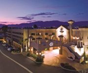
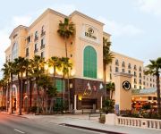
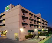
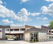
If you need a place to sleep, we compiled a list of available hotels close to the map centre further down the page.
Depending on your travel schedule, you might want to pay a visit to some of the following locations: Los Angeles, Orange, Santa Ana, Riverside and San Bernardino. To further explore this place, just scroll down and browse the available info.
Local weather forecast
Todays Local Weather Conditions & Forecast: 26°C / 79 °F
| Morning Temperature | 16°C / 60 °F |
| Evening Temperature | 25°C / 77 °F |
| Night Temperature | 20°C / 67 °F |
| Chance of rainfall | 0% |
| Air Humidity | 34% |
| Air Pressure | 1013 hPa |
| Wind Speed | Gentle Breeze with 8 km/h (5 mph) from North-East |
| Cloud Conditions | Clear sky, covering 0% of sky |
| General Conditions | Sky is clear |
Monday, 13th of May 2024
26°C (78 °F)
18°C (64 °F)
Sky is clear, gentle breeze, clear sky.
Tuesday, 14th of May 2024
24°C (75 °F)
17°C (62 °F)
Sky is clear, gentle breeze, clear sky.
Wednesday, 15th of May 2024
20°C (68 °F)
15°C (60 °F)
Broken clouds, gentle breeze.
Hotels and Places to Stay
DoubleTree by Hilton Los Angeles - Rosemead
Hilton Los Angeles-San Gabriel
Pasadena The Langham
Holiday Inn Express & Suites PASADENA-COLORADO BLVD.
Holiday Inn EL MONTE - LOS ANGELES
Fairfield Inn & Suites Los Angeles Rosemead
Comfort Inn Near Pasadena Civic Auditorium
Wonder Inn
BEST WESTERN PASADENA ROYALE I
BEST WESTERN PASADENA INN
Videos from this area
These are videos related to the place based on their proximity to this place.
Brazilian Jiu Jitsu Schools in San Gabriel Valley|BJJ Training in Alhambra Montebello|Jiujitsu in LA
BJJ training in San Gabriel Valley | Jiujitsu schools in Alhambra Montebello | BJJ in Los Angeles Southern California |91801 91803 90640|323 626 Try Jiujitsu in Alhambra and Montebello for...
San Gabriel Trench Shoefly in service+Amtrak & Metrolink Sept 2014
One min. of passenger trains and the San Gabriel Trench shoefly begins service. -1- Sept. 5, 2014 Amtrak Train #2 the Sunset Limited passed the Walnut Grove crossing, Rosemead, CA with P42s...
The Talking Ed - Mission San Gabriel Arcángel
Welcome to a California Mission edition of "The Talking Ed," a video postcard series launched from Washington, DC by Southern California native Edward Headington. Find out about California's...
San Gabriel Trench Dec 2014 Jan 2015
Clips taken late December 2014 thru January 2015 showing the construction progress along the San Gabriel, CA railroad trench on the Union Pacific Alhambra Subdivision. Z Trains, Auto Rack,...
San Gabriel, CA Home for Rent - 3 bd/2 ba + Guest house
This beautiful 3 bedroom home is available for rent in San Gabriel, CA. It has custom tile and custom finishings throughout the home. It has been well taken care of and also has a guest house...
The Best Orthodontics San Gabriel CA InStyle Dental
The Best Orthodontics San Gabriel CA InStyle Dental InStyle Dental 138 N. San Gabriel Blvd. San Gabriel, CA 91775 626-287-2625 www.instyledental.com www.facebook.com/instyledentaloffice...
Michael Scott's 4th grade San Gabriel Mission Project 2010
Michael Scott's fourth Grade Mission project.
Future San Gabriel trench - work has begun
Photo - sign posted as work in progress toward lowering the tracks through San Gabriel, California. In the videos if you look closely you will see survey markings & flags as well as people...
Thai Paradise Restaurant in San Gabriel, CA
Welcome to the Thai Paradise Restaurant TheThaiParadise.com 909 West Las Tunas Dr. San Gabriel, CA 91776 (626) 570-8887 We do delivery and catering.
BNSF Grain Train & UP Z at San Gabriel Blvd on UP Alhambra Sub
While waiting for the morning Z train this westbound BNSF grain train showed up! What this train ws doing on the UP Alhambra Sub I do not know.... -1- Westbound BNSF Grain train powered by...
Videos provided by Youtube are under the copyright of their owners.
Attractions and noteworthy things
Distances are based on the centre of the city/town and sightseeing location. This list contains brief abstracts about monuments, holiday activities, national parcs, museums, organisations and more from the area as well as interesting facts about the region itself. Where available, you'll find the corresponding homepage. Otherwise the related wikipedia article.
East San Gabriel, California
East San Gabriel is a census-designated place (CDP) in Los Angeles County, California, United States. The population was 14,874 at the 2010 census, up from 14,512 at the 2000 census.
Rosemead, California
Rosemead is a city in Los Angeles County, California, United States. As of the 2010 census, it had a population of 53,764. Rosemead is part of a cluster of cities, along with Arcadia, Temple City, Monterey Park, San Marino, and San Gabriel, in the west San Gabriel Valley with a growing Asian population.
San Gabriel, California
San Gabriel is a city in Los Angeles County, California, United States. It is named after the Mission San Gabriel Arcángel, founded by Junipero Serra. The city grew outward from the mission and in 1852 became the original township of Los Angeles County. San Gabriel was incorporated in 1913. The city's motto is "A city with a Mission" and it is often called the "Birthplace" of the Los Angeles metropolitan area. At the 2010 census, the population was 39,718.
San Marino, California
San Marino is a small, affluent city in Los Angeles County, California, United States. Incorporated on April 12, 1913, the city was designed by its founders to be uniquely residential, with expansive properties surrounded by beautiful gardens, wide streets, and well maintained parkways. The city is located in the San Rafael Hills. The population was 13,147 at the 2010 census. In 2010, Forbes Magazine ranked the city's 91108 ZIP code as the 63rd most expensive area to live in the United States.
Temple City, California
Temple City is a city in Los Angeles County, California. Temple City is part of a cluster of cities, along with Arcadia, Rosemead, Monterey Park, San Marino, and San Gabriel, in the west San Gabriel Valley with a rapidly growing Asian population. Temple City also has a Cuban and Puerto Rican community, among other Latino nationalities. The population was 35,558 at the 2010 census.
Huntington Library
The Huntington Library, Art Collections and Botanical Gardens (or The Huntington) is a collections-based educational and research institution established by Henry E. Huntington and located in San Marino, California, in the United States. In addition to the library, the institution houses an extensive art collection with a focus in 18th- and 19th-century European art and 17th- to mid-20th-century American art.
Alhambra High School (Alhambra, California)
Alhambra High School is a public high school in Alhambra, California, USA. The school was established in 1898 and is in the Alhambra High School District. It administers one of the most extensive high school and adult education programs in California, offering hundreds of academic, cultural, and recreational courses, day and evening, many located on the Alhambra High School grounds. In 2005, it was given a California Distinguished Schools award.
1987 Whittier Narrows earthquake
The 1987 Whittier Narrows earthquake occurred in the southern San Gabriel Valley and surrounding communities of southern California at 7:42 a.m. on October 1, 1987. The magnitude 5.9 earthquake was originally assigned a magnitude of 6.1 but was revised downward a few days later when additional data became available.
Mark Keppel High School
Mark Keppel High School is a four-year California Distinguished School located in the city of Alhambra, California in the Alhambra Unified School District. The school is on the southern edge of Alhambra, adjacent to the City of Monterey Park, and borders the Interstate 10 Freeway. Mark Keppel serves students from portions of Alhambra, Monterey Park, and Rosemead.
San Gabriel High School
San Gabriel High School is a public high school located around the border of San Gabriel, California and Alhambra, California. It is one of the three high schools in the Alhambra Unified School District. It traditionally served students residing in San Gabriel although the balance was shifted in 1994 when San Gabriel Unified School District separated itself from Alhambra Unified. Upon separation, SGUSD opened Gabrielino High School to serve its students.
Gabrielino High School
Gabrielino High School (abbreviated GHS) is a public high school located on San Gabriel Boulevard in San Gabriel, California, 10 miles east of downtown Los Angeles, serving the 9th to 12th grades. It was established in 1994, and is one of two high schools in the San Gabriel Unified School District. Del Mar High School, a continuation high school, is the second. Gabrielino High School is accredited by Western Association of Schools and Colleges (WASC).
San Marino High School
San Marino High School (SMHS) is a public high school in San Marino, California, United States. It is part of the San Marino Unified School District in Los Angeles County. San Marino High School’s Academic Performance Index (API) of 951 as determined by the California Department of Education is the highest in Los Angeles County.
Temple City High School
Temple City High School (also known as TCHS) is a four-year public high school located in Temple City, California, in the West San Gabriel Valley.
San Gabriel Mission High School
San Gabriel Mission High School, the "school with a mission," is an all-girls Catholic College Preparatory high school located on the grounds of the fourth mission of California, which was founded in 1771 by the Franciscan Padres and often used by Father Junipero Serra as his headquarters. It is located in the Roman Catholic Archdiocese of Los Angeles.
KMRB
KMRB is a radio station in Pasadena, California, USA (licensed to and transmitted from San Gabriel, California) that broadcasts completely in Cantonese 24 hours a day. It is the sister station to KAZN, which broadcasts in Mandarin. It is owned and operated by Multicultural Radio Broadcasting, Inc..
KAZN
KAZN (Chinese: AM 1300 中文廣播電台; pinyin: AM 1300 zhōng wén guǎng bō diàn tái) is a 24 hours Mandarin Chinese radio station in Los Angeles area. Before KAZN, this was an AM simulcast of classical music station KFAC. In the early 1990s, it was a multi-language radio station, Chinese programs were only broadcast at night time, Mandarin and Cantonese. In 1993, as a result of an ownership change, Tang Ron-shu, a Taiwanese insurance saleswoman who leased out most of the programs, was forced to leave.
Wilmar, California
Wilmar was the former name of a then-unincorporated district of San Gabriel Township in the San Gabriel Valley, about eight miles east of the center of Los Angeles. Wilmar was combined with the unincorporated communities of Garvey (to the east of Wilmar) and Potrero Heights (to the south of Wilmar) to become the unincorporated community of South San Gabriel in the early 1950s.
Oak Avenue Intermediate School
Oak Avenue Intermediate School is a two-year public intermediate, junior high, or middle school, located in Temple City, California, in the west San Gabriel Valley. Lawton Gray, formerly dean of students and assistant principal at Temple City High School, was named principal in April 2007.
Emperor Elementary School
Emperor Elementary School is a traditional seven-year K-6 elementary school, or primary school, located in San Gabriel, California, in the west San Gabriel Valley and is part of the Temple City Unified School District.
Hazen Aldrich
Hazen Aldrich (January 10, 1797 – 1873) was an early leader in the Latter Day Saint movement. After the death of Joseph Smith, Jr. , Aldrich went on to lead a small denomination of Latter Day Saints known as the Brewsterites. Aldrich was born in Lebanon, New Hampshire to Andrew H. Aldrich and Annis Sweetland. In April or May 1832, Aldrich was taught about the Latter Day Saint movement by missionaries Orson Pratt and Lyman E. Johnson and was baptized in Bath, New Hampshire.
Henry E. Huntington Middle School
Henry Edwards Huntington Middle School (HMS, HEHMS) is academically the top middle school in Southern California according to the California Academic Performance Index. It is one of four public schools in San Marino, California and a part of the San Marino Unified School District. The current principal is Mr. Dave Murray, while the current assistant principal is Mr James Dahlstien and Ms. Lauren Lahey. Approximately 775 students are enrolled.
Huntington Desert Garden
The Huntington Desert Garden is part of The Huntington Library, Art Collections and Botanical Gardens in San Marino, California. The Desert Garden is one of the world's largest and oldest collections of cacti, succulents and other desert plants, collected from throughout the world. It contains plants from extreme environments, many of which were acquired by Henry E.
Rancho Potrero Grande
Rancho Potrero Grande was a 4,432-acre Mexican land grant in present day Los Angeles County, California given in 1845 by Governor Pío Pico to Manuel Antonio. The name means "Large Pasture". The grant encompasssed present day Rosemead and South El Monte.
Zaxwerks
Zaxwerks Incorporated is a privately owned 3D software company with headquarters in Temple City, California, United States. It specializes in 3D computer graphics, titles and logos. Zaxwerks develops software for digital video, broadcast, film and the World Wide Web, and is seen on television everyday.
Sally Tanner
Sally Tanner (born 1926) represented California's 60th District in the California State Assembly from 1979 to 1992. Her legislative career encompassed environmental issues, including serving as chair of the Environmental Safety and Toxic Materials Committee. On consumer issues, Tanner was the author of a consumer protection act that came to be colloquially referred to as the California Lemon Law.


