Safety Score: 2,7 of 5.0 based on data from 9 authorites. Meaning we advice caution when travelling to United States.
Travel warnings are updated daily. Source: Travel Warning United States. Last Update: 2024-05-05 08:24:42
Delve into Kinneloa Mesa
Kinneloa Mesa in Los Angeles County (California) is located in United States about 2,283 mi (or 3,673 km) west of Washington DC, the country's capital town.
Current time in Kinneloa Mesa is now 12:53 AM (Monday). The local timezone is named America / Los Angeles with an UTC offset of -7 hours. We know of 8 airports close to Kinneloa Mesa, of which 3 are larger airports. The closest airport in United States is Bob Hope Airport in a distance of 16 mi (or 25 km), West. Besides the airports, there are other travel options available (check left side).
Also, if you like playing golf, there are some options within driving distance. We encountered 3 points of interest near this location. If you need a hotel, we compiled a list of available hotels close to the map centre further down the page.
While being here, you might want to pay a visit to some of the following locations: Los Angeles, Orange, Santa Ana, Riverside and San Bernardino. To further explore this place, just scroll down and browse the available info.
Local weather forecast
Todays Local Weather Conditions & Forecast: 23°C / 73 °F
| Morning Temperature | 12°C / 54 °F |
| Evening Temperature | 20°C / 68 °F |
| Night Temperature | 16°C / 61 °F |
| Chance of rainfall | 0% |
| Air Humidity | 21% |
| Air Pressure | 1014 hPa |
| Wind Speed | Gentle Breeze with 8 km/h (5 mph) from North-East |
| Cloud Conditions | Clear sky, covering 3% of sky |
| General Conditions | Sky is clear |
Monday, 6th of May 2024
25°C (76 °F)
17°C (63 °F)
Sky is clear, gentle breeze, clear sky.
Tuesday, 7th of May 2024
24°C (75 °F)
18°C (64 °F)
Sky is clear, gentle breeze, clear sky.
Wednesday, 8th of May 2024
23°C (73 °F)
17°C (63 °F)
Sky is clear, gentle breeze, clear sky.
Hotels and Places to Stay
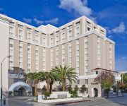
The Westin Pasadena
Dusitd2 Hotel Constance Pasadena
OAKWOOD AT TRIO
Oakwood at City Place
Comfort Inn Near Pasadena Civic Auditorium
OAKWOOD AT GATEWAY VILLAS
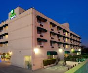
Holiday Inn Express & Suites PASADENA-COLORADO BLVD.
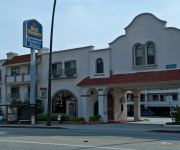
La Casa Inn
BEST WESTERN PASADENA ROYALE I
BEST WESTERN PASADENA INN
Videos from this area
These are videos related to the place based on their proximity to this place.
Regular Meeting Sierra Madre City Council | January 27, 2015
January 27, 2015 | Regular Meeting Sierra Madre City Council.
Special Meeting Sierra Madre City Council
October 29, 2014, Special Meeting Sierra Madre City Council.
Sierra Madre City Council | Regular Meeting | February 24, 2015
February 24, 2015, Regular Sierra Madre City Council Meeting.
Regular Sierra Madre City Council Meeting | January 13, 2015
January 13, 2015, Regular Sierra Madre City Council Meeting.
Sierra Madre Regular City Council Meeting | November 25, 2014
November 25, 2014 Regular Sierra Madre City Council MeetinC.
Regular Sierra Madre City Council Meeting
October 28, 2014, Regular Sierra Madre City Council Meeting.
Sierra Madre City Council | Regular Meeting | March 10, 2015
March 10, 2015 Sierra Madre City Council Regular Meeting.
Regular Sierra Madre City Council Meeting | February 10, 2015
February 10, 2015, Sierra Madre City Council Regular Meeting.
Special Meeting Sierra Madre City Coyuncil
Thursday, November 13, 2014 Special Meeting Sierra Madre City Council.
Videos provided by Youtube are under the copyright of their owners.
Attractions and noteworthy things
Distances are based on the centre of the city/town and sightseeing location. This list contains brief abstracts about monuments, holiday activities, national parcs, museums, organisations and more from the area as well as interesting facts about the region itself. Where available, you'll find the corresponding homepage. Otherwise the related wikipedia article.
Sierra Madre, California
The Sierra Madre is a city in Los Angeles County, California whose population was 10,917 at the 2010 U.S. Census, up from 10,580 at the time of the 2000 U.S. Census. The city is located in the Foothills of the San Gabriel Mountains below the southern edge of the Angeles National Forest. Pasadena and Altadena are to its west, with Arcadia to its south and east. Sierra Madre is known as "Wistaria City", and its city seal is decorated with a drawing of the now widely known 500-foot vine.
Pasadena High School (Pasadena, California)
Pasadena High School (PHS) is a public high school in Pasadena, California.
La Salle High School (Pasadena, California)
La Salle High School is a private, Roman Catholic college preparatory high school in Pasadena, California. It is located in the Roman Catholic Archdiocese of Los Angeles. La Salle High School, founded in 1956, is a Lasallian school. The curriculum pursues a rigorous balance for its 740 students between college preparatory courses, religious education and cultural, social and athletic opportunities.
Henninger Flats
Henninger Flats is a small hanging basin 2,600 feet above sea level in the San Gabriel Mountains in the Angeles National Forest. It was part of the Mount Wilson Toll Road. The trailhead to reach the flats is at the top end of Eaton Canyon in Pasadena, California.
Alverno High School
Alverno High School is an independent, Catholic, college-prep high school for girls located in the Sierra Madre/Pasadena area of southern California, USA.
Eaton Canyon
For other uses of this name see Eaton Canyon (disambiguation). Eaton Canyon is a major canyon beginning at the Eaton Saddle near Mount Markham and San Gabriel Peak in the San Gabriel Mountains in the Angeles National Forest, USA. Its drainage flows into the Rio Hondo river and then into the Los Angeles River. It is named after Judge Benjamin Eaton (not to be confused with Coloradan politician Benjamin Eaton), who lived in the Fair Oaks Ranch House in 1865 not far from Eaton Creek.
The Bunny Museum
The Bunny Museum is a world record-holding museum dedicated to rabbits that was opened to the public in 1998, located in Pasadena, California, USA. The museum currently holds more than 28,000 bunny related items. The museum has held the world record for "owning the most bunny items in the world" since 1999 when it was acknowledged by the Guinness World Records. At that point in time, it housed 8,473 pieces of bunny memorabilia. The slogan of the museum is "The Hoppiest place in the World".
Norma Coombs Alternative School
Norma Coombs Alternative School is located at 2600 Paloma St. , Pasadena, California 91107 and is in the Pasadena Unified School District.


