Safety Score: 2,7 of 5.0 based on data from 9 authorites. Meaning we advice caution when travelling to United States.
Travel warnings are updated daily. Source: Travel Warning United States. Last Update: 2024-05-19 08:11:23
Discover Cloverleaf Canyon
Cloverleaf Canyon in Los Angeles County (California) is a place in United States about 2,278 mi (or 3,666 km) west of Washington DC, the country's capital city.
Current time in Cloverleaf Canyon is now 10:13 AM (Sunday). The local timezone is named America / Los Angeles with an UTC offset of -7 hours. We know of 8 airports near Cloverleaf Canyon, of which 3 are larger airports. The closest airport in United States is Bob Hope Airport in a distance of 21 mi (or 34 km), West. Besides the airports, there are other travel options available (check left side).
Also, if you like playing golf, there are a few options in driving distance. We encountered 1 points of interest in the vicinity of this place. If you need a hotel, we compiled a list of available hotels close to the map centre further down the page.
While being here, you might want to pay a visit to some of the following locations: Los Angeles, Orange, Santa Ana, Riverside and San Bernardino. To further explore this place, just scroll down and browse the available info.
Local weather forecast
Todays Local Weather Conditions & Forecast: 23°C / 73 °F
| Morning Temperature | 14°C / 56 °F |
| Evening Temperature | 21°C / 70 °F |
| Night Temperature | 15°C / 59 °F |
| Chance of rainfall | 0% |
| Air Humidity | 43% |
| Air Pressure | 1016 hPa |
| Wind Speed | Gentle Breeze with 8 km/h (5 mph) from North |
| Cloud Conditions | Clear sky, covering 0% of sky |
| General Conditions | Sky is clear |
Sunday, 19th of May 2024
20°C (68 °F)
14°C (58 °F)
Few clouds, gentle breeze.
Monday, 20th of May 2024
24°C (75 °F)
18°C (64 °F)
Sky is clear, moderate breeze, clear sky.
Tuesday, 21st of May 2024
24°C (75 °F)
16°C (60 °F)
Sky is clear, gentle breeze, clear sky.
Hotels and Places to Stay
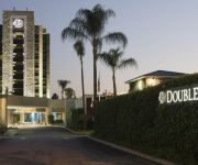
DoubleTree by Hilton Monrovia - Pasadena Area
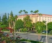
Embassy Suites by Hilton Arcadia Pasadena Area
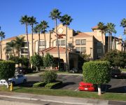
Hampton Inn Los Angeles-Arcadia
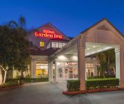
Hilton Garden Inn Arcadia-Pasadena Area
Courtyard Los Angeles Pasadena/Monrovia
Holiday Inn Express & Suites PASADENA-COLORADO BLVD.
Residence Inn Pasadena Arcadia
SpringHill Suites Pasadena Arcadia
Hi-Way Host Motel
BEST WESTERN PASADENA INN
Videos from this area
These are videos related to the place based on their proximity to this place.
Monrovia City Council January 21, 2014
Regular Meeting of the Monrovia City Council from January 21, 2014.
Monrovia City Council | Regular Meeting | September 3, 2013
Regular Meeting of the Monrovia City Council, September 3, 2013.
Monrovia City Council | June 5, 2012 | Study Session
Special Study Session of the Monrovia City Council for June 5, 2012.
Monrovia City Council | June 19, 2012
Regular Meeting of the Monrovia City Council for June 19, 2012.
Monrovia City Council | April 3, 2012
Regular Meeting of the Monrovia City Council for April 3, 2012.
FDR's Legacy - Monrovia Canyon Park
Among the 20 CCC camps that existed in the Angeles National Forest for the development of the park was the Monrovia camp that built roads, trails, campgrounds, and other facilities for the...
Fire on A Hill of Monrovia California - 11:00 AM Stabilized Footage
Video Footage Taken About 11:00am - Fire on A Hill of Monrovia, CA near Madison Ave and Crescent Drive. Playlist of All Footages: ...
Monrovia Hill Brush Fire - 3:55 PM Helicopter Precision Fire Fighting
Playlist of All Footages: http://www.youtube.com/playlist?list=PLKnEqhjtIZPXLuBCSU7AZL1zD0nS6SYM5 Monrovia hill brush fire near Madison Ave & Crescent Dr. Footage of helicopter attacking...
Videos provided by Youtube are under the copyright of their owners.
Attractions and noteworthy things
Distances are based on the centre of the city/town and sightseeing location. This list contains brief abstracts about monuments, holiday activities, national parcs, museums, organisations and more from the area as well as interesting facts about the region itself. Where available, you'll find the corresponding homepage. Otherwise the related wikipedia article.
Bradbury, California
Bradbury is a small, affluent city in the San Gabriel Valley region of Los Angeles County, California, United States. It is located in the foothills of the San Gabriel Mountains below Angeles National Forest. Bradbury is bordered by the city of Monrovia to the west, and Duarte to the south and east. The population was 1,048 at the 2010 census, up from 855 at the 2000 census.
KSSE
KSSE/KSSD/KSSC is a commercial radio station trimulcast located in Southern California, broadcasting on 107.1 FM. The KSSC callsign was assigned to the current KMOQ in the Joplin, Missouri market until 1985. KSSE is located in Arcadia, California, broadcasting to the Greater Los Angeles area. KSSD is located in Fallbrook, California, broadcasting to the northern sections of San Diego County. KSSC is located in Ventura, California, broadcasting to the Oxnard-Ventura, California, area.
Monrovia High School
Monrovia High School is a public high school located in Monrovia, California, a northeastern suburb of Los Angeles, USA. Monrovia High School is the only 9-12 comprehensive high school in the Monrovia Unified School District. Established in 1893, the campus is located in an environment of neo-Spanish architecture, green lawns, hundred-year-old oak trees, and is nestled against the San Gabriel Mountains.
Hughes Airwest Flight 706
Hughes Airwest Flight 706 was a regularly scheduled Hughes Airwest flight operated by a Douglas DC-9-31 that collided in mid-air with a U.S. Marine Corps F-4B Phantom II over southern California on Sunday, June 6, 1971. Flight 706 had departed Los Angeles just after 6 p.m. , en route to Seattle, Washington, with stopovers in Salt Lake City, Utah; Boise, Idaho; Lewiston, Idaho; Pasco, Washington and Yakima, Washington.
Arcadia Unified School District
The Arcadia Unified School District is a school district located in Arcadia, California.
Santa Anita Canyon
Santa Anita Canyon is a canyon in the San Gabriel Mountains, within the Angeles National Forest in Los Angeles County, California.
Chantry Flat
Chantry Flat is a designated "Recreation Area" within the Angeles National Forest, about three miles (5 km) into Big Santa Anita Canyon, and is closely associated with the towns of Arcadia and Sierra Madre, CA. The flat itself houses a large public picnic area, and is the starting point for several historic trails of the San Gabriel Mountains, including the 28.5-mile Gabrielino Trail.
Bradbury Canyon


