Safety Score: 2,7 of 5.0 based on data from 9 authorites. Meaning we advice caution when travelling to United States.
Travel warnings are updated daily. Source: Travel Warning United States. Last Update: 2024-05-05 08:24:42
Discover Dana Strand Village
The district Dana Strand Village of Long Beach in Los Angeles County (California) is a district in United States about 2,303 mi west of Washington DC, the country's capital city.
Looking for a place to stay? we compiled a list of available hotels close to the map centre further down the page.
When in this area, you might want to pay a visit to some of the following locations: Los Angeles, Santa Ana, Orange, Riverside and San Bernardino. To further explore this place, just scroll down and browse the available info.
Local weather forecast
Todays Local Weather Conditions & Forecast: 14°C / 57 °F
| Morning Temperature | 12°C / 54 °F |
| Evening Temperature | 14°C / 57 °F |
| Night Temperature | 13°C / 56 °F |
| Chance of rainfall | 0% |
| Air Humidity | 58% |
| Air Pressure | 1012 hPa |
| Wind Speed | Fresh Breeze with 16 km/h (10 mph) from East |
| Cloud Conditions | Clear sky, covering 0% of sky |
| General Conditions | Light rain |
Monday, 6th of May 2024
15°C (58 °F)
14°C (56 °F)
Sky is clear, moderate breeze, clear sky.
Tuesday, 7th of May 2024
15°C (59 °F)
14°C (58 °F)
Sky is clear, gentle breeze, clear sky.
Wednesday, 8th of May 2024
16°C (60 °F)
15°C (60 °F)
Sky is clear, gentle breeze, clear sky.
Hotels and Places to Stay
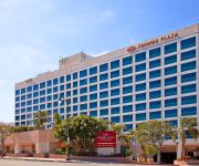
Crowne Plaza LOS ANGELES HARBOR HOTEL
DoubleTree by Hilton San Pedro - Port of Los Angeles
DoubleTree by Hilton Carson
VAGABOND INN SAN PEDRO
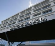
MIYAKO HYBRID HOTEL TORRANCE
La Bonita Inn
Crescent Inn
Motel 6 Carson
Pacific Inn & Suites
Eagle Inn Motel
Videos from this area
These are videos related to the place based on their proximity to this place.
O Holy Night - New Life Center Harbor City 12-23-12 service
Finally got a chance to sing O Holy Night at my church, New Life Center in Harbor City. A little funny towards the end with the lady talking to my brother while filming. Not too bad for an...
LAFD / Wharf Fire / San Pedro Fire Boats in Action! / Part 2 of 3 / Dawn-Morning
9-22-2014 It took Los Angeles Firefighters over 14 hours to control a blaze that ran the underside of a wharf at Berth 177 in San Pedro Harbor. All five Los Angeles Fireboats were utilized...
LAFD / Wharf Fire / San Pedro Fire Boats in Action! / Part 3 of 3 / Morning-Daytime
9-22-2014 It took Los Angeles Firefighters over 14 hours to control a blaze that ran the underside of a wharf at Berth 177 in San Pedro Harbor. All five Los Angeles Fireboats were utilized...
LAFD / Wharf Fire / San Pedro Fire Boats in Action! Part 1 of 3 / Night-Time
9-22-2014 It took Los Angeles Firefighters over 14 hours to control a blaze that ran the underside of a wharf at Berth 177 in San Pedro Harbor. All five Los Angeles Fireboats were utilized...
All in a Year’s Work: Construction of Dana Strand Video
The construction of Dana Strand Senior Apartments was completed in exactly one year. This time-lapse video shows all the of work it took to complete construction. Dana Strand Senior Apartments...
Round Lights in the LA Harbor Sky, Wilmington CA
"In Wilmington, CA unexplainable lights/objects appeared in the Sky as the sun was setting on Halloween night, 2001. The "lights" in the sky first appeared at sunset, and remained very visible...
Natural Hormone Replacement Therapy doctors Wilmington, CA 90744 Hormone treatment
Natural hormone replacement clinics Wilmington, CA 90744 Doctors who treat hormone imbalances naturally. Hormone Therapy clinics Wilmington, CA 90744, Harbor City, CA 90710, Long Beach, CA.
SUPARTZ Knee Pain Therapy Wilmington, CA 90744 Natural Knee Replacement Wilmington
Natural Knee Fluid Injections Wilmington, CA 90744 Supartz Knee Therapy Wilmington, CA 90744 Knee Pain Relief in Wilmington CA. Knee Pain Doctors Harbor City CA. For a FREE Consultation,...
Port Of Los Angeles High Girls Basketball vs. Harbor Teacher Prep (1-28-2015)
Port Of Los Angeles 45, Harbor Teacher Prep 40 @ Los Angeles Harbor College.
Videos provided by Youtube are under the copyright of their owners.
Attractions and noteworthy things
Distances are based on the centre of the city/town and sightseeing location. This list contains brief abstracts about monuments, holiday activities, national parcs, museums, organisations and more from the area as well as interesting facts about the region itself. Where available, you'll find the corresponding homepage. Otherwise the related wikipedia article.
Lomita, California
Lomita is a city in Los Angeles County, California, United States. The population was 20,256 at the 2010 census, up from 20,046 at the 2000 census. The word "lomita" is Spanish for "little knoll."
USS Iowa (BB-61)
USS Iowa (BB-61) was the lead ship of her class of battleship and the fourth in the United States Navy to be named in honor of the 29th state. Owing to the cancellation of the Montana-class battleships, Iowa is the last lead ship of any class of United States battleships and was the only ship of her class to have served in the Atlantic Ocean during World War II. During World War II, she carried President Franklin D.
Wilmington, Los Angeles
Wilmington is a district of Los Angeles, with industry as its primary economic activity. It is adjacent to the Port of Los Angeles, San Pedro, Harbor City, and the cities of Carson and Long Beach to the north and east, respectively. Wilmington is the site of Banning House and Drum Barracks, or Camp Drum, the only major American Civil War landmark in California.
Port of Los Angeles
The Port of Los Angeles, also called Los Angeles Harbor and WORLDPORT L. A, is a port complex that occupies 7,500 acres of land and water along 43 mi of waterfront. The port is located on San Pedro Bay in the San Pedro neighborhood of Los Angeles, approximately 20 mi south of downtown. The Port of Los Angeles adjoins the separate Port of Long Beach, employs over 16,000 people, and is the busiest container port in the United States.
Federal Correctional Institution, Terminal Island
The Federal Correctional Institution, Terminal Island (FCI Terminal Island) is a low-security United States federal prison for male inmates in California. It is operated by the Federal Bureau of Prisons, a division of the United States Department of Justice. FCI Terminal Island is located at the entrance to Los Angeles Harbor, between San Pedro and Long Beach.
Terminal Island
Terminal Island is an island located in Los Angeles County, California between the Port of Los Angeles and Long Beach Harbor. Major parts of the Port are on Terminal Island, as well as the Federal Correctional Institution, Terminal Island.
Long Beach Naval Shipyard
The Long Beach Naval Shipyard, which closed in 1997, was located at Terminal Island between the city of Long Beach and the San Pedro district of Los Angeles and approximately 23 miles south of the Los Angeles International Airport. The Long Beach NSY industrial area encompassed 119 acres of the total 214 acres owned. There were 120 permanent, 39 semi-permanent, and 6 temporary buildings, for a total of 165 buildings.
American Merchant Marine Veterans Memorial
The American Merchant Marine Veterans Memorial, located in San Pedro, California, was commissioned to honor merchant marine veterans from all wars. It consists of a black wall, similar to the Vietnam Memorial, listing the names of merchant seaman lost at sea during time of war, and a bronze statue. The statue, depicting one merchant seaman helping another climb a Jacob's ladder during a rescue at sea, was designed by Jasper D'Ambrosi of Wilmington, California.
Vincent Thomas Bridge
The Vincent Thomas Bridge is a 1,500-foot long suspension bridge, crossing the Los Angeles Harbor in the U.S. state of California, linking San Pedro, Los Angeles, with Terminal Island. The bridge is part of State Route 47. The bridge opened in 1963 and is named for California Assemblyman Vincent Thomas of San Pedro, who championed its construction. It is the fourth longest suspension bridge in California and the 76th longest span in the world.
Battle of Dominguez Rancho
The Battle of Dominguez Rancho or The Battle of the Old Woman's Gun (October 8–9, 1846) was a military engagement of the Mexican–American War. The battle took place within Manuel Dominguez's 75,000-acre Rancho San Pedro.
KFRN
KFRN 1280 AM is a non-commercial traditional Christian radio station licensed to Long Beach, California and serving the Los Angeles market, which runs programming from Family Radio. Its transmitter is located in Wilmington, California. The station first broadcast from the Jergins Trust Building in Long Beach in 1924 as KFON on 1290 kHz. It moved to 1240 kHz in 1927. The 1928 frequency reallocation resulted in a move to 1250 kHz.
Commodore Schuyler F. Heim Bridge
The Commodore Schuyler F. Heim Bridge is a vertical-lift bridge in the Port of Los Angeles. The bridge, dedicated on January 10, 1948, allows State Route 47 to cross over the Cerritos Channel. It is the largest vertical lift bridge on the West Coast. The deck of the bridge is an open grid to decrease weight and ease lifting of the bridge to allow ship traffic to pass underneath.
California Shipbuilding Corporation
California Shipbuilding Corporation built 467 Liberty and Victory ships during World War II, including Haskell-class attack transports. California Shipbuilding Corporation was often referred to as Calship. The Dictionary of American Naval Fighting Ships sometimes refers to this shipyard as California Shipbuilding Co. , but Co[mpany mpany] appears to be an error.
Los Angeles Maritime Museum
The Los Angeles Maritime Museum is a non-profit museum.
Pacific Coast Highway (bus station)
Pacific Coast Highway is a transitway station along the Harbor Freeway in Carson, California, located at its overcrossing with the Pacific Coast Highway in Los Angeles County. It is one of two that are outside of a dedicated transitway; however, the station has its own dedicated lane on the freeway. This station has a 244 space park and ride lot.
Henry Ford Bridge
The Henry Ford Bridge, also known as the Badger Avenue Bridge, carries the Pacific Harbor Line railroad across the Cerritos Channel to Terminal Island from San Pedro, to serve the Port of Los Angeles and Port of Long Beach. It is located in Los Angeles County, Southern California. The original 1924 bridge was replaced in 1996.
Rancho San Pedro
Rancho San Pedro was one of the first California land grants, and the first to win a patent from the United States. The land grant was validated by the Mexican government at 48,000 acres in 1828, and a United States patent validating 43,119 acres was issued in 1858.
The Red Hand Gang
The Red Hand Gang is an American live-action Saturday morning television series on NBC, first broadcast in 1977. The show featured five crime-solving pre-teens and their dog, who lived in the inner city. The group was so named because its members left red hand prints on fences to mark where they had been.
Mary Star of the Sea High School
Mary Star of the Sea High School is the only private, Roman Catholic high school in San Pedro which serves the Los Angeles Harbor and surrounding communities. The school is operated by Mary Star of the Sea Parish under the supervision of the Department of Catholic Schools of the Archdiocese of Los Angeles. The school focuses on the fundamentals of a quality education interwoven with strong Catholic principles.
National Register of Historic Places listings in Los Angeles, California
This is a list of National Register of Historic Places listings in Los Angeles, California. As documented in the table below, there are 213 places listed on the Register in the city of Los Angeles. Twenty-nine of these sites are historic districts which may include numerous buildings and other structures.
Harbor View House
Harbor View House, formerly the Army and Navy Y.M.C.A. , is a Los Angeles Historic-Cultural Monument (HCM #252) located in the San Pedro section of Los Angeles, California, near the Port of Los Angeles. It is a five-story Spanish Colonial Revival style structure located on a bluff overlooking the harbor.
Peck Park
Peck Park is a public park located in the San Pedro district of Los Angeles, California. The park's address is 560 Western Avenue, near the corner of Summerland Avenue. Peck Park is managed by the City of Los Angeles Department of Recreation and Parks. Facilities at the park include a swimming pool, a baseball diamond, indoor and outdoor basketball courts, extensive hiking trails, and a child care center. In 1997 the Peck Park gymnasium was designed by Koning Eizenberg Architecture, Inc..
Harbor City, Los Angeles
Harbor City is a community within Los Angeles, California, United States. As of the 2000 census, the community had a total population of 24,640. The ZIP Code which serves Harbor City Post is 90710.
Norwegian Seamen's Church, San Pedro
The Norwegian Seamen's Church (Norwegian: Den norske sjømannskirke) is a Norwegian Church Abroad that doubles as the Church of Sweden Los Angeles (Swedish: Svenska kyrkan Los Angeles), also known as the Swedish Seamen's Church. It is located in the San Pedro area of Los Angeles, California and is also part of the Church of Sweden Abroad . A print on the wall of the lounge area shows an architectural painting indicating Kemper Nomland as the architect.
Rolling Hills Preparatory School
Rolling Hills Preparatory School (RHP) is a private coeducational school in San Pedro, California. Founded in 1981, the school has approximately 236 students enrolled in grades 6 through 12. Approximately 26% of students receive some degree of financial aid. The Head of School is Peter McCormack. From 1981 to 1991, RHP classes were held at Rolling Hills Covenant Church. In 1992 RHP moved to larger facilities on the Malaga Cove School campus.


