Safety Score: 2,7 of 5.0 based on data from 9 authorites. Meaning we advice caution when travelling to United States.
Travel warnings are updated daily. Source: Travel Warning United States. Last Update: 2024-05-02 08:23:34
Touring Bartolo
Bartolo in Los Angeles County (California) is a town located in United States about 2,285 mi (or 3,678 km) west of Washington DC, the country's capital place.
Time in Bartolo is now 08:38 PM (Thursday). The local timezone is named America / Los Angeles with an UTC offset of -7 hours. We know of 9 airports nearby Bartolo, of which 4 are larger airports. The closest airport in United States is Long Beach /Daugherty Field/ Airport in a distance of 14 mi (or 23 km), South. Besides the airports, there are other travel options available (check left side).
Also, if you like the game of golf, there are several options within driving distance. We collected 10 points of interest near this location. Need some hints on where to stay? We compiled a list of available hotels close to the map centre further down the page.
Being here already, you might want to pay a visit to some of the following locations: Los Angeles, Orange, Santa Ana, Riverside and San Bernardino. To further explore this place, just scroll down and browse the available info.
Local weather forecast
Todays Local Weather Conditions & Forecast: 23°C / 74 °F
| Morning Temperature | 16°C / 61 °F |
| Evening Temperature | 22°C / 72 °F |
| Night Temperature | 18°C / 65 °F |
| Chance of rainfall | 0% |
| Air Humidity | 42% |
| Air Pressure | 1011 hPa |
| Wind Speed | Gentle Breeze with 9 km/h (5 mph) from North-East |
| Cloud Conditions | Clear sky, covering 0% of sky |
| General Conditions | Sky is clear |
Friday, 3rd of May 2024
21°C (70 °F)
16°C (62 °F)
Overcast clouds, moderate breeze.
Saturday, 4th of May 2024
17°C (63 °F)
16°C (60 °F)
Light rain, moderate breeze, broken clouds.
Sunday, 5th of May 2024
19°C (66 °F)
17°C (63 °F)
Sky is clear, moderate breeze, clear sky.
Hotels and Places to Stay
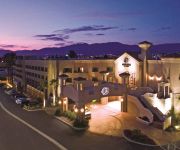
DoubleTree by Hilton Whittier Los Angeles
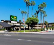
VAGABOND INN WHITTIER
DoubleTree by Hilton Los Angeles - Rosemead
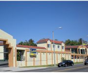
SCOTTISH INNS WHITTIER
Fairfield Inn & Suites Los Angeles Rosemead
ANGELS MOTEL-PICO RIVERA
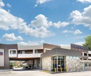
Best Whittier Inn
Good Nite Inn
Friendly Hills Inn
Palms Motel
Videos from this area
These are videos related to the place based on their proximity to this place.
SOLD Listing in Pico Rivera: 9612 Aldrich Street
http://www.delavara.com ~ The De La Vara Team has listed a fabulous 3 Bedroom/2 Bath home in Pico Rivera! This Immaculate Family Home features 1203 square fe...
Is Whittier Museum Haunted?
For years, residents of Uptown Whittier have whispered about supposed hauntings at the Whittier Museum. In this episode, The Ghost Detectives pay a visit to this marble-walled icon of Uptown...
5220 Pioneer Blvd. Whittier, CA 90601
Unique Hugh Comstock Custom Home – This TRUE Post-Adobe architectural dream was designed by Hugh W. Comstock, renowned builder of fairytale dream homes throughout Carmel-by-the-Sea!
Stuie's Brooklyn Bagel Bakery and Jewish Delicatessen - (562) 464-0200
Stuie's Brooklyn Bagel Bakery and Jewish Delicatessen 6545 Greenleaf Ave., Whittier, CA 90601 (562) 464-0200 Real Brooklyn bagels baked fresh dayly-New York Jewish Delicatessen,Hebrew ...
Recumbent Trike Ride to Legg Lake
Three trikes and a road bike take the San Gabriel River Trail North and turn off at the Whittier Narrows Recreation Area - Legg Lake to see the sights. Return trip down the Rio Hondo Creek...
Garage Door Repair West Whittier 1 (800) 801-3903 Garage Door Spring Repair Services
Garage Door Repair West Whittier - Any Type Of Garage Door Repair, Plus Garage Door Spring Repair Services (800) 801-3903 http://www.the-garage-door-guys.com/ Garage Door Repair - The ...
Kirk (Rookie of the Year) Downhill Mtn Biking
Kirk first time mountain bike riding. Here is a clip of Kirk coming down. His is a pro on my book. Location, Whittier, Hellman Wilderness Park near Turnbull Canyon.
Videos provided by Youtube are under the copyright of their owners.
Attractions and noteworthy things
Distances are based on the centre of the city/town and sightseeing location. This list contains brief abstracts about monuments, holiday activities, national parcs, museums, organisations and more from the area as well as interesting facts about the region itself. Where available, you'll find the corresponding homepage. Otherwise the related wikipedia article.
Rose Hills Memorial Park
Rose Hills Memorial Park is the largest cemetery in the United States and is located in Whittier, California. It is owned and operated by Service Corporation International.
Whittier Narrows Dam
Whittier Narrows Dam is 17 m (56 ft) tall earth dam on the San Gabriel River located, as its name implies, at the Whittier Narrows in Montebello, California. It provides water conservation storage and is also the central element of the Los Angeles County Drainage Area (LACDA) flood control system. Its reservoir has a capacity of 82,720,000 m . The Whittier Narrows are a natural gap in the hills that form the southern boundary of the San Gabriel Valley of Southern California.
Whittier Narrows
The Whittier Narrows is located at the southern boundary of the San Gabriel Valley, in Los Angeles County, California. It is a gap in the Puente Hills where the Rio Hondo and the San Gabriel River diverge. It is known as the epicenter of the October 1, 1987 Whittier Narrows earthquake, which measured 5.9 on the Richter Scale.
Pio Pico State Historic Park
Pío Pico State Historic Park is the site of El Ranchito, also known as the Pío Pico Adobe or Pío Pico Mansion, the final home of Pío Pico, the last Governor of Alta California under Mexican rule and a pivotal figure in early California history. Located in Whittier, California, at 6003 Pioneer Blvd. near Whittier Blvd. and Interstate 605, it is California Historical Landmark No. 127, listed as "Casa de Governor Pío Pico". Just west of the park is the San Gabriel River.
Rio Hondo College
Rio Hondo College is a community college located in the city of Whittier, California, United States, named after the Rio Hondo. Founded in 1960, it mainly serves the cities of Whittier, Pico Rivera, Santa Fe Springs, El Monte, and South El Monte. The college is accredited by Accrediting Commission for Community and Junior Colleges of the Western Association of Schools and Colleges. Aside from its academic programs, the college is also home to Rio Hondo Fire Academy and Rio Hondo Police Academy.
Katherine Edwards Middle School
Katherine Edwards Middle School is a middle school in Whittier, California. Edwards Middle School is located in the southwest unincorporated area of Whittier at 6812 S. Norwalk Blvd and is one of two middle schools in the Whittier City School District. The school has an enrollment of 1100 students and conducts grades 6-8.
Golden West Airlines Flight 261
Golden West Airlines, Flight 261, a De Havilland Twin Otter DHC-6, collided with a Cessna 150 (N11421), owned by CessnAir Aviation, Inc. , near Whittier, California. The accident occurred on January 9, 1975 at approximately 4:07 p.m. PST, while the Sun was just 9 degrees above the western horizon, directly into the eyes of the pilots of GW flight 261. Both aircraft were destroyed by the collision and subsequent ground impact.
Rancho Paso de Bartolo
Rancho Paso de Bartolo also called Rancho Paso de Bartolo Viejo was a 10,075-acre Mexican land grant in present day Los Angeles County, California given in 1835 by Governor Jose Figueroa to Juan Crispin Perez. The name refers to a San Gabriel River ford called Paso de Bartolo Viejo (Old Bartolo's Crossing). The rancho includes present day Montebello, Whittier, and Pico Rivera.


