Safety Score: 3,5 of 5.0 based on data from 9 authorites. Meaning please reconsider your need to travel to Turkey.
Travel warnings are updated daily. Source: Travel Warning Turkey. Last Update: 2024-04-27 08:23:39
Delve into Altınçağ
Altınçağ in Hatay is located in Turkey about 278 mi (or 448 km) south-east of Ankara, the country's capital town.
Current time in Altınçağ is now 10:21 PM (Saturday). The local timezone is named Europe / Istanbul with an UTC offset of 3 hours. We know of 8 airports close to Altınçağ, of which 4 are larger airports. The closest airport in Turkey is İskenderun Airport in a distance of 21 mi (or 33 km), South. Besides the airports, there are other travel options available (check left side).
There are two Unesco world heritage sites nearby. The closest heritage site is Ancient Villages of Northern Syria in Syria at a distance of 51 mi (or 82 km). If you need a hotel, we compiled a list of available hotels close to the map centre further down the page.
While being here, you might want to pay a visit to some of the following locations: Dortyol, Erzin, Yakacik, Osmaniye and Toprakkale. To further explore this place, just scroll down and browse the available info.
Local weather forecast
Todays Local Weather Conditions & Forecast: 31°C / 87 °F
| Morning Temperature | 24°C / 75 °F |
| Evening Temperature | 22°C / 71 °F |
| Night Temperature | 21°C / 70 °F |
| Chance of rainfall | 1% |
| Air Humidity | 40% |
| Air Pressure | 1010 hPa |
| Wind Speed | Gentle Breeze with 7 km/h (4 mph) from North-East |
| Cloud Conditions | Overcast clouds, covering 99% of sky |
| General Conditions | Light rain |
Sunday, 28th of April 2024
25°C (77 °F)
20°C (68 °F)
Overcast clouds, light breeze.
Monday, 29th of April 2024
26°C (79 °F)
21°C (71 °F)
Moderate rain, gentle breeze, overcast clouds.
Tuesday, 30th of April 2024
22°C (72 °F)
23°C (74 °F)
Light rain, gentle breeze, overcast clouds.
Hotels and Places to Stay
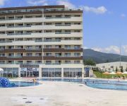
Fourway Hotel & Spa
HOTEL ISOS TERMAL ERZIN
Videos from this area
These are videos related to the place based on their proximity to this place.
Erzin Belediyespor 2 - Van Büyükşehir Belediyespor 0
Stadyum :İskenderun 5 Temmuz Hakemler : Hidayet Yasir Çimen, Özgür Sezgin ,Demircan Şerbetçi.
3. Uluslararası Erzin Narenciye Kültür ve Sanat Festivali - Kortej Yürüyüşü
3. Uluslararası Erzin Narenciye Kültür ve Sanat Festivali - Kortej Yürüyüşü.
Erzin - 23 Nisan 2012-Ulusal Egemenlik ve Çocuk Bayramı
23 Nisan Ulusal Egemenlik ve Çocuk Bayramı 92. Yıldönümü.
Videos provided by Youtube are under the copyright of their owners.
Attractions and noteworthy things
Distances are based on the centre of the city/town and sightseeing location. This list contains brief abstracts about monuments, holiday activities, national parcs, museums, organisations and more from the area as well as interesting facts about the region itself. Where available, you'll find the corresponding homepage. Otherwise the related wikipedia article.
Battle of Issus
The Battle of Issus occurred in southern Anatolia, in November 333 BC. The invading Macedonian troops, led by Alexander the Great, defeated an army led by Darius III of Achaemenid Persia in the second great battle of Alexander's conquest of Asia. After the Macedonians soundly defeated the Persian satraps of Asia Minor (led by the Greek mercenary, Memnon of Rhodes) at the Battle of the Granicus, Darius took personal command of his army.
Kuzuculu
Kuzuculu is a town in Dörtyol district of Hatay Province, Turkey. It is almost merged to Dörtyol to the south at {{#invoke:Coordinates|coord}}{{#coordinates:36|53|N|36|14|E||| | |name= }}. The population is 11300. The town was founded about five centuries ago by an Ottoman pasha named Emir Ali who built a watermill on the creek just at the south of the settlement. The first settlers were from Central Anatolia.
Yeşilköy, Hatay
Yeşilköy is a town in Dörtyol district of Hatay Province, Turkey. It is situated between Nur Mountains and the Mediterranean Sea coast at {{#invoke:Coordinates|coord}}{{#coordinates:36|52|N|36|12|E||| | |name= }}. Turkish state highway D.817 is to the west, Çukurova Motorway is to the east and Dörtyol is to the south of the town. Yeşilköy is almost merged to Dörtyol. The distance to Antakya (center of the province) is 90 kilometres . The population of Yeşilköy is 10532.


