Safety Score: 3,0 of 5.0 based on data from 9 authorites. Meaning we advice caution when travelling to New Zealand.
Travel warnings are updated daily. Source: Travel Warning New Zealand. Last Update: 2024-05-18 08:26:29
Explore Forrest Hill
The district Forrest Hill of Unsworth Heights in Auckland (Auckland) is located in New Zealand about 313 mi north of Wellington, the country's capital.
If you need a place to sleep, we compiled a list of available hotels close to the map centre further down the page.
Depending on your travel schedule, you might want to pay a visit to some of the following locations: Auckland, Whangarei, Hamilton, Tauranga and Rotorua. To further explore this place, just scroll down and browse the available info.
Local weather forecast
Todays Local Weather Conditions & Forecast: 15°C / 58 °F
| Morning Temperature | 8°C / 47 °F |
| Evening Temperature | 12°C / 54 °F |
| Night Temperature | 12°C / 54 °F |
| Chance of rainfall | 0% |
| Air Humidity | 58% |
| Air Pressure | 1019 hPa |
| Wind Speed | Light breeze with 4 km/h (3 mph) from West |
| Cloud Conditions | Clear sky, covering 5% of sky |
| General Conditions | Sky is clear |
Monday, 20th of May 2024
16°C (60 °F)
13°C (56 °F)
Moderate rain, gentle breeze, overcast clouds.
Tuesday, 21st of May 2024
16°C (61 °F)
13°C (56 °F)
Moderate rain, moderate breeze, overcast clouds.
Wednesday, 22nd of May 2024
14°C (57 °F)
12°C (54 °F)
Overcast clouds, gentle breeze.
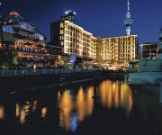
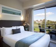
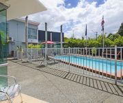
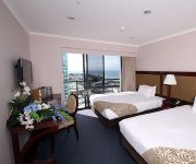
Hotels and Places to Stay
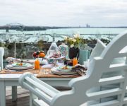
Peace and Plenty Inn
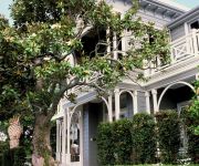
St Marys Residence Private Luxury
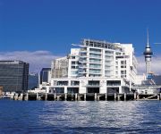
Hilton Auckland
Mollies Boutique Hotel
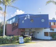
City of Sails Motel
The Esplanade Hotel
The Sebel Auckland Viaduct Harbour
VR Takapuna
Aristotles North Shore
THE SPENCER ON BYRON HOTEL
Videos from this area
These are videos related to the place based on their proximity to this place.
Mechanic North Shore Auckland
http://spargsautotune.co.nz Mechanic North Shore Auckland Call 09-442 1091 We are your Mechanic in North Shore Auckland. Call Us Today at 09-442 1091 or Visit: Sparg's Auto Tune #D 62 Porana...
Pre Purchase Vehicle Inspection North Shore
https://www.youtube.com/watch?v=YiOLJaC2fec Pre Purchase Vehicle Inspection North Shore Auckland Call 09-442 1091 Or Visit: Sparg's Auto Tune #D 62 Porana Road Wairau Valley, Auckland ...
Auto Service Garage North Shore. 09 442 1091
Auto Service Garage North Shore www.spargsautotune.co.nz, We are Auto Service Garage in North Shore Auckland. Call Us Today at 09 442 1091 or Visit: Sparg's Auto Tune #D, 62 Porana Rd Wairau ...
Warrant of fitness North Shore
http://spargsautotune.co.nz Warrant of Fitness North Shore, Sparg's Auto Tune are warrant of fitness and servicing experts in North Shore, call us on 09 442 1091 Sparg's Auto Tune #D, 62...
Auto Service North Shore Auckland 09 442 1091
http://spargsautotune.co.nz Auto Service North Shore Auckland Call 09-442 1091 We are your Auto Service in North Shore Auckland. Call Us Today at 09-442 1091...
WOF, Warrant of Fitness North Shore, Auckland,09 442 1091
http://spargsautotune.co.nz WOF Warrant Of Fitness North Shore Auckland Call 09-442 1091 We are your WOF Warrant Of Fitness in North Shore Auckland. Call Us Today at 09-442 1091 or Visit:...
PineRidge Stream Restoration North Shore City
PineRidge Stream Restoration North Shore City Council Auckland New Zealand.
North Shore Mechanics
http://spargsautotune.co.nz/ We are your Mechanics in North Shore Auckland. Call Us Today at 09 442 1091 or Visit: Sparg's Auto Tune #D, 62 Porana Rd Wairau ...
Auto Service Garage North Shore Auckland Call 09 442 1091
www.spargsautotune.co.nz, We are Auto Service Garage in North Shore Auckland. Call Us Today at 09 442 1091 or Visit: Sparg's Auto Tune #D, 62 Porana Rd Wairau Valley Auckland 0627 09-442...
Car Servicing North Shore Auckland 09 442 1091
Car Service North Shore Auckland Call 09-442 1091 http://spargsautotune.co.nz We are your Car Service in North Shore Auckland. Call Us Today at 09-442 1091 o...
Videos provided by Youtube are under the copyright of their owners.
Attractions and noteworthy things
Distances are based on the centre of the city/town and sightseeing location. This list contains brief abstracts about monuments, holiday activities, national parcs, museums, organisations and more from the area as well as interesting facts about the region itself. Where available, you'll find the corresponding homepage. Otherwise the related wikipedia article.
Glenfield, New Zealand
Glenfield (Formerly Mayfield) is a suburb of North Shore, one of several cities in the Auckland metropolitan area in northern New Zealand. It is located to the north of the Waitemata Harbour, nine kilometres northwest of the Auckland city centre. The suburb is located in the northern inland part of North Shore city, and is surrounded by the suburbs of Marlborough, Sunnynook, Forrest Hill, Birkenhead, Northcote and is situated close to Takapuna.
Rangitoto College
Rangitoto College is a state coeducational secondary school, located on the North Shore of Auckland, New Zealand. Serving Years 9 to 13, Rangitoto has a school roll of 2949 as of July 2012, making it the largest "brick-and-mortar" school in New Zealand (only The Correspondence School has more enrolled students).
Milford, New Zealand
Milford is a suburb of Auckland, New Zealand's largest city. Located on Auckland's North Shore and part of North Shore City, Milford is located on the northern side of Lake Pupuke. It also has a popular swimming beach, which runs some two kilometers from Black Rock in the south to Castor Bay in the north. The Wairau Creek empties into the Hauraki Gulf at the northern end of Milford Beach, and its lower tidal reaches host the Milford Marina.
Westlake Boys High School
Westlake Boys High School is a state secondary school for boys located in Forrest Hill, Auckland, New Zealand. The school caters for Form 3 (Year 9) to Form 7 (Year 13). In February 2012, Westlake Boys High School had over 2300 students, making it one of New Zealand's largest schools for boys in terms of student numbers. Its sister school, Westlake Girls High School, is nearby.
Mairangi Bay
Mairangi Bay is a suburb in North Shore City in New Zealand, across the Waitemata Harbour from Auckland. Mairangi Bay is under the local governance of the North Shore City Council. The population was 5,277 in the 2006 Census, an increase of 501 from 2001. The Bay's beach itself has, along with adjacent Murrays and Campbells Bays, undergone civil works projects since 2004 to improve stormwater management.
Forrest Hill, New Zealand
Forrest Hill is a suburb of Auckland. Forrest Hill was under the local governance of the North Shore City Council, which amalgamated into Auckland Council on 1 November 2010. The population was 5,283 in the 2006 Census, an increase of 372 from 2001.
Hillcrest, Auckland
Hillcrest, Auckland for the suburb of Hamilton, New Zealand, see Hillcrest, Waikato. HillcrestBasic informationLocal authority North Shore CityPopulation 2,943 FacilitiesSurroundsNorth Wairau ValleyNortheast WestlakeEast TakapunaSoutheast AkorangaSouth Northcote CentralSouthwest Northcote WestWest Windy RidgeNorthwest Marlboroughvte Hillcrest is a suburb of North Shore City, one of several cities in the Auckland metropolitan area in northern New Zealand.
Marlborough, Auckland
Marlborough is a suburb of North Shore City, one of the four cities comprising New Zealand's Auckland urban area. It lies eight kilometres to the northwest of the Auckland CBD between the suburbs of Hillcrest and Glenfield. In 2013 this suburb comprised part of the Northcote electorate and is represented by the Member of Parliament Jonathan Coleman, of the National Party.
Carmel College (New Zealand)
Carmel College is a Catholic secondary school for girls located in Milford on Auckland's North Shore. It was established by the Sisters of Mercy in 1957 starting with a student roll of only fifteen girls.
Castor Bay
Castor Bay is a bay and suburb of Auckland in the North Island of New Zealand. Located between Milford and Campbells Bay it forms part of Auckland's East Coast Bays. To the east lies the islands of Rangitoto and Motutapu which are easily visible from land. The suburb is in the North Shore ward, one of the thirteen administrative divisions of Auckland City. The population was 2,877 in the 2006 Census, an increase of 93 from 2001.
North Shore Events Centre
North Shore Events Centre is an indoor arena, located in Auckland, New Zealand. The arena opened in 1992 and has a seated capacity of 4,114 plus standing room for about 300 giving a capacity of 4,400. The Centre primarily hosts basketball games and is the home arena of the New Zealand Breakers who play in the Australasian NBL. It also hosts concerts and netball. In 2009 the Centre hosted the final of the FIBA Under-19 World Championship. The final saw the United States defeat Greece 88-80.
Westlake Girls High School
Westlake Girls High School is a state single-sex girls secondary school, located on the North Shore of Auckland, New Zealand. The school in the suburb of Takapuna, west of Lake Pupuke and adjacent to North Shore Hospital, the Auckland Northern Motorway, and the Northern Busway's Smales Farm station.
Westfield Glenfield
Westfield Glenfield is a shopping centre in Glenfield, part of North Shore City, in Auckland. Opened in 1971, it is situated on the corner of Glenfield Road and Downing Street. The mall was bought by Westfield Group in 1996. In 2000, a major renovation was concluded by Westfield, which cost $100 million. The centre features 132 stores, including the major stores Farmers, The Warehouse, Foodtown and Countdown.
Murrays Bay
Murrays Bay is a small suburb in Auckland's East Coast Bays region. The suburb is roughly the same size as Rothesay Bay, the suburb to the immediate north. It is primarily a residential area but does have a community centre, restaurant and takeaway. Murrays Bay is regularly serviced by buses which go to Takapuna and Auckland City. The population was 4,581 in the 2006 Census, an increase of 303 from 2001.
Sunnynook, New Zealand
Sunnynook is a suburb of North Shore, one of several cities in the Auckland metropolitan area in northern New Zealand, and is under the local governance of the North Shore City Council. The suburb is centered around the Sunnynook Shopping Center and the nearby Sunnynook Park. Sunnynook also has a skateboard bowl located in Sunnynook Park, which is also home to the Glenfield Greyhounds rugby league club. There is also the new Sunnynook bus station.
North Shore Hospital
For North Shore LIJ Hospital on Long Island, see North Shore LIJ Health System North Shore Hospital File:North Shore Hospital across Lake Pupuke. jpgView of North Shore Hospital across the adjacent Lake Pupuke. GeographyLocation North Shore City, Auckland Region, New ZealandOrganisationCare system Waitemata District Health BoardHospital type Teaching, SpecialistServicesEmergency department YesBeds 300+HistoryFounded 1958 as a maternity hospital, 1984 as tertiary hospitalLinksWebsite http://www.
Southern Cross Hospital North Harbour
Southern Cross Hospital North Harbour is the only private surgical in-patient hospital in North Shore City, New Zealand. It is run by Southern Cross Hospitals Limited, part of the Southern Cross Healthcare Group, and was established in 1991. The facility has 67 beds and four operating theatres, with around 5,000 operations undertaken annually.
Westlake, New Zealand
Westlake is a suburb of North Shore City, one of the four cities comprising New Zealand's Auckland urban area. It lies eight kilometres to the northwest of the Auckland CBD between the major suburbs of Milford and Glenfield. The name arises from its position on the western shoreline of Lake Pupuke. Within Westlake are three secondary schools, Westlake Boys High School, Westlake Girls High School and Carmel College, and also North Shore Hospital.
Glenfield North
Glenfield North is a suburb of North Shore, one of several cities in the Auckland metropolitan area in northern New Zealand. The Auckland Northern Motorway passes to the east of the suburb, and Wairau Road (Route 26) separates it from Central Glenfield to the south. The Wairau Park Shopping Complex runs along Link Drive to the south-east. The population of Glenfield North was 4,050 in the 2006 Census, an increase of 165 from 2001.
Campbells Bay
Campbells Bay is a suburb in Auckland City in New Zealand. The suburb is under the local governance of the Auckland Council. The population was 2,316 in the 2006 Census, an increase of 111 from 2001. The suburb is in the 'North Shore ward, one of the thirteen administrative divisions of the city of Auckland. The Bay's beach itself has, along with adjacent Murrays and Mairangi Bays, undergone civil works projects since 2004 to improve stormwater management.
Unsworth Heights
Unsworth Heights is a suburb of North Shore, one of several cities in the Auckland metropolitan area in northern New Zealand. New Zealand State Highway 18 (Upper Harbour Highway) passes to the north of the suburb, and the Albany Highway to the south. The two routes intersect just to the west of Unsworth Heights. Unsworth Reserve is to the east. The population of the Unsworth Heights statistical area was 5,169 in the 2006 Census, an increase of 549 from 2001.
Wairau Valley, Auckland
Wairau Valley is a suburb of North Shore, one of several cities in the Auckland metropolitan area in northern New Zealand. The area is predominantly light industrial/commercial. New Zealand State Highway 1 passes to the east, and the Wairau Park shopping complex extends to the north. Wairau Valley is part of the Glenfield North census area.
Windsor Park, New Zealand
Windsor Park is a suburb of North Shore, one of several cities in the Auckland metropolitan area in northern New Zealand. Windsor Park is part of the Pinehill census area.
Smales Farm Busway Station
Smales Farm Station is a bus station in Westlake, New Zealand, part of the Auckland Northern Busway. It is adjacent to the Smales Farm Office Park which houses Sovereign, Air New Zealand & Telstra Clear as well as others. The station provides shelters, real time information on bus services and passenger drop off and pick up Smales Farm Busway Station was opened on the 2 February 2008. It is the 2nd closest station to the Britomart Transport Centre.
Sunnynook Busway Station
Sunnynook Busway Station is a bus station in Sunnynook, New Zealand, part of the Auckland Northern Busway. Sunnynook is the smallest station on the Northern Busway. The station provides shelters, real time information on bus services and passenger drop off and pick up


