Safety Score: 3,3 of 5.0 based on data from 9 authorites. Meaning please reconsider your need to travel to Netherlands.
Travel warnings are updated daily. Source: Travel Warning Netherlands. Last Update: 2024-05-18 08:26:29
Explore Hoge Land
The district Hoge Land of Epe in Gemeente Epe (Provincie Gelderland) is located in Netherlands about 46 mi east of Amsterdam, the country's capital.
If you need a place to sleep, we compiled a list of available hotels close to the map centre further down the page.
Depending on your travel schedule, you might want to pay a visit to some of the following locations: Zwolle, Arnhem, Wolvega, Lelystad and Kranenburg. To further explore this place, just scroll down and browse the available info.
Local weather forecast
Todays Local Weather Conditions & Forecast: 21°C / 70 °F
| Morning Temperature | 14°C / 57 °F |
| Evening Temperature | 20°C / 68 °F |
| Night Temperature | 14°C / 57 °F |
| Chance of rainfall | 3% |
| Air Humidity | 56% |
| Air Pressure | 1011 hPa |
| Wind Speed | Gentle Breeze with 8 km/h (5 mph) from South |
| Cloud Conditions | Scattered clouds, covering 32% of sky |
| General Conditions | Light rain |
Sunday, 19th of May 2024
19°C (67 °F)
12°C (54 °F)
Moderate rain, moderate breeze, scattered clouds.
Monday, 20th of May 2024
17°C (62 °F)
14°C (57 °F)
Moderate rain, gentle breeze, overcast clouds.
Tuesday, 21st of May 2024
23°C (73 °F)
18°C (64 °F)
Moderate rain, gentle breeze, overcast clouds.
Hotels and Places to Stay
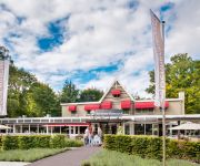
Dennenheuvel
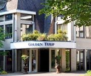
Fletcher Hotel Restaurant Epe-Zwolle
De Witte Berken
Videos from this area
These are videos related to the place based on their proximity to this place.
Sportdag gemeente Epe 3, 5 en 6 Juni 2014 - Buurtsportcoaches gemeente Epe
Succesvolle rentree sportdag Epe en Vaassen Bijna 700 leerlingen kwamen in actie tijdens de sportdag in Epe en Vaassen. Op 3, 5 en 6 juni maakten ze kennis met bekende en minder bekende ...
WAUW: Wethouder Scholten, gemeente Epe, opent nieuwe basketbalvelden pwa hal epe
Op zaterdag 6 September 2014 opende wethouder sportzaken dhr. Scholten 2 nieuwe baskalvelden in de pwa hal te Epe. BASE kan komende seizoen voor het eerst wedstrijden spelen in Epe. Er zal...
Intocht Sinterklaas 2012 Epe
Intocht Sinterklaas in Epe Ruim honderd zwarte pieten begeleiden Sinterklaas bij de inkomst in het dorp Epe.
The Battle voor water (Epe, 14-9-2014)
Met zo'n 45 bikers, de Battle voor water gefietst door de Kroondomeinen. De opbrengst van deze rit was voor het goede doel, zie http://kenyakinderen.nl/epefietstvoorwater De kwaliteit van...
sv Epe 38e Marc Overmars Internationaal Paastoernooi 2014
Ik heb deze video gemaakt met de YouTube-functie voor het maken van diavoorstellingen (http://www.youtube.com/upload)
NEERLANDSCH HOP BEZOEKT HET OOGSTEN VAN DE HOP IN EPE
Op initiatief van Bierevents, heeft Epe na ruim 200 jaar weer een hopveld. Een stuk cultuurhistorie van Epe is hiermee weer tot leven gebracht. In 1700 was Epe, samen met Peize en Schijndel,...
Bertie Verplak @ Live : De Baron Epe, 26-04-2014
Bertie Verplak Live - De Baron, Hoofdstraat 91 te Epe. Voor meer info : www.bertieverplak.com.
SV Epe tegen Oranje 2000, goal from Pierre van Hooijdonk
SV Epe tegen Oranje 2000 (2-4), Pierre van Hooijdonk kan het nog steeds.
Videos provided by Youtube are under the copyright of their owners.
Attractions and noteworthy things
Distances are based on the centre of the city/town and sightseeing location. This list contains brief abstracts about monuments, holiday activities, national parcs, museums, organisations and more from the area as well as interesting facts about the region itself. Where available, you'll find the corresponding homepage. Otherwise the related wikipedia article.
Epe
Epe is a municipality and a town in the eastern Netherlands. The town has 15,593 (01-01-2007) inhabitants, whilst the municipality as a whole has a population of 32,989. The town hall stands in Epe, which is situated about 16 km north of Apeldoorn and 21 km south of Zwolle. Another important town within the municipality is Vaassen (12,739 inhabitants), halfway between Epe and Apeldoorn. It has an interesting castle called 'De Cannenburgh', which is open to visitors (guided tour compulsory).
Hattem
' is a municipality and a city in the eastern Netherlands. The city population is 11,797. (1 jan. 2010) The municipality includes the hamlet of 't Zand.
Heerde
' is a municipality and a town in the eastern Netherlands. Compared to the rest of the Netherlands, Heerde is fairly religious, as are many of the towns and cities in the Veluwe region. The following political parties are currently (August 2009) in the city council: CDA (5 seats), PvdA (5 seats), SGP (3 seats), VVD (2 seats) and the Municipal Farmers Party (2 seats). The municipality has five amateur soccer clubs: vv Heerde, SEH, WZC Wapenveld, vv Wapenveld and Vevo.
Oldebroek
' is a municipality and a town in the eastern Netherlands and it has roughly 6000 inhabitants.
Het Loo Palace
Het Loo Palace (meaning "The Woods Palace") is a palace in Apeldoorn, Netherlands. The symmetrical Dutch Baroque building was designed by Jacob Roman and Johan van Swieten and was built between 1684 and 1686 for stadtholder-king William III and Mary II of England. The garden was designed by Claude Desgotz. The palace was a residence of the House of Orange-Nassau from the 17th century until the death of Queen Wilhelmina in 1962. The building was renovated between 1976 and 1982.
Wezep
Wezep is a town in the Dutch province of Gelderland and it has about 12.000 inhabitants. It is located in the municipality of Oldebroek. Wezep has a railway station and a Municipal Website.
Olst
Olst is a village in the Dutch province of Overijssel, about 7 km north of Deventer. It is located in the municipality of Olst-Wijhe, Until 2002, Olst was the seat of the municipality of the same name. The municipality was merged with that of Wijhe in 2001, keeping the name of the largest constituent part (Olst), until it was renamed Olst-Wijhe a year later.
Zuuk
Zuuk is a hamlet in the Netherlands, south of Zwolle, in the province of Gelderland in the municipality of Epe.
't Harde
't Harde is a village in the Dutch province of Gelderland about 6 km southeast of Elburg, on the edge of the Veluwe forest. It has a train station with connections to Zwolle and Amersfoort. The village's population is approximately 6000 people.
Emst
Emst is a town of 3,000 inhabitants, located in the municipality of Epe in the province of Gelderland in the Netherlands. It is the birthplace of soccer player Marc Overmars. Emst is located in the forest area of Veluwe. More info:
Wapenveld
Wapenveld is a town in Gelderland, The Netherlands, part of the Heerde municipality. It is situated about 10 km from Zwolle. The village (about 6000 inhabitants), is beautifully situated, where the valley of the river IJssel meets the woods of the Veluwe. The Apeldoornse kanaal, which once was used by ships to shortcut the IJssel, runs right through it. The people of Wapenveld earn their living from agriculture (cattle) and industry (AKZO Nobel; and till 2008 Berghuizer paper factory).
Wissel
Wissel is also the German name of Saint Vicelinus. Wissel is a hamlet in the Dutch province of Gelderland. It is located in the municipality of Epe, about 2 km west of the town of Epe.
Teuge
Teuge is a village in the Dutch province of Gelderland. It is best known for its small airport, Teuge International Airport. Population: 800. Recreation and tourism are key. Its main access road is the N344. Teuge is part of the municipality of Voorst.
Nijbroek
Nijbroek is a village in the Dutch province of Gelderland. It is located in the municipality of Voorst, about 12 km northeast of Apeldoorn. Nijbroek was a separate municipality until 1818, when it was merged with Voorst.
Oosterwolde, Gelderland
Oosterwolde is a village in the Dutch province of Gelderland. It is located in the municipality of Oldebroek, about 15 km southwest of Zwolle. Oosterwolde was a separate municipality until 1818, when it was merged with Doornspijk.
Vaassen
Vaassen is one of four villages in the Dutch municipality Epe. Vaassen is situated between Apeldoorn and Zwolle, on the eastern edge of the Veluwe in the province of Gelderland and has 12,719 inhabitants (2008). Vaassen was an independent municipality up to 1 January 1818, when it merged with Epe.
Veessen
Veessen is a village in the Dutch province of Gelderland. It is located in the municipality of Heerde. Veessen was a separate municipality between 1812 and 1818, when it was merged with Heerde.
Zuideinde, Overijssel
Zuideinde is a hamlet in the Dutch province of Overijssel. It is located in the municipality of Kampen, about 8 km south of that city.
Jonas, Netherlands
Jonas (sometimes "De Jonas") is a hamlet in the Dutch province of Gelderland. It lies east of the village of Vaassen, on the western side of the Apeldoornsch Kanaal. Jonas lies on the border of the municipalities Epe and Apeldoorn.
Apeldoorn railway station
Apeldoorn is a railway station, located in the municipality of Apeldoorn, the Netherlands. The station was opened on 15 May 1876, on the Amsterdam–Zutphen railway (Oosterspoorweg). It was opened when the Amersfoort to Zutphen section was completed. Journey time to Amsterdam is about 1 hour 10 minutes
Apeldoorn Osseveld railway station
Apeldoorn Osseveld is a railway station located in Apeldoorn, the Netherlands. The station was opened on 10 December 2006 and is located on the Apeldoorn–Deventer railway. The services is operated by Nederlandse Spoorwegen.
2009 attack on the Dutch Royal Family
The 2009 attack on the Dutch Royal Family occurred on 30 April at Apeldoorn, Netherlands, when a man drove his car at high speed into a parade which included Queen Beatrix, Prince Willem-Alexander and other members of the Royal Family. The occasion of the attack was the Dutch national holiday of Koninginnedag (or Queen's Day). The vehicle drove through people lining the street watching the parade, resulting in eight deaths and ten injuries.
Wittenborg University
Wittenborg University is an international University of Applied Sciences.
Omnisport Apeldoorn
The Omnisport Apeldoorn is a velodrome and multisport indoor arena in Apeldoorn, the Netherlands. Designed by FaulknerBrowns Architects the facility opened in 2008, it is divided into two halls: a cycling hall containing 250 m cycling track and 200 m athletics track and a volleyball hall. The cycling hall has a capacity for 5000 spectators while the volleyball hall has a capacity for 2000 spectators.
De Leest
De Leest is a restaurant located in Vaassen in the Netherlands. It is a fine dining restaurant that was awarded one Michelin star in the period 2003-2006 and two Michelin stars in the period 2007–present. GaultMillau awarded the restaurant 19.0 out of 20 points. De Leest is a member of Les Patrons Cuisiniers.


