Safety Score: 3,3 of 5.0 based on data from 9 authorites. Meaning please reconsider your need to travel to Netherlands.
Travel warnings are updated daily. Source: Travel Warning Netherlands. Last Update: 2024-05-15 08:00:47
Explore Alteveer
Alteveer in Gemeente Noordenveld (Provincie Drenthe) is a city in Netherlands about 82 mi (or 132 km) north-east of Amsterdam, the country's capital.
Local time in Alteveer is now 01:08 AM (Thursday). The local timezone is named Europe / Amsterdam with an UTC offset of 2 hours. We know of 13 airports in the vicinity of Alteveer, of which 5 are larger airports. The closest airport in Netherlands is Eelde Airport in a distance of 6 mi (or 10 km), East. Besides the airports, there are other travel options available (check left side).
There are several Unesco world heritage sites nearby. The closest heritage site in Netherlands is Ir.D.F. Woudagemaal (D.F. Wouda Steam Pumping Station) in a distance of 36 mi (or 59 km), South-West. We found 2 points of interest in the vicinity of this place. If you need a place to sleep, we compiled a list of available hotels close to the map centre further down the page.
Depending on your travel schedule, you might want to pay a visit to some of the following locations: Groningen, Assen, Kollum, Drachten and Schiermonnikoog. To further explore this place, just scroll down and browse the available info.
Local weather forecast
Todays Local Weather Conditions & Forecast: 23°C / 73 °F
| Morning Temperature | 14°C / 56 °F |
| Evening Temperature | 23°C / 73 °F |
| Night Temperature | 15°C / 60 °F |
| Chance of rainfall | 0% |
| Air Humidity | 45% |
| Air Pressure | 1006 hPa |
| Wind Speed | Moderate breeze with 11 km/h (7 mph) from North-West |
| Cloud Conditions | Clear sky, covering 6% of sky |
| General Conditions | Light rain |
Thursday, 16th of May 2024
20°C (68 °F)
14°C (57 °F)
Moderate rain, fresh breeze, few clouds.
Friday, 17th of May 2024
18°C (64 °F)
15°C (59 °F)
Light rain, gentle breeze, overcast clouds.
Saturday, 18th of May 2024
20°C (68 °F)
12°C (53 °F)
Light rain, gentle breeze, broken clouds.
Hotels and Places to Stay
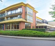
Fletcher Langewold Hotel - Restaurant
Van der Valk Hotel Groningen-Hoogkerk
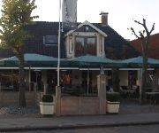
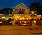
Onder de Linden
Het wapen van Drenthe
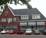
Hotel Norg
Bitter&Zoet
Videos from this area
These are videos related to the place based on their proximity to this place.
ATB Leek Roden Norg
Samen met David rondje Leek , Roden Leek gereden op ATB door de bossen, afstand 46.3 km.
Famke op de wedstrijd in Opende
Famke tijdens de trainingsrondes van de grasbaanrace in Opende op 20 juni 2008.
Doorkomst Dwars door Drenthe 2015
Complete doorkomst van de Energiewacht Dwars door Drenthe in Roderesch. http://wielerparcoursen.123website.nl/
Kinderweekend 2014
Kinderweekend 2014 De Zwerfsteen - Beneluxhuis, Rodenesch vrijdag 6 juni t/m maandag 9 juni 2014.
Discotheek Klaas Pruim Roden Deel 8
Dj Koeke elke zondagavond in de jaren 90 in Discotheek Klaas Pruim Roden.
Discotheek Klaas Pruim Roden Deel 3
Dj Koeke elke zondagavond in de jaren 90 in Discotheek Klaas Pruim Roden.
Incomparables Koningsdag 2014 II
Palestra Wellnesscentre Roden Streetdance Incomparable optreden Koningsdag 2014.
Videos provided by Youtube are under the copyright of their owners.
Attractions and noteworthy things
Distances are based on the centre of the city/town and sightseeing location. This list contains brief abstracts about monuments, holiday activities, national parcs, museums, organisations and more from the area as well as interesting facts about the region itself. Where available, you'll find the corresponding homepage. Otherwise the related wikipedia article.
Roden, Drenthe
Roden is a town in the Dutch province of Drenthe. It is located in the municipality of Noordenveld, about 16 (10 miles) km southeast of Groningen. Roden has 15.000 citizens. Roden was a separate municipality until 1998, before it merged into the municipality of Noordenveld, during the last municipal reorganisations.
Alteveer, Noordenveld
Alteveer is a village in the Netherlands and it is part of the Noordenveld municipality in Drenthe. Alteveer has an altitude of 3 meters (13 feet).
Foxwolde
Foxwolde is a village in the Netherlands and it is part of the Noordenveld municipality in Drenthe. Foxwolde has an altitude of about 1 meter.
Huis ter Heide, Drenthe
Huis ter Heide is a hamlet in the Netherlands and it is part of the Noordenveld municipality in Drenthe. Its population was 124 in 2006.
Leutingewolde
Leutingewolde is a village in the Netherlands and it is part of the Noordenveld municipality in Drenthe. Leutingewolde has an altitude of about 1 meter.
Lieveren
Lieveren is a village in the Netherlands and it is part of the Noordenveld municipality in Drenthe. Lieveren has an altitude of about 4 meters.
Roderesch
Roderesch is a village in the Netherlands, and it is part of the Noordenveld municipality in Drenthe. Roderesch has an altitude of about 3 meters. The word Esch is an old Dutch word for Es, a (farm) field on higher ground.
Steenbergen, Noordenveld
Steenbergen [ˈsteːmbɛrɣə(n) ˈsteːmbɛrɣə(n)] is a village in the Netherlands and it is part of the Noordenveld municipality in Drenthe. Steenbergen has an altitude of about 3 meters.


