Safety Score: 3,6 of 5.0 based on data from 9 authorites. Meaning please reconsider your need to travel to Mexico.
Travel warnings are updated daily. Source: Travel Warning Mexico. Last Update: 2024-04-30 08:30:35
Delve into Guarimbondiro
Guarimbondiro in Salvador Escalante (Estado de Michoacán de Ocampo) with it's 9 habitants is a city located in Mexico about 161 mi (or 259 km) west of Mexico City, the country's capital town.
Current time in Guarimbondiro is now 05:32 PM (Tuesday). The local timezone is named America / Mexico City with an UTC offset of -5 hours. We know of 10 airports closer to Guarimbondiro, of which two are larger airports. The closest airport in Mexico is Licenciado y General Ignacio Lopez Rayon Airport in a distance of 29 mi (or 46 km), West. Besides the airports, there are other travel options available (check left side).
There are several Unesco world heritage sites nearby. The closest heritage site in Mexico is Historic Centre of Morelia in a distance of 55 mi (or 88 km), East. In need of a room? We compiled a list of available hotels close to the map centre further down the page.
Since you are here already, you might want to pay a visit to some of the following locations: Santa Clara del Cobre, Patzcuaro, Huiramba, Tzintzuntzan and Erongaricuaro. To further explore this place, just scroll down and browse the available info.
Local weather forecast
Todays Local Weather Conditions & Forecast: 26°C / 79 °F
| Morning Temperature | 16°C / 61 °F |
| Evening Temperature | 23°C / 73 °F |
| Night Temperature | 15°C / 60 °F |
| Chance of rainfall | 0% |
| Air Humidity | 16% |
| Air Pressure | 1013 hPa |
| Wind Speed | Moderate breeze with 9 km/h (6 mph) from North-East |
| Cloud Conditions | Few clouds, covering 18% of sky |
| General Conditions | Few clouds |
Tuesday, 30th of April 2024
26°C (78 °F)
13°C (56 °F)
Overcast clouds, gentle breeze.
Wednesday, 1st of May 2024
27°C (80 °F)
14°C (58 °F)
Few clouds, gentle breeze.
Thursday, 2nd of May 2024
31°C (88 °F)
16°C (61 °F)
Scattered clouds, gentle breeze.
Hotels and Places to Stay
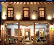
GRAN HOTEL
Videos from this area
These are videos related to the place based on their proximity to this place.
Danza De Santa Clara Del Cobre 2012 (parte 1)
Danza De Santa Clara Del Cobre, Michoacán, Mexico. Despues De La Visita Al Señor De Caracuaro.
Michoacán al Máximo 2014: Vuelos acrobáticos en el lago de patzcuaro
ESPÉRO LO DISFRUTES Y NO OLVIDES COMPARTIRLO. Exhibición de vuelo acrobático, paracaidismo, y acrobacias acuáticas; Concierto gratuito de Sasha, Erik y Benny; adrenalina, música y ...
The area around Patzcuaro, Mexico (part 1 of 2)
A slideshow of the area around Patzcuaro, Mexico (part 1 of 2). Turn the volume way up!! To view the slideshow in much better quality visit http://www.maison-t-bayou.com link to part 2 ...
Patzcuaro, Mexico (part 1 of 2)
A slideshow of Patzcuaro, Mexico (part 1 of 2) . Turn the volume way up!! To view the slideshow in much better quality visit http://www.maison-t-bayou.com link to part 2 http://www.youtube.com/...
Patzcuaro yellow submarine
Blind Patzcuaro street musician playing Yellow Submarine outside the Plaza de Once Patios.
torneo patzcuaro pump it up exceed
este vídeo es para recordar a todos los pumpers que ya no bailan que a ver si ya se ponen las pilas para los torneos que vienen hehehe n.n.
Videos provided by Youtube are under the copyright of their owners.
Attractions and noteworthy things
Distances are based on the centre of the city/town and sightseeing location. This list contains brief abstracts about monuments, holiday activities, national parcs, museums, organisations and more from the area as well as interesting facts about the region itself. Where available, you'll find the corresponding homepage. Otherwise the related wikipedia article.
Santa Clara del Cobre
Santa Clara del Cobre is a town and municipality located in the center of the state of Michoacán, Mexico, 18 km from Pátzcuaro and 79 km from the state capital of Morelia. While the official name of the municipality is Salvador Escalante, and the town is often marked as "Villa Escalante" or "Salvador Escalante" on maps, both entities are interchangeably called Santa Clara del Cobre. The town is part of the Pátzcuaro region of Michoacán, and ethnically dominated by the P'urhépecha people.


