Safety Score: 2,8 of 5.0 based on data from 9 authorites. Meaning we advice caution when travelling to Greece.
Travel warnings are updated daily. Source: Travel Warning Greece. Last Update: 2024-04-27 08:23:39
Touring Livadás
Livadás in Chania (Crete) is a town located in Greece about 187 mi (or 301 km) south of Athens, the country's capital place.
Time in Livadás is now 02:31 AM (Sunday). The local timezone is named Europe / Athens with an UTC offset of 3 hours. We know of 8 airports nearby Livadás, of which one is a larger airport. The closest airport in Greece is Chania International Airport in a distance of 25 mi (or 41 km), North-East. Besides the airports, there are other travel options available (check left side).
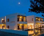
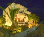
Need some hints on where to stay? We compiled a list of available hotels close to the map centre further down the page.
Being here already, you might want to pay a visit to some of the following locations: Palaiochora, Gerani, Kissamos, Chania and Chora Sfakion. To further explore this place, just scroll down and browse the available info.
Local weather forecast
Todays Local Weather Conditions & Forecast: 21°C / 70 °F
| Morning Temperature | 15°C / 59 °F |
| Evening Temperature | 20°C / 68 °F |
| Night Temperature | 17°C / 63 °F |
| Chance of rainfall | 0% |
| Air Humidity | 58% |
| Air Pressure | 1012 hPa |
| Wind Speed | Moderate breeze with 9 km/h (6 mph) from South |
| Cloud Conditions | Clear sky, covering 0% of sky |
| General Conditions | Sky is clear |
Sunday, 28th of April 2024
21°C (70 °F)
18°C (64 °F)
Sky is clear, moderate breeze, clear sky.
Monday, 29th of April 2024
22°C (71 °F)
17°C (63 °F)
Sky is clear, moderate breeze, clear sky.
Tuesday, 30th of April 2024
21°C (69 °F)
18°C (64 °F)
Broken clouds, moderate breeze.
Hotels and Places to Stay
Monastery Estate
Syia Hotel
Idomeneas Apartments & Studios
Videos from this area
These are videos related to the place based on their proximity to this place.
Παλαιόχωρα Scuba diving Paleochora Chania Crete HD
Η σπηλιά βρίσκεται σε βάθος 19 μέτρα και σε απόσταση 200 μέτρα Ανατολικά από την πρώτη καντίνα στην παραλία...
Kantanos gorge bike tour p2 Podilatreis
A bike tour organised by podilatreis crossing the Kantanos gorge where the quarry is slowly destroying the face of the gorge.
Best places in Western Crete, Greece [HD]
This is my amateur brief presentation of Western Crete I visited last year. Crete is a beautiful island with a lot of fantastic beaches and landscapes. I hope you will like it!
Sunset over Archon Villa, timelapse
My first experiments with timelapse photography: Sunset over Archon Villa, Crete.
Evening falling over Archon villa
Evening falling over Archon villa, Prodromi, Crete. My first experiments into timelapse photography...
Videos provided by Youtube are under the copyright of their owners.
Attractions and noteworthy things
Distances are based on the centre of the city/town and sightseeing location. This list contains brief abstracts about monuments, holiday activities, national parcs, museums, organisations and more from the area as well as interesting facts about the region itself. Where available, you'll find the corresponding homepage. Otherwise the related wikipedia article.
Lissos
Lissos ("Λισσός" in Greek) is an ancient city in south-west Crete, in Agios Kirikos area, near the small village of Sougia, 70 km south of Chania. Lissos and Syia was the harbours of the city of Elyros, the most important ancient city of the area, located near the village Rodovani. It was established in the Classical period and flourished until the Late Antiquity. Its name was made certain by inscriptions. The early history of the city is unknown.
Rodovani
Rodovani is a community and a small village in Chania regional unit on the island of Crete, Greece. It is part of the municipal unit of East Selino (Anatoliko Selino). The community consists of the following villages (population in 2001): Rodovani, pop. 122 Agriles, pop. 45 Kamaria, pop. 37 Livada, pop. 39 Maza, pop. 93 Near Rodovani is located the ancient city of Elyros.
Elyros
Elyros (Ἔλυρος in Greek) is an ancient city, located in southwest Crete, in Kefala Hill, near the village Rodovani and is presently unexcavated. Elyros was flourishing at least as early as the Greek Classical Period, e.g. 500 to 350 BC. In the Classical Period Elyros was the most important ancient city in southwestern Crete, having about 16,000 inhabitants. It was an industrial and commercial city with large weapons production. Syia and Lissos were its harbours.
Syia
Syia (Συία in Greek) is an ancient city in south-west Crete. It is located in Sougia village, 70 km south of Chania.
Sougia
Sougia (Greek Σούγια) is a community and a small village in Chania regional unit on the island of Crete, Greece. It is part of the municipal unit of East Selino (Anatoliko Selino). It is located on the south coast of the island, 70 km south of Chania. The community consists of the following villages (population in 2001): Sougia, pop. 109 Koustogerako, pop. 76 Livadas, pop. 24 Moni, pop.
Agia Eirini Gorge
Agia Eirini Gorge (Greek Φαράγγι Αγίας Ειρήνης) is located in the south-west of the island of Crete, Greece, in Lefka Ori. The gorge starts near the village of Agia Eirini and it ends near the village of Sougia, on the south coast. It is 8 kilometres long and 45–500 metres ( ) deep, in a forested area with steep mountain cliffs, and is easy to walk. In 1866, 1,000 women and children escaped from the Turks through this gorge.
Kampanos
Kampanos is a community and a village in Chania regional unit on the island of Crete, Greece. It is the seat of the municipal unit of East Selino (Anatoliko Selino). The community consists of the following villages (population in 2001): Kampanos, pop. 205 Maralia, pop. 40 The village is in a basin surrounded by very old olive oil trees, close to the village an old school is located which is the town hall of East Selino. The village is 52km from Chania city center,about 1,10 hours
Koustogerako
Koustogerako is a small village in Chania regional unit on the island of Crete, Greece. It has 76 residents and it belongs to the municipal unit of East Selino (Anatoliko Selino). The village is built in a wild, beautiful position, at an elevation of 510m. Deep gorges and steep mountain cliffs surround the village. Southwest of the village at a height of 200 m. is the cave of Cyclops, possibly related to the namesake tale found in Homer's Odyssey. Koustogerako has a notable history.


!['Cave [Sea Whispers - Paleochora - Crete]' preview picture of video 'Cave [Sea Whispers - Paleochora - Crete]'](https://img.youtube.com/vi/gRfqY4lAqu4/mqdefault.jpg)


!['Best places in Western Crete, Greece [HD]' preview picture of video 'Best places in Western Crete, Greece [HD]'](https://img.youtube.com/vi/W2SvkSiAmxc/mqdefault.jpg)


