Safety Score: 3,0 of 5.0 based on data from 9 authorites. Meaning we advice caution when travelling to Belgium.
Travel warnings are updated daily. Source: Travel Warning Belgium. Last Update: 2024-05-10 08:04:54
Discover Profondval
Profondval in Province de Liège (Wallonia) is a town in Belgium about 52 mi (or 83 km) east of Brussels, the country's capital city.
Current time in Profondval is now 04:35 PM (Friday). The local timezone is named Europe / Brussels with an UTC offset of 2 hours. We know of 9 airports near Profondval, of which 5 are larger airports. The closest airport in Belgium is Liège Airport in a distance of 2 mi (or 3 km), North-West. Besides the airports, there are other travel options available (check left side).
There are several Unesco world heritage sites nearby. The closest heritage site is Aachen Cathedral in Germany at a distance of 29 mi (or 47 km). The closest in Belgium is Stoclet House in a distance of 49 mi (or 47 km), North-East. Also, if you like playing golf, there are a few options in driving distance. Looking for a place to stay? we compiled a list of available hotels close to the map centre further down the page.
When in this area, you might want to pay a visit to some of the following locations: Maastricht, Hannut, Lincent, Selfkant and Namur. To further explore this place, just scroll down and browse the available info.
Local weather forecast
Todays Local Weather Conditions & Forecast: 19°C / 65 °F
| Morning Temperature | 10°C / 49 °F |
| Evening Temperature | 18°C / 64 °F |
| Night Temperature | 13°C / 55 °F |
| Chance of rainfall | 0% |
| Air Humidity | 64% |
| Air Pressure | 1024 hPa |
| Wind Speed | Gentle Breeze with 6 km/h (4 mph) from South-West |
| Cloud Conditions | Overcast clouds, covering 95% of sky |
| General Conditions | Overcast clouds |
Saturday, 11th of May 2024
21°C (70 °F)
15°C (59 °F)
Broken clouds, light breeze.
Sunday, 12th of May 2024
23°C (73 °F)
16°C (61 °F)
Light rain, gentle breeze, scattered clouds.
Monday, 13th of May 2024
17°C (63 °F)
14°C (56 °F)
Light rain, moderate breeze, overcast clouds.
Hotels and Places to Stay
Park Inn By Radisson Liege Airport
Campanile Liege / Luik
ibis Liège Seraing
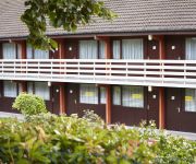
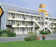
Premiere Classe
Videos from this area
These are videos related to the place based on their proximity to this place.
Rox 3 brigade canine de seraing en démo à Strée
Attaque par toit ouvrant k9 chien de Police bijten aanval politiehond bite attack dog police bissen angriff Hund Polizei ataque mordida perro policia ring belge mondioring.
Rox 2 brigade canine de Seraing en démo à Strée
fuyante au dessus d'un capot k9 chien de Police bijten aanval politiehond bite attack dog police bissen angriff Hund Polizei ataque mordida perro policia ring belge mondioring.
BRUSK - construction du bowl de Flémalle - coping travel
Petit tour de coping. Collectif Brusk, les skaters/bmxers locaux, le CCJ de Flémalle. www.brusk.be.
Marie Partners dance
Chorégraphie écrite sur http://www.cottonfields.org/ Niveau : Débutant, 32 Temps Chorégraphie : Micheline Tremblay Position : Side By Side - Skaters Position Musique : Marie / Julian Austin.
White Rose Line dance
Niveau : Débutant-Intermédiaire, 36 Temps - 4 Murs. Chorégraphie : Gaye Teather. Musique : White Rose / Toby Keith. Chorégraphie écrite sur http://www.cottonfields.org/
Cours VTT à Flémalle (24-04-2014)
Cours VTT à Flémalle, le 24 Avril 2014. Ecole VTT Patric Maes (Seraing).
Crazy For You Two, partner dance (it must be love)
Niveau : Débutant-Intermédiaire, en position sweetheart , en cercle, 32 Temps Chorégraphie : Donna Marie Bilodeau. Chorégraphie écrite sur http://www.cottonfields.org/ Musiques...
Spaque Cokerie Flémalle à Liège : Sous haute sécurité
Pendant la durée des travaux sur le site Cokerie Flémalle à Liège, les travailleurs et les visiteurs sont soumis à des mesures de protection très strictes.
La Commune de Flemalle
Dans le cadre de l'opération Made In de la CCI Connect, cap sur la commune de Flemalle en quelques données économiques...
BRUSK - construction du bowl de Flémalle - reportage RTC
2e semaine de l'atelier de construction participatif reportage de RTC - 06/08/09 Collectif Brusk, les skaters/bmxers locaux, le CCJ de Flémalle. www.brusk.be.
Videos provided by Youtube are under the copyright of their owners.
Attractions and noteworthy things
Distances are based on the centre of the city/town and sightseeing location. This list contains brief abstracts about monuments, holiday activities, national parcs, museums, organisations and more from the area as well as interesting facts about the region itself. Where available, you'll find the corresponding homepage. Otherwise the related wikipedia article.
Chokier
Chokier is a village and subdivision of the municipality of Flémalle in the province of Liège in Belgium, located on the left bank of the river Meuse. The village is dominated by the Château de Chokier, an 18th century rebuild of the earlier medieval castle, standing on a cliff overlooking the Meuse valley.
Liège Airport
Liège Airport, also called Liège-Bierset, is an important cargo airport in Belgium. It was at the end of 2011 the 7th biggest cargo airport in Europe. Liège airport is the biggest cargo airport in Belgium and the third biggest for passengers after Brussels Airport and Brussels South Charleroi Airport. The airport is located in Grâce-Hollogne, Liège Province, north-west of the city of Liège, in the east of Belgium.
Hollogne-aux-Pierres
Hollogne-aux-Pierres is a former Walloon municipality of Belgium, now merged with Grâce-Hollogne. It is in this area that the police, on 30 July 1950, opened fire on the inhabitants of Grâce-Berleur, killing four people. This sad event is the tragic element which led to the end of the royal question.
John Cockerill (company)
The John Cockerill Company was a Belgian iron, steel and manufacturing company based in Seraing in the region of Liege, founded by the British industrialist family fathered by William Cockerill. From 1825 the owner was John Cockerill and the company known as John Cockerill & Cie.
Jemeppe-sur-Meuse
Jemeppe-sur-Meuse is a section of the Belgian city of Seraing located in Wallonia, in the province of Liege. It was a separate municipality before the merging of municipalities in 1977. The inhabitants are about 10,000 and are called 'Jemeppians'. This town is best known for its steel industry, and before 1960, its coal mines. The old town has three castles: Ordange Castle, Antoine Castle and Courtejoie Castle. It is also the moral center of the antoinism, at the antoinist temple.
Mons-lez-Liège
Mons-lez-Liege is a section of the Belgian municipality of Flemalle located in the Walloon Region, in the province of Liège. The town was also known under the name of Mons-Crotteux until 1977. It was a separate municipality before the merging of municipalities in 1977. It is the birthplace of Louis Antoine, in 1846. He founded the Antoinism in Jemeppe-sur-Meuse in 1910.
Val-Saint-Lambert Abbey
Val-Saint-Lambert Abbey was a Cistercian abbey in the Prince-Bishopric of Liège. It is situated in Seraing on the right bank of the Meuse, within the Walloon municipality of Belgium, about 13 kilometres southwest of Liege. Founded in 1202, the abbey's monks were expelled during the French Revolution. In the 19th century, the building ruins were converted into the Val Saint Lambert crystal factory. The structure is considered to be an important example of Cistercian architecture.


