Discover Shorewell Park
The district Shorewell Park of Burnie in Burnie (Tasmania) is a subburb in Australia about 437 mi south-west of Canberra, the country's capital city.
If you need a hotel, we compiled a list of available hotels close to the map centre further down the page.
While being here, you might want to pay a visit to some of the following locations: Hobart, Currie, Melbourne, and . To further explore this place, just scroll down and browse the available info.
Local weather forecast
Todays Local Weather Conditions & Forecast: 14°C / 57 °F
| Morning Temperature | 9°C / 48 °F |
| Evening Temperature | 10°C / 49 °F |
| Night Temperature | 9°C / 49 °F |
| Chance of rainfall | 0% |
| Air Humidity | 66% |
| Air Pressure | 1034 hPa |
| Wind Speed | Gentle Breeze with 6 km/h (4 mph) from North-West |
| Cloud Conditions | Broken clouds, covering 69% of sky |
| General Conditions | Broken clouds |
Tuesday, 7th of May 2024
15°C (59 °F)
11°C (51 °F)
Sky is clear, light breeze, clear sky.
Wednesday, 8th of May 2024
16°C (61 °F)
12°C (53 °F)
Overcast clouds, gentle breeze.
Thursday, 9th of May 2024
17°C (62 °F)
14°C (57 °F)
Light rain, moderate breeze, clear sky.
Hotels and Places to Stay
The Menai Hotel Motel
Burnie Ocean View Motel and Holiday Caravan Park
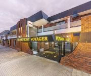
Beachfront Voyager Motor Inn
BEST WESTERN MURCHISON LODGE
WELLERS INN MOTEL AND FUNCTION CENTRE
Comfort Hotel Townhouse Burnie
IKON HOTEL
Videos from this area
These are videos related to the place based on their proximity to this place.
Burnie Regional Museum Presents 2014
A look back at just a few of the exciting things that happened at the Burnie Regional Museum this year!
2012 - McDonalds Burnie International.wmv
This is the Southern Cross Televeision - Tasmania commercial promoting the 2012 - McDonald's Burnie International - Tennis Tournament to be held at the Burnie Tennis Centre. It is part of...
2011 - SKILLED BURNIE TEN - RACE DAY
The 2011 SKILLED BURNIE TEN was run on Sunday October 16 starting at 11.15am. Southern Cross Television are great supporters of the SKILLED BURNIE TEN and th...
2011 - SKILLED BURNIE TEN - Compilation Video
This is a "Compilation Video" of the Skilled Burnie Ten provided by Southern Cross to promote the race. The 2011 SKILLED BURNIE TEN was run on Sunday October 16 starting at 11.15am. Southern...
2012 - B&E BURNIE TEN - WEEK ONE - TEAMS LEADER BOARD
This is the week one "Team Leader Board" advertisement for the 2012 - B&E BURNIE TEN that is to be held on Sunday October 21 starting at 11.15am. Southern Cr...
2012 - B&E BURNIE TEN - WEEK THREE - TEAM PROFILE - TASAL HOBART
This is the "Teams Introduction" advertisement for Tasal -- Hobart, who are competing in the 2012 - B&E BURNIE TEN that is to be held on Sunday October 21 st...
2012 - B&E BURNIE TEN - WEEK TWO - TEAM PROFILE - RACT BURNIE
This is the "Teams Introduction" advertisement for RACT -- Burnie, who are competing in the 2012 - B&E BURNIE TEN that is to be held on Sunday October 21 sta...
2012 - B&E BURNIE TEN - WEEK EIGHT - TEAM PROFILE - NYRSTAR HOBART
This is the "Teams Introduction" advertisement for NYRSTAR - Hobart, who are competing in the 2012 - B&E BURNIE TEN that is to be held on Sunday October 21 starting at 11.15am. Southern Cross...
2012 - B&E BURNIE TEN - WEEK NINE - TEAM WRAP UP - NORTHERN TASMANIAN TEAMS
This is the teams "Wrap-Up" advertisement for the Southern Cross training teams from Northern Tasmania, who are competing in the 2012 - B&E BURNIE TEN that i...
2012 - B&E BURNIE TEN - WEEK FOUR - TEAM PROFILE - RACT LAUCESTON
This is the "Teams Introduction" advertisement for RACT - Launceston, who are competing in the 2012 - B&E BURNIE TEN that is to be held on Sunday October 21 starting at 11.15am. Southern Cross...
Videos provided by Youtube are under the copyright of their owners.
Attractions and noteworthy things
Distances are based on the centre of the city/town and sightseeing location. This list contains brief abstracts about monuments, holiday activities, national parcs, museums, organisations and more from the area as well as interesting facts about the region itself. Where available, you'll find the corresponding homepage. Otherwise the related wikipedia article.
Burnie, Tasmania
Burnie is a port city on the north-west coast of Tasmania, originally settled in 1827 as Emu Bay. The (then) town was renamed for William Burnie – a director of the Van Diemen's Land Company – in the early 1840s. The town boundary usually includes the outer town of Somerset. Burnie is governed by the City of Burnie local government area. At the 2011 Australian Census the local government area recorded a population of 19,329.
Bass Highway, Tasmania
The Bass Highway is a highway in Tasmania, Australia. It is a part of the National Highway, designated as National Highway 1 and connects the major cities across the north of the state - Burnie, Devonport and Launceston.
Wynyard, Tasmania
Wynyard is a rural town on the north-west coast of Tasmania, Australia 16 kilometres west of Burnie on the Bass Highway at the mouth of the Inglis River. At the 2006 census Wynyard had a population of 4,812. It is part of the Waratah-Wynyard Council local government area and a major regional hub, servicing many of the surrounding rural districts. The largest employer in the town is the cheese factory, owned by the New Zealand dairy company Fonterra.
Riana, Tasmania
For artists and places with similar names, see Riana. Riana is a small town in the north-west of Tasmania, next to the Dial Range. It is near Penguin, Tasmania. At the 2006 census, Riana and the surrounding area had a population of 287. The fertile red soil hosts paddocks of vegetables and dairy farms.
Marist Regional College
Marist Regional College is a Roman Catholic, co-educational, secondary school, located in Parklands, a suburb of Burnie, Tasmania, Australia. Marist Regional College is part of the Association of Marist Schools of Australis AMSA network of catholic high schools across Australia, and is one of several within Australia and around the world that share the same name of "Marist" College. The college currently caters for around 845 students from Years 7 to 12.
Acton, Tasmania
Acton is a suburb of the City of Burnie in north-west Tasmania, Australia. It's 2006 population was 1,352.
City of Burnie
The City of Burnie is a local government area of Tasmania. It covers the city of Burnie and surrounding areas, although it does not include the town of Somerset - usually classed as part of the Burnie metropolitan area. The city's motto is "non nobis solum" (not for ourselves alone); for many years this was on the council seal but in 1992 a new, more colourful logo was created which did not include the motto. It did also not include the emu (which had been Burnie's unofficial animal emblem).
North West Regional Hospital
North West Regional Hospital is the primary healthcare facility for the North Western region of Tasmania, and has two campuses, the larger at Burnie and the smaller Mersey campus at Latrobe, near Devonport, in Tasmania. NW Regional covers a population base of over 100,000 people. The hospital is hybrid public/private heathcare, with 160 public beds, and 70 private. It offers a full range of general care, and nuclear medicine service.
Brooklyn, Tasmania
This article is about the town in Tasmania. For other locations, see Brooklyn (disambiguation) Brooklyn is a suburb of Burnie, Tasmania, Australia to the south-east of the main town centre. Brookville Post Office opened on 1 August 1953 and was renamed Brooklyn in 1968. It closed in 1973.
Cooee, Tasmania
Cooee is a small town on the north-west coast of Tasmania immediately west of Burnie, to which it is in effect a dormitory suburb. At the 2006 census, Cooee had a population of 574.
Doctors Rocks, Tasmania
Doctors Rocks is both a geographical feature and a district on the north-west coast of Tasmania between Somerset and Wynyard. The geographical feature is a basalt outcrop on the beachfront, behind which an escarpment rises to the north west coast plateaux.
Dial Range
The Dial Range is a small mountain range in northwest Tasmania, south of the town of Penguin near the coast. It extends about 14 km north to south and 4-5 km west to east. It is bordered on the east and south by the Leven River, with the Gunns Plains to the south. There are approximately 52 km of state owned land in the range. Of this, 43.54 km is state forest and forest reserve managed by Forestry Tasmania.
Guide Falls
Guide Falls are situated closely to the back of Burnie, Tasmania. Head out of Burnie on the same road to cradle mountain then turn right just outside the Ridgley boundary and continue down into the gully and turn left when you get to the posted gate sign. Once entered the guide river is to the right and if you continue to drive up the gravel road to the top you will reach the falls. There at the top is a very safe and great view from the fenced lookout.
Burnie High School
Burnie High School is a public, co-educational, high school, located in Cooee, a suburb of Burnie, Tasmania, Australia. In April 2007, the old, original Burnie High School building located in Burnie itself was gutted by fire. The old school had been built in 1929 and following the fire, many of its remains had to be demolished for safety reasons. The building had been due to become the new home of the Creative Paper company and the new Burnie Visitor Centre.
West Park Oval
West Park Oval is an Australian Rules football, cycling and athletics venue located on the shores of Bass Strait in Burnie, Tasmania. It is the current home of the Burnie Dockers in the Tasmanian State League and previously in the NTFL and in the original TFL Statewide League.


