Explore Lilli Pilli
The district Lilli Pilli of Malua Bay in Eurobodalla (New South Wales) is located in Australia about 71 mi south-east of Canberra, the country's capital.
If you need a place to sleep, we compiled a list of available hotels close to the map centre further down the page.
Depending on your travel schedule, you might want to pay a visit to some of the following locations: Canberra, Katoomba, Parramatta, Sydney and . To further explore this place, just scroll down and browse the available info.
Local weather forecast
Todays Local Weather Conditions & Forecast: 18°C / 64 °F
| Morning Temperature | 13°C / 55 °F |
| Evening Temperature | 15°C / 59 °F |
| Night Temperature | 12°C / 54 °F |
| Chance of rainfall | 3% |
| Air Humidity | 73% |
| Air Pressure | 1021 hPa |
| Wind Speed | Gentle Breeze with 6 km/h (4 mph) from North-East |
| Cloud Conditions | Scattered clouds, covering 25% of sky |
| General Conditions | Moderate rain |
Tuesday, 14th of May 2024
17°C (63 °F)
14°C (57 °F)
Light rain, light breeze, clear sky.
Wednesday, 15th of May 2024
18°C (64 °F)
13°C (55 °F)
Overcast clouds, light breeze.
Thursday, 16th of May 2024
17°C (62 °F)
13°C (56 °F)
Scattered clouds, light breeze, broken clouds.
Hotels and Places to Stay
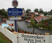
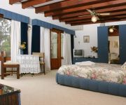
BEST WESTERN SUNSEEKER MOTOR
Chalet Swisse Spa
Bay Breeze Boutique Accommodation
LincolnDowns Resort Batemans
The Bower at Broulee
Araluen Motor Lodge
Abel Tasman Motel
Oaks Ranch and Country Club
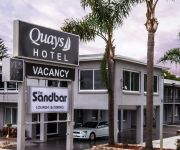
Quays Hotel
Bayside Motel
Videos from this area
These are videos related to the place based on their proximity to this place.
Batemans Bay RC Race Day- March
Best moments of the race day for the March meeting at The Batemans Bay RC Club.
Houseboat wedged under Batemans Bay Bridge
Houseboat breaks free of its mooring and wedges under the Batemans Bay bridge. Marine Rescue tows the vessel to safety in rough conditions and gusting winds.
Batemans Bay Rally 2011 in car SS5 Bob Jane Hyundai Excel Crazy Dave Roberts/Paul Mallos
Stage: Middle Ridge Date: 30 July 2011 Time: 5:05 PM Stage Distance: 0.00km Stage Time: 06:23 Top Speed: 0km/h Average Speed: 0km/h Car: Hyundai Car Number: Car No.33 Driver: Dave...
FISHING SOUTH COAST AUSTRALIA
a must watch,,,,,,,,,some real nice fish, squid, lobster and mud crab, people having great times out in the fresh air catching the freshest sea food and cooking with it, showing off fishing...
Rally of the Bay 2014 SS7 Right 4 Rally
The Right 4 Rally Team get into the second day of the Rally of the Bay 2014 with the second special stage of the day. Pace increases. Partial video of SS7 as the 2nd camera file corrupted....
SQUID JIGS AND BETA BITE
a great day fishing for squid, we use,,, BETA BITE on or squid jigs and wow what a fantastic product,,,,https://www.youtube.com/watch?v=eJcjKe_rtDE,,,,,,,,,,,,,from,,,,,,,,, http://www.catchfishing...
RUSTY SNAPPER FISHING IN LUMPY SEAS
Rusty catching a couple snapper in lumpy seas,,,,,,after credits a uncut clip.
SNAPPER FISHING STARTING TO WARM UP
three days fishing for snapper some nice fish taken, dale showing old school hand line technique.
Videos provided by Youtube are under the copyright of their owners.
Attractions and noteworthy things
Distances are based on the centre of the city/town and sightseeing location. This list contains brief abstracts about monuments, holiday activities, national parcs, museums, organisations and more from the area as well as interesting facts about the region itself. Where available, you'll find the corresponding homepage. Otherwise the related wikipedia article.
Clyde River National Park
Clyde River is a national park in south-eastern New South Wales between Batemans Bay and Nelligen. It includes 9 km of river frontage to the Clyde River, bounded on three sides by the Clyde River and on the northeast by the Kings Highway. It was created from a part of Benandarah State Forest; in 2000 10.91 km² of the state forest was set aside as a national park.
Moruya, New South Wales
Moruya is a town in New South Wales, Australia, situated on the Moruya River, on the far south coast situated on the Princes Highway 305 kilometres south of Sydney and 175 kilometres from Canberra. At the 2006 census, Moruya had a population of 2,432 people. The town relies predominantly on agriculture, aquaculture, and tourism. Moruya is administered by the Eurobodalla Shire council and the shire chambers are located in the town.
Milestone
A milestone is one of a series of numbered markers placed along a road or boundary at intervals of one mile or occasionally, parts of a mile. They are typically located at the side of the road or in a median. They are alternatively known as mile markers, mileposts or mile posts (sometimes abbreviated MPs). Mileage is the distance along the road from a fixed commencement point. Milestones are constructed to provide reference points along the road.
Batemans Bay
Batemans Bay is a town and a bay in the South Coast region of the state of New South Wales, Australia. Batemans Bay is administered by the Eurobodalla Shire council. The town is on the Princes Highway (Highway 1) about 280 kilometres from Sydney, 760 km from Melbourne and 151 km from Canberra via the Kings Highway. At the 2006 census it had a population of 10,845. The Clyde River empties here into the Tasman Sea.
Eurobodalla Shire
Eurobodalla Shire is a local government area located in the South Coast region of New South Wales, Australia. The Shire is located in a largely mountainous coastal region and situated adjacent to the Tasman Sea, the Princes Highway and the Kings Highway. The Mayor of Eurobodalla Shire Council is Cr. Lindsay Brown, an independent politician.
Moruya River
The Moruya River is in southern New South Wales, Australia. Its freshwater reaches are known as the Deua River. The headwaters of the Moruya River rise as the Deua River south of Braidwood. The village of Araluen lies in the upper valley of the river, and the site of gold mining in the late nineteenth century. The town of Moruya is located on the lower, estuarine reaches of the river, about 10 kilometers from the sea.
Moruya High School
Moruya High School is the main public high school (secondary school) in Moruya on the far south coast of New South Wales, Australia. Moruya High School is comprehensive and coeducational. The school is committed to the belief that every student has the capacity to learn and experience success. High expectations are established for attendance, application and performance. As a result students have enjoyed outstanding success across the spectrum of academic, sporting and artistic performance.
Mogo, New South Wales
Mogo is a small heritage town in the South Coast region of the state of New South Wales, Australia. Mogo is administered by the Eurobodalla Shire council. The town is located on the Princes Highway (Highway 1), south of Batemans Bay and north of Moruya. At the 2006 census, Mogo had a population of 257 people. Mogo was established during the Gold Rush after a gold find was reported in 1851. Bimbimbie, the last gold mine in the Mogo area, closed in 1984 with the floating of the Australian Dollar.
Malua Bay, New South Wales
Malua Bay is a locality in the South Coast region of the state of New South Wales, Australia. It is situated in the Eurobodalla Shire. At the 2006 census, Malua Bay had a population of 1,907 people. Malua Bay town centre is located on George Bass Drive, about 13 kilometres drive from the town of Batemans Bay. The town boundaries extend to Dunns Creek Road in the West, Ridge Road to the North, and almost to Burri Road in the South, where it abuts the town of Rosedale.
Broulee, New South Wales
Broulee is a town on the south coast of New South Wales between Batemans Bay and Moruya. In 2006, the town had a population of 1,292 people. Just off the beach is a Broulee Island, currently joined to the mainland, but in past years the connecting spit has been covered by water, at times a very deep navigable channel with a strong current. The first harbour in the area south of Batemans Bay was established at Broulee behind what is now known as the island.
Rosedale, New South Wales
Rosedale is a beachside settlement in New South Wales, Australia. It is south of Batemans Bay on the south coast. The area is administered by the Eurobodalla Shire. At the 2006 census, Rosedale had a population of 127 people.
Batemans Bay High School
Batemans Bay High School is a Government secondary school located in Batemans Bay, New South Wales, Australia. It supports approximately 800 students and 50 teachers.
Mogo Zoo
Mogo Zoo is a small privately owned zoo in Mogo on the south coast of New South Wales, Australia. It is a member of ARAZPA and has had some success in breeding programs for endangered species, including the Snow Leopard, Cotton-top Tamarin, Red Panda, and Sumatran Tiger. It is also the only zoo in Australia along with the National Zoo and Aquarium in Canberra to hold white lions. Unlike most small Australian zoos, Mogo Zoo focuses on exotic species. It is owned by Bill and Sally Padey.
Nelligen, New South Wales
Nelligen is a village on the Clyde River on the South Coast of New South Wales, Australia. It is located on the Kings Highway.
South Durras, New South Wales
South Durras is a small village on the South Coast of New South Wales, Australia. South Durras is located approximately 280 kilometres south of Sydney and 15 kilometres north of Batemans Bay, in the local government area of Eurobodalla Shire. The village is surrounded by the Murramarang National Park.
Batehaven, New South Wales
Batehaven is a locality approximately 4 kilometres from Batemans Bay in south-central New South Wales.
Tomaga River
The Tomaga River is a river of the state of New South Wales in Australia.


