Safety Score: 2,7 of 5.0 based on data from 9 authorites. Meaning we advice caution when travelling to United States.
Travel warnings are updated daily. Source: Travel Warning United States. Last Update: 2024-05-17 08:07:57
Discover Forest Trail
The district Forest Trail of Island of Palms in Charleston County (South Carolina) is a district in United States about 448 mi south of Washington DC, the country's capital city.
Looking for a place to stay? we compiled a list of available hotels close to the map centre further down the page.
When in this area, you might want to pay a visit to some of the following locations: Charleston, Moncks Corner, Georgetown, Kingstree and Saint George. To further explore this place, just scroll down and browse the available info.
Local weather forecast
Todays Local Weather Conditions & Forecast: 29°C / 85 °F
| Morning Temperature | 23°C / 73 °F |
| Evening Temperature | 27°C / 81 °F |
| Night Temperature | 22°C / 72 °F |
| Chance of rainfall | 7% |
| Air Humidity | 57% |
| Air Pressure | 1013 hPa |
| Wind Speed | Moderate breeze with 10 km/h (6 mph) from North-East |
| Cloud Conditions | Overcast clouds, covering 99% of sky |
| General Conditions | Moderate rain |
Sunday, 19th of May 2024
23°C (74 °F)
20°C (68 °F)
Moderate rain, moderate breeze, overcast clouds.
Monday, 20th of May 2024
25°C (76 °F)
21°C (69 °F)
Sky is clear, moderate breeze, clear sky.
Tuesday, 21st of May 2024
25°C (78 °F)
20°C (68 °F)
Sky is clear, moderate breeze, clear sky.
Hotels and Places to Stay
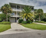
Cameron Boulevard 3901 by RedAwning
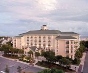
WILD DUNES RESORT
Fairway Dunes 3 by RedAwning
Home2 Suites By Hilton Mt Pleasant Charleston
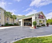
Hampton Inn - Suites Charleston-MtPleasant-Isle Of Palms
Residence Inn Charleston Mt. Pleasant
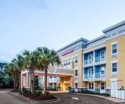
Comfort Suites at Isle of Palms Connector
Homewood Suites by Hilton Charleston - Mt Pleasant
Seascape 317 by RedAwning
Beach Club 29 by RedAwning
Videos from this area
These are videos related to the place based on their proximity to this place.
Isle of Palms Beach Again.. with a kite underneath the drone
Drone flight over the beach at Isle of Palms pier.
Isle of Palms Drone Flight Jan 17 2015
A short, fun flight at the beach on Isle of Palms, SC with the DJI Phantom 2 Vision + version 3. This is near Charleston,SC.
Isle Of Palms, SC TOUR
Search for homes: www.StevenClarkeRealEstate.com For more information on Isle Of Palms, Wild Dunes, Sullivan's Island, or Charleston Real Estate OR for booking a summer vacation contact: ...
7 Driftwood Ln, Isle of Palms SC 29451
Stunning waterfront home offered by Carolina Coastal Properties 843.886.9444. Located on Isle of Palms, a resort island community on the beach near Charleston, South Carolina. Interior photos...
Isle of Palms SC Pier
Just wanted to see what the new signs are on the end of the Isle of Palms Pier!
A DAY AT THE BEACH ISLE OF PALMS By Frankie Scavullo
Photos of the beach of Isle of Palms SC put to movie format Photos by Frankie Scavullo.
1010 Ocean Blvd # 201, Isle of Palms, SC
Condo is available for weekly and winter rental. Please contact Donna Bell at Vintage Escapes of Charleston, (877) 346-1029.
Videos provided by Youtube are under the copyright of their owners.
Attractions and noteworthy things
Distances are based on the centre of the city/town and sightseeing location. This list contains brief abstracts about monuments, holiday activities, national parcs, museums, organisations and more from the area as well as interesting facts about the region itself. Where available, you'll find the corresponding homepage. Otherwise the related wikipedia article.
USS Housatonic (1861)
The first USS Housatonic was a screw sloop-of-war of the United States Navy, named for the Housatonic River of New England which rises in Berkshire County, Massachusetts, and flows southward into Connecticut before emptying into Long Island Sound a little east of Bridgeport, Connecticut. Housatonic was the first ship in history to be sunk by a submarine.
Fort Moultrie
Moultrie]] Fort Moultrie is the name of a series of citadels on Sullivan's Island, South Carolina, built to protect the city of Charleston, South Carolina. The first fort, built of palmetto logs, inspired the flag and nickname of South Carolina, "The Palmetto State". It is named for the commander in the Battle of Sullivan's Island, General William Moultrie.
Dewees Island
Dewees Island is a barrier island about 11 miles north of Charleston, South Carolina. The island is over 1,200 acres (4.9 km²). The inlet between it and the Isle of Palms is shown on early maps as Spence's Inlet, but is today called Dewees Inlet. The island is private and accessible only by ferry or private boat. Located on intercoastal waterway, the island has 2.6 miles of beachfront with dune, marsh, and maritime forest ecosystems. There are 150 homesites with 63 finished homes on the island.
WXLY
WXLY is a radio station in Mount Pleasant, South Carolina. Owned by Clear Channel Communications and broadcasting at 102.5 FM, the station airs an adult contemporary format using the brand name Y102.5 and the slogan "Songs you can sing along with."
Wando High School
Wando High School is a high school in Mt. Pleasant, South Carolina. Home of the Wando Warriors, the school was re-built in 2004 to accommodate the town's rapid growth during the 1990s. It is the largest high school in the state of South Carolina. Located now on 1000 Warrior Way off Highway 17. Wando offers over 250 classes, including Advanced placement, Dual Credit, Honors, College Preparatory, and Applied Technology courses.
Mount Pleasant Regional Airport (South Carolina)
Mount Pleasant Regional Airport, also known as Faison Field, is a public airport located 9 nmi northeast of the central business district of Mount Pleasant, a town in Charleston County, South Carolina, United States. It is owned by the Charleston County Aviation Authority. It was formerly the East Cooper Airport. Although most U.S. airports use the same three-letter location identifier for the FAA and IATA, this airport is assigned LRO by the FAA but has no designation from the IATA.
Goat Island (South Carolina)
Goat Island is an island located between Mt. Pleasant and Isle of Palms, South Carolina, USA, on the Intracoastal Waterway. It is one of the smallest islands of the region, being only as large as a neighborhood street. There is another Goat Island in Murrells Inlet, South Carolina, that is approximately 20,000 square feet. It is called Goat Island because every spring a man named Bubba Love (a local celebrity) and few friends place some goats on the islands.
College of Marine Arts
The College of Marine Arts was operated as the Sea Research Society's formal higher education wing from 1972 until 1978. It was initially located in Columbia, South Carolina and later moved to Mount Pleasant, outside of Charleston where it was housed in the former Berkeley County courthouse building on Pitt Street.
WALC
WALC is a radio station located in Charleston, South Carolina. The station is licensed by the Federal Communications Commission (FCC) to broadcast with 13.5 kW on 100.5 FM. It is owned by the Radio Training Network and broadcasts a Contemporary Christian format under the name HIS Radio 100.5.
WSSX-FM
WSSX-FM is a Top 40 contemporary hit radio (CHR) music formatted radio station located in Charleston, South Carolina. The station is licensed by the Federal Communications Commission (FCC) to broadcast with an effective radiated power (ERP) of 100 kW. The station is owned by Cumulus Media.
WXST
WXST (99.7 FM, "Star 99.7") is a Gold-based Urban Adult Contemporary radio station located in Charleston, South Carolina, but licensed by the FCC to the town of Hollywood, South Carolina. The station broadcasts with an ERP of 70 kW.
WSCC-FM
WSCC-FM, also known as "News Radio 94.3 WSC", is a radio station located in Charleston, South Carolina. The station is licensed by the Federal Communications Commission (FCC) to the nearby community of Goose Creek and broadcasts on 94.3 FM with an effective radiated power (ERP) of 25 kW.
WCKN
WCKN is a radio station broadcasting a country music format. Licensed to Moncks Corner, South Carolina, USA, the station serves the Charleston, South Carolina area. The station is currently owned by Apex Broadcasting, Inc.
WEZL
WEZL is a radio station broadcasting a country music format. Licensed to Charleston, South Carolina, USA, the station is currently owned by Clear Channel Communications. The Weasel Morning Show consists of longtime radio personalities TJ Phillips, Gary Griffin and Ric Rush. TJ, Gary and Ric consistently have the top rated morning show in Charleston, SC. Other cast members include WCBD's Rob Fowler, traffic reporter Michael Hart, and local contributor "Bad Joke" Tom.
University School of the Lowcountry
University School of the Lowcountry (USL) is a small independent school, grades 3-8, located in Mount Pleasant, South Carolina. University School is located on the campus of Hibben United Methodist Church. USL is designed for high-achieving, curious, hard-working, nice, and empathetic students. The school also has a 90% acceptance rate to Academic Magnet High School through the 2011-2012 school year and exemplary performance on the 7th grade Duke TIP SAT and 8th grade PSAT programs.
Battle of Sullivan's Island
The Battle of Sullivan's Island or the Battle of Fort Sullivan was fought on June 28, 1776, during the American Revolutionary War, also known as the American War of Independence. It took place near Charleston, South Carolina, during the first British attempt to capture the city from American rebels. It is also sometimes referred to as the First Siege of Charleston, owing to a more successful British siege in 1780.
WRFQ (FM)
WRFQ "Q-104.5" is a classic rock radio station in Charleston, South Carolina, owned by Clear Channel Communications. The station airs the Bob and Tom morning show.
WFCH
WFCH is a radio station broadcasting a Religious format. Licensed to Charleston, South Carolina, USA, it serves the Charleston SC area. The station is currently owned by Family Stations, Inc..
WZJY
WZJY is a radio station broadcasting a Spanish language format also heard on WAZS-AM. Licensed to Mount Pleasant, South Carolina, USA, it serves the Charleston, South Carolina area. The station is currently owned by Thomas B. Daniels.
Laing Middle School
Laing Middle School is a middle school located on 2213 Highway 17 N, Mount Pleasant, South Carolina. Grades 6 through 8 are taught here. The school was originally founded as a school for black children by Cornelia Hancock in 1816. The school is currently run under the leadership of Mrs. Deborah G. Price Laing Middle SchoolType Public middle schoolPrincipal Deborah G. PriceGrades 6-8Location Mt.
Isle of Palms Connector Bridge
The Isle of Palms Connector Bridge connects the town of Mount Pleasant with the Isle of Palms in South Carolina. The bridge is part of, and comprises most of the length of, South Carolina Highway 517, which is commonly known as the "Isle of Palms Connector", and bears the official name of "Clyde Moultrie Dangerfield Highway". It connects US 17 in Mount Pleasant, SC with South Carolina Highway 703 on the Isle of Palms.
Ben Sawyer Bridge
The Ben Sawyer Bridge is a swing bridge that connects the town of Mount Pleasant with Sullivan's Island in South Carolina. The bridge swings on its central axis to open for boat traffic which is too tall to clear the bridge, and has an operator's station in the center of the span from which an attendant can operate the bridge. The bridge was constructed in 1945, but its swing-span section was replaced in 2010, albeit retaining the same general appearance.
Sinking of USS Housatonic
The Sinking of USS Housatonic on 17 February 1864 during the American Civil War was an important turning point in naval warfare. The Confederate States Navy submarine, H.L. Hunley made her first and only attack on a Union Navy warship when she staged a clandestine night attack on the USS Housatonic in Charleston harbor.
WHDC-LD
WHDC-LDCharleston, South CarolinaBranding WHDC 12Slogan All 100% Local!Channels Digital: 40Virtual: 12Subchannels 12.1 Independent12.2 Mega TVOwner Local HDTV, Inc.
Mary Bowers (ship)
The blockade runner Mary Bowers, Captain Jesse DeHorsey (or Horsey), bound from Bermuda to Charleston, South Carolina with an assorted cargo, struck the submerged wreck of the SS Georgiana in fourteen feet of water a mile off of Long Island (the present day Isle of Palms, South Carolina) on August 31, 1864. She “went on with such force as to make immense openings in her bottom,” and she sank in a “few minutes, most of the officers and men saving only what they stood in.


