Safety Score: 2,7 of 5.0 based on data from 9 authorites. Meaning we advice caution when travelling to United States.
Travel warnings are updated daily. Source: Travel Warning United States. Last Update: 2024-05-16 08:19:50
Delve into Fourmile
Fourmile in Bell County (Kentucky) is located in United States about 393 mi (or 633 km) west of Washington DC, the country's capital town.
Current time in Fourmile is now 12:25 AM (Friday). The local timezone is named America / New York with an UTC offset of -4 hours. We know of 8 airports close to Fourmile, of which 7 are larger airports. The closest airport in United States is McGhee Tyson Airport in a distance of 69 mi (or 112 km), South. Besides the airports, there are other travel options available (check left side).
There is one Unesco world heritage site nearby. It's Great Smoky Mountains National Park in a distance of 106 mi (or 170 km), South-East. Also, if you like playing golf, there are some options within driving distance. If you need a hotel, we compiled a list of available hotels close to the map centre further down the page.
While being here, you might want to pay a visit to some of the following locations: Pineville, Barbourville, Manchester, Williamsburg and Harlan. To further explore this place, just scroll down and browse the available info.
Local weather forecast
Todays Local Weather Conditions & Forecast: 22°C / 71 °F
| Morning Temperature | 15°C / 60 °F |
| Evening Temperature | 18°C / 65 °F |
| Night Temperature | 17°C / 62 °F |
| Chance of rainfall | 3% |
| Air Humidity | 74% |
| Air Pressure | 1011 hPa |
| Wind Speed | Gentle Breeze with 7 km/h (5 mph) from North |
| Cloud Conditions | Overcast clouds, covering 100% of sky |
| General Conditions | Moderate rain |
Friday, 17th of May 2024
23°C (74 °F)
17°C (63 °F)
Moderate rain, gentle breeze, overcast clouds.
Saturday, 18th of May 2024
21°C (69 °F)
17°C (63 °F)
Light rain, light breeze, overcast clouds.
Sunday, 19th of May 2024
27°C (80 °F)
18°C (65 °F)
Scattered clouds, light breeze.
Hotels and Places to Stay
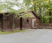
Pine Mountain State Resort
Videos from this area
These are videos related to the place based on their proximity to this place.
Tanning Salon, Beauty Supply Store in Barbourville KY 40906
Paradise Tan Gallery is your source for tanning in Barbourville, KY. We've been locally owned and operated since 2009.Come to our tanning salon and get a natural looking bronzed tone that will...
Tristian participating in Barbourville Elementary's Winter Festival
"Winter Festival" @ Barbourville Elementary (Barbourville, KY). Tristian dancing at the Winter Festival. He is always smiling and full of energy. I call him ...
Pack 529 hiking at Sandy Bottom Trails & Rolling down the moutain.
Cub Scout Pack 529 hiked the Sandy Bottom Trails. 11/3/13 At the conclusion of hiking our scouts still had some energy. One of the scouts started rolling dow...
Pineville Kentucky
Driving through Pineville KY... We decided to record our drive of the city because it's an awesome, quiet little town. This was taken October 31st of 2008. Some things have change I'm sure.
Chained Rock, Pine Mountain State Resort Park in Pineville Kentucky. Kentucky State Parks
Pine Mountain State Resort Park is a park located in Bell County, Kentucky, United States. The park opened in 1924 as Kentucky's first state park. Each spring, the park hosts the annual Kentucky...
Grace Asher and Robert Crawford Birthday, 2013
Grace Asher and Bob Crawford Observed their mutual birthday at the home of Tommy and Kithy Asher, Pineville, Kentucky, July 21, 2013.
Press Conference 01.17.2014 - Governor Steve Beshear
Governor Steve Beshear and Congressman Harold "Hal" Rogers joined U.S. Agriculture Secretary Tom Vilsack to announce the first report from last month's Shaping Our Appalachian Region (SOAR)...
Mini Family Reunion
We recently had a mini family reunion of the Cornett and Rice families. The event was at Cracker Barrel in Middlesboro, KY June 21, 2013.
This Week at The Museum Promotional Video
This Week at the Museum is a weekly YouTube show featuring items, exhibits and people at the Bell County Historical Society Museum in Middlesboro, KY. The museum is located at 207 N. 20th...
Videos provided by Youtube are under the copyright of their owners.
Attractions and noteworthy things
Distances are based on the centre of the city/town and sightseeing location. This list contains brief abstracts about monuments, holiday activities, national parcs, museums, organisations and more from the area as well as interesting facts about the region itself. Where available, you'll find the corresponding homepage. Otherwise the related wikipedia article.
WANO
WANO is a radio station licensed to Pineville, Kentucky, and serving the greater Bell County community. WANO broadcasts with a full-time signal of 1,000 Watts on 1230AM.
WRIL
WRIL is a radio station broadcasting a Top 40 music format to Southeast Kentucky, USA, parts of southwest Virginia as well as uppereast Tennessee. The city of license is Pineville, Kentucky. The station was put on the air by Bell County resident John McPherson. Other managers included Monty Macanally. Lester Adkins was a top DJ and sales person and Rick Nelson handled the sports from 1975 until the station went off the air in 2006.
Kentucky Route 2014 Bridge
The Kentucky Route 2014 Bridge along Kentucky Route 2014 in Bell County, Kentucky is a wood bridge near Pineville, Kentucky. The bridge is 328 feet long. The bridge is a Warren through truss bridge, and one of the early styles of the bridge. The bridge was constructed in 1873 by the Louisville Bridge and Iron Company and Phoenix Iron Company of Pennsylvania and is currently maintained by the Kentucky Transportation Cabinet.
Fourmile, Kentucky
Fourmile is a populated place located in Bell County, Kentucky. Fourmile appears on the Pineville U.S. Geological Survey Map.


