Safety Score: 2,7 of 5.0 based on data from 9 authorites. Meaning we advice caution when travelling to United States.
Travel warnings are updated daily. Source: Travel Warning United States. Last Update: 2024-05-10 08:04:54
Delve into Summit Terrace
Summit Terrace in San Bernardino County (California) is located in United States about 2,243 mi (or 3,610 km) west of Washington DC, the country's capital town.
Current time in Summit Terrace is now 11:59 PM (Friday). The local timezone is named America / Los Angeles with an UTC offset of -7 hours. We know of 8 airports close to Summit Terrace, of which 3 are larger airports. The closest airport in United States is Ontario International Airport in a distance of 22 mi (or 36 km), South-West. Besides the airports, there are other travel options available (check left side).
Also, if you like playing golf, there are some options within driving distance. We encountered 2 points of interest near this location. If you need a hotel, we compiled a list of available hotels close to the map centre further down the page.
While being here, you might want to pay a visit to some of the following locations: San Bernardino, Riverside, Orange, Santa Ana and Los Angeles. To further explore this place, just scroll down and browse the available info.
Local weather forecast
Todays Local Weather Conditions & Forecast: 24°C / 74 °F
| Morning Temperature | 14°C / 56 °F |
| Evening Temperature | 24°C / 76 °F |
| Night Temperature | 16°C / 61 °F |
| Chance of rainfall | 0% |
| Air Humidity | 17% |
| Air Pressure | 1012 hPa |
| Wind Speed | Moderate breeze with 10 km/h (6 mph) from South |
| Cloud Conditions | Clear sky, covering 0% of sky |
| General Conditions | Sky is clear |
Saturday, 11th of May 2024
26°C (78 °F)
17°C (62 °F)
Sky is clear, gentle breeze, clear sky.
Sunday, 12th of May 2024
23°C (74 °F)
15°C (58 °F)
Sky is clear, fresh breeze, clear sky.
Monday, 13th of May 2024
21°C (71 °F)
14°C (57 °F)
Sky is clear, moderate breeze, clear sky.
Hotels and Places to Stay
Holiday Inn Express & Suites HESPERIA
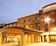
Courtyard Victorville Hesperia
SpringHill Suites Victorville Hesperia
Maple Motel Hesperia
MOTEL 6 HESPERIA
Videos from this area
These are videos related to the place based on their proximity to this place.
A Trip to Cajon Pass on 4-6-11 Part 1 HD
Watch in High Definition! On April 6, 2011, I took a trip to Cajon Pass with a few friends that I know from the San Diego Model Railroad Museum and the Pacific Southwest Railway Museum. We...
A Trip to Cajon Pass on 4-6-11 Part 3 HD
Watch in High Definition! On April 6, 2011, I took a trip to Cajon Pass with a few friends that I know from the San Diego Model Railroad Museum and the Pacific Southwest Railway Museum. We...
A Trip to Cajon Pass on 4-6-11 Part 2 HD
Watch in High Definition! On April 6, 2011, I took a trip to Cajon Pass with a few friends that I know from the San Diego Model Railroad Museum and the Pacific Southwest Railway Museum. We...
Trains in Cajon Pass on 8-12-11 Part 2 HD
Watch in High Definition! On the final day of our trip, we spent the entire day in Cajon Pass. We started at Hill 582 and worked our way down to Blue Cut. This was a great final day to our...
Trains in Cajon Pass on 8-12-11 Part 4 HD
Watch in High Definition! On the final day of our trip, we spent the entire day in Cajon Pass. We started at Hill 582 and worked our way down to Blue Cut. This was a great final day to our...
Two BNSF Hotshot Trains Pass Hill 582 in Cajon Pass HD
Watch in High Definition! Here's the final video from my quick trip to Hill 582 in Cajon Pass. As the sun was setting, two final BNSF Hotshots descended the hill past us. Trains: Train 1:...
Three BNSF Trains Pass Through Silverwood HD
Watch in High Definition! Here's the final video from my day trip to Cajon Pass in December, 2014. We spent the final hours of daylight at Silverwood (also known as West Summit Island or The...
A Few Trains at Hill 582 on Cajon Pass HD
Watch in High Definition! The day after our trip up the UP tracks, my friend and I spent part of the day watching trains in Cajon Pass. I didn't end up doing very much filming, but I still...
Railfanning The Bluff on 4-5-13 Part 2 HD
Watch in High Definition! On the second day of the trip with my friend, we headed to Cajon Pass. To start the day out, we headed to The Bluff, also known as West Summit Island. The spot...
Railfanning The Bluff on 4-5-13 Part 1 HD
Watch in High Definition! On the second day of the trip with my friend, we headed to Cajon Pass. To start the day out, we headed to The Bluff, also known as West Summit Island. The spot...
Videos provided by Youtube are under the copyright of their owners.
Attractions and noteworthy things
Distances are based on the centre of the city/town and sightseeing location. This list contains brief abstracts about monuments, holiday activities, national parcs, museums, organisations and more from the area as well as interesting facts about the region itself. Where available, you'll find the corresponding homepage. Otherwise the related wikipedia article.
Cajon Pass
Cajon Pass is a mountain pass between the San Bernardino Mountains and the San Gabriel Mountains in southern California in the United States. It was created by the movements of the San Andreas Fault. The Mojave Desert pass is an important link from the Greater San Bernardino Area to the Victor Valley, and northeast to Las Vegas. Cajon Pass is at the head of Horsethief Canyon, traversed by California State Route 138 (SR 138) and railroad tracks owned by BNSF Railway and Union Pacific Railroad.
2006 Mercy Air Bell 412 crash
The 2006 Mercy Air helicopter accident occurred on December 10, 2006, about 1755 Pacific standard time, when a Bell 412SP helicopter, call sign "Mercy Air 2," impacted mountainous terrain near Hesperia, California and the Cajon Pass. The commercial helicopter pilot and two medical crew members were killed and the helicopter was destroyed, by the impact and post impact fire. On July 30, 2008, the National Transportation Safety Board released its probable cause report on the accident.


