Safety Score: 2,7 of 5.0 based on data from 9 authorites. Meaning we advice caution when travelling to United States.
Travel warnings are updated daily. Source: Travel Warning United States. Last Update: 2024-05-16 08:19:50
Delve into George
The district George of Adelanto in San Bernardino County (California) is a subburb in United States about 2,234 mi west of Washington DC, the country's capital town.
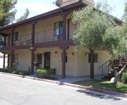
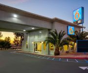
If you need a hotel, we compiled a list of available hotels close to the map centre further down the page.
While being here, you might want to pay a visit to some of the following locations: San Bernardino, Riverside, Orange, Santa Ana and Los Angeles. To further explore this place, just scroll down and browse the available info.
Local weather forecast
Todays Local Weather Conditions & Forecast: 28°C / 83 °F
| Morning Temperature | 17°C / 62 °F |
| Evening Temperature | 29°C / 84 °F |
| Night Temperature | 22°C / 71 °F |
| Chance of rainfall | 0% |
| Air Humidity | 21% |
| Air Pressure | 1009 hPa |
| Wind Speed | Moderate breeze with 12 km/h (8 mph) from East |
| Cloud Conditions | Clear sky, covering 6% of sky |
| General Conditions | Sky is clear |
Friday, 17th of May 2024
30°C (85 °F)
19°C (66 °F)
Sky is clear, moderate breeze, clear sky.
Saturday, 18th of May 2024
27°C (81 °F)
18°C (64 °F)
Sky is clear, moderate breeze, clear sky.
Sunday, 19th of May 2024
26°C (79 °F)
15°C (59 °F)
Sky is clear, moderate breeze, clear sky.
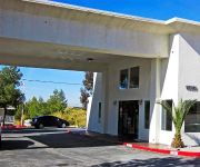
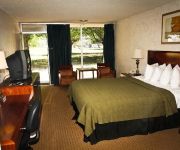
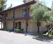
Hotels and Places to Stay
New Corral Motel
Motel 6 Victorville - Desert Express
Green Tree Inn
SUNSET INN VICTORVILLE
TRAVEL INN AND SUITES
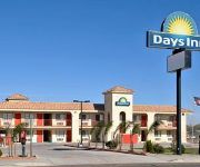
DAYS INN ADELANTO-VICTORVILLE
AMERICAS BEST VALUE INN
Rodeway Inn Victorville
MOTEL 6 VICTORVILLE APPLE VALLEY
MOTEL 6 VICTORVILLE
Videos from this area
These are videos related to the place based on their proximity to this place.
15415 Crabapple Ln Victorville CA
http://www.exite-listings.com/26276 Manufacturing Zoned land, This is a unique piece of property Most of the M-2 zoned land has been purchased by City of Victorville This property is located...
The Lighthouse Church of Adelanto California
Adam Neil pastors The Lighthouse Christian Fellowship Church in Adelanto, California, along with his wife Kiesha and their two children. As a Bible based church they seek to outreach in their...
Adelanto City Council - Nov. 19, 2014 - Residents says more prisons will not fix issues
Charging companies more to build prisons in the high desert. Adelanto's financial problems will not be fixed by adding more prisons.
Adelanto CA. RC Aerial Video the AP solution -low resolution-
http://hdrcpicvideos.blogspot.com/ this video is from the soccer field of Adelanto CA a small town at the high desert.
Find Personal Injury Lawyer Adelanto CA - Call: (855) 978-3515
Find Personal Injury Lawyer Adelanto CA - Call us Now! - (855) 978-3515 The Following Article Is Just For You if You Need Help With Personal Injury Issues! H...
Adelanto City Council - Discussing Immigration Detention Center Expansion
Adelanto City Council- High Desert resident expresses opposition - Nov. 19, 2014 High Desert resident expresses opposition to Adelanto City Council approval for Geo Group expansion. "Adelanto...
Best Personal Injury Lawyer Adelanto CA - Call Toll Free: (855) 978-3515
Best Personal Injury Lawyer Adelanto CA - Call us Toll Free! - (855) 978-3515 If You Need Help With Personal Injury Issues Then The Following Article Is Just...
Adelanto City Council - Discussing Immigration Detention Center Expansion
Representatives of The GEO Group discuss detention expansion in the City of Adelanto, CA. The city council hears information regarding permits and expansion plans.
Find Personal Injury Attorney Adelanto CA - Call: (855) 978-3515
Find Personal Injury Attorney Adelanto CA - Call us Today! - (855) 978-3515 The Following Article Is Just For You if You Need Help With Personal Injury Issue...
Videos provided by Youtube are under the copyright of their owners.
Attractions and noteworthy things
Distances are based on the centre of the city/town and sightseeing location. This list contains brief abstracts about monuments, holiday activities, national parcs, museums, organisations and more from the area as well as interesting facts about the region itself. Where available, you'll find the corresponding homepage. Otherwise the related wikipedia article.
Adelanto, California
Adelanto is a city in San Bernardino County, California about 9 miles northwest of Victorville. The population was 31,765 at the 2010 census, up from 18,130 at the 2000 census.
Mountain View Acres, California
Mountain View Acres is a census-designated place (CDP) in San Bernardino County, California, United States. The population was 3,130 at the 2010 census, up from 2,521 at the 2000 census.
Victor Valley, California
Victor Valley is a subregion of Southern California, north of the San Bernardino Mountains in the Mojave Desert. It is located in San Bernardino County and situated east of the Antelope Valley and north of the Cucamonga Valley. The Victor Valley is part of the Inland Empire subregion of the Greater Los Angeles Area. Out of 5 incorporated cities, the largest one is Victorville.
Stater Bros. Stadium
Stater Bros. Stadium is a stadium in Adelanto, California. It is primarily used for baseball and is the home field of the High Desert Mavericks minor league baseball team. It holds 3,808 people. It was built in 1991, when the Mavericks came to the area. Mavericks Stadium, a city-owned $6.5 million dollar facility, opened on April 23, 1991. The green of the baseball diamond sharply contrasts the surrounding desert landscape.
Southern California Logistics Airport
Southern California Logistics Airport, also known as Victorville Airport, is a public airport located in the city of Victorville in San Bernardino County, California approximately 20 mi north of San Bernardino. Prior to its civil usage, the facility was George Air Force Base from 1941 to 1992 which was a front-line United States Air Force base. The airport is home to Southern California Aviation, a large transitional facility for commercial aircraft.
KILM
KILM, virtual channel 64, is an independent television station licensed to Barstow, California, USA, but with studios in Beverly Hills. The station is owned by Multicultural Broadcasting, but is operated by Alki David's FilmOn under a local marketing agreement. Through this arrangement, KILM carries programming from FilmOn and My Combat Channel.
Mojave Heights, California
Mojave Heights is a community in southern California in the United States. It lies just west of the old U.S. Route 66 in San Bernardino County. The town is located between Victorville and Adelanto, just south of Oro Grande.
George Air Force Base
George Air Force Base (1941–1992) is a former United States Air Force base located within city limits, 8 miles northwest of central Victorville, California, about 75 miles northeast of Los Angeles, California. The facility was closed by the Base Realignment and Closure (or BRAC) 1992 commission at the end of the Cold War. It is now the site of Southern California Logistics Airport. The base was listed as a Superfund site on February 21, 1990.
KVFG
KVFG is a commercial radio station in Victorville, California, broadcasting to the Victor Valley, California, area. KVFG is owned by CBS Radio.
Academy for Academic Excellence
The Academy for Academic Excellence (AAE) is a K-12 public charter school located in Apple Valley, California. The school was first chartered in 1997 by the Apple Valley Unified School District. The AAE is a direct-funded charter school operating as its own Local Educational Agency (LEA). The school currently operates three sites, a K-1 site (Thunderbird Campus), a 2-4 site (Corwin Campus), and a 5-12 site (Mojave River Campus) located on 150 acres adjoining the Mojave River.
The Mall of Victor Valley
The Mall of Victor Valley is a shopping mall located in Victorville, California. It is managed by The Macerich Company. The mall is located near Interstate 15 and Bear Valley Road. The mall has three anchors JCPenney, Sears and a Cinemark 16-screen theatre.
KRSX (AM)
KRSX is a commercial radio station in Victorville, California, broadcasting to the Victor Valley, California, area on 1590 AM. KRSX airs a ranchera music format branded as "Mi Compadre 1590 AM".
KATJ-FM
KATJ-FM is a commercial radio station in Victorville, California, broadcasting to the Victor Valley, California, area on 100.7 FM. It is the High Desert's only live country station. KATJ-FM airs a country music format branded as "Kat Country".
KPTG-LP
KPTG-LP is a radio station broadcasting a religious format. Licensed to Adelanto, California, USA, it serves the Victor Valley area. The station is owned by Calvary Chapel of Adelanto. Much of its programming replicates that of KWVE-FM in San Clemente, California.
Victorville (Amtrak station)
The Victor Valley Transportation Center is an intermodal transit center served by Amtrak, Greyhound, the Victor Valley Transit Authority and military shuttles to Fort Irwin. The center also serves as a Park-and-Ride facility for car-pooling commuters. There is a station building that is open during service hours, with a waiting area and restrooms. The station is served by the Amtrak Southwest Chief, once daily in each direction.
Desert Valley Hospital
Desert Valley Hospital (DVH) is an 83 bed acute care facility in Victorville, California, USA. DVH is owned and operated by Prime Healthcare Services, Inc. (PHS), a hospital management company located in Ontario. PHS was founded in 2001 by Prem Reddy, who acts as its present Chairman of the Board. The hospital groundbreaking was done by Roy Rogers. The hospital is accredited by the American Osteopathic Association's Healthcare Facilities Accreditation Program.
KXRD
KXRD (89.5 FM) is an Air 1 affiliate station licensed to Victorville, California, and serves the Victor Valley area. KXRD signed on in 1996 as a simulcast of KLRD in Yucaipa, California, known as "K-Lord". Shortly after KXRD signed on, the stations were renamed "Air 1", marking the beginning of the Air 1 network.
KHMS
KHMS is a radio station broadcasting a Contemporary Christian format. Licensed to Victorville, California, USA, it serves the Victor Valley area. The station is owned by Faith Communications Corp. and features programing provided from the SOS Radio Network.
DARPA Grand Challenge (2007)
The third driverless car competition of the DARPA Grand Challenge, was commonly known as the DARPA Urban Challenge. It took place on November 3, 2007 at the site of the now-closed George Air Force Base (currently used as Southern California Logistics Airport), in Victorville, California, in the West of the United States. Discovery's Science channel followed a few of the teams and covered the Urban Challenge in its Robocars series.
KIXW (AM)
KIXW is based in Victorville, California, USA, broadcasting on 960 AM (also known locally as "Talk 960"; the station was a long-time CBS Radio affiliate for many years). The station is affiliated with Talk Radio Network but also carries The Rush Limbaugh Show and Coast to Coast AM.
California Route 66 Museum
The California Route 66 Museum is located on historic U.S. Route 66 in Victorville, California, in Old Town Victorville. Three display rooms and a gift shop are housed in the 5,000-square-foot former Red Rooster Cafe. Constantly changing exhibitions follow the development of the Mother Road from the time of early pioneer trails and railroads. Historic photographs and artifacts explore the impact of the highway upon the local economy and culture.
Sunset Ridge, Victorville, California
Sunset Ridge is a small community or neighborhood in the area of Victorville, Hesperia, and Phelan, California. It varies in elevations this community is 3,500 ft–4,000 ft above sea level. It is two and a half hours north-east of Los Angeles. The average heat of summer is 90F degrees, the cold of winter is about 40F degrees. The average snowfall is at least six inches.
Federal Correctional Institution, Victorville
The Federal Correctional Institution, Victorville (FCI Victorville) is a medium-security United States federal prison for male inmates in Victorville, California. Part of the Victorville Federal Prison Complex, it is operated by the Federal Bureau of Prisons, a division of the United States Department of Justice. The facility also has an adjacent satellite prison camp for low-security female inmates. The complex is located on land that was formerly part of George Air Force Base.
United States Penitentiary, Victorville
The United States Penitentiary, Victorville (USP Victorville) is a high-security United States federal prison for male inmates in California. It is part of the Victorville Federal Correctional Complex (FCC Victorville) and is operated by the Federal Bureau of Prisons, a division of the United States Department of Justice. FCC Victorville is located on land that was formerly part of George Air Force Base and is approximately 85 miles northeast of Los Angeles.
Federal Correctional Complex, Victorville
The Federal Correctional Complex, Victorville (FCC Victorville) is a United States federal prison complex in California. It is operated by the Federal Bureau of Prisons, a division of the United States Department of Justice, and consists of two facilities: Federal Correctional Institution, Victorville (FCI Victorville): a medium-security facility for male inmates with a satellite prison camp that houses minimum-security female offenders.


