Safety Score: 2,7 of 5.0 based on data from 9 authorites. Meaning we advice caution when travelling to United States.
Travel warnings are updated daily. Source: Travel Warning United States. Last Update: 2024-05-11 07:34:58
Explore Friendly Village of Anaheim
The district Friendly Village of Anaheim of Yorba Linda in Orange County (California) is located in United States about 2,274 mi west of Washington DC, the country's capital.
If you need a place to sleep, we compiled a list of available hotels close to the map centre further down the page.
Depending on your travel schedule, you might want to pay a visit to some of the following locations: Orange, Santa Ana, Riverside, Los Angeles and San Bernardino. To further explore this place, just scroll down and browse the available info.
Local weather forecast
Todays Local Weather Conditions & Forecast: 26°C / 79 °F
| Morning Temperature | 15°C / 59 °F |
| Evening Temperature | 25°C / 77 °F |
| Night Temperature | 19°C / 66 °F |
| Chance of rainfall | 0% |
| Air Humidity | 35% |
| Air Pressure | 1012 hPa |
| Wind Speed | Gentle Breeze with 8 km/h (5 mph) from North-East |
| Cloud Conditions | Clear sky, covering 0% of sky |
| General Conditions | Sky is clear |
Monday, 13th of May 2024
26°C (78 °F)
17°C (62 °F)
Sky is clear, moderate breeze, clear sky.
Tuesday, 14th of May 2024
22°C (71 °F)
16°C (60 °F)
Sky is clear, gentle breeze, clear sky.
Wednesday, 15th of May 2024
19°C (67 °F)
15°C (59 °F)
Broken clouds, gentle breeze.
Hotels and Places to Stay
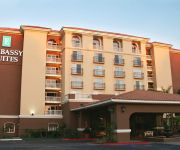
Embassy Suites by Hilton Anaheim North
Fairfield Inn Anaheim Hills Orange County
Residence Inn Anaheim Hills Yorba Linda
AYRES SUITES YORBA LINDA ANAHEIM HILLS
Anaheim Hills Inn and Suites
Motel 6 Orange - Anaheim
Big A Motel
Sky Palm Motel
Orange Tustin Inn
EXTENDED STAY AMERICA YORBA LI
Videos from this area
These are videos related to the place based on their proximity to this place.
19162 Mesa Dr, Villa Park
For more details click here: http://www.visualtour.com/showvt.asp?t=3011322 19162 Mesa Dr Villa Park, CA 92861 $2888888, 4 bed, 4.5 bath, 4657 SF, MLS# PW13048850 Everything about this...
Transitional Design Build Kitchen & Home Remodel in Yorba Linda Orange County
Check out this beautiful custom design build kitchen & home remodel that we have completed in city of Yorba Linda Orange County APlus has been a family-owned business for two generations....
Carpet Cleaning Yorba Linda | 714-621-5852 | Yorba Linda carpet cleaning
http://www.timscarpetcleaning.com Call 714-621-5852 We pride our selves in providing the best carpet cleaning Yorba Linda service in Orange county. We service Yorba Linda, Brea, Anaheim, ...
Yorba Linda Property Management Firm
Property management means much more than maintenance and financial management. You need a reliable Yorba Linda property management partner with the necessary expertise, whether in ...
Carpet Cleaning Yorba Linda | 714-701-6892
Carpet Cleaning Yorba Linda professionals that use green products and advanced carpet cleaning technology to guarantee results and customer satisfaction. Serving the Yorba Linda, California...
Water Extraction Yorba Linda CA 92887 866-445-8856 Water Damage
Visit: http://waterdamage-yorbalinda.com/ Water Extraction Disaster Response of Yorba Linda CA 866-445-8856. Service Experience you can trust when you need the job done right, right away. We...
One of Yorba Linda's Largest Homes
4490 Ohio Yorba Linda, Ca. 92660 11000 sq.ft.home on over an Acre in Yorba Linda. Built in 2009 Listed at $6.9 million Contact Listing Agent Paula Pelton for more information. Coldwell...
Yorba Linda Pines Apartments in Yorba Linda, CA
Yorba Linda Pines Apartments in Yorba Linda, CA http://www.amcliving.com/profile.asp?Aid=18668 Our two and three-bedroom townhomes offer the spacious home you need with the style you want....
Paws 'n' Claws Veterinary Hospital - Short | Yorba Linda, CA
http://pawsnclaws.com/ - Call us today at (714) 462-8666. At Paws 'n' Claws Veterinary Hospital, we specialize in wellness exams, pet health, and emergency care. In addition our facility is...
Videos provided by Youtube are under the copyright of their owners.
Attractions and noteworthy things
Distances are based on the centre of the city/town and sightseeing location. This list contains brief abstracts about monuments, holiday activities, national parcs, museums, organisations and more from the area as well as interesting facts about the region itself. Where available, you'll find the corresponding homepage. Otherwise the related wikipedia article.
Placentia, California
Placentia is a city in northern Orange County, California. The population was 50,533 at the 2010 census, up from 46,488 at the 2000 census. This includes the community of Atwood, which is included in the city of Placentia, and is located in its southernmost quadrant. Primarily known as a bedroom community, Placentia is known for its quiet neighborhoods and strong public safety.
Villa Park, California
Villa Park is a city in northern Orange County, California, near and surrounded by the City of Orange, and close to Anaheim Hills, that incorporated in 1962. As of the 2010 Census, the city had a population of 5,812, down from 5,999 at the 2000 census, achieving the status of the smallest city in Orange County by population (La Palma is Orange County's smallest city in area). Villa Park includes about 2,000 homes and the land is nearly 99% built out.
Richard Nixon Presidential Library and Museum
The Richard Nixon Presidential Library and Museum is the presidential library and final resting place of Richard Milhous Nixon, the 37th President of the United States. Located in Yorba Linda, California, the library is one of twelve administered by the National Archives and Records Administration.
Atwood, Placentia, California
Atwood is a small neighborhood in Placentia, California. It was named for W. J. Atwood, an oil company executive, and was formerly an unincorporated town within Orange County. Its unofficial boundaries are defined roughly as the area of Placentia in the square formed by Orangethorpe Ave. , Van Buren St. , Lakeview Rd. and Miraloma Ave. There is a post office in Atwood with a ZIP code of 92811. However, this ZIP code is only used for PO boxes.
KFSH-FM
KFSH-FM is a radio station in the Los Angeles metropolitan area broadcasting on the FM dial at 95.9 mHz with a contemporary Christian music format full time. It is owned by Salem Communications and is known as "The Fish". The branding is a direct reference to the ancient fish icon used by the Christian church from its birth during the Roman Empire to the present, and the icon itself is part of the station logo.
El Dorado High School (Placentia, California)
El Dorado High School is a 9th–12th grade public high school located in Placentia, California. Established in 1966, it is one of four high schools in the Placentia-Yorba Linda Unified School District. The campus is located at 1651 Valencia Avenue, approximately 29 miles from downtown Los Angeles and 18 miles from the California coastline. The school currently has an enrollment of over 2,400 students. The school's first graduating class was the class of 1969.
Santiago Canyon College
Santiago Canyon College is a two-year community college located at the eastern border of Orange, California at Chapman and Jamboree. It opened in 1985 as the Orange Campus branch to nearby Santa Ana College. In July 1997 the name of the Orange Campus was changed to Santiago Canyon College. Santiago Canyon College was fully accredited by the Western Association of Schools and Colleges in 2000.
KWIZ
KWIZ, is a commercial radio station located in Santa Ana, California, broadcasting to the Los Angeles-Orange County area on 96.7 FM. KWIZ airs a Regional Mexican music format branded as "Sondido 96.7 FM". In the early days, Spider McLaine, Karen Sharpe, John Novak and James Gomez hosted radio shows. The station switched to Spanish language in 1998, about 50 years KWIZ was in operation.
Orange County Zoo
The Orange County Zoo is a small 8-acre zoo located within the 477-acre Irvine Regional Park in the city of Orange, California, United States. The zoo is mainly home to animals and plants that are native to the Southwestern United States.
Olive, California
Olive is an unincorporated parcel of about 25 acres located along Lincoln Avenue between Eisenhower Park and Orange Olive Road, and surrounded by the city of Orange, Orange County, USA.
Orange Park Acres, California
Orange Park Acres is an unincorporated community, forming an island surrounded by the City of Orange in Orange County, California. Its residents are overwhelmingly upper-middle class to wealthy. Its northern border is Santiago Canyon Road and its southern border is Chapman Avenue. It comprises approximately 5,500 residents and is about 1.4 square miles in size.
El Modena, California
El Modena is an area around El Modena High School in the city of Orange, California. It is located near and east of the intersection of Hewes Street and Chapman Avenue. Much of the area was annexed by Orange in the 1960s and 1970s, but there is still an enclave of unincorporated county land to the east of the high school.
California's 42nd congressional district
California's 42nd congressional district is a congressional district in the U.S. state of California that from 2003 to 2013 covered parts of Los Angeles, Orange, and San Bernardino counties in Southern California. The district is currently represented by Republican Ken Calvert. The district is now centered in the Inland Empire including communities of Corona and Murrieta.
Esperanza High School
Esperanza High School (EHS) is a 9th–12th grade public high school located in Anaheim, California and is part of the Placentia-Yorba Linda Unified School District. It is a California Distinguished School and is home to various C.I.F. championship athletic programs; it is also home to numerous academic clubs, such as Speech and Debate, Mock Trial, and Academic Decathlon. It is a member of the Century League. The school's colors are cardinal and gold, and its mascot is the Aztec.
El Modena High School
El Modena High School, also known as called El Mo (or "ElMo"), is a traditional 4 year public high school located in the El Modena neighborhood in the eastern portion of the city of Orange in Orange County, California. The school celebrated its 40th anniversary during the 2006-7 school year. El Modena High is part of the Orange Unified School District and competes in the Century League.
Canyon High School (Anaheim, California)
Canyon High School is a traditional four-year high school located in the Anaheim Hills community in the city of Anaheim, California and is an International Baccalaureate school. It is located on 40 acres of land on Imperial Highway between the cross streets of Santa Ana Canyon Road and Nohl Ranch Road, and serves students in the Orange Unified School District. The school, which opened its doors in 1973, has a student population of 2,400.
El Rancho Charter School
El Rancho is a charter school located in Anaheim Hills, Anaheim, California. The 2008-2009 enrollment was 1,118 students.
Villa Park High School
Villa Park High School (or VPHS) is a suburban public high school in Villa Park, California. The school was built in 1964 and is one of four comprehensive high schools in the Orange Unified School District. The campus serves students residing in Villa Park and portions of the cities of Orange and Anaheim. Enrollment at VPHS (for 2011-12 school year) is 2,491 students.
Anaheim Hills, Anaheim, California
Anaheim Hills is an affluent planned community encompassing the eastern portions of the city of Anaheim, in Orange County, California.
Anaheim Canyon (Metrolink station)
Anaheim Canyon is a Metrolink station in Anaheim, California, served by the Inland Empire–Orange County Line. It is located at 1039 North Pacificenter Drive, which is near La Palma Avenue and North Tustin Avenue.
Rancho Cañón de Santa Ana
Rancho Cañón de Santa Ana was a 13,328-acre land grant in present day Orange County, California given by Mexican governor José Figueroa in 1834 to Bernardo Yorba. The name means "Canyon of Santa Ana". The grant included present day Yorba Linda.
Yorba Linda High School
Yorba Linda High School (YLHS) is a 9th–12th grade public high school located in Yorba Linda, California and is part of the Placentia-Yorba Linda Unified School District. The school's colors are Navy Blue, Crimson and Silver. The school mascot is the Mustang. Most students come from Yorba Linda, California with the rest generally residing in Anaheim and east Placentia.
Lutheran High School of Orange County
Lutheran High School of Orange County is a private Lutheran high school in Orange, California, founded in 1973.
Villa Park Dam
Villa Park Dam is an embankment dam on Santiago Creek in Orange County, California in the United States. Along with the upstream Santiago Dam, the dam serves primarily for flood control for the cities of Villa Park, Orange, Tustin and Santa Ana and also regulates the inflow of Santiago Creek into the Santa Ana River. Construction was completed in 1963, and the dam is owned by the Orange County Water District.
Peters Canyon
Peters Canyon Regional Park is a regional park within the Orange County Regional Parks System. The park contains 354 acres of southern California wildlife, including costal sage shrub, riparian, freshwater marsh, and grasslands, and is located within the boundaries of both Orange, California and Tustin, California. Peters Canyon was given to this city in 1992 by the Irvine Company who had used it previously for cattle grazing.


