Safety Score: 2,7 of 5.0 based on data from 9 authorites. Meaning we advice caution when travelling to United States.
Travel warnings are updated daily. Source: Travel Warning United States. Last Update: 2024-05-17 08:07:57
Discover Charter Oak Mobile Estates
The district Charter Oak Mobile Estates of San Dimas in Los Angeles County (California) is a district in United States about 2,271 mi west of Washington DC, the country's capital city.
Looking for a place to stay? we compiled a list of available hotels close to the map centre further down the page.
When in this area, you might want to pay a visit to some of the following locations: Orange, Santa Ana, Los Angeles, Riverside and San Bernardino. To further explore this place, just scroll down and browse the available info.
Local weather forecast
Todays Local Weather Conditions & Forecast: 22°C / 72 °F
| Morning Temperature | 15°C / 58 °F |
| Evening Temperature | 22°C / 72 °F |
| Night Temperature | 16°C / 61 °F |
| Chance of rainfall | 0% |
| Air Humidity | 53% |
| Air Pressure | 1014 hPa |
| Wind Speed | Gentle Breeze with 7 km/h (4 mph) from North |
| Cloud Conditions | Clear sky, covering 0% of sky |
| General Conditions | Sky is clear |
Saturday, 18th of May 2024
22°C (72 °F)
15°C (59 °F)
Sky is clear, gentle breeze, clear sky.
Sunday, 19th of May 2024
23°C (73 °F)
13°C (56 °F)
Sky is clear, gentle breeze, clear sky.
Monday, 20th of May 2024
17°C (63 °F)
13°C (55 °F)
Overcast clouds, gentle breeze.
Hotels and Places to Stay
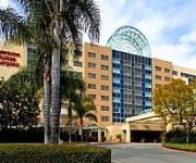
Sheraton Fairplex Hotel & Conference Center
DoubleTree by Hilton Pomona
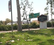
Hampton Inn Los Angeles-West Covina
Holiday Inn Express & Suites SAN DIMAS
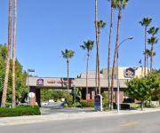
BEST WESTERN SAN DIMAS HOTEL
BEST WESTERN DIAMOND BAR HOTEL AND SUITE
BEST WESTERN PLUS WEST COVINA
Fairfield Inn & Suites Los Angeles West Covina
La Quinta Inn and Suites Pomona
DAYS INN OF WEST COVINA
Videos from this area
These are videos related to the place based on their proximity to this place.
Thunder Rapids (HD POV) - Water Slide at Raging Waters (San Dimas, CA)
Thunder Rapids is a family style raft slide at Raging Waters in San Dimas. This HD POV shows the high banked turns and all the excitement. Make sure to take a ride on Thunder Rapids on your...
The Bermuda Triangle (HD POV) - Water Slide at Raging Waters (San Dimas, CA)
Bermuda Triangle water slide consists of three twisting, turning, downward tunnels that recycle more than 2500 gallons of water a minute and make you feel like you've entered the Bermuda Triangle....
Dragon's Den (HD POV) - Water Slide at Raging Waters (San Dimas, CA)
This two-person bowl slide is the newest wave in slide design and technology. Guests soar down a 45-foot-drop through a fully enclosed flume, spin around a 35 foot bowl, all while a 9-foot...
CampgroundViews.com - East Shore RV Park San Dimas California CA Bonelli County Park
http://www.CampgroundViews.com takes user submitted videos combined with professional editing to provide tent and RV campers with a first person view of a campground or RV park. East Shore...
Tunnel of Terror (HD POV) - Water Slide at Raging Waters (San Dimas, CA)
We hope you aren't afraid of the dark!! On this thrill slide you'll experience a breathtaking 40-ft drop. Soar to dizzying heights on back-to-back vertical banks. Complete a pair of hi-speed...
2010 Covina Colts @ San Dimas Saints
Watch the San Dimas Saints fold in the 4th Quarter to the Covina Colts, blowing a 23 - 6 Halftime lead to lose 27 - 23 on a fantastic 4th Quarter drive led by QB BL throwing the game winning...
Ragin Racer (HD POV) - Water Slide at Raging Waters (San Dimas, CA)
Ragin Racer is a nonstop thrill ride to the finish at Raging Waters in San Dimas. Make sure to stop by for a ride on your next visit to Souther California's largest Water Park! Please LIKE...
High Extreme 2 : Left Side (HD POV) - Water Slide at Raging Waters (San Dimas, CA)
Guests are taken to a new thrill level, beginning their descent head first on mats. Go down 600-foot-long flumes, banking and rocking off turns for an exhilarating ride of up to 35 miles per...
Sticky Steve San Dimas Waterfall Cataract Falls
This video was uploaded from an Android phone. Sticky Steve Comment this video! And I need Your boys names too too add the other videos.
Videos provided by Youtube are under the copyright of their owners.
Attractions and noteworthy things
Distances are based on the centre of the city/town and sightseeing location. This list contains brief abstracts about monuments, holiday activities, national parcs, museums, organisations and more from the area as well as interesting facts about the region itself. Where available, you'll find the corresponding homepage. Otherwise the related wikipedia article.
University of La Verne
The University of La Verne is a private research university located in La Verne, California, United States, about 35 miles east of Los Angeles. Founded in 1891, the university is composed of the College of Arts & Sciences, College of Business & Public Management, College of Education and Organizational Leadership, College of Law, and a Regional Campus Administration that oversees seven regional campuses. It awards both undergraduate and graduate degrees.
Charter Oak, California
Charter Oak is a census-designated place (CDP) in Los Angeles County, California, approximately 26 miles east of downtown Los Angeles. The population was 9,310 at the 2010 census, up from 9,027 at the 2000 census. Charter Oak is located in the eastern San Gabriel Valley, situated along Arrow Highway in between Covina to the south, Glendora to the north and San Dimas to the east. Some residents refer to the CDP portion as the "unincorporated part of Covina".
Covina, California
Covina is a small city in Los Angeles County, California about 22 miles east of downtown Los Angeles, in the San Gabriel Valley region. The population was 47,796 at the 2010 census, up from 46,837 at the 2000 census. The city's slogan, "One Mile Square and All There" was coined when the incorporated area of the city was only (some say slightly less than) one square mile, making it the smallest city in area in the country.
Glendora, California
Glendora is a municipality in Los Angeles County, California, United States, 23 miles east of downtown Los Angeles. As of the 2010 census, the population of Glendora was 50,073. Glendora is an upscale city with a diverse housing stock and a consistently high-ranking school district. Glendora lies within the San Gabriel Valley, area code 626.
Frank G. Bonelli Regional Park
Frank G. Bonelli Regional Park is a synthetic (i.e. , man-made) recreation park in San Dimas, California of Los Angeles County. It is near the Orange Freeway (State Route 57), the Foothill Freeway (Interstate 210) and the San Bernardino Freeway (Interstate 10). The park contains a beautiful 250 acre (1 km²) lake called Puddingstone Reservoir, which provides a place for fishing, swimming, sailing, wind surfing, boating, jet skiing, etc.
California State Polytechnic University, Pomona
California State Polytechnic University, Pomona (CPP, Cal Poly Pomona, or Cal Poly,, and informally CSU Pomona) is a public polytechnic university located in Pomona, California, United States. It is one of two polytechnics in the 23-member California State University system and one of only seven in all of the United States.
Kellogg Interchange
The Kellogg Interchange complex is a freeway interchange in Southern California. The interchange is located at the boundary between the cities of San Dimas and Pomona about 25 miles east of downtown Los Angeles. It is named for the nearby W. K. Kellogg Ranch, now home to Cal Poly Pomona.
Rubel Castle
Rubel Castle (also known as Rubelia) was established in Glendora, California, by Michael Clarke Rubel (April 16, 1940-October 15, 2007). It has been called "a San Gabriel Valley version of Watts Towers. ” Rubel purchased a 2 ½ acre citrus orchard on which the structure resides in 1959. He and his friends completed construction in 1986.
Brackett Field
Brackett Field is a public airport located one mile (2 km) southwest of La Verne, in Los Angeles County, California, USA. It was named after Dr. Frank Parkhurst Brackett (1865–1951).
Damien High School
Damien High School is an all-male Roman Catholic high school in La Verne, California named for Saint Damien of Molokai. The school had its first graduating class in 1963. Each of Damien's freshmen classes draws from an average of over 75 different elementary and junior high schools for youths from Los Angeles and San Bernardino counties. It is located in the Roman Catholic Archdiocese of Los Angeles.
Puddingstone Reservoir
Puddingstone Reservoir is a 250 acre (1 km²) synthetic lake northeast of the interchange between the Orange Freeway (State Route 57) and the San Bernardino Freeway (Interstate 10) in Los Angeles County, California, United States. Activities include fishing, swimming, sailing, wind surfing, and camping. Brackett Field, Raging Waters, and Fairplex (formerly the Los Angeles County Fairgrounds) are all adjacent to Puddingstone Reservoir, which is inside Bonelli Regional Park.
Auto Club Raceway at Pomona
Auto Club Raceway at Pomona, formerly known as Pomona Raceway, is a racing facility located in Pomona, California that features a quarter-mile dragstrip. The dragstrip is most famous for hosting the NHRA's Winternationals event since 1961, the traditional season opener, as well as the seasons last race, the NHRA Finals. The facility has a seating capacity of 40,000 spectators. It is one of the most famous, well known dragstrips in North America.
Cal Poly Pomona College of Engineering
The Cal Poly Pomona College of Engineering is the engineering college at California State Polytechnic University, Pomona (Cal Poly Pomona) located in Pomona, California, United States.
Cal Poly Pomona College of Environmental Design
The Cal Poly Pomona College of Environmental Design (CENV) is a college part of the California State Polytechnic University, Pomona (Cal Poly Pomona). The college houses over 1,600 students; making it one of largest environmental design programs in the United States. The college offers bachelor's degrees in five departments, as well as three master's degree programs.
Cal Poly Pomona College of Business Administration
The Cal Poly Pomona College of Business Administration is the business college at California State Polytechnic University, Pomona (Cal Poly Pomona) located in Pomona, California, United States. The College of Business Administration educates students in technical and managerial competence necessary for successful performance in business, industry, government and education. CBA is accredited by AACSB International.
Cal Poly Pomona College of Education and Integrative Studies
The College of Education and Integrative Studies (CEIS) at Cal Poly Pomona has 4 departments.
W. K. Kellogg Arabian Horse Center
The W. K. Kellogg Arabian Horse Center is a research facility on the campus of the California State Polytechnic University, Pomona (Cal Poly Pomona) which specializes on equine studies, breeding and research.
Collins College of Hospitality Management
The Collins College of Hospitality Management is a college part of the California State Polytechnic University, Pomona (Cal Poly Pomona). Founded in 1973, it was the first hospitality management studies program in California and its thousand students make it the largest such school in the state. As of 2010, The Collins College of Hospitality Management is ranked third in the nation by restaurant executives. Andrew Hale Feinstein is Dean and James A. Collins Distinguished Chair.
Covina massacre
The Covina massacre occurred on December 24, 2008, in Covina, a city in the suburbs of Los Angeles, California, United States. Nine people were killed from either gunshot wounds or an arson fire inside a house on 1129 East Knollcrest Drive where a Christmas Eve party was being held.
Rancho Los Nogales
Rancho Los Nogales was a 1,004-acre Mexican land grant in present day Los Angeles County, California given in 1840 by Governor Juan Alvarado to Jose de la Luz Linares. The name means "Ranch of the Walnut Trees" in Spanish. The triangular-shaped land grant between San Jose Creek and Diamond Bar Creek included parts of present day Walnut and Diamond Bar.
San Dimas High School
San Dimas High School is a secondary school located in San Dimas, California, in the United States. It is part of the Bonita Unified School District. Most of the students come from Lone Hill Middle School which shares the same city block as the High School. The school has a student body of 1,296 http://dq. cde. ca. gov/dataquest/Enrollment/GradeEnr.
CLA Building
The Classroom, Laboratory & Administration Building commonly known simply as the CLA Building is a building on the campus of the California State Polytechnic University, Pomona (Cal Poly Pomona). Designed by Albuquerque, New Mexico-based architect Antoine Predock in the Futurist style and completed in 1993, it has come to be the defining image of the university. Its pointed, triangular and open top makes it the most distinct tower on the university campus.
Cal Poly Pomona University Library
The Cal Poly Pomona University Library is the main library on the campus of California State Polytechnic University, Pomona (Cal Poly Pomona). It has in its collection 670,580 books; 6,883 serial subscriptions and 10,417 audiovisual materials. The library houses art paintings by Roy Lichtenstein and Le Corbusier. The library participates in the Online Computer Library Center (OCLC) Enhance program which allows the library to correct or add information to bibliographic records in WorldCat.
Hilmer Lodge Stadium
Hilmer Lodge Stadium on the Mount San Antonio College (Mt. SAC) campus in Walnut, California is the football stadium for the community college. It is also the home of the Mt. SAC Relays, an annual, multi-day track and field festival that attracts elite athletes from around the world to this early season (April) event. The event claims to host 15,000 participants with crowds of spectators to match.
Badillo Elementary School
Badillo Elementary School was built in 1957. Badillo was named after two brothers, Julian and Antonio Badillo (Badilla). They were coffee bean farmers from Costa Rica who came to Covina to establish a coffee plantation. Badillo Elementary School is one of ten schools in the Charter Oak Unified School District and is located in the City of Covina in the San Gabriel Valley which is east of Los Angeles. 30px This United States school-related article is a stub.


