Safety Score: 2,7 of 5.0 based on data from 9 authorites. Meaning we advice caution when travelling to United States.
Travel warnings are updated daily. Source: Travel Warning United States. Last Update: 2024-05-10 08:04:54
Discover Imperial Courts
The district Imperial Courts of Lynwood in Los Angeles County (California) is a subburb in United States about 2,296 mi west of Washington DC, the country's capital city.
If you need a hotel, we compiled a list of available hotels close to the map centre further down the page.
While being here, you might want to pay a visit to some of the following locations: Los Angeles, Orange, Santa Ana, Riverside and San Bernardino. To further explore this place, just scroll down and browse the available info.
Local weather forecast
Todays Local Weather Conditions & Forecast: 23°C / 74 °F
| Morning Temperature | 16°C / 61 °F |
| Evening Temperature | 21°C / 69 °F |
| Night Temperature | 18°C / 65 °F |
| Chance of rainfall | 0% |
| Air Humidity | 41% |
| Air Pressure | 1014 hPa |
| Wind Speed | Moderate breeze with 10 km/h (6 mph) from North-East |
| Cloud Conditions | Clear sky, covering 0% of sky |
| General Conditions | Sky is clear |
Saturday, 11th of May 2024
24°C (76 °F)
19°C (67 °F)
Sky is clear, gentle breeze, clear sky.
Sunday, 12th of May 2024
22°C (72 °F)
20°C (67 °F)
Sky is clear, gentle breeze, clear sky.
Monday, 13th of May 2024
22°C (71 °F)
18°C (64 °F)
Sky is clear, gentle breeze, clear sky.
Hotels and Places to Stay
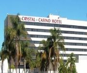
CRYSTAL CASINO AND HOTEL LOS ANGELES
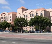
Hampton Inn Los Angeles-Carson
Satellite Motel
Diamond Bell Inn & Suites
Sea Rock Inn
SCOTTISH INNS MAYWOOD HUNTINGTON PARK
Lido Hotel
Rio Motor Palace Inn
Clover Motel
Town House Motel
Videos from this area
These are videos related to the place based on their proximity to this place.
Compton Teenage Wasteland Revolución 77
Digitally remastered copy of Revolución 77 off Teenage Wasteland's self title album. Written by Stanley Castaneda, Preformed by Teenage Wasteland.
Guy Going Gangsta At Metro Station In Lynwood CA
Just look at him like if he knew I was recording it, but hey sing with me, pin pin pire pin pin pire!
We Buy Houses Lynwood CA - CALL 310-800-2603 - Sell My House Fast Lynwood CA
We Buy Houses Lynwood, GET QUICK CASH OFFER at http://www.crystalbuyshousesfast.com/ Your looking to sell your house fast in Lynwood CA? That is how you find this video. Fortunately, you've...
President Obama driving by Century City, Los Angeles
Obama passing century city in la. April 21 2011.
2004 Chevrolet Avalanche Used Cars Lynwood CA
http://www.qkandeasyautosales.com This 2004 Chevrolet Avalanche is available from Quick & Easy Auto Sales. For details, call us at 424-785-7053.
NWA Pro/Mach-1 Wrestling Center City Slam pt2
NO DISQUALIFICATION!!! Leo Blaze, Josh Rozay, Andrew Hellman, James Morgan w/Christian Cole VS. Nick Madrid, Jarek Matthews, Kyle Webb, Jason Watts (7-23-11) "Part 2"
2000 Ford F150 Used Cars Lynwood CA
http://www.qkandeasyautosales.com This 2000 Ford F150 is available from Quick & Easy Auto Sales. For details, call us at 424-785-7053.
2006 Land Rover Range Rover Used Cars Lynwood CA
http://www.qkandeasyautosales.com This 2006 Land Rover Range Rover is available from Quick & Easy Auto Sales. For details, call us at 424-785-7053.
Help-Portrait Los Angeles December 10, 2011
Help Portrait Los Angeles December 10,2011 @Imperial Court Rec Center. *Video shot by Ed Lyman,Tim Greenlee, and Breezy Baldwin* Founded by Celebrity Photographer Jeremy Cowart, ...
Что такое vlog | Банды Лос-Анджелеса | Район Watts CA
Решил рассказать немного о моем канале, планах на будущее и о том, что такое влог (vlog). Не забывайте смотреть...
Videos provided by Youtube are under the copyright of their owners.
Attractions and noteworthy things
Distances are based on the centre of the city/town and sightseeing location. This list contains brief abstracts about monuments, holiday activities, national parcs, museums, organisations and more from the area as well as interesting facts about the region itself. Where available, you'll find the corresponding homepage. Otherwise the related wikipedia article.
Compton, California
Compton is a city in southern Los Angeles County, California, United States, situated southeast of downtown Los Angeles. The city of Compton is one of the oldest cities in the county and on May 11, 1888, was the eighth city to incorporate. As of the 2010 United States Census, the city had a total population of 96,455. It is known as the "Hub City" due to its geographic centrality in Los Angeles County. Neighborhoods in Compton include Sunny Cove, Leland, Downtown Compton, and Richland Farms.
East Rancho Dominguez, California
East Rancho Dominguez, also known as East Compton, is an unincorporated community and census-designated place (CDP) located in southern Los Angeles County, California. The population was 15,135 at the 2010 census, up from 9,286 at the 2000 census. East Rancho Dominguez is an accepted city name according to the USPS, and shares the 90221 ZIP Code with Compton. East Rancho Dominguez is an unincorporated enclave surrounded by Compton within five blocks east and west of Atlantic Ave.. Alondra Blvd.
Florence-Graham, California
Florence-Graham (locally known as Florence-Firestone) is a census-designated place (CDP) in Los Angeles County, California, United States. The population was 63,387 at the 2010 census, up from 60,197 at the 2000 census. The census area includes separate communities of Florence, Firestone Park, and Graham.
South Gate, California
South Gate is the seventeenth largest city in Los Angeles County, California, with 7.4 square miles . South Gate is located 7 miles southeast of downtown Los Angeles It is part of the Gateway Cities region of southeastern Los Angeles County. As of the 2010 census, the city had a population of 94,396. The city was incorporated on January 20, 1923, and it became known as the "Azalea City" when it adopted the flower as its symbol in 1965. In 1990, South Gate was one of ten U.S.
Walnut Park, California
Walnut Park is a census-designated place (CDP) in Los Angeles County, California, United States. The population was 15,966 at the 2010 census, down from 16,180 at the 2000 census.
Willowbrook, California
Willowbrook is an unincorporated community and census-designated place (CDP) in Los Angeles County, California. The population was 35,983 at the 2010 census, up from 34,138 at the 2000 census. The community is located near the southeast edge of, and is often considered part of, South Los Angeles. Willowbrook is often mistaken to be the city of Compton because they share the zipcode 90222, and the majority of residents use Compton as their mailing address.
Los Angeles metropolitan area
The Los Angeles metropolitan area, also known as Metropolitan Los Angeles or the Southland, is the 13th largest metropolitan area in the world and the second-largest metropolitan area in the United States. It is entirely located in the southern portion of the U.S. State of California.
Watts, Los Angeles
Watts is a mostly residential district in South Los Angeles, California.
Compton High School
Compton High School is a high school in Compton, California, part of the Compton Unified School District.
Compton/Woodley Airport
Compton/Woodley Airport is a county-owned public-use airport located two miles (3 km) southwest of the central business district of Compton, a city in southern Los Angeles County, California, United States. According to the FAA's National Plan of Integrated Airport Systems for 2007–2011, it is categorized as a reliever airport. The airport opened on May 10, 1924.
Nickerson Gardens
Nickerson Gardens is a 1054-unit public housing apartment complex at 1590 East 114th Street http://www. hacla. org/attachments/wysiwyg/10/dvmptsforpublichousing. pdf in Watts, Los Angeles, California. Nickerson Gardens consists of 156 buildings with townhouse style units ranging in size from one bedroom to five bedrooms. It was completed in the year 1955, and the original architect was Paul Revere Williams. It was named after William Nickerson, Jr.
Gonzaque Village
Gonzaque Village (formerly Hacienda Village), a public housing project located in Watts, Los Angeles, California, it's operated by the Housing Authority of the City of Los Angeles. It was built in 1942 in 17.6 acres (71,200 m²) of flat land. Its 71 one-story buildings have 182 units housing 437 residents. The projects is home to the Eastside Hacienda Village Bloods and Southside Watts Village Boys 13.
John C. Fremont High School
John C. Fremont Senior High School is a Title 1 co-educational public high school located in South Central, Los Angeles, California, United States. Fremont serves several Los Angeles neighborhoods and the unincorporated community of Florence-Graham; some sections of Florence-Graham are jointly zoned to Fremont and David Starr Jordan High School. The Avalon Gardens public housing project is zoned to Fremont. The school first opened in 1924 and is named after John C. Frémont.
Martin Luther King, Jr. Multi-Service Ambulatory Care Center
The Martin Luther King, Jr. Multi-Service Ambulatory Care Center (MLK-MACC), formerly known as Martin Luther King Jr. /Drew Medical Center (King/Drew) and later Martin Luther King Jr. -Harbor Hospital (MLK-Harbor or King-Harbor), is a public urgent care center and outpatient clinic in Willowbrook, an unincorporated section of Los Angeles County, California, north of the city of Compton and south of the Watts neighborhood of Los Angeles.
Verbum Dei High School
Verbum Dei High School, colloquially referred to as "the Verb” is an all-male Catholic, Jesuit, college and career preparatory complemented by a corporate internship program, serving young men of Watts and the surrounding communities who are economically and academically under served.
Avalon Gardens
The Avalon Gardens is a public housing project with 80 units at 701 East 88th Place, Los Angeles, California http://www. hacla. org/housing_programs/pubhsg_addresses. htm. The Housing Authority of the City of Los Angeles operates the complex.
King Drew Magnet High School of Medicine and Science
King Drew Magnet High School of Medicine and Science is an alternative high school of the Los Angeles Unified School District, located in Willowbrook, unincorporated Los Angeles County, California. The school offers a very extensive medical magnet program, in teamwork with King Drew Medical Center, which is located adjacent to the school site.
Los Angeles Airways Flight 417
Los Angeles Airways Flight 417 was a helicopter that crashed on August 14, 1968 in the city of Compton, California. All eighteen passengers and three crewmembers were fatally injured. The aircraft was destroyed by impact and fire. According to the National Transportation Safety Board the probable cause of the accident was fatigue failure. The accident happened when the yellow blade, one of five main rotor blades, separated at the spindle which attached the blade to the rotor head.
South Los Angeles
South Los Angeles (often abbreviated as South L.A. and also known as South Central) is a large geographic and cultural portion lying to the southwest and southeast of downtown Los Angeles, California. It had a population of 749,453 in 2000, according to the U.S. Census with a density of 14,671 people per square mile. The area was formerly called South Central, and is still widely known as such. It borders the Westside on the northwest, and Downtown Los Angeles on the northeast.
Judge Harry Pregerson Interchange
The Judge Harry Pregerson Interchange is a stack interchange near the Athens and Watts communities of Los Angeles, California. It is the interchange of the following routes: I-105 (Glenn M.
Lynwood, California
Lynwood is a city in Los Angeles County, California, United States of America. As of the 2010 census, the city had a total population of 69,772, down from 69,845 at the 2000 census. Lynwood is located near South Gate and Compton in the southern portion of the Los Angeles Basin. Incorporated in 1921, the city is named for Mrs. Lynn Wood Sessions, wife of a local dairyman, Charles Sessions. The local railroad siding and later Pacific Electric Railway station were named after the dairy.
Nadeau, California
Nadeau is a former settlement in the Tehachapi Mountains, in Kern County, California. It was located on the railroad 5 miles east of Cameron, and west of Tehachapi, California.
Centennial High School (Compton, California)
Centennial High School (commonly referred to as The Apaches because of its mascot or The Big-10) is a public high school in Compton, California, part of the Los Angeles metropolitan area. Construction of Centennial High School began in 1953, and it was erected in 1954, with its first graduating class in 1954. It is the smallest of the three high schools in the Compton Unified School District, which also includes Compton High School and Manuel Dominguez High School.
Rancho La Tajauta
Rancho Tajauta was a 3,560-acre Mexican land grant in present day Los Angeles County, California given in 1843 by Governor Manuel Micheltorena to Anastasio Avila. The grant was named for the Gabrielino/Tongva place name of Tajáuta. The grant encompassed present day Willowbrook and Watts.
Cooper Drum Company
Cooper Drum Company recycled closed top, steel drums on a 3.8-acre facility in South Gate, California from 1976 to 2003. They used strong chemicals to recondition the drums, leading to public concern about health impacts on the surrounding community. In particular, staff and students from Tweedy Elementary School, which borders the Cooper Drum site to the south, complained of health problems that may have resulted from exposure to toxic chemical coming from Cooper Drum Company.


