Safety Score: 3,0 of 5.0 based on data from 9 authorites. Meaning we advice caution when travelling to New Zealand.
Travel warnings are updated daily. Source: Travel Warning New Zealand. Last Update: 2024-04-26 08:02:42
Explore Tangowahine
Tangowahine in Kaipara District (Northland) is a city in New Zealand about 377 mi (or 607 km) north of Wellington, the country's capital.
Local time in Tangowahine is now 11:41 PM (Friday). The local timezone is named Pacific / Auckland with an UTC offset of 12 hours. We know of 8 airports in the vicinity of Tangowahine, of which one is a larger airport. The closest airport in New Zealand is Dargaville Aerodrome in a distance of 6 mi (or 9 km), South-West. Besides the airports, there are other travel options available (check left side).
If you need a place to sleep, we compiled a list of available hotels close to the map centre further down the page.
Depending on your travel schedule, you might want to pay a visit to some of the following locations: Whangarei, Kaitaia, Auckland, Hamilton and Tauranga. To further explore this place, just scroll down and browse the available info.
Local weather forecast
Todays Local Weather Conditions & Forecast: 22°C / 72 °F
| Morning Temperature | 13°C / 56 °F |
| Evening Temperature | 15°C / 59 °F |
| Night Temperature | 14°C / 57 °F |
| Chance of rainfall | 0% |
| Air Humidity | 49% |
| Air Pressure | 1007 hPa |
| Wind Speed | Gentle Breeze with 7 km/h (4 mph) from North-East |
| Cloud Conditions | Overcast clouds, covering 89% of sky |
| General Conditions | Light rain |
Saturday, 27th of April 2024
17°C (63 °F)
13°C (55 °F)
Light rain, light breeze, overcast clouds.
Sunday, 28th of April 2024
18°C (64 °F)
15°C (59 °F)
Few clouds, light breeze.
Monday, 29th of April 2024
19°C (66 °F)
15°C (60 °F)
Light rain, gentle breeze, scattered clouds.
Hotels and Places to Stay
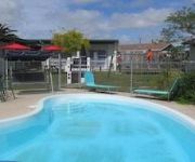
Parkview Motel
Northern Wairoa Hotel
Videos from this area
These are videos related to the place based on their proximity to this place.
Road Trip: Episode 9
The final departure but is this really the end? An interactive part-drama, part-doco series filmed across New Zealand, featuring real-life stories from local communities. http://FB.COM/NZRoadTri...
Newman Engineering Baylys 2 Dargaville Run/Walk - 9 May 2010
Event two in the Sport Northland Run/Walk Series. The event has two distances 6.8km and 12km. Start footage is from the 6.8km start. More information at www.runwalkseries.co.nz.
Big Trees Liammichelle's photos around Waipoua Kauri Forest, New Zealand (big tree new zealand)
Preview of Liammichelle's blog at TravelPod. Read the full blog here: http://www.travelpod.com/travel-blog-entries/liammichelle/downunder-0405/1103258160/tpod.html This blog preview was...
Videos provided by Youtube are under the copyright of their owners.
Attractions and noteworthy things
Distances are based on the centre of the city/town and sightseeing location. This list contains brief abstracts about monuments, holiday activities, national parcs, museums, organisations and more from the area as well as interesting facts about the region itself. Where available, you'll find the corresponding homepage. Otherwise the related wikipedia article.
Tangowahine
Tangowahine is a community on the northern Kaipara Harbour in Northland, New Zealand. The Tangowahine Stream flows from the Tutumoe Range east and then south to join the Wairoa River at Tangowahine. State Highway 14 passes through Tangowahine. Dargaville is 12 km to the south west, and Tangiteroria is 15 km north east.
Manganui River (Northland)
New Zealand's largest Manganui River is a river of the Northland Region of New Zealand's North Island. It follows a generally westward course from its sources west of Ruakaka before its outflow into the Wairoa River five kilometres east of Dargaville. The river's lower course is noted for its convoluted, winding path through low-lying swampy terrain, and several oxbow lakes are associated with this stretch of the river.


