Safety Score: 3,0 of 5.0 based on data from 9 authorites. Meaning we advice caution when travelling to Belgium.
Travel warnings are updated daily. Source: Travel Warning Belgium. Last Update: 2024-05-08 08:04:21
Explore Caturiaux
The district Caturiaux of Basse Lasne in Province du Brabant Wallon (Wallonia) is located in Belgium about 14 mi south-east of Brussels, the country's capital.
If you need a place to sleep, we compiled a list of available hotels close to the map centre further down the page.
Depending on your travel schedule, you might want to pay a visit to some of the following locations: Chastre, Brussels, Lennik, Namur and Enghien. To further explore this place, just scroll down and browse the available info.
Local weather forecast
Todays Local Weather Conditions & Forecast: 13°C / 55 °F
| Morning Temperature | 8°C / 46 °F |
| Evening Temperature | 13°C / 56 °F |
| Night Temperature | 12°C / 54 °F |
| Chance of rainfall | 0% |
| Air Humidity | 81% |
| Air Pressure | 1027 hPa |
| Wind Speed | Gentle Breeze with 6 km/h (4 mph) from South |
| Cloud Conditions | Overcast clouds, covering 93% of sky |
| General Conditions | Overcast clouds |
Thursday, 9th of May 2024
17°C (63 °F)
12°C (53 °F)
Broken clouds, light breeze.
Friday, 10th of May 2024
19°C (66 °F)
14°C (56 °F)
Broken clouds, gentle breeze.
Saturday, 11th of May 2024
21°C (69 °F)
14°C (57 °F)
Light rain, gentle breeze, overcast clouds.
Hotels and Places to Stay
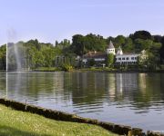
Chateau du Lac
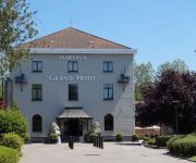
Martin's Grand Hotel
RELAIS DE L'EMPEREUR
Des Heures Claires
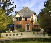
Martin’s Manoir
MARTINS LE LIDO
Martin's Waterloo
Videos from this area
These are videos related to the place based on their proximity to this place.
krav maga wavre rixensart
Pour de plus amples informations (cours, tarifs...) veuillez consulter notre site web : www.kravmaga-wavre-rixensart.be www.kravmaga-belgium.be/
Débardage au cheval au centre PMS, Rixensart
Marc et Ulysse de Trait pour Trait qui débardent au centre PMS de Rixensart.
Rixensart 8h26... une situation ordinaire...
Depuis quelques semaines, comme l'an dernier, en heure de pointe la SNCB met des trains minuscules, les gens sont entassés comme du bétail, dans des conditions de sécurité catastrophiques......
Tilt - Espace culturel d'éveil et d'ouverture
Un espace culturel pour enfants qui propose des activités, stages, ateliers... au coeur du Brabant-Wallon. C'est l'abréviation de Terrain Interactif Ludique pour Tous, un espace dédié...
Chanson Capillairo-militaire
Le 09/03/2013 au Centre Culturel de Rixensart Présentation de l'album "La Surprise du Chef" par Rémy Orianne.
No sun edit Bmx
Edit faite le 24 aout 2012 avec Robin Vandermoortele et Maxime Donnay pour Max'is Production( Maxime Donnay) . Tourner et rider en Belgique a Rixensart dans le BW . Merci au personne qui on...
Rémy Orianne - La Surprise n°1 du Chef
Le 09/03/2013 au Centre Culturel de Rixensart Présentation de l'album "La Surprise du Chef" par Rémy Orianne.
La surprise n°2 et n°3 du Chef
Le 09/03/2013 au Centre Culturel de Rixensart Présentation de l'album "La Surprise du Chef" par Rémy Orianne.
Videos provided by Youtube are under the copyright of their owners.
Attractions and noteworthy things
Distances are based on the centre of the city/town and sightseeing location. This list contains brief abstracts about monuments, holiday activities, national parcs, museums, organisations and more from the area as well as interesting facts about the region itself. Where available, you'll find the corresponding homepage. Otherwise the related wikipedia article.
Battle of Waterloo
The Battle of Waterloo was fought on Sunday, 18 June 1815 near Waterloo in present-day Belgium, then part of the United Kingdom of the Netherlands. An Imperial French army under the command of Emperor Napoleon was defeated by the armies of the Seventh Coalition, comprising an Anglo-Allied army under the command of the Duke of Wellington combined with a Prussian army under the command of Gebhard von Blücher. It was the culminating battle of the Waterloo Campaign and Napoleon's last.
Society for Worldwide Interbank Financial Telecommunication
The Society for Worldwide Interbank Financial Telecommunication (SWIFT) provides a network that enables financial institutions worldwide to send and receive information about financial transactions in a secure, standardized and reliable environment. SWIFT also markets software and services to financial institutions, much of it for use on the SWIFTNet Network, and ISO 9362 bank identifier codes (BICs) are popularly known as "SWIFT codes".
Walloon Brabant
Walloon Brabant is a province of Wallonia in Belgium. It borders on (clockwise from the North) the province of Flemish Brabant and the provinces of Liège, Namur and Hainaut. Its capital is Wavre. It has an area of 1,093 km² and contains only one administrative district, the Arrondissement of Nivelles, with 27 municipalities.
La Haye Sainte
La Haye Sainte (sacred hedge) is a walled farmhouse compound at the foot of an escarpment on the Charleroi-Brussels road. It has changed very little since it played a very important part in the battle of Waterloo on 18 June 1815. The road leads from La Belle Alliance, where Napoleon had his headquarters on the morning of the battle, through where the centre of the French front line was located, to a crossroads on the ridge which is at the top of the escarpment and then on to Brussels.
La Belle Alliance
La Belle Alliance is an inn situated a few miles south of Brussels in Belgium. On the morning of June 18, 1815 the inn became Napoleon Bonaparte's headquarters for the Battle of Waterloo. After the battle, at around 21:00, the Duke of Wellington and Gebhard Blücher met close to the inn signifying the end of the fighting.
Université catholique de Louvain
The Université catholique de Louvain (UCL), is Belgium's largest French-speaking university. It is located in Louvain-la-Neuve, with satellite campuses in Brussels, Charleroi, Mons and Tournai. It split from the Catholic University of Leuven (founded in 1834 in Mechlin under the name of Catholic University of Mechlin), Belgium's oldest university, in 1968, while the Dutch half of the university remained in Leuven under the name Katholieke Universiteit Leuven.
Hougoumont
Château d'Hougoumont (originally Goumont) is a large farmhouse situated at the bottom of an escarpment near the Nivelles road in Braine-l'Alleud, near Waterloo, Belgium. The escarpment is where British and other allied forces faced Napoleon's Army at the Battle of Waterloo on June 18, 1815. The name "Hougoumont" is derived from "Gomme Mont" which means "Gum hill". It was built on a little hill with pine trees around it, from which pine gum was collected to make turpentine.
Battle of Quatre Bras
The Battle of Quatre Bras, between Wellington's Anglo-Dutch army and the left wing of the Armée du Nord under Marshal Michel Ney, was fought near the strategic crossroads of Quatre Bras on 16 June 1815.
Villers Abbey
Villers Abbey (abbaye de Villers) is an ancient Cistercian abbey located in the town of Villers-la-Ville in the Walloon Brabant province of Wallonia (Belgium), one piece of the Wallonia's Major Heritage. Founded in 1146, the abbey was abandoned in 1796. Most of the site has since fallen into ruins.
Ohain, Belgium
Ohain is a town in the Belgian municipality of Lasne, located in the province of Walloon Brabant.
Sonian Forest
The Sonian Forest is a 4,421-hectare forest that lies across the south-eastern part of Brussels, Belgium. The forest lies in the Flemish municipalities of Sint-Genesius-Rode, Hoeilaart, Overijse and Tervuren, in Uccle, Watermael-Boitsfort, Auderghem and Woluwe-Saint-Pierre in the Brussels-Capital Region and in the Walloon towns of La Hulpe and Waterloo. Thus it stretches out over the three Belgian Regions. It is maintained by Flanders (56%), the Brussels-Capital Region (38%) and Wallonia (6%).
Battle of Wavre
The Battle of Wavre was the final major military action of the Hundred Days campaign and the Napoleonic Wars. It was fought on 18–19 June 1815 between the Prussian rearguard under the command of General Johann von Thielmann and three corps of the French army under the command of Marshal Grouchy. A blocking action, this battle kept 33,000 French soldiers from reaching the battle at Waterloo. This battle helped the Allied forces defeat the French army there.
Wavre transmitter
The Wavre radio transmitter is a facility for mediumwave, shortwave, FM and TV broadcasting near Wavre in Belgium. For the mediumwave transmissions it uses a grounded 250-metre high guyed mast. Furthermore there is a backup mast for medium wave transmissions, which is 90 metres high. For shortwave broadcasting several directional antennas and a curtain antenna are used. The towers are two of the tallest structures in Belgium.
World International School
World International School - new name ISF Waterloo (ISF) is a school in Sint-Genesius-Rode, Belgium, close to Brussels, and provides an international education in English for pupils aged 2 ½ to 18. French is taught at all levels. The programme offered in Primary Years is the International Primary Curriculum (IPC). Middle Years students are prepared for University of Cambridge International Certificate of Secondary Education IGCSE.
Plancenoit
Plancenoit is a village in the municipality of Lasne, Walloon Brabant, Belgium. The village was a key strategic point during the Battle of Waterloo as it was the main focal point of the Prussians' flank attack on Napoleon's army. In June every year, the village plays host to an annual re-enactment of the battle. A monument in the village commemorates the Prussian troops who died in the battle. 40x40px Wikimedia Commons has media related to: Plancenoit
St. John's International School (Belgium)
St. John's International School is an international private day school located in Waterloo, Belgium. The school was founded by a group of Catholic nuns belonging to Faithful Companions of Jesus (FCJ) in 1964. The school has a student body from a very international background with 60 different nationalities represented. St. John's (abbrev. STJ) runs from pre-kindergarten to 12th grade, the final year of high school. It offers the International Baccalaureate Diploma program.
Lion's Mound
Lion Hill redirects here. For a mountain in Hong Kong, see Lion Rock. {{#invoke:Coordinates|coord}}{{#coordinates:50|40|42|N|4|24|17|E|type:landmark |primary |name= }} The Lion's Mound (or "Lion's Hillock", "Butte du Lion" in French, "Leeuw van Waterloo" in Dutch) is a large conical artificial hill raised on the battlefield of Waterloo to commemorate the location where William II of the Netherlands was knocked from his horse by a musket ball to the shoulder during the battle.
Lake Genval
Lake Genval (Dutch: Meer van Genval, French: Lac de Genval) is a scenic lake located in Belgium southeast of Brussels near the Sonian Forest and the cities of Rixensart, Walloon Brabant and Overijse, Flemish Brabant. A popular vacation and holiday destination, the lake is surrounded by beautiful, turn-of-the-century homes built during the Belle Époque. Situated to the lake's south lies the Château du Lac, an exquisite five-star hotel, restaurant, and bar.
Battle at Kruger
Battle at Kruger is an eight-minute amateur wildlife video that depicts an unfolding confrontation between a herd of Cape buffalo, a small pride of lions, and one or two crocodiles. The video was shot in September 2004 at the Transport Dam watering hole in Kruger National Park, South Africa, during a safari guided by Frank Watts. It was filmed by videographer David Budzinski and photographer Jason Schlosberg.
Mont-Saint-Jean, Belgium
Mont-Saint-Jean is a hamlet located in the province of Walloon Brabant, Belgium, south of Waterloo located partly on Waterloo and partly on Braine-l'Alleud where the National road (N5) going from Brussels to Charleroi crosses the National road (N234) going from Nivelles to Leuven.
Centre d'Etudes des Crises et Conflits Internationaux
The CECRI (Centre d'Etude des Crises et Conflits Internationaux) is a research centre at Université catholique de Louvain, Belgium. Its central aim is to provide analyses and to conduct academic research on contemporary international crises and conflicts. It currently hosts 19 research members, plus associates, and the current head is Prof. Amine Ait-Chaalal.
Church of Saint Joseph, Waterloo
The Church of Saint Joseph of Waterloo (French - Église Saint-Joseph de Waterloo) is an 18th century Belgian church in Waterloo dedicated to Saint Joseph.
Genval railway station
Genval is a railway station in Genval, Walloon Brabant, Belgium. The station opened in 1889 on the Line 161 (Brussels - Namur).
Solvay Castle
Solvay Castle (French: Château Solvay, also called Château de La Hulpe), is a château located in the municipality of La Hulpe, Walloon Brabant, Belgium. The château was built by the Marquis de Béthune about the year 1840. In the late 19th century, the house and estate were acquired by Ernest Solvay, and have since been known as the Domaine Solvay. Today the property is owned by the regional government of Wallonia, and is classified as an "Exceptional Heritage Site in Wallonia.
Groenendael Priory
Groenendael Priory (French: Prieuré de Groenendael; meaning, "green valley"; alternate, Gruenendale) is located in the Sonian Forest in the municipality of Hoeilaart in the Flemish Brabant, about 10 kilometres southeast of Brussels, Belgium. The former monastery of Augustinian canons was founded around 1343. Reduced to the rank of priory in the fifteenth century, it was referred to as a 'useless convent' in 1784 and demolished shortly afterwards.


