Safety Score: 3,0 of 5.0 based on data from 9 authorites. Meaning we advice caution when travelling to Belgium.
Travel warnings are updated daily. Source: Travel Warning Belgium. Last Update: 2024-05-14 08:25:02
Discover Nonceveux
Nonceveux in Province de Liège (Wallonia) is a city in Belgium about 66 mi (or 106 km) south-east of Brussels, the country's capital city.
Local time in Nonceveux is now 07:51 PM (Tuesday). The local timezone is named Europe / Brussels with an UTC offset of 2 hours. We know of 10 airports in the vicinity of Nonceveux, of which 5 are larger airports. The closest airport in Belgium is Liège Airport in a distance of 17 mi (or 28 km), North-West. Besides the airports, there are other travel options available (check left side).
There are several Unesco world heritage sites nearby. The closest heritage site is Aachen Cathedral in Germany at a distance of 26 mi (or 42 km). The closest in Belgium is Stoclet House in a distance of 63 mi (or 42 km), North-East. Also, if you like golfing, there are a few options in driving distance. Looking for a place to stay? we compiled a list of available hotels close to the map centre further down the page.
When in this area, you might want to pay a visit to some of the following locations: Maastricht, Troisvierges, Wincrange, Bastogne and Aachen. To further explore this place, just scroll down and browse the available info.
Local weather forecast
Todays Local Weather Conditions & Forecast: 24°C / 75 °F
| Morning Temperature | 14°C / 58 °F |
| Evening Temperature | 21°C / 70 °F |
| Night Temperature | 13°C / 56 °F |
| Chance of rainfall | 1% |
| Air Humidity | 54% |
| Air Pressure | 1005 hPa |
| Wind Speed | Moderate breeze with 11 km/h (7 mph) from North |
| Cloud Conditions | Scattered clouds, covering 26% of sky |
| General Conditions | Light rain |
Wednesday, 15th of May 2024
13°C (55 °F)
12°C (54 °F)
Moderate rain, light breeze, overcast clouds.
Thursday, 16th of May 2024
12°C (54 °F)
12°C (54 °F)
Moderate rain, light breeze, overcast clouds.
Friday, 17th of May 2024
11°C (52 °F)
11°C (53 °F)
Light rain, light breeze, overcast clouds.
Hotels and Places to Stay
Hostellerie Villa des Roses
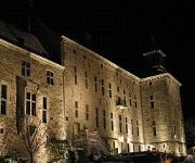
Château de Harzé Centre séminaire
Hôtel Le Montana
Videos from this area
These are videos related to the place based on their proximity to this place.
Chute lors de l'OHM Trail Aywaille 2011
OHM Trail Aywaille à Aywaille en Belgique. Lors d'une descente facile sur un large chemin forestier, je suis tombé au km 22. Il me restait encore 13 km, et se fut dur dur. Mais au final,...
2012.05.05 Qannik in Aywaille.flv
Die Eisbärenfamilie in Aywaille in Belgien wurde zusammengeführt und lebt jetzt zusammen auf der Anlage.
2012 07 29 Awyaille Brüllen
Eine Bärenfamilie ist in Aywaille in einem Gehege untergebracht. Diese Zusammenführung funktioniert in der Regel harmonisch. Manchmal brüllt man sich aber an, aber dies ohne große Anzeichen...
Videos provided by Youtube are under the copyright of their owners.
Attractions and noteworthy things
Distances are based on the centre of the city/town and sightseeing location. This list contains brief abstracts about monuments, holiday activities, national parcs, museums, organisations and more from the area as well as interesting facts about the region itself. Where available, you'll find the corresponding homepage. Otherwise the related wikipedia article.
Ninglinspo
The Ninglinspo is a stream in Belgium, tributary of the Amblève upstream from Remouchamps around Quarreux. The valley of Ninglinspo is classed as an outstanding heritage area of Wallonia. It runs between Vert-Buisson and Nonceveux. The Ninglinspo forms rapids around enormous blocks of quartzite, forming a series of pools with evocative names. The site is favoured by tourists due to its beauty. The Ninglinspo valley has been entirely lit to allow for nighttime walks.
Chefna
Chefna is a river of Belgium. It springs in Ville-au-bois and flows for 5 kilometres through the province of Liège, before debouching ino the Amblève. Around 1802, several farmers started looking for gold in the river and on the right bank the pits of a primitive goldmine can be found, although they have been mostly overgrown.
Rubicon (Belgium)
The Rubicon is an underground river in the province of Liège in the northern-central part of Belgium. It flows through the Caves of Remouchamps, where the world's longest underground trip by boat in a cave is possible (600 m).
Côte de La Redoute
The Côte de La Redoute is part of the Liège-Bastogne-Liège cycle route. It is located in the municipality of Aywaille and its incline is 2.3 km at 7.4%. It is named after a redoubt in the battle of Sprimont, which occurred at the village of Fontin, which is located on it, in the commune of Esneux. It also runs along an access route to autoroute E25 level with the village of Remouchamps. The region is the birthplace of the cyclist Philippe Gilbert.
Battle of Sprimont
The battle of Sprimont, battle of Esneux or battle of the Ourthe was a battle between French Republican and Austrian troops on the plateau between the valleys of the Vesdre, the Ourthe and the Amblève, 20 km to the south of Liège. It occurred on 17 and 18 September 1794 and was a French Republican victory put a final end to the Ancien Régime in what is now Belgium. The French troops dislodged Austrian troops occupying the plateau, though the French suffered heavy losses.


