Safety Score: 2,7 of 5.0 based on data from 9 authorites. Meaning we advice caution when travelling to United States.
Travel warnings are updated daily. Source: Travel Warning United States. Last Update: 2024-05-05 08:24:42
Discover Club Acres
The district Club Acres of Orangeburg in Orangeburg County (South Carolina) is a district in United States about 429 mi south-west of Washington DC, the country's capital city.
Looking for a place to stay? we compiled a list of available hotels close to the map centre further down the page.
When in this area, you might want to pay a visit to some of the following locations: Saint Matthews, Bamberg, Saint George, Columbia and Barnwell. To further explore this place, just scroll down and browse the available info.
Local weather forecast
Todays Local Weather Conditions & Forecast: 27°C / 80 °F
| Morning Temperature | 20°C / 68 °F |
| Evening Temperature | 23°C / 74 °F |
| Night Temperature | 22°C / 72 °F |
| Chance of rainfall | 4% |
| Air Humidity | 62% |
| Air Pressure | 1017 hPa |
| Wind Speed | Gentle Breeze with 7 km/h (4 mph) from North-West |
| Cloud Conditions | Clear sky, covering 2% of sky |
| General Conditions | Moderate rain |
Monday, 6th of May 2024
27°C (81 °F)
20°C (68 °F)
Moderate rain, gentle breeze, overcast clouds.
Tuesday, 7th of May 2024
29°C (84 °F)
23°C (74 °F)
Light rain, moderate breeze, few clouds.
Wednesday, 8th of May 2024
31°C (87 °F)
25°C (76 °F)
Light rain, moderate breeze, overcast clouds.
Hotels and Places to Stay
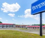
Rodeway Inn & Suites Orangeburg
BAYMONT INN & SUITES ORANGEBUR
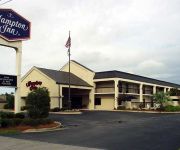
Hampton Inn & Suites Orangeburg
Holiday Inn Express & Suites ORANGEBURG
Fairfield Inn Orangeburg
HOWARD JOHNSON EXPRESS INN - O
Quality Inn & Suites Orangeburg
BAYMONT INN & SUITES ORANGEBUR
SUPER 8 ORANGEBURG NEAR SC STA
DAYS INN ORANGEBURG SOUTH
Videos from this area
These are videos related to the place based on their proximity to this place.
(803) 937-4422 | Dentist in Orangeburg SC | Dentist Orangeburg SC
Need A Dentist In Orangeburg SC | Call (803) 937-4422 Now!! The Best Dentistry Orangeburg SC Has To Offer!
Personal Injury Trial Lawyers Orangeburg, South Carolina - Law Firm of Lanier & Burroughs, LLC
Call (803) 268-9800 or visit us at http://www.landblawfirm.com. Our clients can expect attorneys that are compassionate, aggressive and effective. We have over 50 years experience in handling...
The Black Butler vs The James Anthony at CWA Pro Wrestling, Orangeburg, SC
James Anthony makes debuts in CWA Pro Wrestling against The Black Butler.
Experienced Truck Accident Lawyers Orangeburg, South Carolina - Law Firm of Lanier & Burroughs, LLC
Call (803) 268-9800 or visit us at http://www.landblawfirm.com. At Lanier and Burroughs we have over 50 years of experience with trucking cases including fatigued drivers, rollovers, defective...
The Black Butler vs. Billy Bash at CWA in Orangeburg, SC
Billy Bash defends has CWA Cruiser weight title against The Black Butler. Wrestling at its best in CWA.
Orangeburg Autocross 02-16-2008, 95 STS2, 29.111 seconds
2st place STS2 run from the 02-16-2008 Autocross at the Prince-of-Orangeburg Mall in Orangeburg SC. Hoasted by the South Carolina region of the Sports Car Club of America. Driven by Marty...
Videos provided by Youtube are under the copyright of their owners.
Attractions and noteworthy things
Distances are based on the centre of the city/town and sightseeing location. This list contains brief abstracts about monuments, holiday activities, national parcs, museums, organisations and more from the area as well as interesting facts about the region itself. Where available, you'll find the corresponding homepage. Otherwise the related wikipedia article.
Orangeburg County, South Carolina
Orangeburg County is a county located in the Piedmont region of the U.S. state of South Carolina. As of the 2010 census, the population was 92,501. Its county seat is Orangeburg. It is home to Claflin University, a private college located in Orangeburg that is the oldest historically black college or university (HBCU) in the state. It is also the location of South Carolina State University, the only public HBCU in the state.
Oxford, Alabama
Oxford is a city in Calhoun and Talladega counties in the U.S. state of Alabama. The population was 14,592 at the 2000 census. Oxford is one of two principal cities of and included in the Anniston-Oxford Metropolitan Statistical Area. 21,348 residents lived in the city according to the 2010 Census, an increase of 46.3% since the 2000 Census.
Cameron, South Carolina
Cameron is a town in Calhoun County, South Carolina, United States. The population was 449 at the 2000 census. It is part of the Columbia, South Carolina Metropolitan Statistical Area.
Cope, South Carolina
Cope is a town in Orangeburg County, South Carolina, United States. The population was 77 at the 2010 census, a decline from 107 in 2000.
Brookdale, South Carolina
Brookdale is a census-designated place (CDP) in Orangeburg County, South Carolina, United States. The population was 4,724 at the 2000 census.
Orangeburg, South Carolina
Orangeburg, also known as "The Garden City," is the principal city in and the county seat of Orangeburg County, South Carolina, United States. The city is the fifth-oldest European city in the state of South Carolina. The population of the city was 13,964 as of the 2010 census (though the greater city population was 67,326). The city is located 37 miles southeast of Columbia, on the north fork of the Edisto River in the Piedmont area.
Rowesville, South Carolina
Rowesville is a town in Orangeburg County, South Carolina, United States. The population was 378 at the 2000 census.
Wilkinson Heights, South Carolina
Wilkinson Heights is a census-designated place (CDP) in Orangeburg County, South Carolina, United States. The population was 3,068 at the 2000 census.
South Carolina State University
South Carolina State University is a historically black university located in Orangeburg, South Carolina, United States. It is the only state funded, historically black land-grant institution in South Carolina and is a member-school of the Thurgood Marshall College Fund.
Claflin University
Claflin University is located in Orangeburg, South Carolina, United States. Claflin University was founded in 1869 and is the oldest historically black college or university in the state of South Carolina.
Oliver C. Dawson Stadium
Oliver C. Dawson Stadium is a 22,000-seat multi-purpose stadium in Orangeburg, South Carolina. It opened in 1955 with major renovations in 1994. It is home to the South Carolina State University Bulldogs football and women's soccer teams.
SHM Memorial Center
S-H-M Memorial Center is a 3,200-seat multi-purpose arena in Orangeburg, South Carolina, named in memorandum of Smith Hammond, Delano Middleton, and Henry Smith, who died in the Orangeburg Massacre. It is home to the South Carolina State University Bulldogs basketball team.
Orangeburg–Calhoun Technical College
Orangeburg–Calhoun Technical College, officially abbreviated as OCtech, is the campus of the South Carolina Technical College System intended to serve Orangeburg and Calhoun counties.
Four Hole Swamp
Four Holes Swamp is a small blackwater river that is a tributary to the Edisto River in South Carolina. The swamp rises in Calhoun County and flows 62 miles to the confluence, in an unusual braided pattern; it has no well-defined channel, but multiple channels that start and disappear, yet maintain a flow. The swamp is the home of the Francis Beidler Forest, a 16,000-acre nature preserve of virgin cypress and tupelo forest owned and operated by the Audubon Society.
WHXT
WHXT is an Urban Contemporary radio station licensed to Orangeburg, South Carolina and serves the Columbia, South Carolina market. The YMF Media outlet is licensed by the Federal Communications Commission (FCC) to broadcast at 103.9 MHz with an effective radiated power (ERP) of 9.2 kW. The station goes by the name Hot 103.9 and its current slogan is "Columbia's #1 Choice for Blazin' Hip-Hop and R&B."
WGFG
WGFG, known on-air as "Cat Country 105.3", is a country music radio station licensed to Branchville, South Carolina, USA. The station is currently owned by Miller Communications, Inc. Bad Dog is also the home of Bamberg-Ehrhardt High School football and Clemson Tigers football. Some of the artists that can be found on The Bad Dog are Led Zeppelin, Pink Floyd, Lynyrd Skynyrd, Styx, and lesser-known classic rock artists like the Ozark Mountain Daredevils, Little Feat and Average White Band.
WPJK
WPJK is a radio station broadcasting a Christian radio format. Licensed to Orangeburg, South Carolina, USA. The station is currently owned by Bose Gowdy.
WPOG
WPOG is a radio station broadcasting a format. Licensed to St. Matthews, South Carolina, USA. The station is currently owned by Grace Baptist Church of Orangeburg. WPOG's programming is also heard on 91.9 WWOS in St. George, South Carolina. Call sign MHz City of license Power Class Additional Information WWOS 91.9 St. George, South Carolina 6,000 A FCC
WQKI-FM
WQKI-FM is a radio station broadcasting a Urban Oldies format. Licensed to Orangeburg, South Carolina, USA. The station is currently owned by Miller Communications, Inc..
WSSB-FM
WSSB-FM is a radio station broadcasting a Variety format. Licensed to Orangeburg, South Carolina, USA. The station is currently owned by South Carolina State University.
Orangeburg Preparatory Schools, Inc
Orangeburg Preparatory Schools, Inc. is an independent, college-preparatory, coeducational day school enrolling students in preschool through twelfth grade. Orangeburg Prep has two campuses: the Lower Campus, housing preschool to 5th grade; and the Upper Campus, housing grades 6 to 12. OPS also operates a year-round day care center on the Lower Campus. In 2002, Kelley Bryant Mims became the first alumnus to serve as Head of School.
Calhoun County High School
Calhoun County High School is a public secondary school in St. Matthews, South Carolina, USA.
Church of the Redeemer (Orangeburg, South Carolina)
The Church of the Redeemer is one of two independent Anglican Communion parishes of the Diocese of South Carolina in the city of Orangeburg, South Carolina.
WTQS
WTQS is a radio station licensed to Cameron, South Carolina, USA. The station is currently owned by Glory Communications, Inc.
Hawthorne School of Aeronautics
Hawthorne School of Aeronautics is a closed flying school/airport airport located 5 miles south of Orangeburg, South Carolina. The school was closed in 1945. Today the land is being used for non-aviation purposes.


